Subject: Eastern United States
Period: 1852 (dated)
Publication:
Color: Hand Color
Size:
29.4 x 24.5 inches
74.7 x 62.2 cm
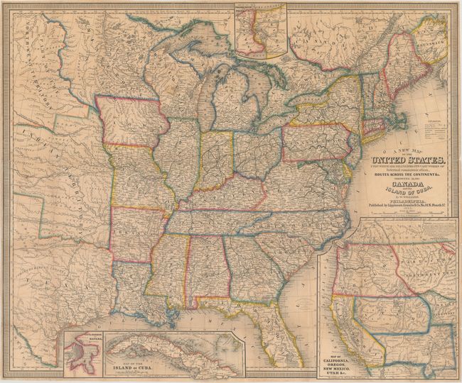
This is the first edition of this highly detailed map according to Wheat (later editions were published in 1854 and 1857). It features inset maps of Niagara River and Falls, Havana, the Island of Cuba, and a great Map of California, Oregon, New Mexico Utah &c. The main map shows the country as far west as the Texas panhandle and the Great Plains, which consists of Minnesota, North-West Territory, and Indian Territory. There are numerous forts, railroads, trade routes and the tracks of several explorers. The inset map of the West (9.3 x 10.5") shows explorers' routes and immigrant trails, most notably the Oregon Route. The Great Basin in Utah Territory is bounded by the erroneous mountain range labeled Dividing Range between the Waters of the Pacific and the Waters of the Great Basin. In the Northwest, Ft. Nisqually is named and Portland is Oregon City. Copyright dated 1851.
References: Wheat (TMW) #769; Phillips (Maps) p. 901.
Condition: B+
Issued folding with light toning, minor staining, and a number of small fold separations that have been repaired on verso with archival tissue.