Catalog Archive
Auction 176, Lot 128

"Carte de la Nouvelle Angleterre, Nouvelle York, Nouvelle Jersey, et Pensilvanie", Laporte, Joseph de

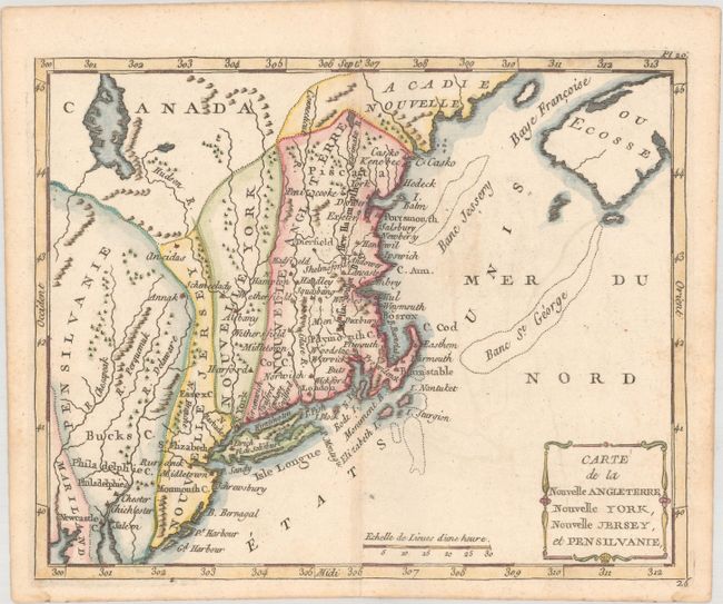
Subject: Colonial New England & Mid-Atlantic United States

Period: 1783 (circa)

Publication:

Color: Hand Color

Size:
8.7 x 7 inches
22.1 x 17.8 cm
Download High Resolution Image
(or just click on image to launch the Zoom viewer)

Uncommon, small map with odd boundaries, dating to the end of the Revolutionary War. Each state appears as an amorphous strip stretching north-south, reflecting France's lack of knowledge of colonial boundaries. In New England, Massachusetts Bay and New Hampshire seem to have been added to the plate, and are spelled Massachusset Bey and Hew Hampshire. This is a variant of the Laporte map, with the addition of Etats Unis in the Atlantic, rather than Possesions Anglois, but this is not the later 1799 Berthelon issue with the simpler cartouche.

References: cf. McCorkle #780.2.

Condition: A

Very light offsetting and minor toning along the centerfold.

Estimate: $200 - $230

Sold for: $210

Closed on 2/12/2020

Archived