Subject: New England - United States
Period: 1826 (dated)
Publication: A New American Atlas
Color: Hand Color
Size:
21.4 x 16.9 inches
54.4 x 42.9 cm
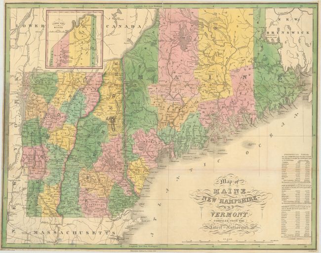
Finely's maps employ a delicate and elegant engraving style and provided extensive topographical and watershed information. He was the dominant map maker in the United States in the early 1820s into the 1830s. His atlases were very successful, outselling rival atlases by Carey & Lea, and Tanner. His maps were printed on high quality paper and were routinely corrected and updated.
This folding version of Finley's atlas map delineates the counties, roads, limited watershed, scores of towns and villages. The "Statistical Table" gives populations by county for 1810 and 1820. Maps from Finley's folio A New American Atlas are scarce, but the 15 maps were also published in a rare pocket atlas version that is scarcer still. The maps in this issue were printed on thin paper folding into 3.5" x 6" format. This example is from an edition published between 1827 and 1830. Ristow says, "The same plates, with dates and publisher's name changed, were used by S. Augustus Mitchell in 1831 for an atlas published under the same title as Finley's 1826 volume." This map does not contain Mitchell's imprint and appears as an unrecorded edition published by Finely prior to his collaboration with Mitchell. Drawn by Vance and engraved by J. H. Young.
References: cf. Philips (A) #1378; Ristow, p. 270.
Condition: B+
Issued folding on thin, banknote style paper with a few tiny splits at fold intersections and minor toning along a few folds. A short tear and some paper weakness in border at left has been archivally repaired. Narrow margins all around.