Filtered by Category:United States(Show All Categories)
Showing results for:Auction 149
Catalog Archive
216 lots
Page 1 of 5
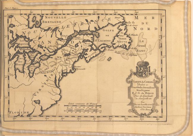
Auction 149, Lot 108
Subject: Colonial United States & Canada
Le Beau, Claude
Carte du Canada Dediee a Son Altesse Serenissime Monseigneur [in book] Avantures du Sr. C. le Beau…, 1738
Size: 4 x 6.3 inches (10.2 x 16 cm)
Estimate: $900 - $1,100
Sold for: $450
Closed on 5/21/2014
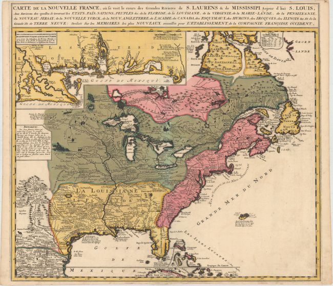
Auction 149, Lot 109
Subject: Colonial United States & Canada
Ottens/De Fer
Carte de la Nouvelle France, ou se Voit le Cours des Grandes Rivieres de S. Laurens & de Mississipi Aujour d'hui S. Louis..., 1745
Size: 21.6 x 19.5 inches (54.9 x 49.5 cm)
Estimate: $2,300 - $2,600
Reduced Version of De Fer's Influential Map of French Possessions in North America
Sold for: $1,700
Closed on 5/21/2014
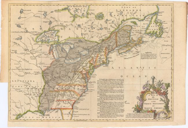
Auction 149, Lot 110
Subject: Colonial United States & Canada
Lodge, John
A Map of the British and French Settlements in North America, 1755
Size: 15.3 x 11 inches (38.9 x 27.9 cm)
Estimate: $450 - $550
Sold for: $550
Closed on 5/21/2014
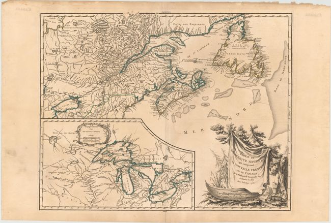
Auction 149, Lot 111
Subject: Colonial Eastern United States & Canada, Great Lakes
Robert de Vaugondy, Didier
Partie de l'Amerique Septent? qui Comprend la Nouvelle France ou le Canada, 1755
Size: 23.8 x 18.8 inches (60.5 x 47.8 cm)
Estimate: $700 - $850
Unsold
Closed on 5/21/2014
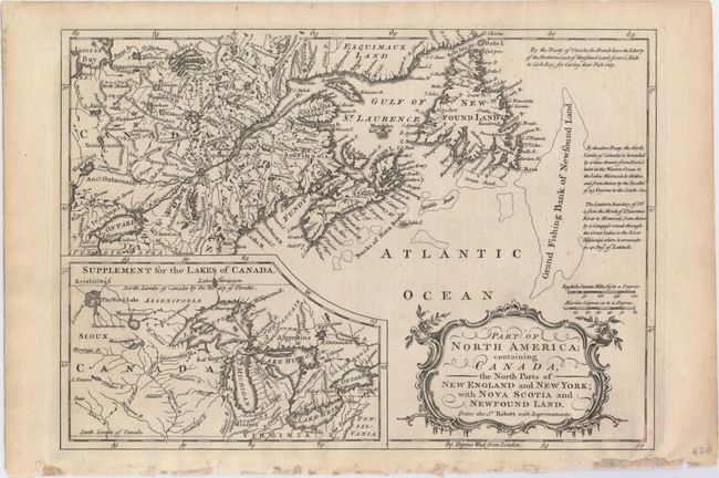
Auction 149, Lot 112
Subject: Colonial United States & Canada, Great Lakes
Barrow, John (Sir)
Part of North America; Containing Canada, the North Parts of New England and New York; with Nova Scotia and Newfound Land. From Sr. Robert with Improvements, 1759
Size: 11.5 x 8.1 inches (29.2 x 20.6 cm)
Estimate: $140 - $180
Sold for: $275
Closed on 5/21/2014
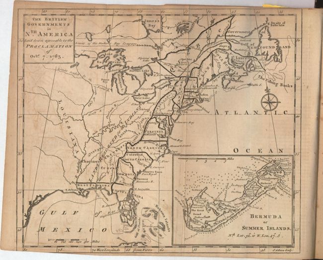
Auction 149, Lot 113
Subject: Colonial United States & Canada
Gibson, John
[Lot of 2] The British Governments in Nth. America Laid Down Agreeable to the Proclamation of Octr. 7, 1763 [and] [October and December 1763 Issues of Gentleman's Magazine], 1763
Size: 9.3 x 8 inches (23.6 x 20.3 cm)
Estimate: $275 - $375
Sold for: $240
Closed on 5/21/2014
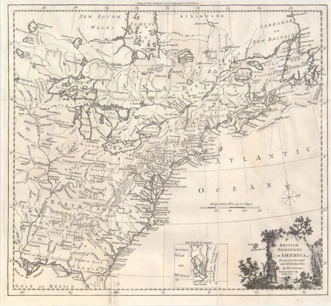
Auction 149, Lot 114
Subject: Colonial United States & Canada
Kitchin, Thomas
British Dominions in America, Drawn from the Latest and Best Authorities, 1770
Size: 14.8 x 13.4 inches (37.6 x 34 cm)
Estimate: $600 - $800
Sold for: $450
Closed on 5/21/2014
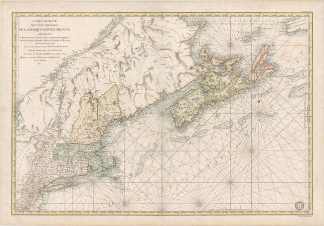
Auction 149, Lot 115
Subject: Colonial United States & Canada
Sartine
Carte Reduite des Cotes Orientales de l'Amerique Septentrionale. Contenant Celles des Provinces de New-York et de la Nouveau Angleterre, Celles de l'Acadie ou Nouvelle Ecosse..., 1780
Size: 33.8 x 22.9 inches (85.9 x 58.2 cm)
Estimate: $1,500 - $1,800
Unsold
Closed on 5/21/2014
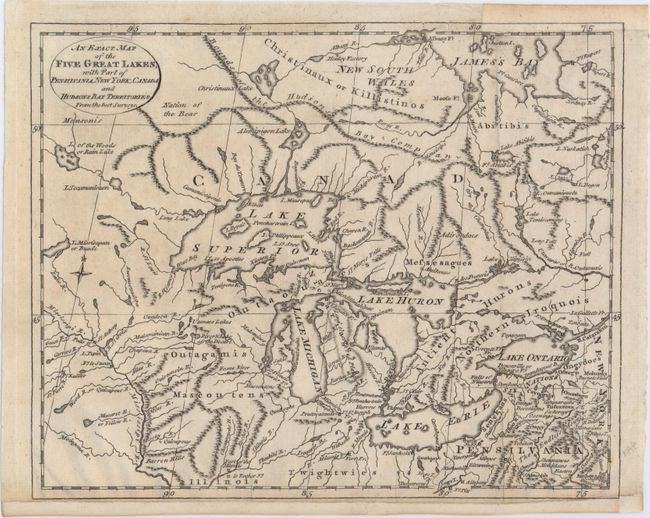
Auction 149, Lot 116
Subject: Colonial Great Lakes, Canada
Lodge, J.
An Exact Map of the Five Great Lakes, with Part of Pensilvania, New York, Canada and Hudsons Bay Territories. From the Best Surveys, 1778
Size: 10.1 x 8.2 inches (25.7 x 20.8 cm)
Estimate: $250 - $350
Sold for: $180
Closed on 5/21/2014
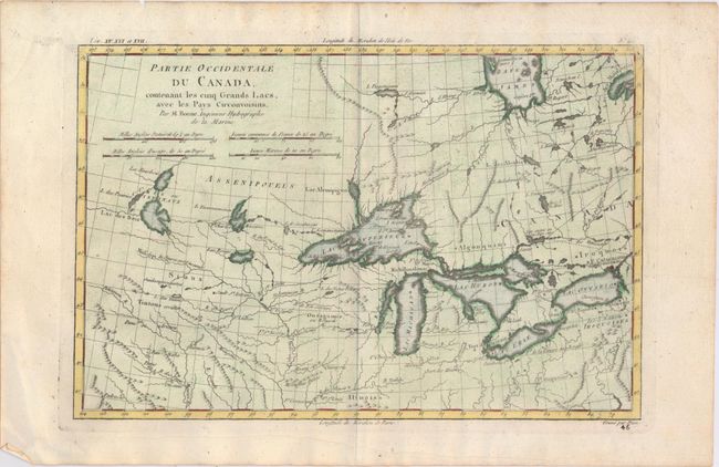
Auction 149, Lot 117
Subject: Colonial United States & Canada, Great Lakes
Bonne/Raynal
Partie Occidentale du Canada Contenant les Cinq Grands Lacs, avec les Pays Circonvoisins, 1780
Size: 12.4 x 8.2 inches (31.5 x 20.8 cm)
Estimate: $250 - $325
Sold for: $240
Closed on 5/21/2014
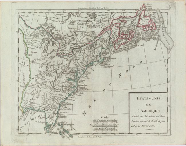
Auction 149, Lot 118
Subject: Eastern United States & Canada
Robert de Vaugondy
Etats-Unis de l'Amerique Divises en 13 Provinces avec Leurs Limites, Suivant le Traite de Paix fait le 20 Janvier 1783, 1785
Size: 9.3 x 8.1 inches (23.6 x 20.6 cm)
Estimate: $160 - $190
Sold for: $140
Closed on 5/21/2014
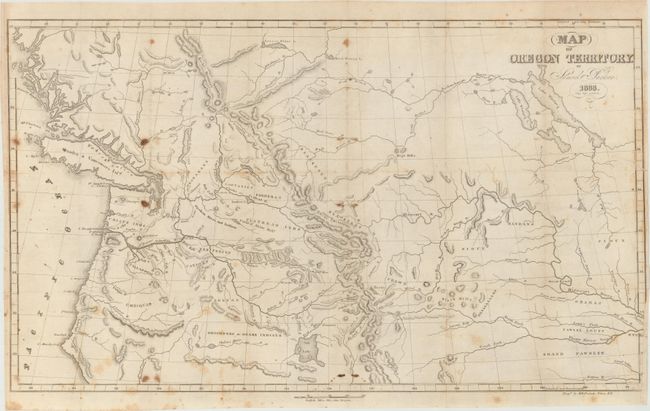
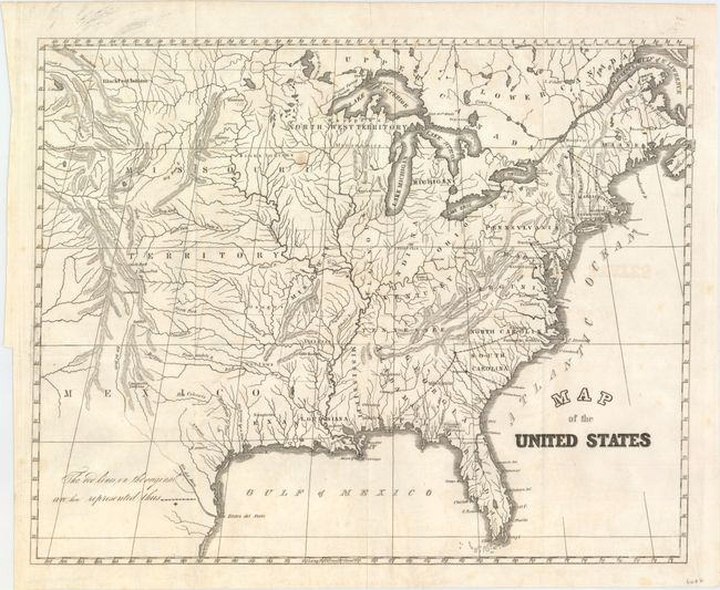
Auction 149, Lot 119
Subject: Northwestern United States, Canada
Parker, Samuel (Rev.)
Map of Oregon Territory, 1838
Size: 22.3 x 14 inches (56.6 x 35.6 cm)
Estimate: $275 - $350
Sold for: $250
Closed on 5/21/2014
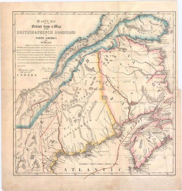
Auction 149, Lot 120
Subject: Canada & Maine
Mr. Jay's Map. Extract from a Map of the British & French Dominions in North America [with book] A Memoir on the North-Eastern Boundary…, 1843
Size: 12.8 x 13.3 inches (32.5 x 33.8 cm)
Estimate: $200 - $250
Sold for: $160
Closed on 5/21/2014
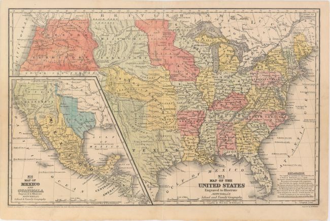
Auction 149, Lot 121
Subject: United States, Texas, Mexico
Mitchell, Samuel Augustus
No. 5 Map of the United States Engraved to Illustrate Mitchell's School and Family Geography, 1839
Size: 16.8 x 10.3 inches (42.7 x 26.2 cm)
Estimate: $160 - $200
Sold for: $325
Closed on 5/21/2014
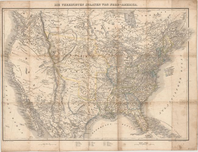
Auction 149, Lot 122
Subject: United States, Texas
Bromme, Traugott
Die Vereinigten Staaten von Nord-America, 1840
Size: 25.2 x 18.5 inches (64 x 47 cm)
Estimate: $600 - $800
Sold for: $200
Closed on 5/21/2014
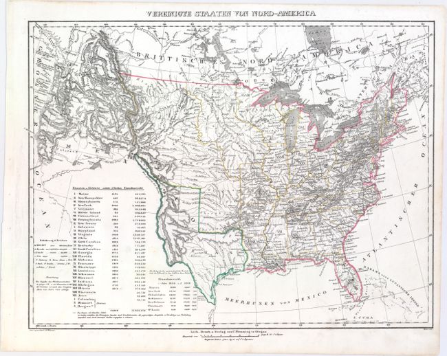
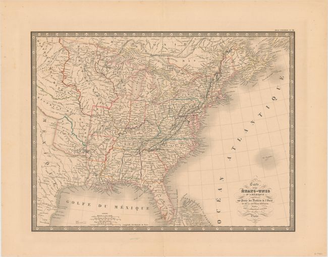
Auction 149, Lot 123
Subject: United States
Flemming, Carl
Vereinigte Staaten von Nord-America, 1844
Size: 16.1 x 12.6 inches (40.9 x 32 cm)
Estimate: $275 - $350
Unsold
Closed on 5/21/2014
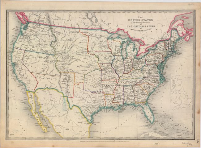
Auction 149, Lot 124
Subject: United States
Wyld, James
The United States & the Relative Position of the Oregon & Texas, 1852
Size: 21.5 x 14.8 inches (54.6 x 37.6 cm)
Estimate: $400 - $500
Sold for: $475
Closed on 5/21/2014
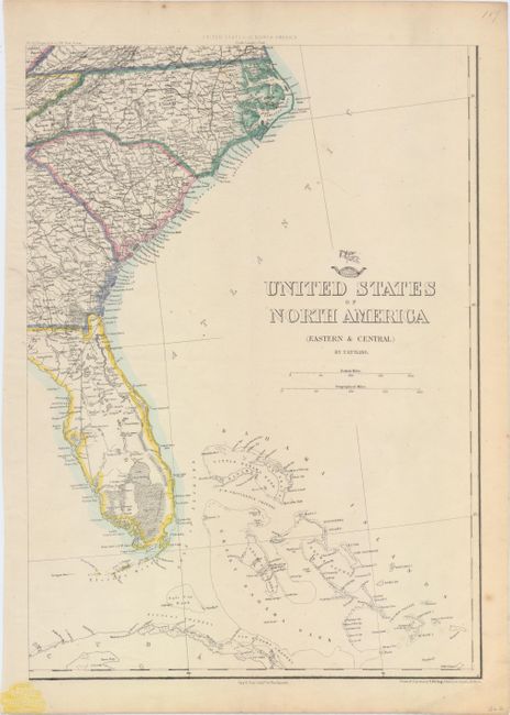
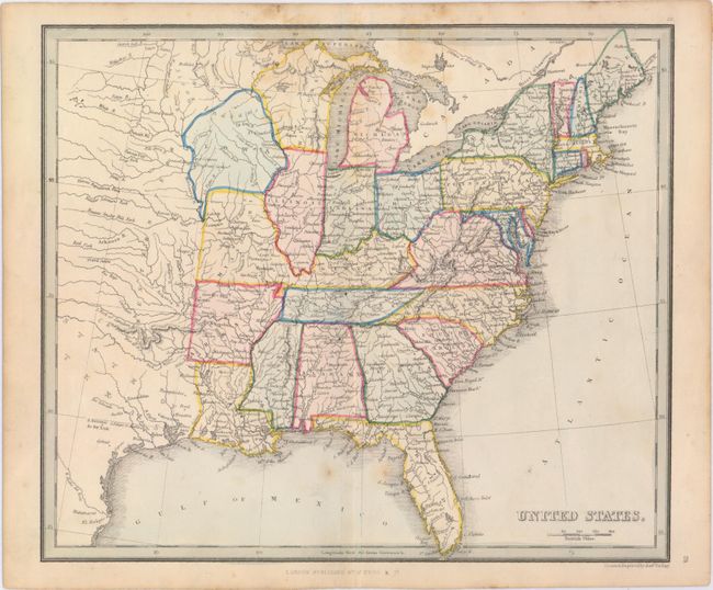
Auction 149, Lot 125
Subject: United States
Ettling, Theodor
[On 6 Sheets] United States of North America (Eastern & Central), 1859
Size: 12.1 x 16.9 inches (30.7 x 42.9 cm)
Estimate: $400 - $500
Sold for: $200
Closed on 5/21/2014
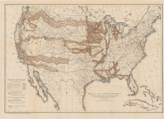
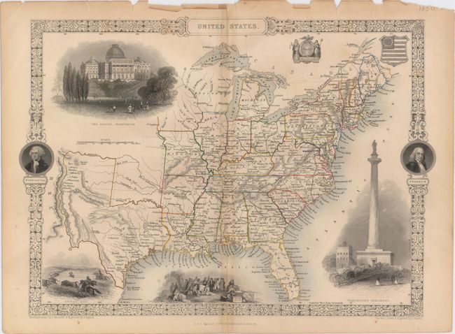
Auction 149, Lot 126
Subject: United States
Donaldson, Thomas
[Lot of 2] Map of the United States Exhibiting the Grants of Lands Made by the General Government to Aid in the Construction of Railroads and Wagon Roads... [and] Map of the Railroads in Whole or in Part West, North or South of the Missouri River..., 1883
Size: See Description
Estimate: $180 - $220
Sold for: $160
Closed on 5/21/2014
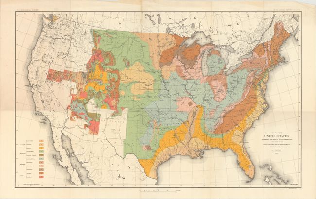
Auction 149, Lot 127
Subject: United States
U.S. Geological Survey (USGS)
Map of the United States Exhibiting the Present Status of Knowledge Relating to the Areal Distribution of Geologic Groups, 1884
Size: 28 x 17.3 inches (71.1 x 43.9 cm)
Estimate: $200 - $250
Sold for: $110
Closed on 5/21/2014
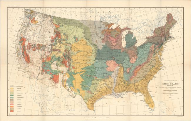
Auction 149, Lot 128
Subject: United States
U.S. Geological Survey (USGS)
Reconnaissance Map of the United States Showing the Distribution of the Geologic System So Far As Known, 1893
Size: 28 x 17.4 inches (71.1 x 44.2 cm)
Estimate: $180 - $220
Sold for: $110
Closed on 5/21/2014
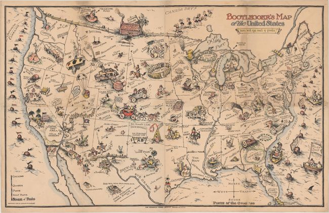
Auction 149, Lot 129
Subject: United States
Bootlegger's Map of the United States, 1926
Size: 32 x 22 inches (81.3 x 55.9 cm)
Estimate: $1,100 - $1,400
McCandish's Humorous Prohibition Map
Sold for: $800
Closed on 5/21/2014
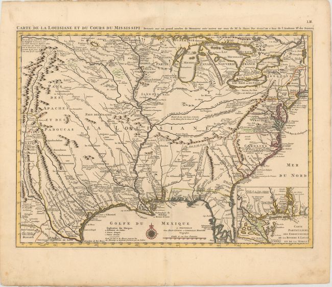
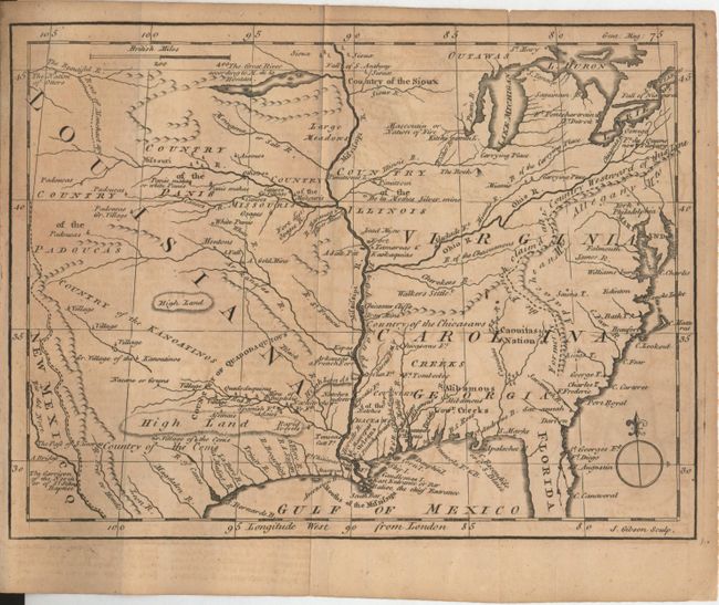
Auction 149, Lot 130
Subject: Colonial United States, Louisiana Territory
Delisle/Covens & Mortier
Carte de la Louisiane et du Cours du Mississipi Dressee sur un Grand Nombre de Memoires entr'autres sur ceux de Mr. le Maire, 1733
Size: 23.4 x 17.2 inches (59.4 x 43.7 cm)
Estimate: $2,750 - $3,500
Delisle's Influential Map of the Louisiana Territory
Sold for: $2,750
Closed on 5/21/2014
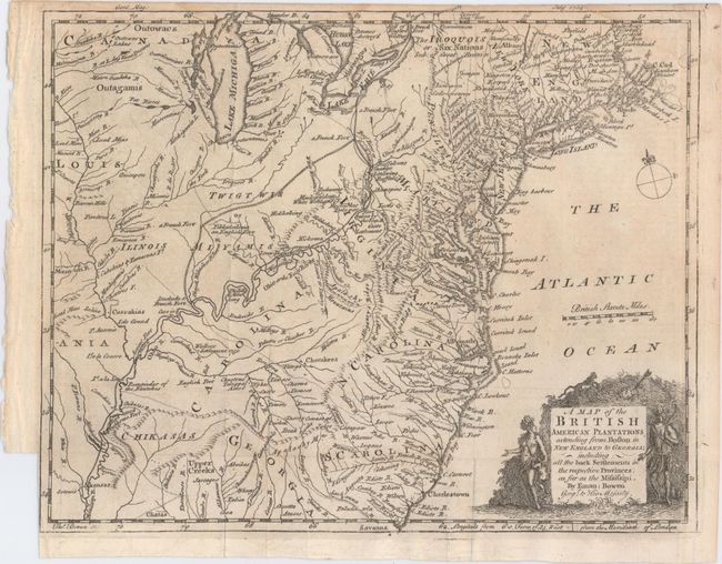
Auction 149, Lot 131
Subject: Colonial United States
Bowen, Emanuel
A Map of the British American Plantations Extending from Boston in New England to Georgia; Including All the Back Settlements in the Respective Provinces, As Far As the Mississipi, 1754
Size: 10.8 x 8.6 inches (27.4 x 21.8 cm)
Estimate: $400 - $500
Sold for: $250
Closed on 5/21/2014
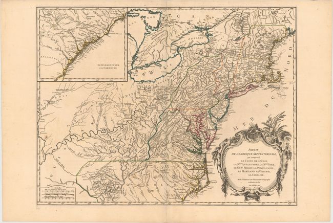
Auction 149, Lot 132
Subject: Colonial United States
Robert de Vaugondy, Didier
Partie de l'Amerique Septentrionale, qui Comprend le Cours de l'Ohio, la Nlle. Angleterre, la Nlle. York, le New Jersey, la Pensylvanie, le Maryland la Virginie, la Caroline, 1755
Size: 24.4 x 18.8 inches (62 x 47.8 cm)
Estimate: $800 - $950
Sold for: $600
Closed on 5/21/2014
Auction 149, Lot 133
Subject: Colonial United States
Gibson, John
[Untitled - North America, Louisiana, Virginia & Carolina], 1763
Size: 9.5 x 7.1 inches (24.1 x 18 cm)
Estimate: $220 - $275
Sold for: $160
Closed on 5/21/2014
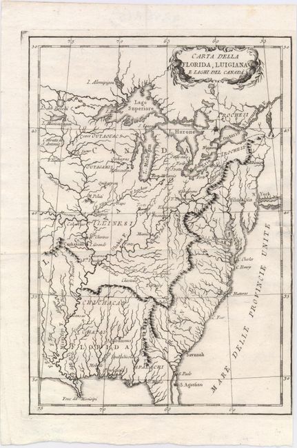
Auction 149, Lot 134
Subject: Eastern United States
Anon.
Carta della Florida, Luigiana e Laghi del Canada, 1800
Size: 6.8 x 9.8 inches (17.3 x 24.9 cm)
Estimate: $300 - $375
Unsold
Closed on 5/21/2014
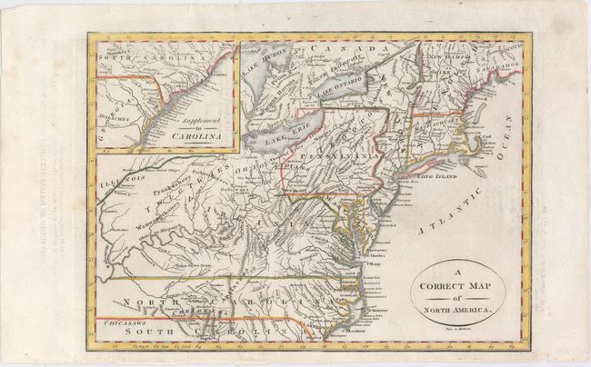
Auction 149, Lot 135
Subject: Eastern United States
A Correct Map of North America, 1800
Size: 11.6 x 8.3 inches (29.5 x 21.1 cm)
Estimate: $220 - $250
Sold for: $275
Closed on 5/21/2014
Auction 149, Lot 136
Subject: Eastern United States
Andriveau-Goujon, J.
Carte des Etats-Unis d'Amerique Comprenant une Partie des Districts de l'Ouest et de la Nouvelle Bretagne, 1837
Size: 19.8 x 15.1 inches (50.3 x 38.4 cm)
Estimate: $150 - $200
Sold for: $75
Closed on 5/21/2014
Auction 149, Lot 137
Subject: Eastern United States
U.S. Government
Map of the United States, 1838
Size: 14.7 x 11.8 inches (37.3 x 30 cm)
Estimate: $100 - $130
Sold for: $55
Closed on 5/21/2014
Auction 149, Lot 138
Subject: Eastern United States
Findlay, Alexander
United States, 1843
Size: 10.4 x 8.9 inches (26.4 x 22.6 cm)
Estimate: $100 - $140
Sold for: $75
Closed on 5/21/2014
Auction 149, Lot 139
Subject: Eastern United States, Texas
Tallis, John
United States, 1851
Size: 13.5 x 9.7 inches (34.3 x 24.6 cm)
Estimate: $200 - $250
Sold for: $190
Closed on 5/21/2014
Auction 149, Lot 140
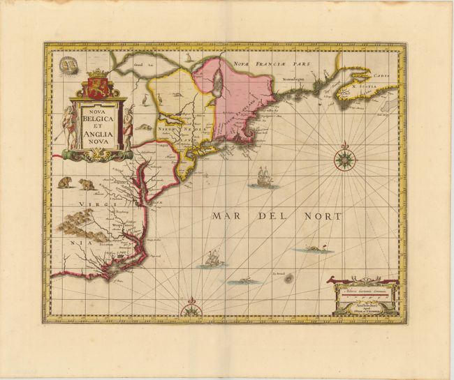
Subject: Colonial New England & Mid-Atlantic
Jansson/Valck & Schenk
Nova Belgica et Anglia Nova, 1694
Size: 19.5 x 15 inches (49.5 x 38.1 cm)
Estimate: $2,200 - $2,400
Jansson's Influential Map of the East Coast
Sold for: $1,500
Closed on 5/21/2014
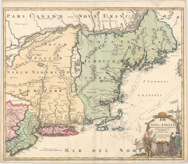
Auction 149, Lot 141
Subject: Colonial New England & Mid-Atlantic
Homann, Johann Baptist
Nova Anglia Septentrionali Americae Implantata Anglorumque Coloniis Florentissima, 1730
Size: 22.8 x 19.2 inches (57.9 x 48.8 cm)
Estimate: $1,200 - $1,500
Sold for: $900
Closed on 5/21/2014
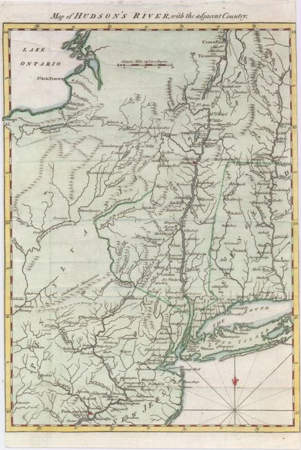
Auction 149, Lot 142
Subject: Colonial New England
Anon.
Map of Hudson's River, with the Adjacent Country, 1778
Size: 8.4 x 11.6 inches (21.3 x 29.5 cm)
Estimate: $220 - $250
Sold for: $170
Closed on 5/21/2014
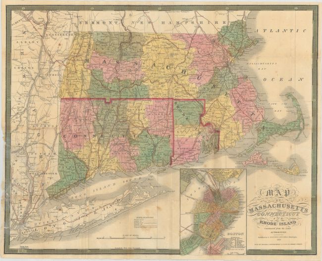
Auction 149, Lot 143
Subject: New England
Mitchell/Cowperthwait
Map of Massachusetts Connecticut and Rhode Island Constructed from the Latest Authorities, 1850
Size: 21.8 x 17.2 inches (55.4 x 43.7 cm)
Estimate: $220 - $250
Sold for: $160
Closed on 5/21/2014
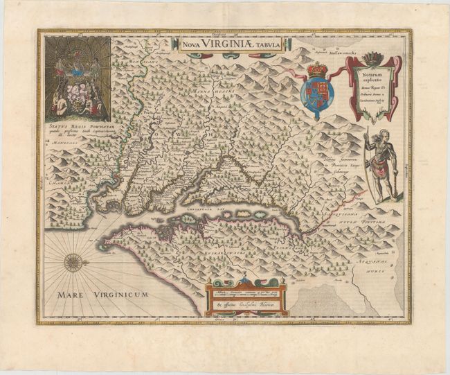
Auction 149, Lot 144
Subject: Colonial Mid-Atlantic United States
Hondius/Blaeu
Nova Virginiae Tabula, 1642
Size: 18.9 x 14.8 inches (48 x 37.6 cm)
Estimate: $2,750 - $3,500
One of the Most Important 17th Century Maps of the Chesapeake Bay - Full Original Color
Sold for: $1,850
Closed on 5/21/2014
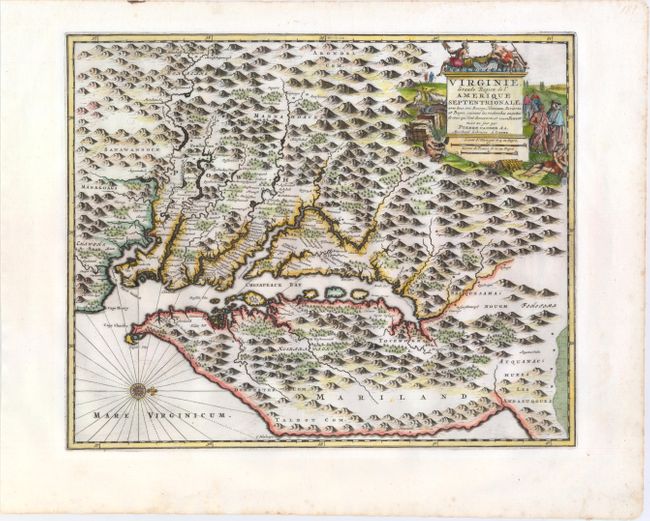
Auction 149, Lot 145
Subject: Colonial Mid-Atlantic United States
Aa, Pieter van der
Virginie, Grande Region de l'Amerique Septentrionale, avec Tous Ses Bourgs, Hameaux, Rivieres et Bayes, Suivant les Recherches Exactes de Ceux qui l'ont Decouverte, et Nouvellement Mise au Jour, 1729
Size: 14.1 x 11.4 inches (35.8 x 29 cm)
Estimate: $1,800 - $2,000
Rare Derivative of John Smith's Map of the Chesapeake Bay
Sold for: $1,300
Closed on 5/21/2014
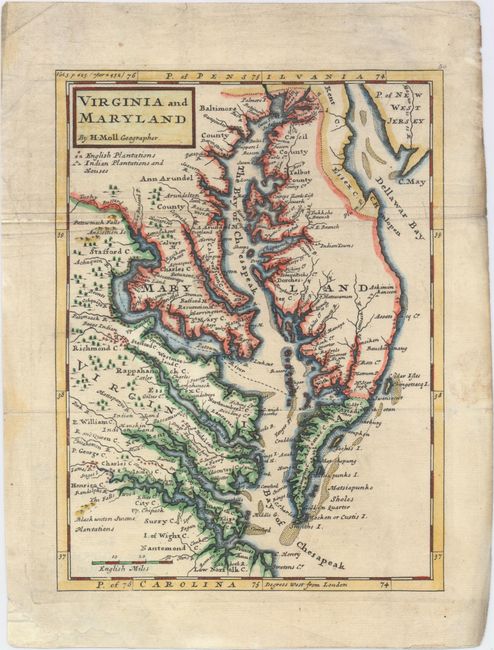
Auction 149, Lot 146
Subject: Colonial Mid-Atlantic United States
Moll, Herman
Virginia and Maryland, 1729
Size: 7.9 x 10.6 inches (20.1 x 26.9 cm)
Estimate: $550 - $700
Sold for: $425
Closed on 5/21/2014
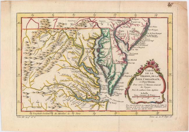
Auction 149, Lot 147
Subject: Colonial Mid-Atlantic United States
Bellin, Jacques Nicolas
Carte de la Virginie, de la Baye Chesapeack, et Pays Voisins pour Servir a l'Histoire Generale des Voyages…, 1757
Size: 11.4 x 7.6 inches (29 x 19.3 cm)
Estimate: $275 - $350
Sold for: $230
Closed on 5/21/2014
Auction 149, Lot 148
Subject: Mid-Atlantic United States
Russell, John C.
Map of the Middle States, of America. Comprehends New-York, New-Jersey, Pennsylvania, Delaware, and the Territory N:W: of Ohio, 1794
Size: 18.1 x 14.3 inches (46 x 36.3 cm)
Estimate: $400 - $500
Sold for: $300
Closed on 5/21/2014
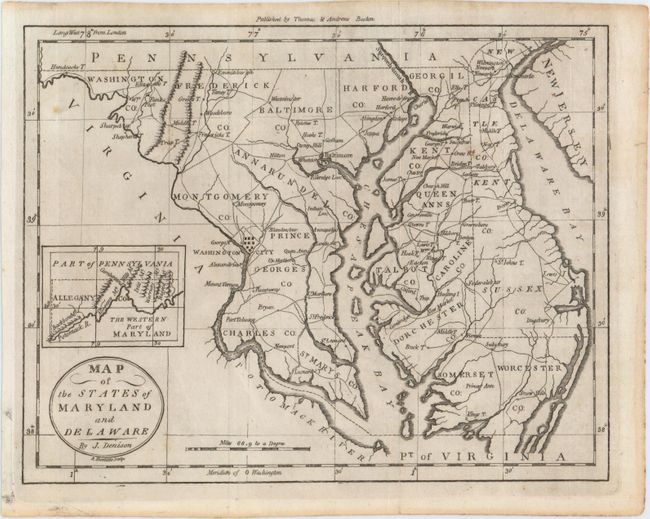
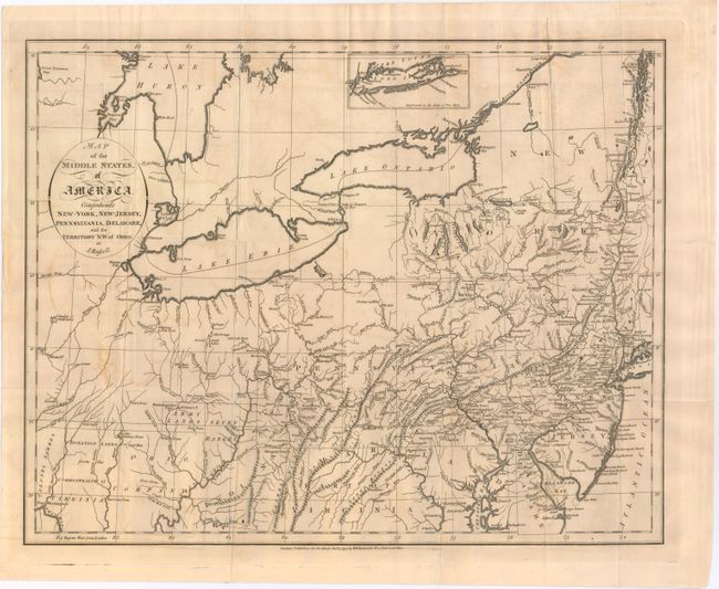
Auction 149, Lot 149
Subject: Mid-Atlantic United States
Denison, James
Map of the States of Maryland and Delaware, 1796
Size: 9.5 x 7.5 inches (24.1 x 19.1 cm)
Estimate: $200 - $230
Sold for: $150
Closed on 5/21/2014
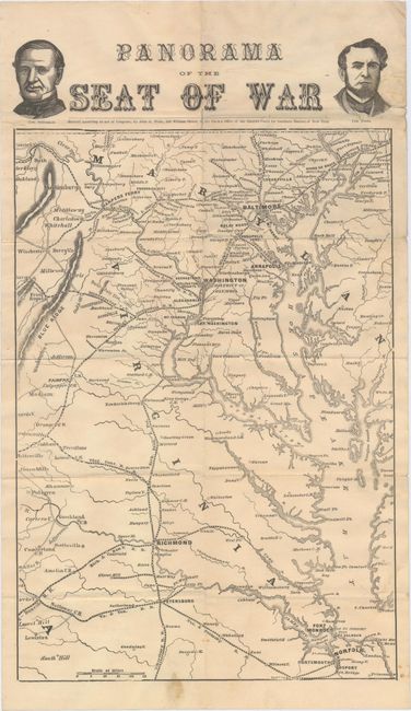
Auction 149, Lot 150
Subject: Mid-Atlantic United States, Civil War
Wells, J.
Panorama of the Seat of War, 1861
Size: 9.2 x 15.4 inches (23.4 x 39.1 cm)
Estimate: $350 - $450
Sold for: $300
Closed on 5/21/2014
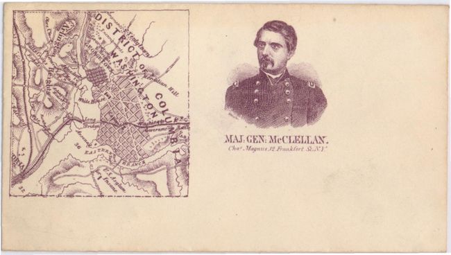
Auction 149, Lot 151
Subject: Mid-Atlantic United States, Civil War
Magnus, Charles
[Lot of 3 - Unused Civil War Envelopes], 1862
Size: 5.6 x 3.1 inches (14.2 x 7.9 cm)
Estimate: $150 - $180
Sold for: $130
Closed on 5/21/2014
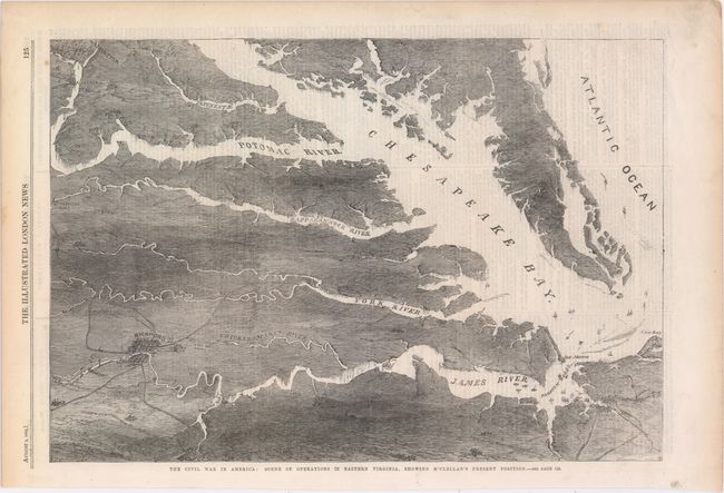
Auction 149, Lot 152
Subject: Mid-Atlantic United States
[Lot of 2] The Civil War in America: Scene of Operations in Eastern Virginia, Showing McClellan's Present Position [and] Map Illustrating General Lee's Advance into Pennsylvania [on sheet with] Plan of Pittsburg [and] The Defences of Washington, 1862-63
Size: 10.8 x 16 inches (27.4 x 40.6 cm)
Estimate: $160 - $200
Unsold
Closed on 5/21/2014
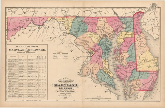
Auction 149, Lot 153
Subject: Mid-Atlantic United States
Gray, F. A.
[Lot of 2] New Railroad Map of the States of Maryland, Delaware, and the District of Columbia [and] Maryland Delaware and the District of Columbia, 1873-76
Size: See Description
Estimate: $100 - $130
Sold for: $170
Closed on 5/21/2014
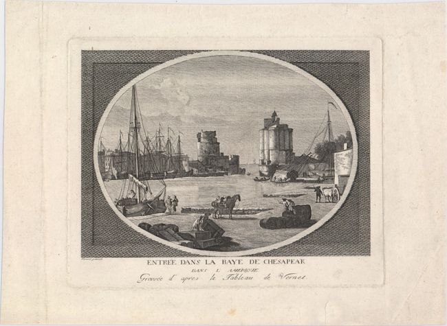
Auction 149, Lot 154
Subject: Colonial Chesapeake Bay
Anon.
Entree dans la Baye de Chesapeak dans l'Amerique, 1775
Size: 8.3 x 5.9 inches (21.1 x 15 cm)
Estimate: $160 - $200
Imaginary View of the Entrance to the Chesapeake Bay During the Revolutionary War
Sold for: $325
Closed on 5/21/2014
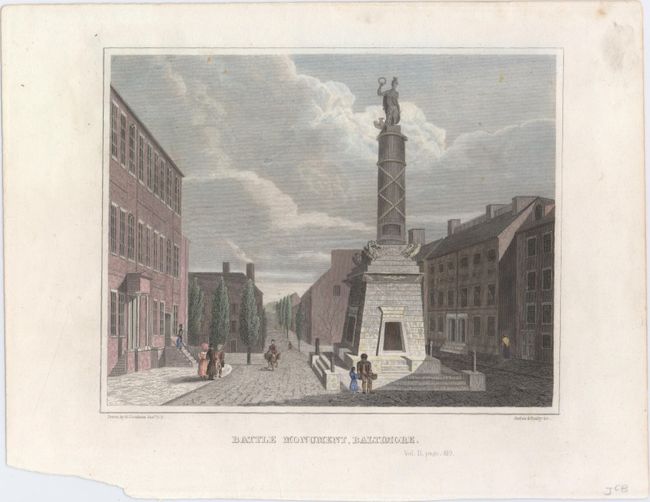
Auction 149, Lot 155
Subject: Baltimore, MD & Washington, D.C.
[Lot of 4] Battle Monument, Baltimore [and] [Views of Washington, D.C.], 1834-40
Size: See Description
Estimate: $140 - $180
Sold for: $100
Closed on 5/21/2014
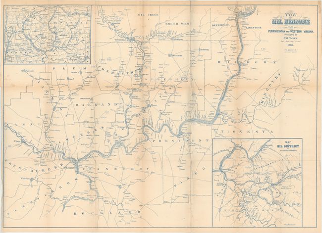
Auction 149, Lot 156
Subject: Pennsylvania, West Virginia
Sweet, S.H.
The Oil Regions of Pennsylvania and Western Virginia, 1865
Size: 30.8 x 22.3 inches (78.2 x 56.6 cm)
Estimate: $350 - $450
Sold for: $200
Closed on 5/21/2014
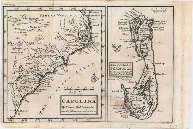
Auction 149, Lot 157
Subject: Colonial Southeast and Bermuda
Moll, Herman
Carolina [on sheet with] A Map of ye Island of Bermudos, Divided Into Its Tribes, with the Castles, Forts &c., 1708
Size: 10.3 x 6.9 inches (26.2 x 17.5 cm)
Estimate: $350 - $450
Sold for: $375
Closed on 5/21/2014
216 lots
Page 1 of 5