Subject: Eastern United States & Canada
Period: 1785 (circa)
Publication:
Color: Hand Color
Size:
9.3 x 8.1 inches
23.6 x 20.6 cm
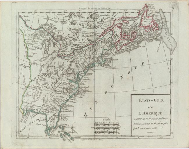
This is an early map of the newly created United States. The map shows the eastern seaboard as far north as Newfoundland and to the Mississippi River in the west. The southern portion of Florida is fragmented into numerous waterways. Western Florida extends to the Mississippi River. The oversized Pennsylvania extends to about 43°, joining the northern shore of Lake Erie. Filled with many Indian tribes including the Mohawks in northern New York and Cherakees around present-day Tennessee. This map is a slight variation from the reference - it is from the same plate which was re-engraved to remove "Par LaMarche Geogr?". The dating on the map refers to the Treaty of Paris ending the Revolution. Longitude west from Paris displayed at bottom, east from l'Isle de Fer at top.
References: cf. McCorkle #783.12.
Condition: A
Original outline color with two tiny worm holes on either side of the centerfold and some faint printer's ink residue.