Subject: Colonial Eastern United States & Canada, Great Lakes
Period: 1755 (dated)
Publication: Atlas Universel
Color: Hand Color
Size:
23.8 x 18.8 inches
60.5 x 47.8 cm
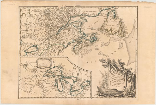
This is a handsome map of Newfoundland, Nova Scotia, and the entire course of the St. Lawrence River. The most prominent feature of the map is the very large inset of the 1744 Bellin version of the Great Lakes. The wonderful cartouche features the title on a blanket draped over a wooden canoe, which appears beside a threatening beaver. This is the second state of the map, published during the French and Indian War when the region illustrated was disputed between France and Britain.
References: Pedley #459; Karpinski p.141-42; Kershaw #355; McCorckle #755.36.
Condition: B+
Fine original outline color, a sharp impression, and wide original margins. Very good with a bit of light surface soil, a couple faint spots, and a professionally repaired short fold separation at bottom. The upper margin paper edge (far away from the map) is soiled and chipped.