Subject: United States
Period: 1884 (dated)
Publication: Fifth Annual Report of the United States Geological Survey…
Color: Printed Color
Size:
28 x 17.3 inches
71.1 x 43.9 cm
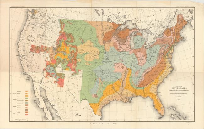
This is the first published geological map of the United States by the nascent USGS. It is generally referred to as the McGee map after the compiler. The legend at lower left names and color codes twelve different geological formations. There is also very fine detail of hydrology. Vast areas of the western U.S. remain blank, reflecting the infancy and inadequacy of western geological explorations at the time, and coincidentally emphasizing the need for more congressional funding. The mapping of the King, Hayden, Powell and Wheeler surveys are evident in the West, but little else. This was Plate II in the annual report. This was the most up-to-date map at the time, but was soon to be superseded by Hitchock's 1886 map which augmented the western states' geological detail.
References:
Condition: A
Issued folding. Fine impression and bright coloring with a small amount of toning along one fold and a few minor creases confined to the top blank margin.