Subject: Pennsylvania, West Virginia
Period: 1865 (dated)
Publication:
Color: Printed Color
Size:
30.8 x 22.3 inches
78.2 x 56.6 cm
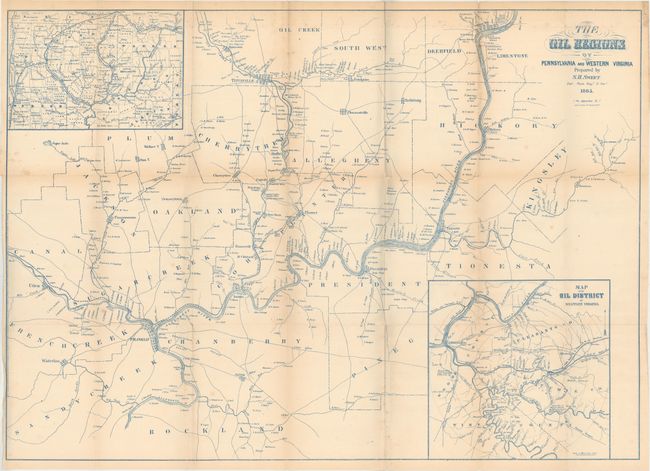
This very early map of the oil regions in Pennsylvania and West Virginia includes a large inset (8.8 x 8.8") entitled "Map of the Oil District of Western Virginia" and an untitled inset (8.5 x 6") showing Crawford, Warren, Venango, Mercer and Clarion Counties. The map is very detailed and notes locations of oil wells with the main map also giving extensive property ownership information. The map extends from Utica east to Oil Spring in Kingsley County in the east, and from Oil Creek south to Franklin and beyond to Rockland County. Locates Oil City, and numerous individual wells. The town of Cornplanter, named after a Seneca Indian chief, was renamed Oil City and became the major center, along with Titusville, for the area we know today as the Oil Regions. Printed in blue ink.
References:
Condition: B+
Issued folding with a few short splits at fold intersections, some minor foxing, and light toning along the folds.