Filtered by Category:Canada(Show All Categories)
Showing results for:Auction 164
Catalog Archive
30 lots
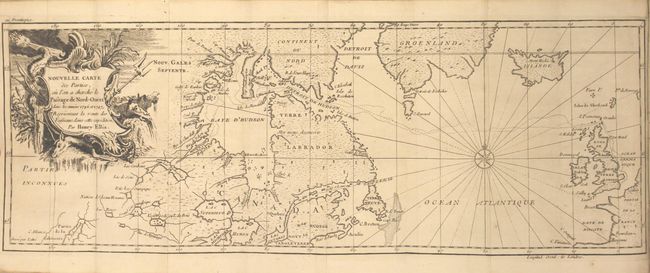
Auction 164, Lot 95
Subject: Canada & North Atlantic
Ellis, Henry
[2 Volumes] Voyage de la Baye de Hudson. Fait en 1746 & 1747, pour la Decouverte du Passage de Nord-Ouest ... Tome Premier [and] ... Tome Second, 1749
Size: 4.4 x 7.6 inches (11.2 x 19.3 cm)
Estimate: $800 - $1,000
Unsold
Closed on 9/13/2017
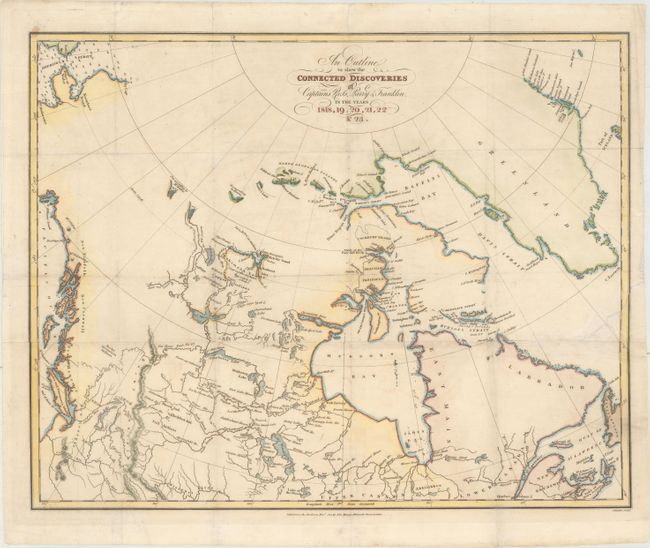
Auction 164, Lot 96
Subject: Canada
Franklin, John [Rear Admiral Sir]
An Outline to Shew the Connected Discoveries of Captains Ross, Parry & Franklin, in the Years 1818, 19, 20, 21, 22 & 23, 1823
Size: 18.1 x 14.4 inches (46 x 36.6 cm)
Estimate: $180 - $220
Sold for: $100
Closed on 9/13/2017
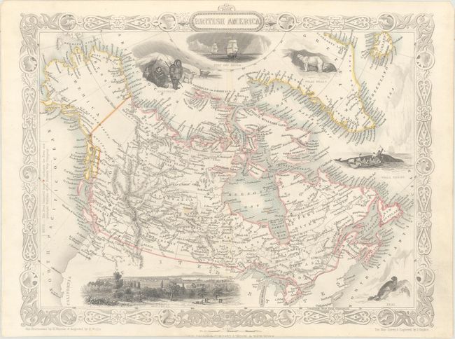
Auction 164, Lot 97
Subject: Canada
Tallis, John
British America, 1850
Size: 13 x 10.2 inches (33 x 25.9 cm)
Estimate: $130 - $160
Sold for: $200
Closed on 9/13/2017
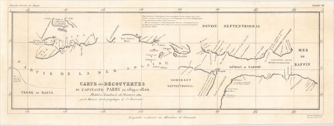
Auction 164, Lot 98
Subject: Canadian Arctic
Carte des Decouvertes du Capitaine Parry en 1819 et 1820, 1820
Size: 25 x 8.5 inches (63.5 x 21.6 cm)
Estimate: $160 - $200
Sold for: $100
Closed on 9/13/2017
Auction 164, Lot 99
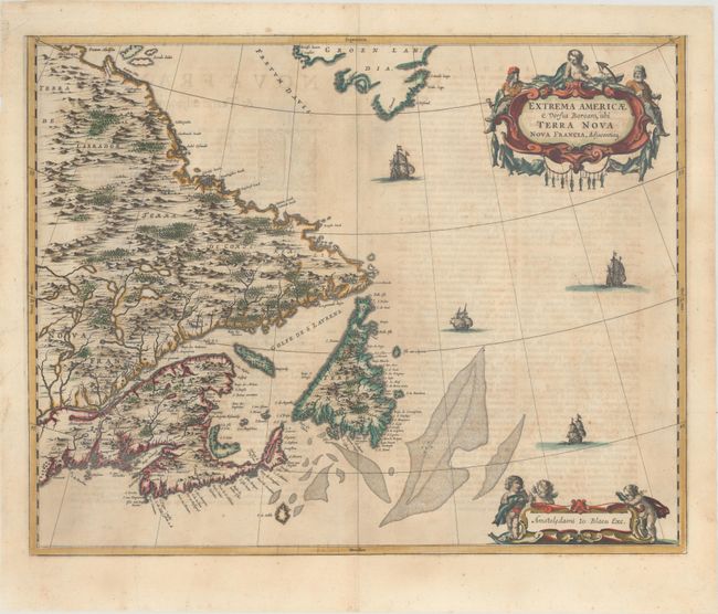
Subject: Eastern Canada
Blaeu, Johannes
Extrema Americae Versus Boream, ubi Terra Nova Nova Francia, Adjacentiaq., 1662
Size: 22.3 x 17.6 inches (56.6 x 44.7 cm)
Estimate: $1,500 - $1,800
Blaeu's Only Map of Canada, Showing the Canadian Maritimes
Sold for: $1,600
Closed on 9/13/2017
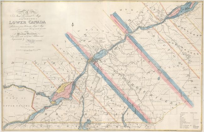
Auction 164, Lot 100
Subject: Eastern Canada, Quebec
Lay, Amos
A New Correct Map of the Seat of War in Lower Canada Protracted from Hollands Large Map Compiled from Actual Survey Made by Order of the Provincial Government..., 1814
Size: 33.1 x 21.6 inches (84.1 x 54.9 cm)
Estimate: $1,600 - $2,000
Lay's Update to Samuel Holland's Map
Sold for: $1,100
Closed on 9/13/2017
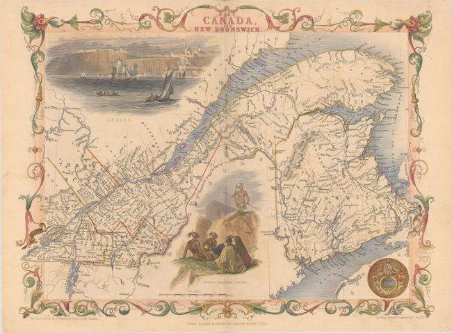
Auction 164, Lot 101
Subject: Eastern Canada
Tallis, John
East Canada, and New Brunswick, 1850
Size: 13.6 x 10.2 inches (34.5 x 25.9 cm)
Estimate: $140 - $180
NO RESERVE
Sold for: $90
Closed on 9/13/2017
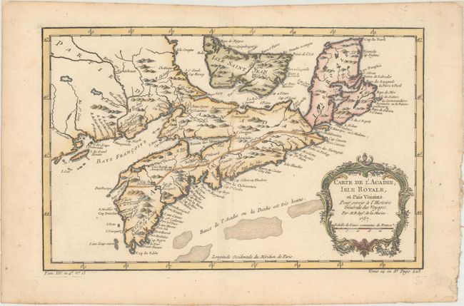
Auction 164, Lot 102
Subject: Nova Scotia, Canada
Bellin, Jacques Nicolas
Carte de l'Acadie, Isle Royale, et Pais Voisins. Pour Servir a l'Histoire Generale des Voyages, 1757
Size: 13 x 8.3 inches (33 x 21.1 cm)
Estimate: $160 - $190
Sold for: $120
Closed on 9/13/2017
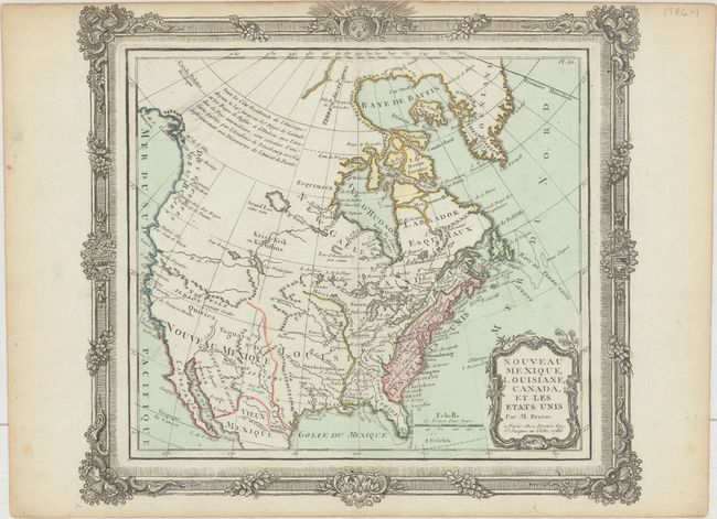
Auction 164, Lot 103
Subject: United States & Canada
Brion de la Tour/Desnos
Nouveau Mexique, Louisiane, Canada, et les Etats Unis, 1786
Size: 12.4 x 11.3 inches (31.5 x 28.7 cm)
Estimate: $190 - $220
Sold for: $140
Closed on 9/13/2017
Auction 164, Lot 104
Subject: United States & Canada
Rossi, Luigi
Dominj Inglesi in America, 1820
Size: 9.8 x 7.8 inches (24.9 x 19.8 cm)
Estimate: $150 - $180
Unsold
Closed on 9/13/2017
Auction 164, Lot 105
Subject: Colonial Northern United States & Canada
Tirion, Isaac
Nieuwe Kaart van Kanada, de Landen aan de Hudsons-Baay en de Noordwestelyke deelen van Noord-Amerika, 1769
Size: 17.4 x 12.3 inches (44.2 x 31.2 cm)
Estimate: $275 - $350
Sold for: $200
Closed on 9/13/2017
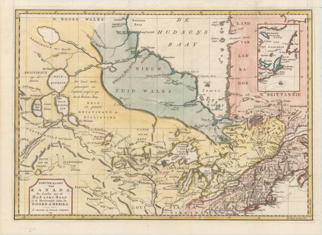
Auction 164, Lot 106
Subject: Colonial Eastern United States & Canada
Fer, Nicolas de
Carte de la Nouvelle France, ou se voit le Cours des Grandes Rivieres de S. Laurens & de Mississipi Aujour d'hui S. Louis, aux Environs Des-quelles se Trouvent les Etats, Pais, Nations, Peuples &c..., 1719
Size: 21.6 x 19.7 inches (54.9 x 50 cm)
Estimate: $1,700 - $2,000
Striking Map of French Colonial Possessions
Sold for: $900
Closed on 9/13/2017
Auction 164, Lot 107
Subject: Colonial Eastern United States & Canada
Homann, Johann Baptist
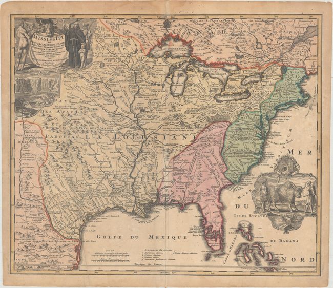
Amplissimae Regionis Mississipi seu Provinciae Ludovicinae..., 1720
Size: 22.8 x 19.3 inches (57.9 x 49 cm)
Estimate: $1,600 - $1,900
Striking Map of Colonial America with Buffalo Vignette
Sold for: $800
Closed on 9/13/2017
Auction 164, Lot 108
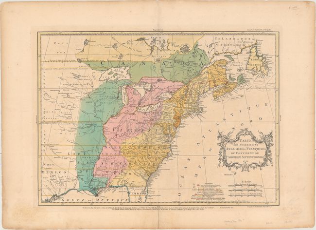
Subject: Colonial Eastern United States & Canada
Palairet, Jean
Carte des Possessions Angloises & Francoises du Continent de l'Amerique Septentrionale, 1755
Size: 22.7 x 16.4 inches (57.7 x 41.7 cm)
Estimate: $2,300 - $2,750
Important Map of French and English Territorial Claims at the Outset of the French and Indian War
Sold for: $1,600
Closed on 9/13/2017
Auction 164, Lot 109
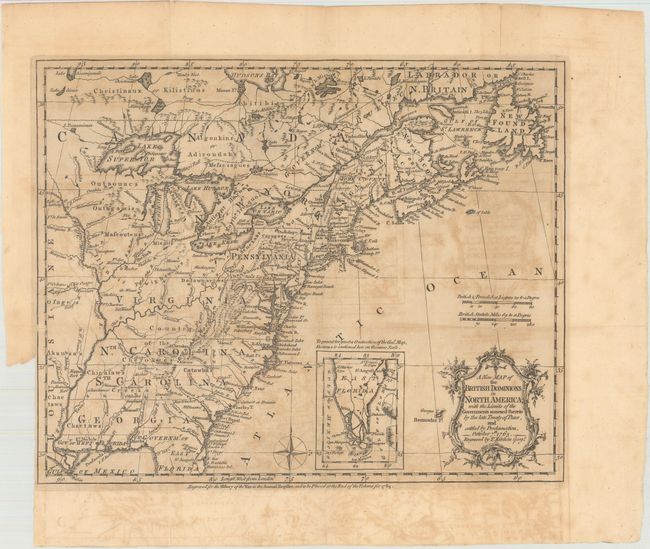
Subject: Colonial Eastern United States & Canada
Kitchin, Thomas
A New Map of the British Dominions in North America; with the Limits of the Governments Annexed Thereto by the Late Treaty of Peace, and Settled by Proclamation, October 7th 1763, 1763
Size: 11.9 x 9.6 inches (30.2 x 24.4 cm)
Estimate: $325 - $400
Sold for: $240
Closed on 9/13/2017
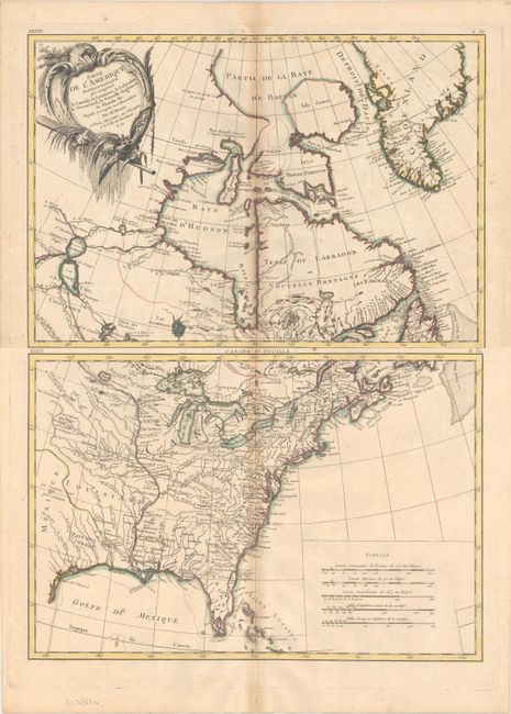
Auction 164, Lot 110
Subject: Colonial Eastern United States & Canada
Bonne/Lattre
[On 2 Sheets] Partie de l'Amerique Septentrionale, qui Comprend le Canada, la Louisiane, le Labrador, le Groenland, la Nouvelle Angleterre, la Floride &c. Projettee et Assujettie aux Observations, 1771
Size: 17.2 x 11.8 inches (43.7 x 30 cm)
Estimate: $450 - $550
Sold for: $275
Closed on 9/13/2017
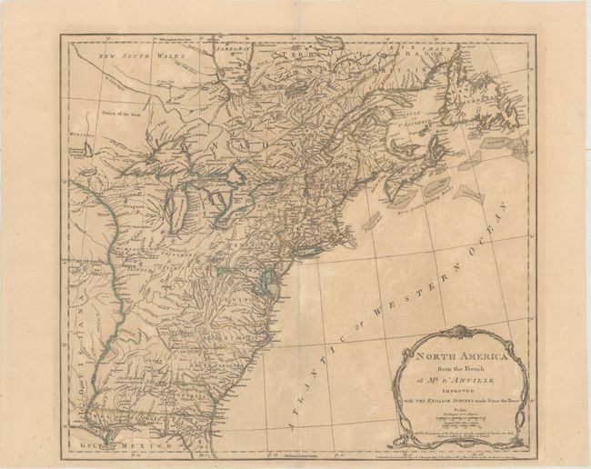
Auction 164, Lot 111
Subject: Colonial Eastern United States & Canada
Jefferys/Sayer & Bennett
North America from the French of Mr. d'Anville Improved with the English Surveys Made Since the Peace, 1775
Size: 20.3 x 18.2 inches (51.6 x 46.2 cm)
Estimate: $550 - $700
Sold for: $300
Closed on 9/13/2017
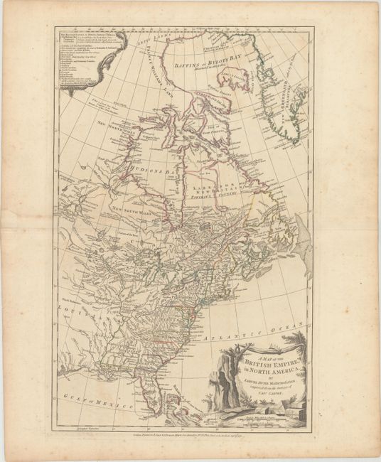
Auction 164, Lot 112
Subject: Colonial Eastern United States & Canada
Dunn, Samuel
A Map of the British Empire, in North America, 1776
Size: 12.1 x 18.8 inches (30.7 x 47.8 cm)
Estimate: $1,100 - $1,400
Unsold
Closed on 9/13/2017
Auction 164, Lot 113
Subject: Colonial Eastern United States & Canada
Lotter, Mathias Albrecht
Carte Nouvelle de l'Amerique Angloise Contenant tout ce que les Anglois Possedent sur le Continent de l'Amerique Septentrionale Savoir le Canada..., 1776
Size: 19.4 x 23.7 inches (49.3 x 60.2 cm)
Estimate: $1,200 - $1,500
Sold for: $800
Closed on 9/13/2017
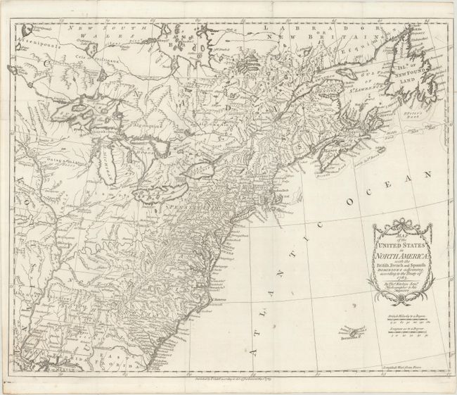
Auction 164, Lot 114
Subject: Eastern United States & Canada
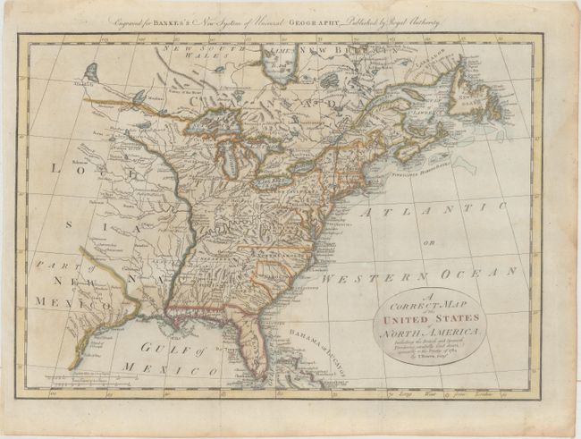
Kitchin, Thomas
Map of the United States in North America: with the British, French and Spanish Dominions Adjoining, According to the Treaty of 1783, 1783
Size: 20.1 x 16.2 inches (51.1 x 41.1 cm)
Estimate: $1,000 - $1,300
One of the Earliest English-Produced Maps to Acknowledge the United States
Sold for: $750
Closed on 9/13/2017
Auction 164, Lot 115
Subject: Eastern United States & Canada
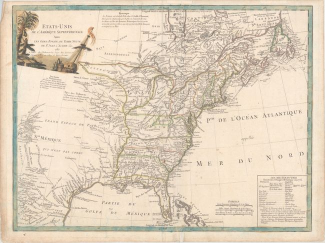
Delamarche, Charles Francois
Etats-Unis de l'Amerique Septentrionale avec les Isles Royale, de Terre Neuve, de St. Jean, l'Acadie &c., 1785
Size: 24.8 x 18.8 inches (63 x 47.8 cm)
Estimate: $900 - $1,100
First Reference to Michigan as a Land Division of the United States
Sold for: $600
Closed on 9/13/2017
Auction 164, Lot 116
Subject: Eastern United States & Canada
Bowen, Thomas
A Correct Map of the United States of North America. Including the British and Spanish Territories, Carefully Laid Down Agreeable to the Treaty of 1784, 1787
Size: 17.6 x 12.4 inches (44.7 x 31.5 cm)
Estimate: $350 - $450
Sold for: $450
Closed on 9/13/2017
Auction 164, Lot 117
Subject: Eastern United States & Canada
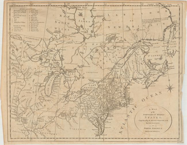
Stockdale, John
A Map of the Northern and Middle States; Comprehending the Western Territory and the British Dominions in North America. From the Best Authorities, 1792
Size: 15.7 x 12.5 inches (39.9 x 31.8 cm)
Estimate: $500 - $650
Sold for: $150
Closed on 9/13/2017
Auction 164, Lot 118
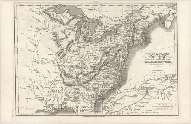
Subject: Eastern United States & Canada
Baines, Edward
United States of America Exhibiting the Seat of War on the Canadian Frontier. From 1812. to 1815, 1816
Size: 13.6 x 9.5 inches (34.5 x 24.1 cm)
Estimate: $350 - $425
Unsold
Closed on 9/13/2017
Auction 164, Lot 119
Subject: Eastern United States & Canada
Brue, Adrien Hubert
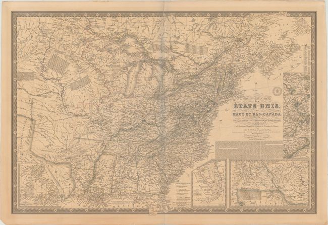
Nouvelle Carte des Etats-Unis, des Haut et Bas-Canada, de la Nouvle.-Ecosse, du Nouvau Brunswick, de Terre-Neuve &a..., 1836
Size: 36.5 x 24.8 inches (92.7 x 63 cm)
Estimate: $500 - $600
Sold for: $300
Closed on 9/13/2017
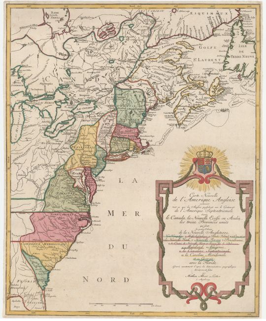
Auction 164, Lot 120
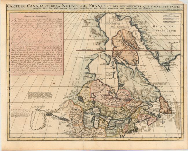
Subject: Colonial Northeastern United States & Canada
Chatelain, Henry Abraham
Carte du Canada ou de la Nouvelle France, & des Decouvertes qui y ont ete Faites, Dressee sur les Observations les Plus Nouvelles, & sur Divers Memoires tant Manuscrits qu' Imprimez, 1719
Size: 20.5 x 16.1 inches (52.1 x 40.9 cm)
Estimate: $600 - $750
Sold for: $350
Closed on 9/13/2017
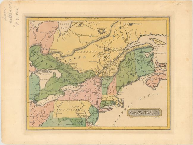
Auction 164, Lot 121
Subject: Northeastern United States & Canada
Lucas, Fielding
Canada, &c., 1816
Size: 10.6 x 8.4 inches (26.9 x 21.3 cm)
Estimate: $250 - $325
Unsold
Closed on 9/13/2017
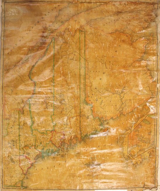
Auction 164, Lot 122
Subject: Maine, Eastern Canada
Greenleaf, Moses
[Wall Map] Map of the State of Maine with the Province of New Brunswick, 1832
Size: 41 x 49.2 inches (104.1 x 125 cm)
Estimate: $1,400 - $1,700
Second Edition of Greenleaf's Large Map of Maine
Sold for: $950
Closed on 9/13/2017
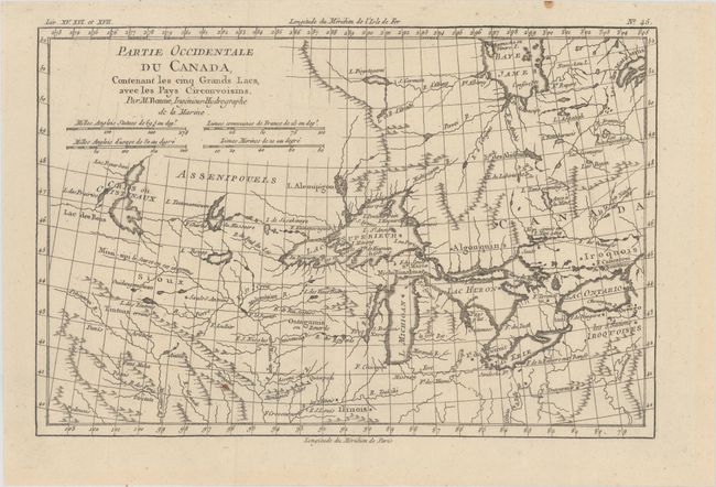
Auction 164, Lot 123
Subject: Great Lakes
Bonne, Rigobert
Partie Occidentale du Canada, Contenant les Cinq Grands Lacs, avec les Pays Circonvoisins, 1775
Size: 12.6 x 8.4 inches (32 x 21.3 cm)
Estimate: $220 - $250
Sold for: $130
Closed on 9/13/2017
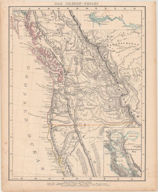
Auction 164, Lot 124
Subject: Western United States & Canada
Flemming, Carl
Das Oregon-Gebiet, 1848
Size: 12.6 x 16.1 inches (32 x 40.9 cm)
Estimate: $220 - $250
Sold for: $160
Closed on 9/13/2017
30 lots