Filtered by Category:Pacific Ocean, New Zealand, Australia(Show All Categories)
Showing results for:Auction 164
Catalog Archive
15 lots
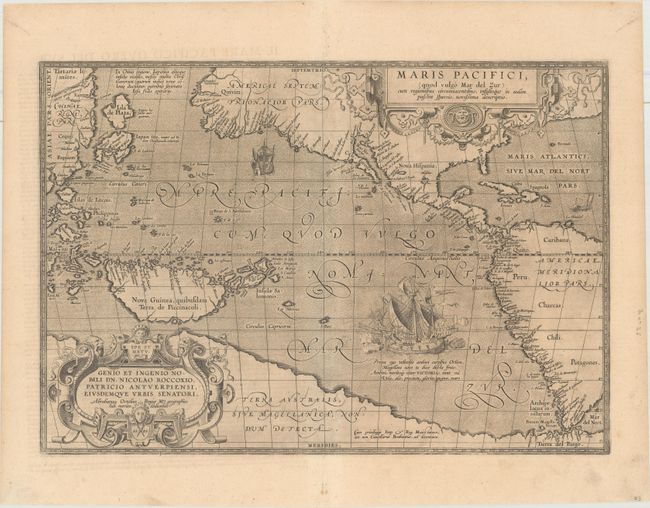
Auction 164, Lot 715
Subject: Pacific Ocean
Ortelius, Abraham
Maris Pacifici, (quod Vulgo Mar del Zur) cum Regionibus Circumiacentibus, Insulisque in Eodem Passim Sparsis, Novissima Descriptio, 1589
Size: 19.6 x 13.6 inches (49.8 x 34.5 cm)
Estimate: $7,500 - $8,500
The First Printed Map Devoted to the Pacific
Unsold
Closed on 9/13/2017
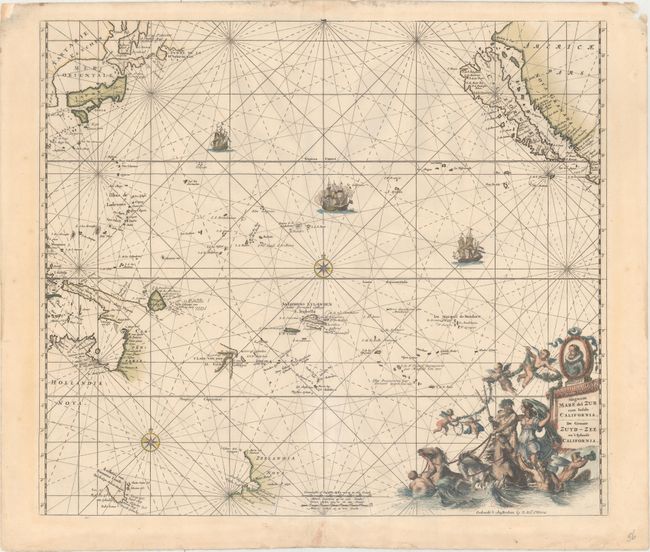
Auction 164, Lot 716
Subject: Pacific Ocean, California
Ottens, Reiner and Joshua
Magnum Mare del Zur cum Insula California / De Groote Zuyd-Zee en 't Eylandt California, 1745
Size: 22.4 x 19.3 inches (56.9 x 49 cm)
Estimate: $2,200 - $2,500
One of the Finest Charts Showing California as an Island
Sold for: $1,100
Closed on 9/13/2017
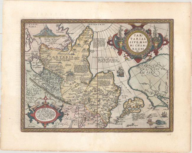
Auction 164, Lot 717
Subject: North Pacific, Northern Asia & Northwestern North America
Ortelius, Abraham
Tartariae sive Magni Chami Regni Typus, 1598
Size: 18.8 x 14 inches (47.8 x 35.6 cm)
Estimate: $950 - $1,200
Sold for: $750
Closed on 9/13/2017
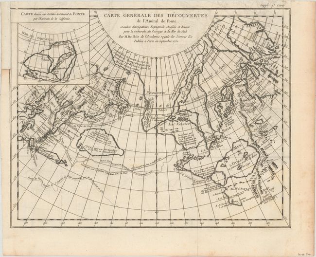
Auction 164, Lot 718
Subject: North Pacific Ocean
Robert de Vaugondy, Didier
Carte Generale des Decouvertes de l'Amiral de Fonte et Autres Navigateurs Espagnols Anglois et Russes..., 1755
Size: 14.7 x 11.6 inches (37.3 x 29.5 cm)
Estimate: $140 - $170
Sold for: $60
Closed on 9/13/2017
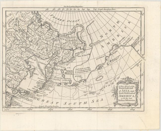
Auction 164, Lot 719
Subject: North Pacific Ocean
Anon.
A New Map of the North East Coast of Asia, and North West Coast of America, with the Late Russian Discoveries, 1764
Size: 9.3 x 6.7 inches (23.6 x 17 cm)
Estimate: $130 - $160
Sold for: $95
Closed on 9/13/2017
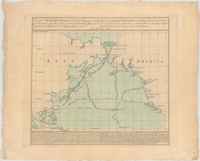
Auction 164, Lot 720
Subject: North Pacific Ocean
Lotter, Tobias Conrad
Carte de l'Ocean Pacifique au Nord de l'Equateur... / Charte des Stillen Weltmeers im Nordlichen Aequator..., 1781
Size: 20 x 18.4 inches (50.8 x 46.7 cm)
Estimate: $800 - $950
Sold for: $500
Closed on 9/13/2017
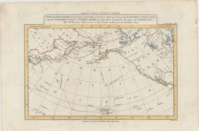
Auction 164, Lot 721
Subject: North Pacific Ocean
Wilkie, J. & T.
A Map of the Discoveries Made by Capts. Cook & Clerke, in the Years 1778 & 1779 Between the Eastern Coast of Asia and the Western Coast of North America..., 1787
Size: 11.1 x 7.6 inches (28.2 x 19.3 cm)
Estimate: $110 - $140
Sold for: $80
Closed on 9/13/2017
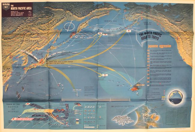
Auction 164, Lot 722
Subject: North Pacific Ocean
U.S. Navy Dept.
Nav War Map No. 4 - The North Pacific Area, 1944
Size: 57.2 x 38.3 inches (145.3 x 97.3 cm)
Estimate: $400 - $600
Fascinating, Large-Scale WWII Pictorial Map
Sold for: $375
Closed on 9/13/2017
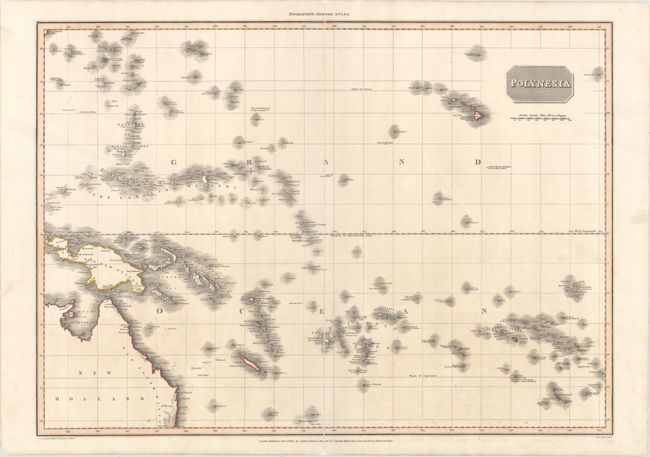
Auction 164, Lot 723
Subject: Pacific Islands
Pinkerton, John
Polynesia, 1813
Size: 27.4 x 19.8 inches (69.6 x 50.3 cm)
Estimate: $300 - $400
Sold for: $220
Closed on 9/13/2017
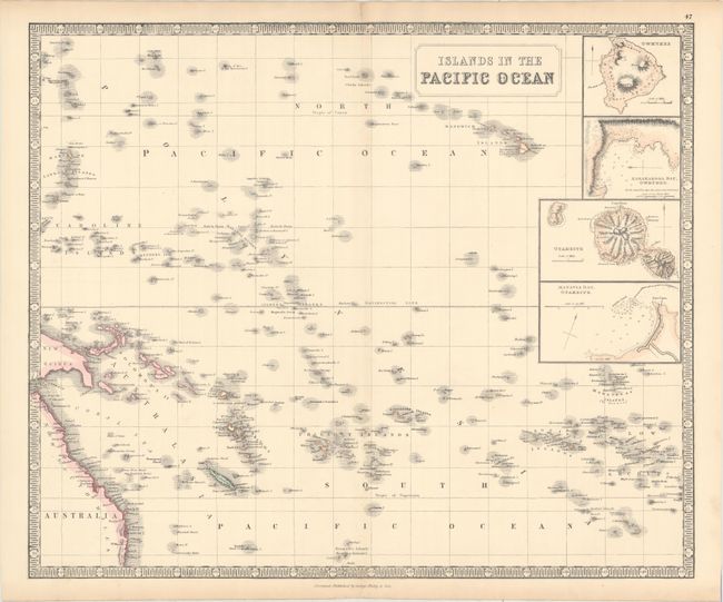
Auction 164, Lot 724
Subject: Pacific Islands
Philip, George
Islands in the Pacific Ocean, 1862
Size: 23.9 x 19.8 inches (60.7 x 50.3 cm)
Estimate: $200 - $230
Sold for: $150
Closed on 9/13/2017
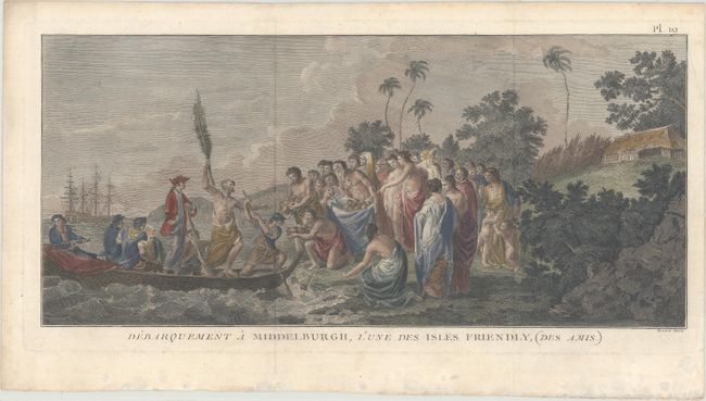
Auction 164, Lot 725
Subject: Tonga
Cook/Benard
Debarquement a Middelburgh, l'Une des Isles Friendly, (des Amis), 1778
Size: 18.1 x 8.3 inches (46 x 21.1 cm)
Estimate: $160 - $190
Unsold
Closed on 9/13/2017
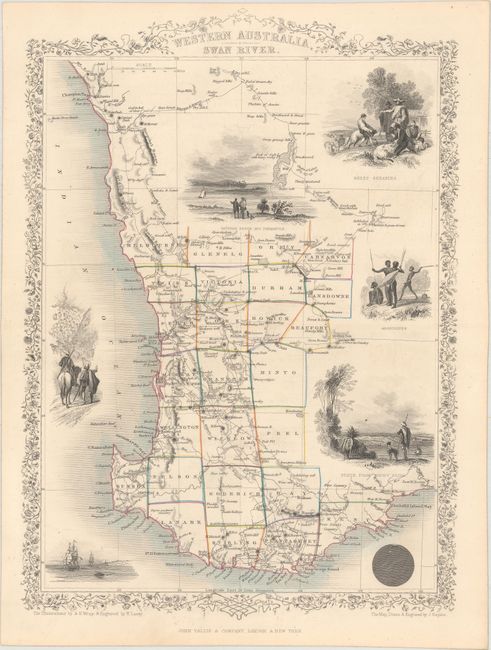
Auction 164, Lot 726
Subject: Australia
Tallis, John
[Lot of 3] Western Australia, Swan River [and] New South Wales [and] Part of South Australia, 1850
Size: 9.7 x 13.5 inches (24.6 x 34.3 cm)
Estimate: $250 - $325
NO RESERVE
Sold for: $170
Closed on 9/13/2017
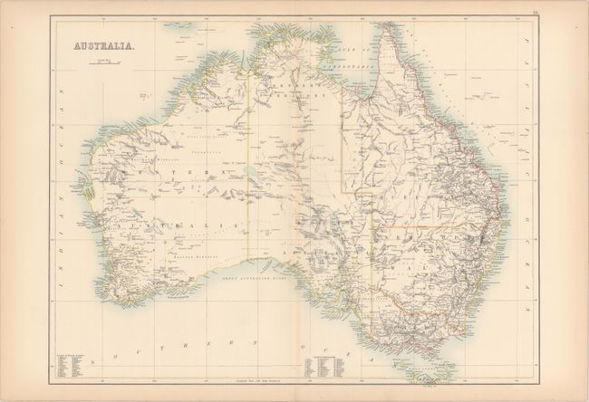
Auction 164, Lot 727
Subject: Australia
Black, Adam & Charles
Australia, 1896
Size: 21.8 x 16.4 inches (55.4 x 41.7 cm)
Estimate: $120 - $150
Unsold
Closed on 9/13/2017
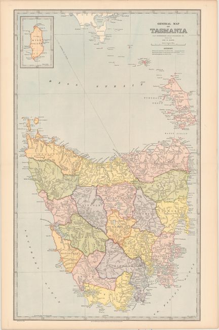
Auction 164, Lot 728
Subject: Tasmania
General Map of Tasmania, 1888
Size: 14.5 x 24 inches (36.8 x 61 cm)
Estimate: $80 - $100
NO RESERVE
Sold for: $19
Closed on 9/13/2017
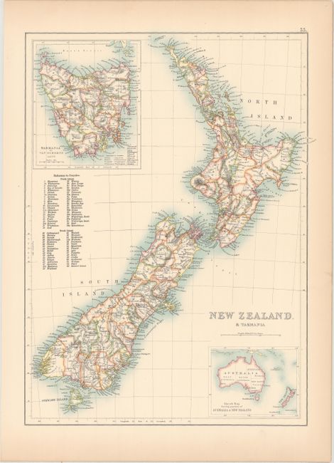
Auction 164, Lot 729
Subject: New Zealand & Tasmania
Black, Adam & Charles
New Zealand & Tasmania, 1896
Size: 11.3 x 15.1 inches (28.7 x 38.4 cm)
Estimate: $80 - $100
Sold for: $60
Closed on 9/13/2017
15 lots