Subject: Eastern United States & Canada
Period: 1836 (dated)
Publication:
Color: Hand Color
Size:
36.5 x 24.8 inches
92.7 x 63 cm
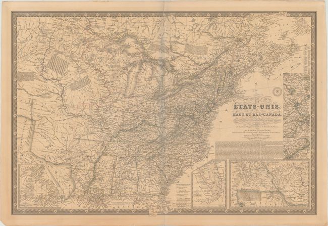
This large and unusual map shows the United States east of the Texas panhandle and Arkansas and Missouri River valleys, which are divided into the Ozark, Osage, Sioux, and Mandan Indian Districts. The map is beautifully engraved and incredibly detailed, particularly of the roads and railroads. Notations throughout concern the Indian tribes, river courses, and early western trails. Sheet includes seven insets: Newfoundland, Southern Florida, Western United States, Philadelphia & Trenton vicinity, New York City vicinity, Boston vicinity and Baltimore & Washington -- all surrounded in a bold keyboard style border. Printed on thick paper with the embossed seal of the Brue firm.
References:
Condition: B+
Original outline color with light toning and offsetting. There are archival repairs to a centerfold separation that enters 2.5" at top and a tear that just enters the border at bottom. There is a light blue shadow along the centerfold that is caused by our scanner and does not appear on the map itself.