Subject: Western United States & Canada
Period: 1848 (circa)
Publication:
Color: Hand Color
Size:
12.6 x 16.1 inches
32 x 40.9 cm
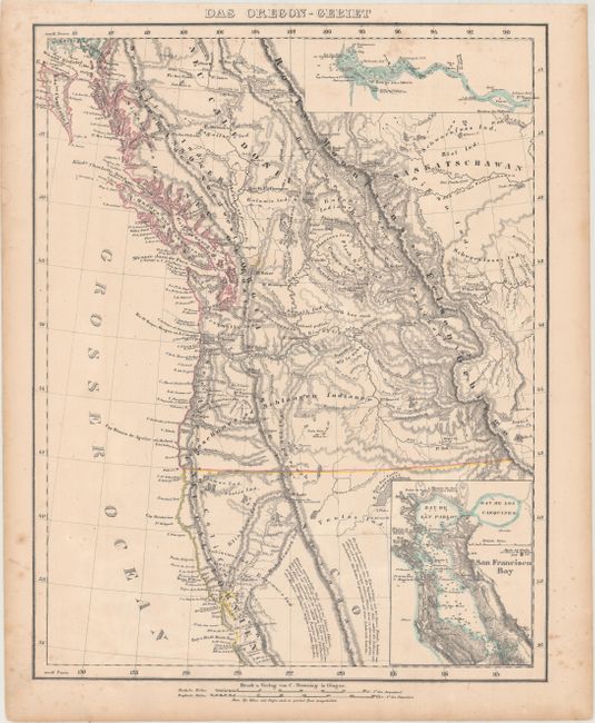
The United States and Great Britain established in 1818 joint claim over the Oregon Territory - the region north of Spanish controlled Upper California up to the southern boundary of Russia's Alaska Territory at North latitude 54°40'. By the late 1830's this arrangement was beginning to fall apart.
In the 1840's the expansionist Democrats, including their 1844 presidential candidate, James Polk, claimed the entire region for the United States. Their expansionist desires were expressed by Polk's famous campaign slogan, "Fifty-four Forty or Fight!" The slogan also became a rally cry for Americans desiring to settle the territory. Following Polk's election, the dispute was resolved by the 1846 Treaty of Oregon, which struck a compromise that fixed the U.S./Canadian boundary at 49º North.
This uncommon German map of Oregon Territory shows the U.S. claim extending well into British Columbia to 54°40. The map reaches south to Monterey, and inland to the Sierra Nevadas and Rocky Mountains. The information is taken from the maps of Fremont and other western explorers. The Columbia River and San Francisco Bay are included in detailed insets, complete with soundings.
References:
Condition: B+
Original outline color with minor toning and light scattered foxing primarily in the blank margins. There is a short edge tear in the left blank margin.