Subject: Eastern Canada
Period: 1662 (circa)
Publication: Atlas Maior
Color: Hand Color
Size:
22.3 x 17.6 inches
56.6 x 44.7 cm
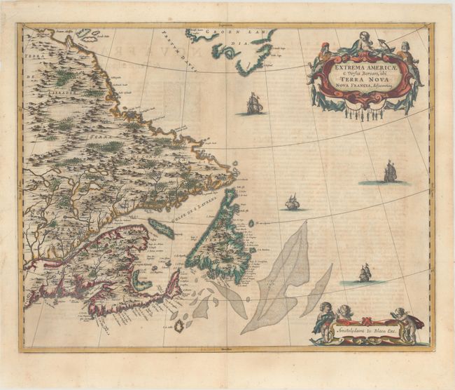
This handsome map of the Canadian Maritimes is based on Samuel de Champlain's great map of 1632, and augmented with place names from De Laet and Jansson. This is Blaeu's only map of Canada. It shows Nova Scotia, Newfoundland, the Gulf of St. Lawrence, Labrador and the Davis and Hudson Straits as well as the southern tip of Greenland and a portion of northern Maine. The elaborate cartouches symbolize the importance of the Grand Banks fisheries, which are boldly engraved on the map. Only five editions of the Atlas Maior, containing this map, were published prior to the fire that destroyed the Blaeu printing house in 1672. Thus the map is now quite scarce. Published in the Latin text edition of the Atlas Major.
References: Burden #371, Goss (Blaeu) p. 158; Kershaw #149; Van der Krogt (Vol. II) #9130:2.
Condition: B+
A crisp impression on paper with a large elephant watermark, original outline color in the map and later color in the cartouches. There is light toning and some show-through of text on verso.