Filtered by Category:Books, Atlases, Travel Guides, Geography & Reference Books(Show All Categories)
Showing results for:Auction 182
Catalog Archive
54 lots
Page 1 of 2
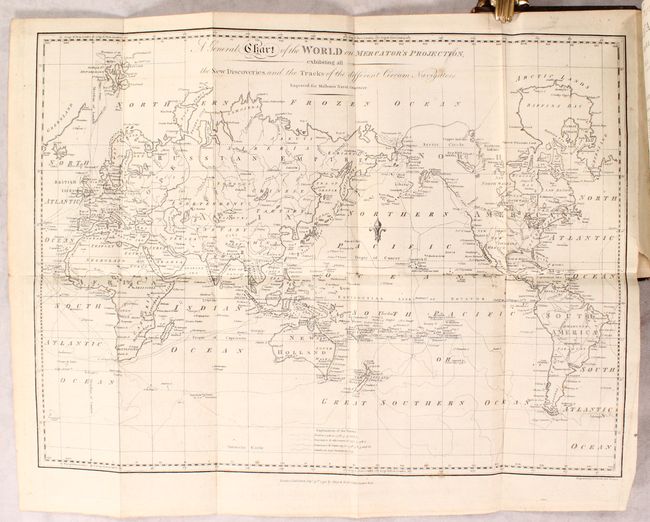
Auction 182, Lot 6
Subject: World
Aa, Pieter van der
Nova Delineatio Totius Orbis Terrarum [in] Le Grand Theatre Historique, ou Nouvelle Histoire Universelle, tant Sacree que Profane..., 1703
Size: 13.3 x 10.1 inches (33.8 x 25.7 cm)
Estimate: $1,000 - $1,300
Sold for: $1,100
Closed on 4/28/2021
Auction 182, Lot 13
Subject: World
Brouckner/Remondini
[2 Maps in Books] Dizionario Geografico Portatile, Ouvero Descrizione di Tutti i Regni, Provincie, Citta, Patriarcati…, 1761
Size: 4.9 x 7.3 inches (12.4 x 18.5 cm)
Estimate: $500 - $650
Sold for: $300
Closed on 4/28/2021
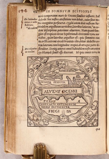
Auction 182, Lot 27
Subject: Ancient World
Macrobius, Ambrosius Aurelius Theodo
Macrobii Ambrosii, Aurelii Theodosii, Viri Consularis & illustris, In Somnium Scipionis, Lib. II. Saturnaliorum, Lib. VII…, 1548
Size: 4.5 x 7 inches (11.4 x 17.8 cm)
Estimate: $1,100 - $1,400
Sold for: $850
Closed on 4/28/2021
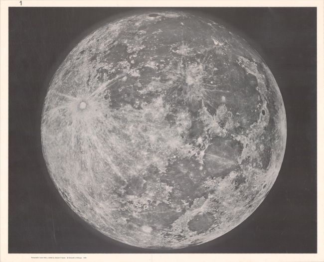
Auction 182, Lot 50
Subject: Moon
Photographic Lunar Atlas - Based on Photographs Taken at the Mount Wilson, Lick, Pic du Midi, McDonald and Yerkes Observatories, 1960
Size: 18.2 x 22 inches (46.2 x 55.9 cm)
Estimate: $275 - $350
Sold for: $1,200
Closed on 4/28/2021
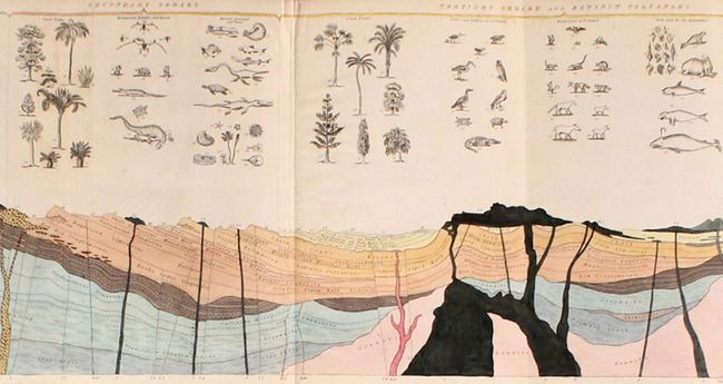
Auction 182, Lot 56
Subject: Cartographic Miscellany, Earth
Ideal Section of a Portion of the Earth's Crust, Intended to Shew the Order of Deposition of the Stratified Rocks... [in] Geology and Mineralogy Considered with Reference to Natural Theology (Vol II only), 1837
Size: 45.8 x 8 inches (116.3 x 20.3 cm)
Estimate: $550 - $700
Sold for: $400
Closed on 4/28/2021
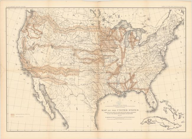
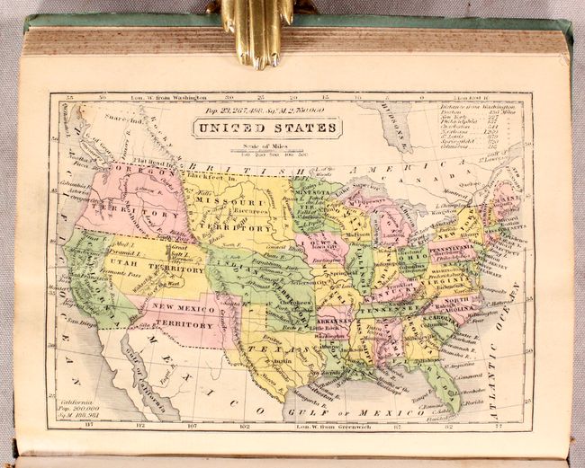
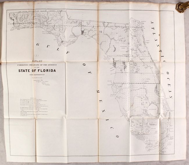
Auction 182, Lot 141
Subject: United States
Powell, John Wesley
Report on the Lands of the Arid Region of the United States, with a More Detailed Account of the Lands of Utah. With Maps, 1879
Size: 9.3 x 11.9 inches (23.6 x 30.2 cm)
Estimate: $300 - $375
Sold for: $220
Closed on 4/28/2021
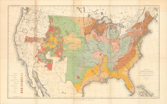
Auction 182, Lot 142
Subject: United States, Geology
U.S. Geological Survey (USGS)
Map of the United States Exhibiting the Present Status of Knowledge Relating to the Areal Distribution of Geologic Groups... [and] Map of the United States Exhibiting the Progress Made in the Geographic Survey [in] Fifth Annual Report..., 1885
Size: 28.2 x 17.4 inches (71.6 x 44.2 cm)
Estimate: $300 - $375
Sold for: $150
Closed on 4/28/2021
Auction 182, Lot 157
Subject: Eastern United States
Marshall, John
Atlas to Marshall's Life of Washington, 1832
Size: 5.7 x 8.9 inches (14.5 x 22.6 cm)
Estimate: $350 - $425
Sold for: $300
Closed on 4/28/2021
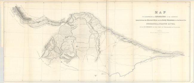
Auction 182, Lot 200
Subject: Western United States
Fremont/Preuss
Map to Illustrate an Exploration of the Country, Lying Between the Missouri River and the Rocky Mountains... [with report] Report from the Secretary of War, Communicating ... Lieut. Fremont's Report of His Exploring Expedition to the Rocky Mountains, 1843
Size: 32.7 x 13.9 inches (83.1 x 35.3 cm)
Estimate: $900 - $1,100
First Printing of Fremont's First Expedition to the Rockies
Sold for: $700
Closed on 4/28/2021
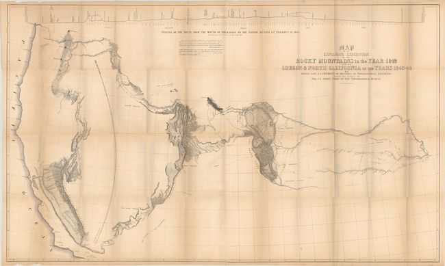
Auction 182, Lot 201
Subject: Western United States
Fremont, John Charles
[Lot of 2] Map of an Exploring Expedition to the Rocky Mountains in the Year 1842... [with report] [and] Message of the President of the United States, Communicating the Proceedings of the Court Martial in the Trial of Lieutenant Colonel Fremont, 1845-48
Size: See Description
Estimate: $900 - $1,100
Sold for: $650
Closed on 4/28/2021
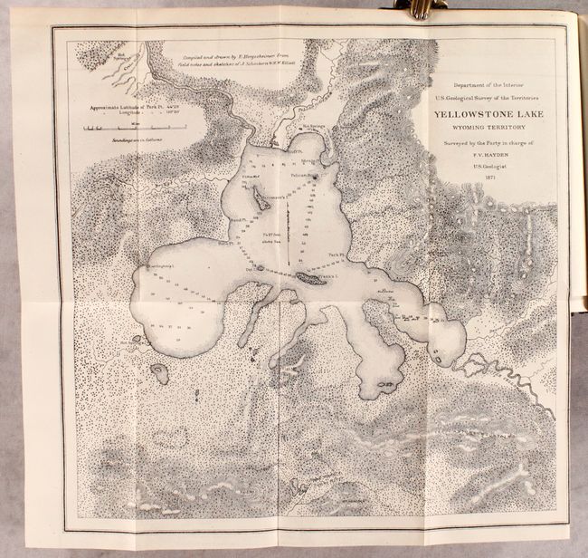
Auction 182, Lot 213
Subject: Montana, Wyoming & Yellowstone
Hayden, Ferdinand Vandeveer
Preliminary Report of the United States Geological Survey of Montana and Portions of Adjacent Territories; Being a Fifth Annual Report of Progress, 1872
Size: 5.9 x 9 inches (15 x 22.9 cm)
Estimate: $240 - $300
Important Report that Helped Establish Yellowstone National Park
Sold for: $350
Closed on 4/28/2021
Auction 182, Lot 215
Subject: Southwestern United States
Emory, William Hemsley
Military Reconnaissance of the Arkansas, Rio del Norte and Rio Gila... [with report] Notes of a Military Reconnoissance, from Fort Leavenworth, in Missouri, to San Diego, in California..., 1848
Size: 64 x 30 inches (162.6 x 76.2 cm)
Estimate: $450 - $550
Sold for: $290
Closed on 4/28/2021
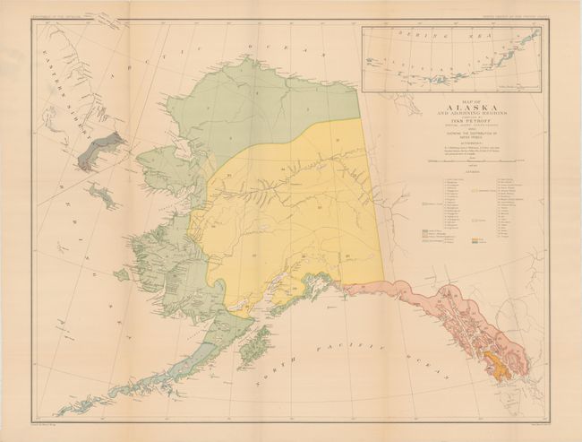
Auction 182, Lot 222
Subject: Alaska
U.S. Department of Interior
[2 Maps with Report] Map of Alaska and Adjoining Regions [and] Map of Alaska and Adjoining Regions ... Showing the Distribution of Native Tribes [with] Alaska: Its Population, Industries, and Resources [and other reports], 1884
Size: 30.6 x 24.3 inches (77.7 x 61.7 cm)
Estimate: $275 - $350
Sold for: $140
Closed on 4/28/2021
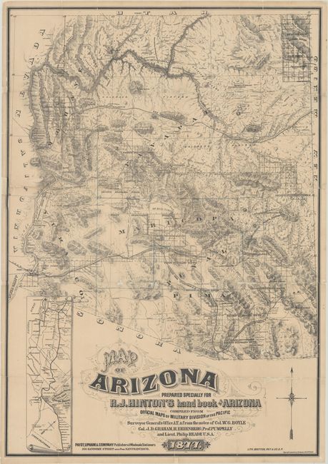
Auction 182, Lot 226
Subject: Arizona
Hinton, Richard J.
Map of Arizona Prepared Specially for R.J. Hinton's Hand Book of Arizona Compiled from Official Maps of Military Division of the Pacific… [with] The Hand-book to Arizona: Its Resources, History, Towns, Mines, Ruins and Scenery..., 1877
Size: 24.1 x 34.6 inches (61.2 x 87.9 cm)
Estimate: $5,500 - $7,000
One of the Earliest Large-Scale Maps of Arizona Territory
Unsold
Closed on 4/28/2021
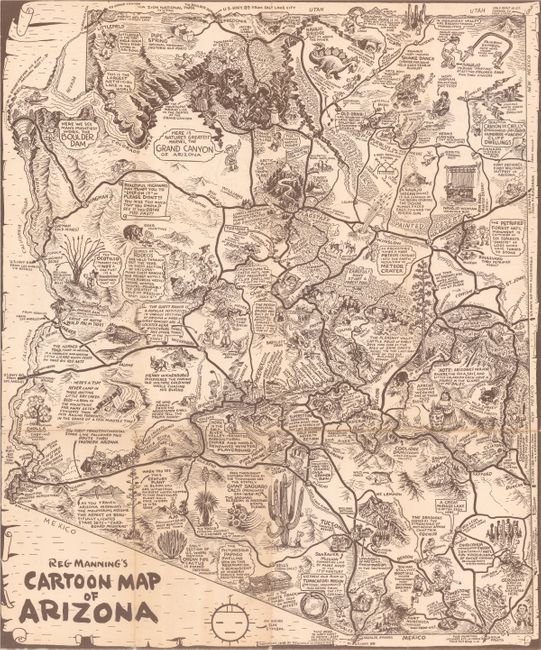
Auction 182, Lot 229
Subject: Arizona
Reg Manning's Cartoon Map of Arizona [with] Reg Manning's Cartoon Guide of Arizona, 1938
Size: 16 x 19.2 inches (40.6 x 48.8 cm)
Estimate: $90 - $120
Sold for: $110
Closed on 4/28/2021
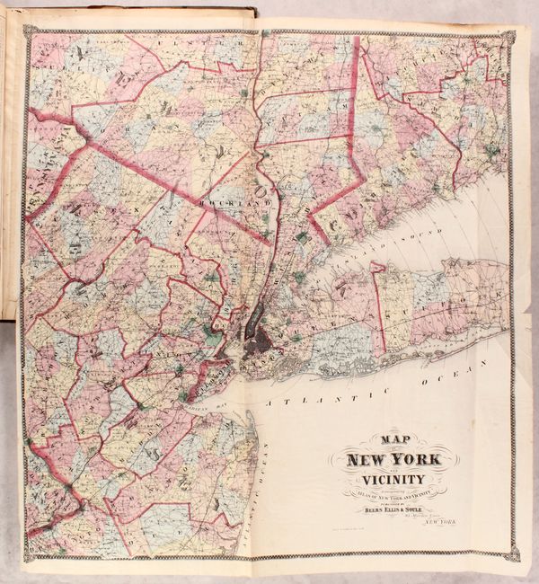
Auction 182, Lot 299
Subject: New York City, New York
Beers, Ellis & Soule
Atlas of New York and Vicinity from Actual Surveys, 1867
Size: 15 x 18 inches (38.1 x 45.7 cm)
Estimate: $1,000 - $1,300
Sold for: $750
Closed on 4/28/2021
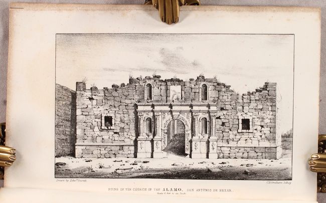
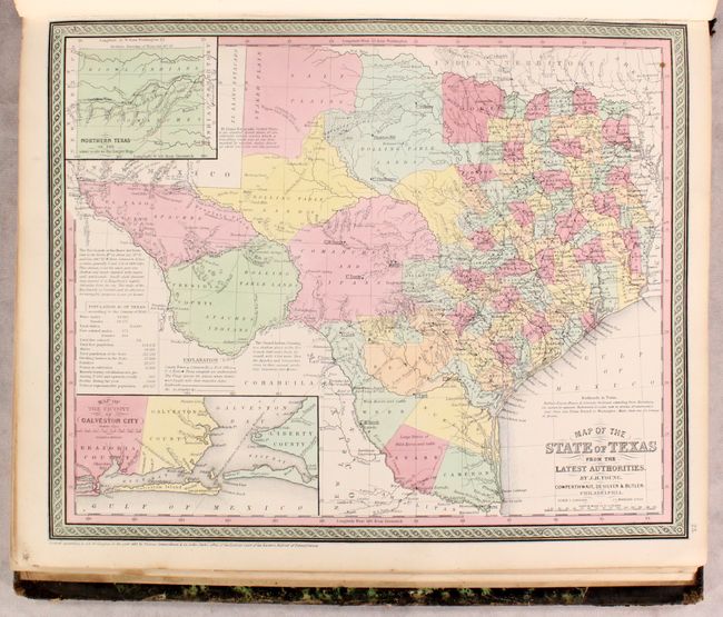
Auction 182, Lot 331
Subject: San Antonio, Texas
U.S. War Department
Report of the Secretary of War Communicating ... a Map Showing the Operations of the Army of the United States in Texas and the Adjacent Mexican States on the Rio Grande..., 1850
Size: 5.8 x 8.8 inches (14.7 x 22.4 cm)
Estimate: $800 - $950
Earliest Published Views of the Ruins of the Alamo
Sold for: $1,300
Closed on 4/28/2021
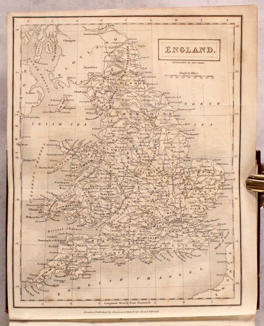
Auction 182, Lot 461
Subject: Britain
Hall, Sidney
[3 Volumes] A Topographical Dictionary of Great Britian and Ireland, Compiled from Local Information, and the Most Recent and Official Authorities, 1833
Size: 5.4 x 8.4 inches (13.7 x 21.3 cm)
Estimate: $400 - $475
Sold for: $275
Closed on 4/28/2021
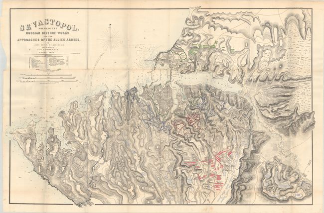
Auction 182, Lot 569
Subject: Black Sea, Crimea
U.S. War Department
Sevastopol, Shewing the Russian Defence Works and the Approaches of the Allied Armies [with report] Report of the Secretary of War, Communicating the Report of Captain George B. McClellan..., 1857
Size: 46.1 x 30.3 inches (117.1 x 77 cm)
Estimate: $350 - $425
Sold for: $200
Closed on 4/28/2021
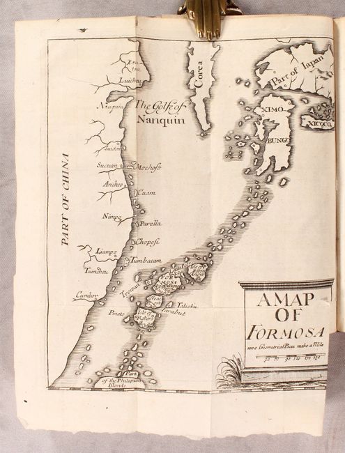
Auction 182, Lot 680
Subject: Taiwan
A Map of Formosa [bound in] An Historical and Geographical Description of Formosa, an Island Subject to the Emperor of Japan..., 1704
Size: 6.6 x 7.9 inches (16.8 x 20.1 cm)
Estimate: $700 - $850
Completely Fictitious Account of Formosa
Sold for: $650
Closed on 4/28/2021
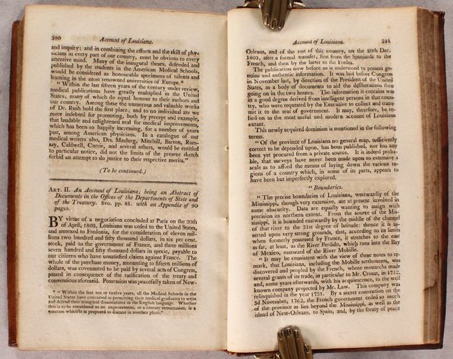
Auction 182, Lot 783
Subject: Document - Lewis & Clark
[Lewis & Clark] The Medical Repository and Review of American Publications…Second Hexade. Vol. I, 1804
Size: 5.3 x 8.4 inches (13.5 x 21.3 cm)
Estimate: $300 - $400
Remarkable Magazine Volume with Important Louisiana and Lewis & Clark Reports
Sold for: $450
Closed on 4/28/2021
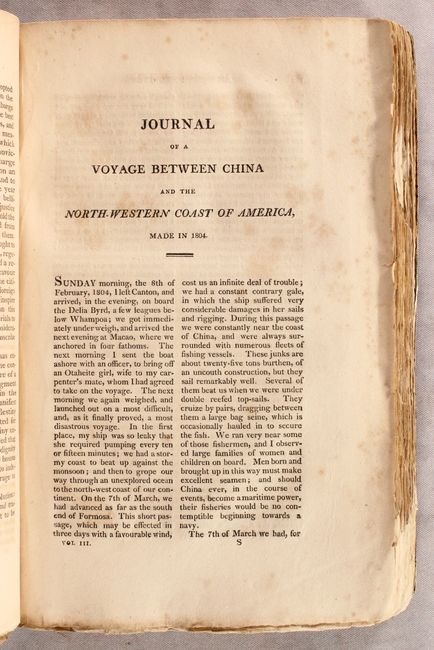
Auction 182, Lot 784
Subject: Document - California
[California] Journal of a Voyage Between China and the North-Western Coast Of America, Made In 1804 [in] The American Register: or General Repository of History, Politics, and Science Part I For 1808. Vol. III, 1808
Size: 5.6 x 9.3 inches (14.2 x 23.6 cm)
Estimate: $500 - $700
First Extensive Account of California Published in the United States by an American Visitor
Sold for: $1,400
Closed on 4/28/2021

Auction 182, Lot 788
Subject: Document - Mormon War & Western Exploration
U.S. War Department
Message of the President of the United States, to the Two Houses of Congress at the Commencement of the First Session of the Thirty-fifth Congress ...Vol. II, 1858
Size: 5.9 x 9.1 inches (15 x 23.1 cm)
Estimate: $250 - $325
Reports on the Mormon War and Western Exploration
Sold for: $425
Closed on 4/28/2021
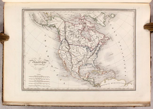
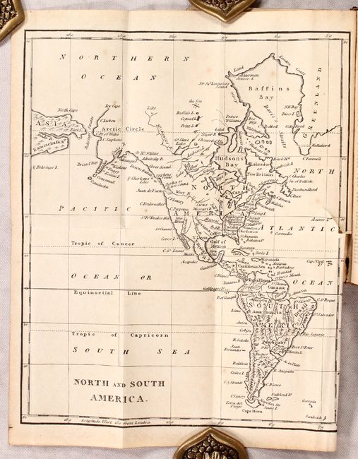
Auction 182, Lot 794
Subject: Atlases
Rizzi-Zannoni, Giovanni Antonio
Atlas Geographique Contenant la Mappemonde et les Quatre Parties, avec les Differents Etats d'Europe, 1762
Size: 3.4 x 5 inches (8.6 x 12.7 cm)
Estimate: $1,200 - $1,500
First Edition
Sold for: $800
Closed on 4/28/2021
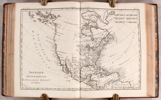
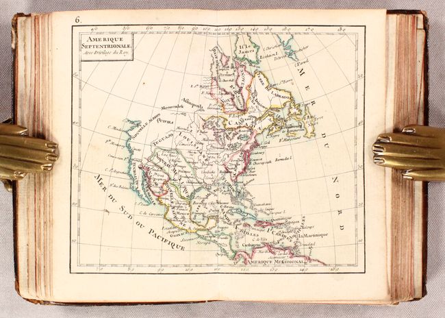
Auction 182, Lot 795
Subject: Atlases
Bonne/Raynal
Atlas de Toutes les Parties Connues du Globe Terrestre, Dresse pour l'Histoire Philosophique & Politique des Etablissemens & du Commerce des Europeens dans les Deux Indes, 1780
Size: 8 x 10.4 inches (20.3 x 26.4 cm)
Estimate: $1,200 - $1,500
Sold for: $1,000
Closed on 4/28/2021
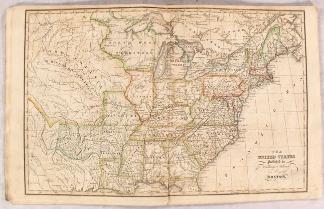
Auction 182, Lot 796
Subject: Atlases
Cummings & Hilliard
[Untitled - School Atlas], 1821
Size: 9.8 x 12 inches (24.9 x 30.5 cm)
Estimate: $275 - $350
Sold for: $550
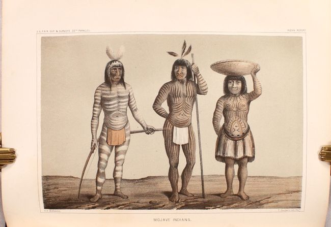
Closed on 4/28/2021
Auction 182, Lot 797
Subject: Atlases
Malte-Brun, Conrad
Atlas Complet du Precis de la Geographie Universelle de Malte-Brun..., 1837
Size: 11.2 x 15.8 inches (28.4 x 40.1 cm)
Estimate: $500 - $650
Sold for: $850
Closed on 4/28/2021
Auction 182, Lot 798
Subject: Atlases
Cowperthwait, Desilver & Butler
A New Universal Atlas Containing Maps of the Various Empires, Kingdoms, States and Republics of the World..., 1854
Size: 14 x 17.5 inches (35.6 x 44.5 cm)
Estimate: $1,900 - $2,200
Cowperthwait's Desirable Atlas Emphasizing the American Continent
Sold for: $2,750
Closed on 4/28/2021
Auction 182, Lot 799
Subject: Atlases
Colton, Joseph Hutchins
Colton's Atlas of the World, Illustrating Physical and Political Geography ... Volume I. - North and South America, Etc., 1856
Size: 16.6 x 19.1 inches (42.2 x 48.5 cm)
Estimate: $1,400 - $1,700
Sold for: $1,600
Closed on 4/28/2021
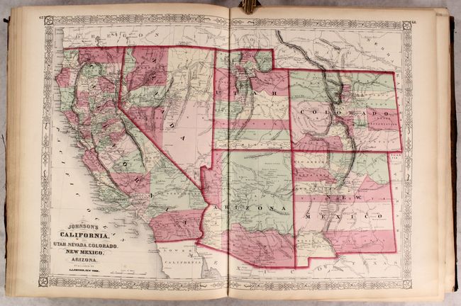
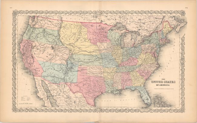
Auction 182, Lot 800
Subject: Atlases
Johnson, A. J.
Johnson's New Illustrated Family Atlas of the World, with Physical Geography, and with Descriptions Geographical, Statistical, and Historical..., 1867
Size: 14.9 x 18.8 inches (37.8 x 47.8 cm)
Estimate: $600 - $750
Sold for: $400
Closed on 4/28/2021
Auction 182, Lot 801
Subject: Geography Books
Brookes, Richard
The General Gazetteer; or, Compendious Geographical Dictionary, in Miniature..., 1812
Size: 3.6 x 5.8 inches (9.1 x 14.7 cm)
Estimate: $275 - $350
Unsold
Closed on 4/28/2021
Auction 182, Lot 802
Subject: Geography Books
Darby, William
View of the United States, Historical, Geographical, and Statistical; Exhibiting, in a Convenient Form, the Natural and Artificial Features of the Several States..., 1828
Size: 3.8 x 6.1 inches (9.7 x 15.5 cm)
Estimate: $500 - $650
Unsold
Closed on 4/28/2021
Auction 182, Lot 803
Subject: Geography Books, Texas
Goodrich, Samuel Griswold
The First Book of History, Combined with Geography; Containing the History and Geography of the Western Hemisphere. For the Use of Schools..., 1852
Size: 5.5 x 7.2 inches (14 x 18.3 cm)
Estimate: $140 - $170
Sold for: $100
Closed on 4/28/2021
Auction 182, Lot 804
Subject: Exploration & Surveys
Anson, George
A Voyage Round the World, in the Years MDCCXL, I, II, III, IV...., 1748
Size: 7.9 x 9.9 inches (20.1 x 25.1 cm)
Estimate: $1,600 - $1,900
First Edition of Anson's Voyage
Unsold
Closed on 4/28/2021
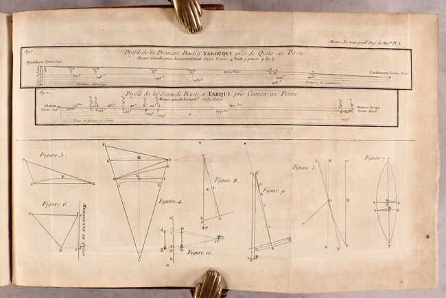
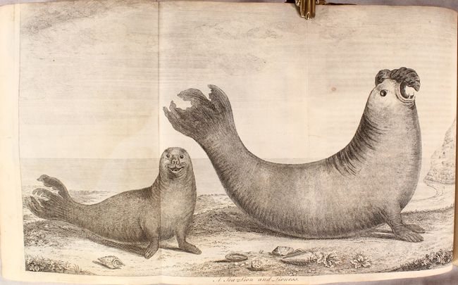
Auction 182, Lot 805
Subject: Exploration & Surveys, Peru
La Condamine
Mesure des Trois Premiers Degres du Meridien dans l'Hemisphere Austral, Tiree des Observations de Mrs. de l'Academie Royale des Sciences, Envoyes par le Roi sous l'Equateur, 1751
Size: 7.9 x 10 inches (20.1 x 25.4 cm)
Estimate: $300 - $400
Sold for: $150
Closed on 4/28/2021
Auction 182, Lot 806
Subject: Exploration & Surveys
U.S. Government
[Maps and Views] Message from the President of the United States … First Session of the Thirty-third Congress. Part IV. Maps and Other Illustrations Belonging to Reports Accompanying the Message, 1853
Size: 6 x 9.2 inches (15.2 x 23.4 cm)
Estimate: $180 - $220
Sold for: $100
Closed on 4/28/2021
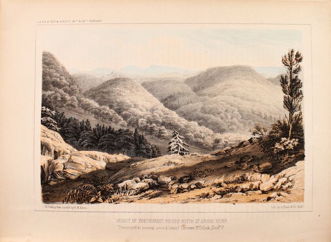
Auction 182, Lot 807
Subject: Railroad Surveys
U.S. Railroad Surveys
[Pacific Railroad Surveys - Volume II] Reports of Explorations and Surveys, to Ascertain the most Practicable and Economical Route for a Railroad from the Mississippi River to the Pacific Ocean, Volume II, 1855
Size: 9.3 x 11.9 inches (23.6 x 30.2 cm)
Estimate: $300 - $375
Sold for: $220
Closed on 4/28/2021
Auction 182, Lot 808
Subject: Railroad Surveys
U.S. Railroad Surveys
[Pacific Railroad Surveys - Volume III] Reports of Explorations and Surveys, to Ascertain the Most Practicable and Economical Route for a Railroad from the Mississippi River to the Pacific Ocean ... Volume III, 1856
Size: 9.3 x 12 inches (23.6 x 30.5 cm)
Estimate: $300 - $375
Sold for: $220
Closed on 4/28/2021
Auction 182, Lot 809
Subject: Miscellaneous Books
Malham, John (Rev.)
[2 Volumes] The Naval Gazetteer; or, Seaman's Complete Guide. Containing a Full and Accurate Account..., 1795
Size: 5.3 x 8.3 inches (13.5 x 21.1 cm)
Estimate: $1,200 - $1,500
Complete First Edition of Malham's Gazetteer
Sold for: $900
Closed on 4/28/2021
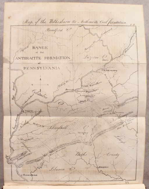
Auction 182, Lot 810
Subject: Miscellaneous Books, Lithography
[2 Maps in Book] Map of the Wilkesbarre &c Anthracite Coal Formation [and] Barton on the Catskills [bound in] The American Journal of Science, and Arts ... Vol. IV..., 1821-22
Size: 5.3 x 8.7 inches (13.5 x 22.1 cm)
Estimate: $400 - $600
Volume Includes the First Two Maps Lithographed in the United States
Sold for: $220
Closed on 4/28/2021
Auction 182, Lot 811
Subject: References, Facsimile Atlas
Mercator, Gerard
[Facsimile] Atlas sive Cosmographicae Meditationes de Fabrica Mundi et Fabricati Figura, 1988
Size: 13.1 x 17.8 inches (33.3 x 45.2 cm)
Estimate: $240 - $300
Sold for: $275
Closed on 4/28/2021
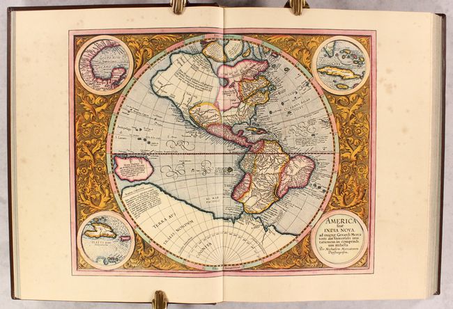
Auction 182, Lot 812
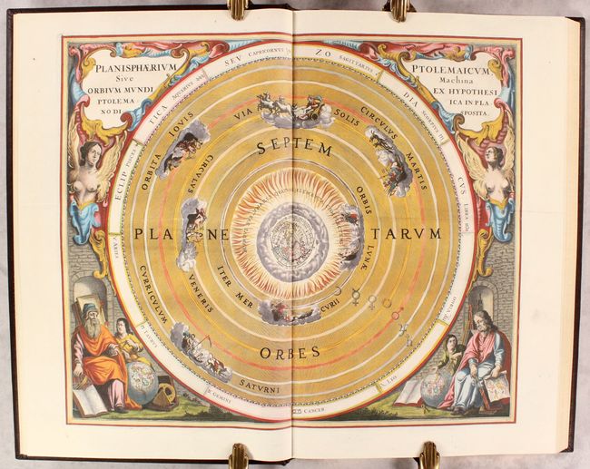
Subject: References, Facsimile Atlas
Cellarius, Andreas
[Facsimile] Harmonia Macrocosmica seu Atlas Universalis et Novus, Totius Universi Creati Cosmographiam Generalem, et Novam Exhibens..., 2008
Size: 13 x 20.5 inches (33 x 52.1 cm)
Estimate: $300 - $375
Sold for: $220
Closed on 4/28/2021
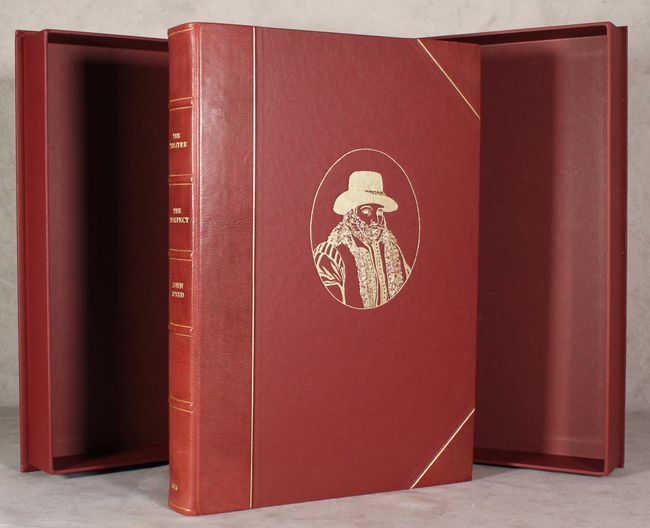
Auction 182, Lot 813
Subject: References, Facsimile Atlas
Speed, John
[Facsimile] The Theatre of the Empire of Great Britain with the Prospect of the Most Famous Parts of the World, 1991
Size: 12.7 x 18 inches (32.3 x 45.7 cm)
Estimate: $400 - $475
Sold for: $900
Closed on 4/28/2021
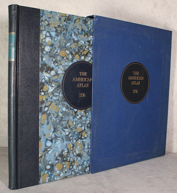
Auction 182, Lot 814
Subject: References, Facsimile Atlas
Jefferys/Sayer & Bennett
[Facsimile] The American Atlas: or, a Geographical Description of the Whole Continent of America: Wherein Are Delineated at Large, Its Several Regions, Countries, States, and Islands..., 1976
Size: 17 x 21.9 inches (43.2 x 55.6 cm)
Estimate: $700 - $850
Sold for: $500
Closed on 4/28/2021
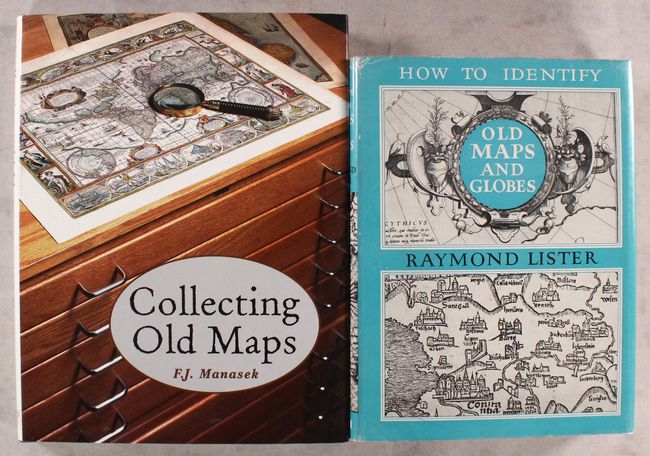
Auction 182, Lot 815
Subject: References
[Lot of 2] Collecting Old Maps [and] How to Identify Old Maps and Globes, 1965-98
Size: See Description
Estimate: $100 - $130
NO RESERVE
Sold for: $220
Closed on 4/28/2021
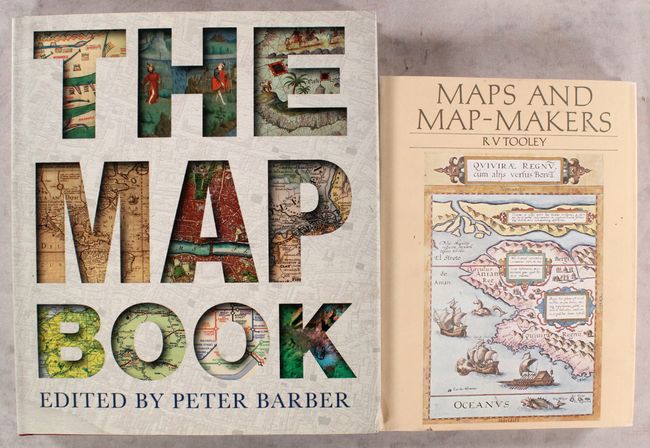
Auction 182, Lot 816
Subject: References
[Lot of 2] The Map Book [and] Maps and Map-Makers, 1978-2005
Size: See Description
Estimate: $70 - $90
NO RESERVE
Sold for: $75
Closed on 4/28/2021
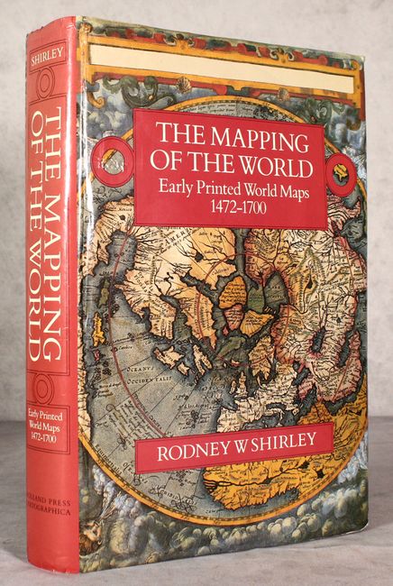
Auction 182, Lot 817
Subject: References, World
Shirley, Rodney W.
The Mapping of the World - Early Printed World Maps 1472-1700, 1987
Size: 9.8 x 13.8 inches (24.9 x 35.1 cm)
Estimate: $400 - $475
Sold for: $450
Closed on 4/28/2021
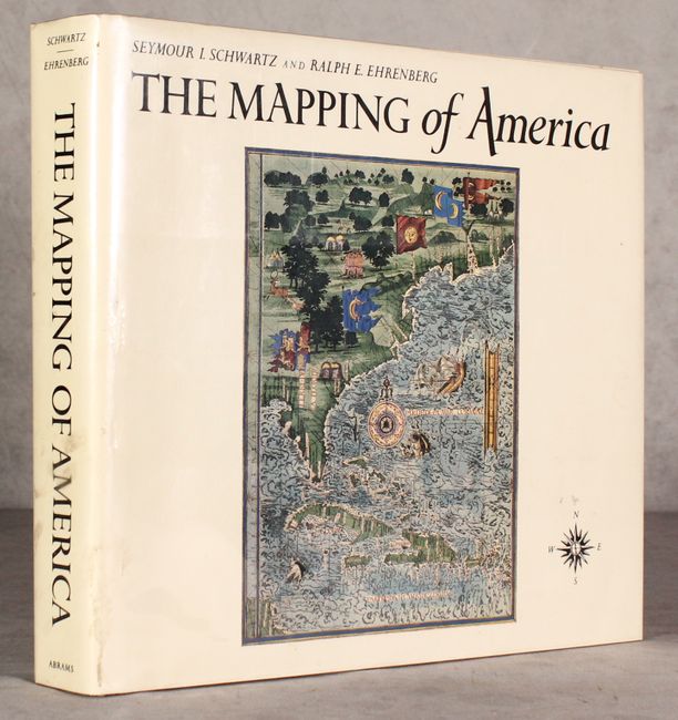
Auction 182, Lot 818
Subject: References, North America
Schwartz & Ehrenberg
The Mapping of America, 1980
Size: 11.9 x 10.9 inches (30.2 x 27.7 cm)
Estimate: $70 - $90
NO RESERVE
Sold for: $26
Closed on 4/28/2021
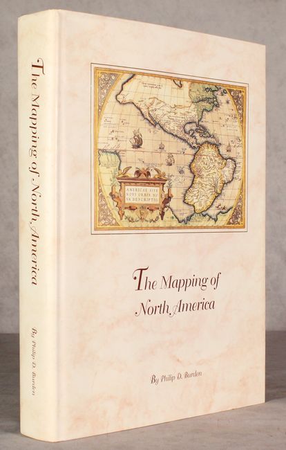
Auction 182, Lot 819
Subject: References, North America
Burden, Philip D.
The Mapping of North America - A List of Printed Maps 1511-1670, 1996
Size: 10.6 x 14.3 inches (26.9 x 36.3 cm)
Estimate: $200 - $230
Sold for: $150
Closed on 4/28/2021
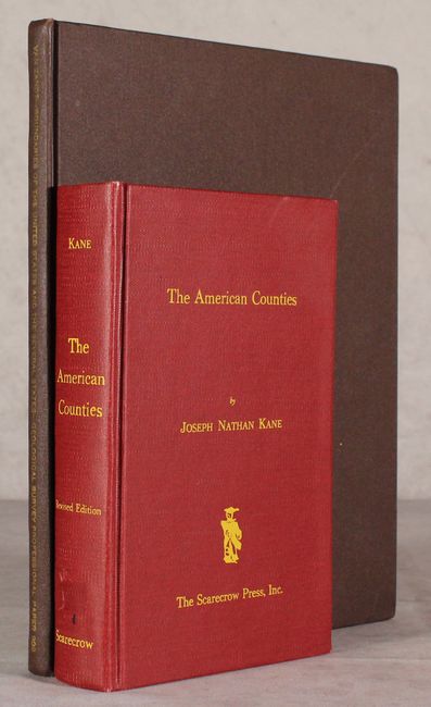
Auction 182, Lot 820
Subject: References, United States
[Lot of 2] Boundaries of the United States and the Several States [and] The American Counties, 1962-76
Size: See Description
Estimate: $40 - $50
NO RESERVE
Sold for: $110
Closed on 4/28/2021
54 lots
Page 1 of 2