Subject: Railroad Surveys
Period: 1856 (published)
Publication: H.R. Ex. Doc. 91, 33rd Congress, 2nd Session
Color: Hand Color
Size:
9.3 x 12 inches
23.6 x 30.5 cm
During the 1850s, the U.S. government sponsored an extensive series of expeditions designed to gather information on the vast new territories that had been acquired in western North America. The discovery of gold in California further stimulated westward traffic and heightened the need for a faster and more convenient way to bring the far-flung parts of the country together. In 1853 Congress commissioned the Army's Topographic Bureau to conduct a series of surveys to find a suitable route for a transcontinental railroad. There were six major expeditions; five of them covered the area between the Great Plains and west coast, and the sixth explored the coastal states of California and Oregon. All of these expeditions were accompanied by naturalists and artists to document the landscape, flora and fauna along the route.
The reports, maps and lithographs were published in the 13 volume report "Explorations and Surveys to ascertain the most practicable and economical route for a Railroad from the Mississippi river to the Pacific Ocean."
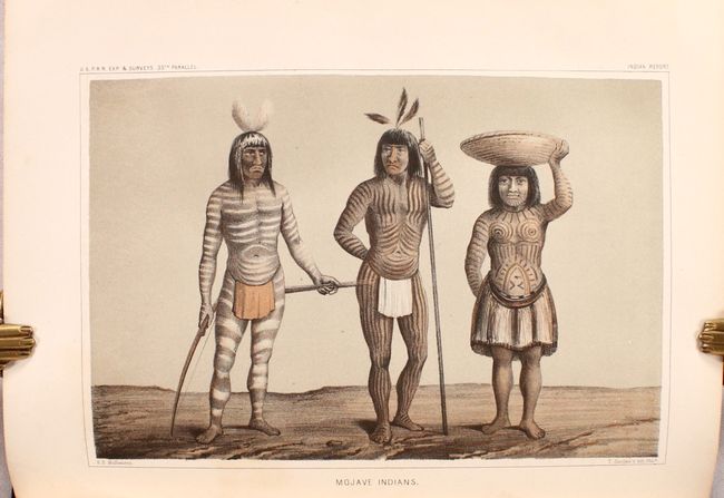
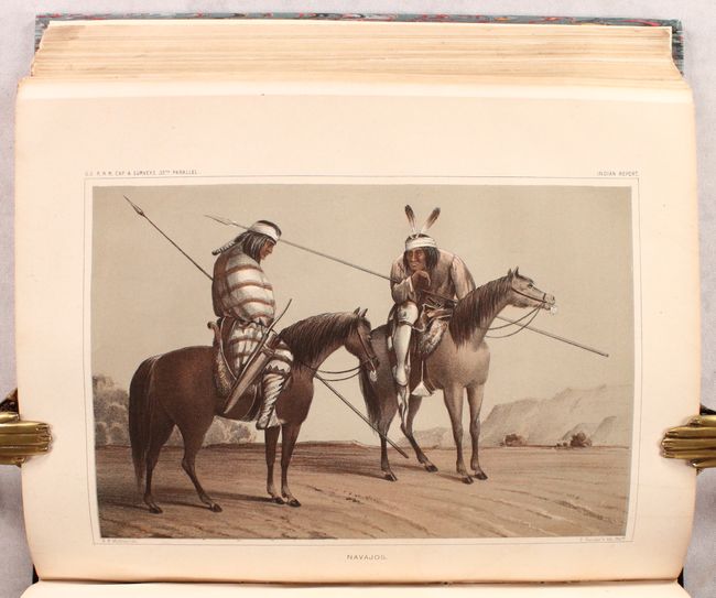
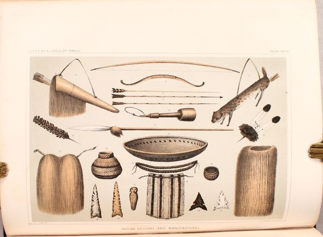
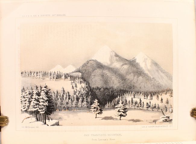
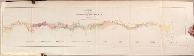
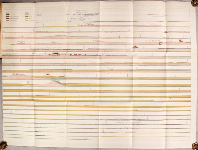
This House of Representatives volume contains the reports of Lt. A. W. Whipple, Corps of Topographical Engineers, regarding his explorations and discoveries along the 35th parallel. It contains a superb collection of tinted lithographs including the lovely Zuni plate, San Francisco Mountains (Flagstaff), the Mojave Valley, the Mojave Villages, Navajoes (mounted on horseback with spears), plates of weapons, baskets and implements, and the famous Mojave Indians plate showing three heavily tattooed Indians, all by H.B. Mollhausen, the expedition artist. There are 21 tinted plates and 10 black and white plates including fossils, all full page, plus the colorful, two geological sections, and the large folding map at the rear entitled Geological Map of the Route Explored... covering the route from Memphis to the small town of Los Angeles. The route cuts across the Llano Estacado, north of the Wichita Mountains, and along the edge of the Mogollon Rim, here named the Sierra Mogoyon. The underlying geology surveyed by the notable geologist Jules Marcou is delineated and color-coded with a legend across the bottom naming nine geological types. A few cities are located along the way; Helena, Napoleon, Vicksburg, Pine Bluff, Little Rock, Fort Smith, San Antonio, Fort Defiance and Needles. Rebound in faux quarter leather over marbled boards with gilt title on spine
References:
Condition: B+
Contents are very good with occasional light toning and/or scattered foxing. Modern binding is pristine.