Filtered by Category:United States(Show All Categories)
Showing results for:Auction 182
Catalog Archive
249 lots
Page 1 of 5
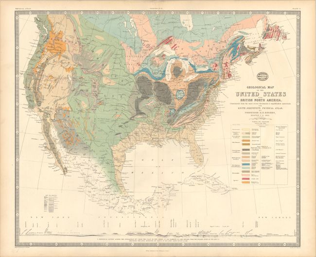
Auction 182, Lot 119
Subject: United States & Canada
Rogers, Henry Darwin
Geological Map of the United States and British North America, Constructed from the Most Recent Documents & Unpublished Materials..., 1855
Size: 24.3 x 20 inches (61.7 x 50.8 cm)
Estimate: $300 - $400
Sold for: $220
Closed on 4/28/2021
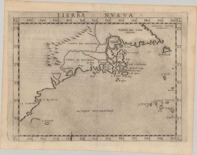
Auction 182, Lot 120
Subject: Eastern United States & Canada
Ruscelli, Girolamo
Tierra Nueva, 1574
Size: 9.6 x 7 inches (24.4 x 17.8 cm)
Estimate: $1,200 - $1,500
Ruscelli's Map of the East Coast
Sold for: $950
Closed on 4/28/2021
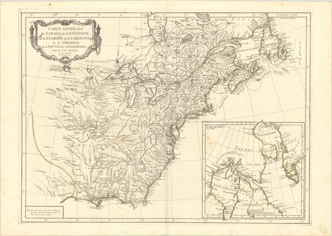
Auction 182, Lot 121
Subject: Colonial Eastern United States & Canada
D'Anville/Santini
Carte Generale du Canada, de la Louisiane, de la Floride, de la Caroline, de la Virginie, de la Nouvelle Angleterre Etc., 1776
Size: 25.6 x 18.8 inches (65 x 47.8 cm)
Estimate: $475 - $600
Sold for: $350
Closed on 4/28/2021
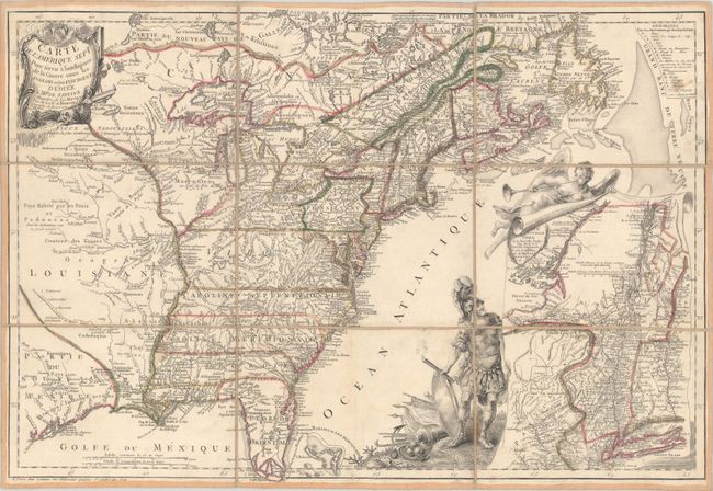
Auction 182, Lot 122
Subject: Colonial Eastern United States & Canada
Beaurain, Jean Chev. De
Carte de l'Amerique Septle. pour Servir a l'Intelligence de la Guerre Entre les Anglois et les Insurgents, 1777
Size: 24.5 x 16.8 inches (62.2 x 42.7 cm)
Estimate: $7,000 - $8,500
Important Map Published Just Prior to France's Entrance in the Revolutionary War
Sold for: $5,500
Closed on 4/28/2021
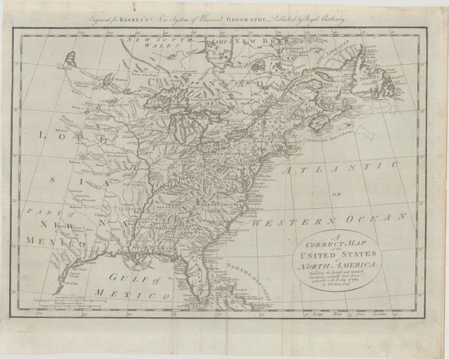
Auction 182, Lot 123
Subject: Eastern United States & Canada
Bowen, Thomas
A Correct Map of the United States of North America. Including the British and Spanish Territories, Carefully Laid Down Agreeable to the Treaty of 1784, 1787
Size: 17.4 x 12.3 inches (44.2 x 31.2 cm)
Estimate: $400 - $475
Sold for: $300
Closed on 4/28/2021
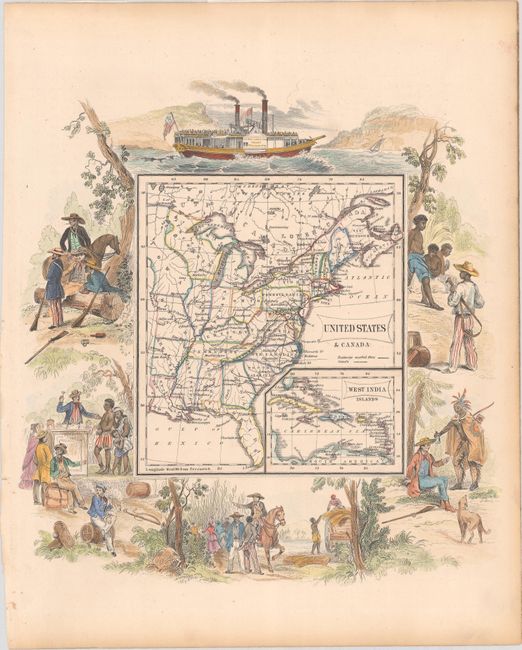
Auction 182, Lot 124
Subject: Eastern United States & Canada
Lizars, William Home
United States & Canada, 1853
Size: 9.8 x 10.4 inches (24.9 x 26.4 cm)
Estimate: $200 - $250
Map with Scenes of Slavery
Sold for: $160
Closed on 4/28/2021
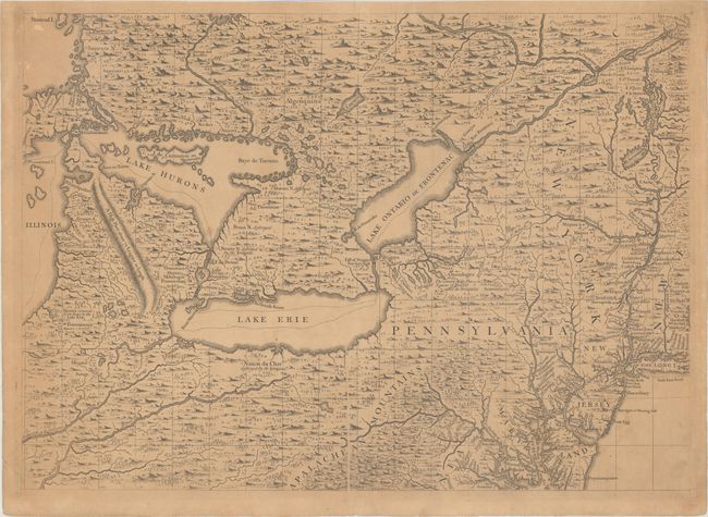
Auction 182, Lot 125
Subject: Colonial Northeastern United States & Canada, Great Lakes
Popple, Henry
[A Map of the British Empire in America (Sheet 6) - Great Lakes and Mid-Atlantic Regions], 1734
Size: 27.1 x 19.4 inches (68.8 x 49.3 cm)
Estimate: $2,000 - $2,300
Popple's Epic Map - Great Lakes & Northeast Sheet
Sold for: $2,300
Closed on 4/28/2021
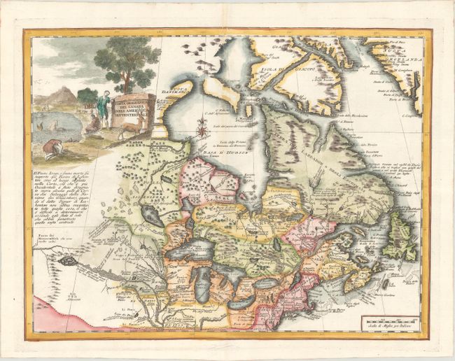
Auction 182, Lot 126
Subject: Colonial Northeastern United States & Canada, Great Lakes
Albrizzi, Girolamo
Carta Geografica del Canada nell' America Settentrionale, 1750
Size: 16.8 x 12.9 inches (42.7 x 32.8 cm)
Estimate: $700 - $850
Sold for: $850
Closed on 4/28/2021
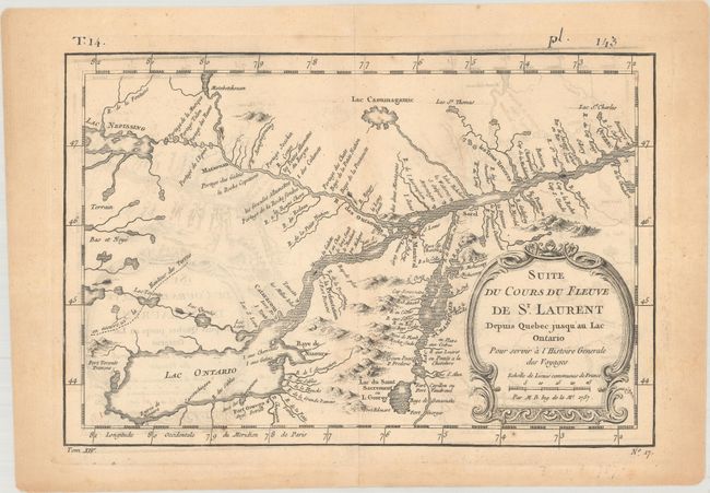
Auction 182, Lot 127
Subject: Colonial Northeastern United States & Canada, Great Lakes
[Lot of 3] Suite du Cours du Fleuve de St. Laurent Depuis Quebec Jusqu'au Lac Ontario... [and] Plan of the Forts Ontario and Oswego... [and] Charte der Neuen Niederlassungen in Ober Canada nach der Smythschen Charte, 1757-1814
Size: See Description
Estimate: $275 - $350
Unsold
Closed on 4/28/2021
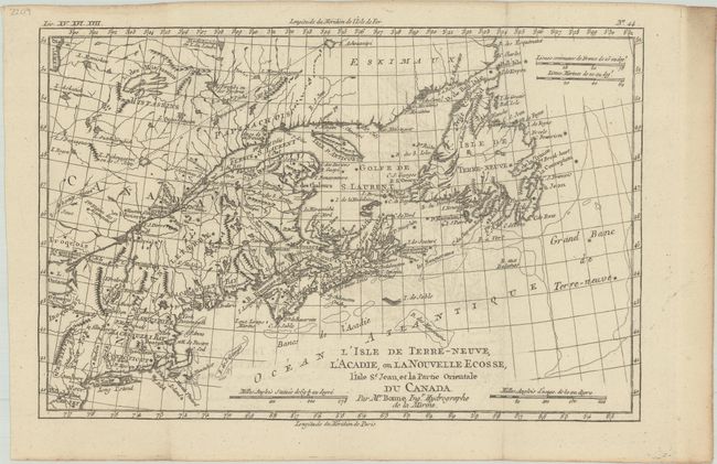
Auction 182, Lot 128
Subject: Colonial Northeastern United States & Canada
Bonne, Rigobert
L'Isle de Terre-Neuve, l'Acadie, ou la Nouvelle Ecosse, l'Isle St. Jean, et la Partie Orientale du Canada, 1782
Size: 12.4 x 8.2 inches (31.5 x 20.8 cm)
Estimate: $120 - $150
Sold for: $90
Closed on 4/28/2021
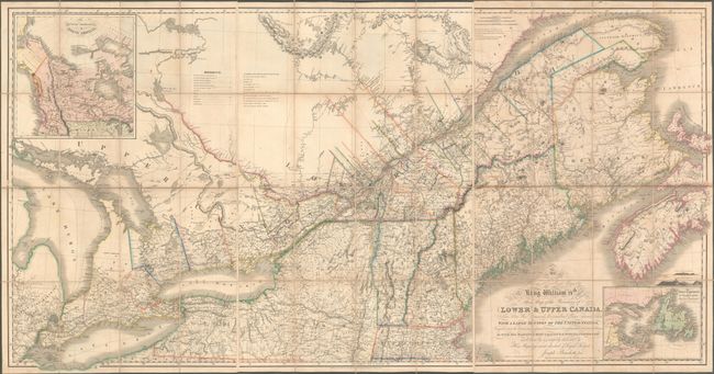
Auction 182, Lot 129
Subject: Northeastern United States & Canada
Bouchette, Joseph
[On 3 Sheets] To His Most Excellent Majesty King William IVth This Map of the Provinces of Lower & Upper Canada, Nova Scotia, New Brunswick, Newfoundland & Prince Edwards Island, with a Large Section of the United States..., 1831
Size: 24.6 x 37.9 inches (62.5 x 96.3 cm)
Estimate: $6,500 - $8,000
Rare and Important Map Promoting Canadian Immigration
Sold for: $7,000
Closed on 4/28/2021
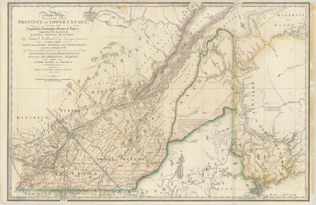
Auction 182, Lot 130
Subject: Maine & Eastern Canada
Wyld, James
A New Map of the Province of Lower Canada, Describing All the Seigneuries, Townships, Grants of Land, &c. Compiled from Plans Deposited in the Patent Office Quebec; by Samuel Holland, Esq. Surveyor General…, 1838
Size: 34.2 x 22.7 inches (86.9 x 57.7 cm)
Estimate: $400 - $500
Sold for: $300
Closed on 4/28/2021
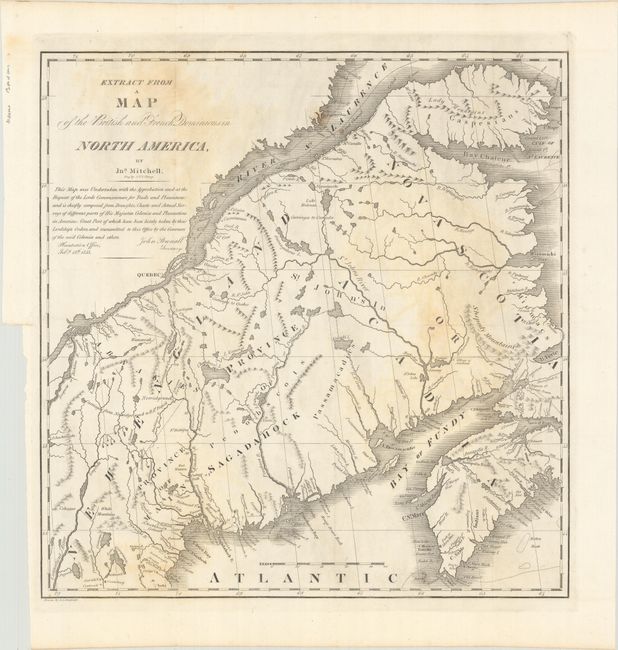
Auction 182, Lot 131
Subject: Maine & Eastern Canada
U.S. Government
Extract from a Map of the British and French Dominions in North America, 1838
Size: 13.3 x 13.7 inches (33.8 x 34.8 cm)
Estimate: $110 - $140
Sold for: $80
Closed on 4/28/2021
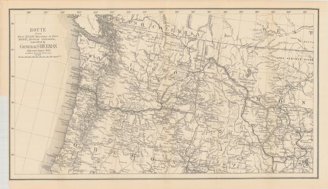
Auction 182, Lot 132
Subject: Northwestern United States & British Columbia
U.S. Government
Route from Fort Ellis Montana to Fort Hope, British Columbia, Travelled by General Sherman July and August 1884, as Shown by Heavy Black Line, 1883
Size: 27.4 x 15.2 inches (69.6 x 38.6 cm)
Estimate: $250 - $325
Sold for: $180
Closed on 4/28/2021
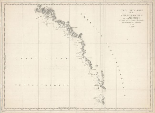
Auction 182, Lot 133
Subject: Western Canada & Alaska
La Perouse, Comte Jean F. Galoup, de
Carte Particuliere de la Cote du Nord-Ouest de l'Amerique Reconnue par les Fregates Francaises la Boussole et l'Astrolabe en 1786. 1e. Feuille, 1797
Size: 27.3 x 19.6 inches (69.3 x 49.8 cm)
Estimate: $120 - $150
Sold for: $130
Closed on 4/28/2021
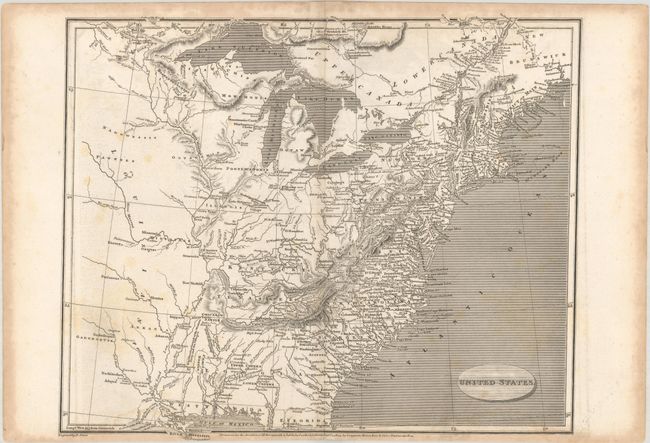
Auction 182, Lot 134
Subject: United States
[Lot of 3] United States [and] United States [and] Vereinigte Staaten von Nord-America und Mexico, 1805-52
Size: See Description
Estimate: $200 - $230
Sold for: $150
Closed on 4/28/2021
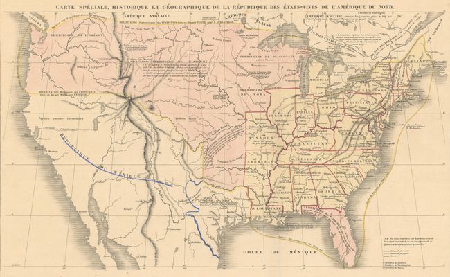
Auction 182, Lot 135
Subject: United States, Texas
Renouard, Paul
Carte Speciale, Historique et Geographique de la Republique des Etats-Unis de l'Amerique du Nord, 1842
Size: 16.9 x 10 inches (42.9 x 25.4 cm)
Estimate: $350 - $425
Sold for: $250
Closed on 4/28/2021
Auction 182, Lot 136
Subject: United States, Railroads
Throop, O. H.
[Untitled - Map of Proposed Routes of Western Railroads], 1846
Size: 15.9 x 10.1 inches (40.4 x 25.7 cm)
Estimate: $180 - $220
Sold for: $130
Closed on 4/28/2021
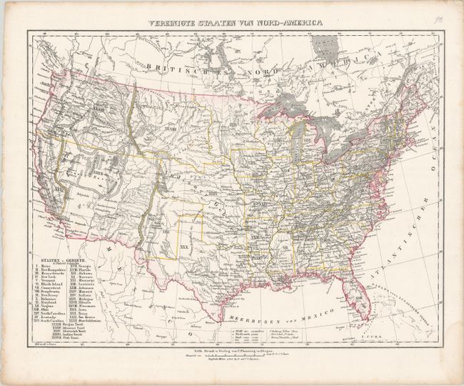
Auction 182, Lot 137
Subject: United States
Flemming, Carl
Vereinigte Staaten von Nord-America, 1850
Size: 16 x 12.2 inches (40.6 x 31 cm)
Estimate: $160 - $190
Sold for: $120
Closed on 4/28/2021
Auction 182, Lot 138
Subject: United States
Cowperthwait, Desilver & Butler
A New Map of the United States of America by J.H. Young, 1850
Size: 26.3 x 15.9 inches (66.8 x 40.4 cm)
Estimate: $275 - $350
Sold for: $350
Closed on 4/28/2021
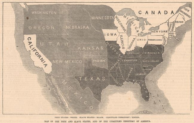
Auction 182, Lot 139
Subject: United States
Map of the Free and Slave States, and of the Unsettled Territory of America, 1856
Size: 8 x 4.8 inches (20.3 x 12.2 cm)
Estimate: $40 - $60
NO RESERVE
Sold for: $70
Closed on 4/28/2021
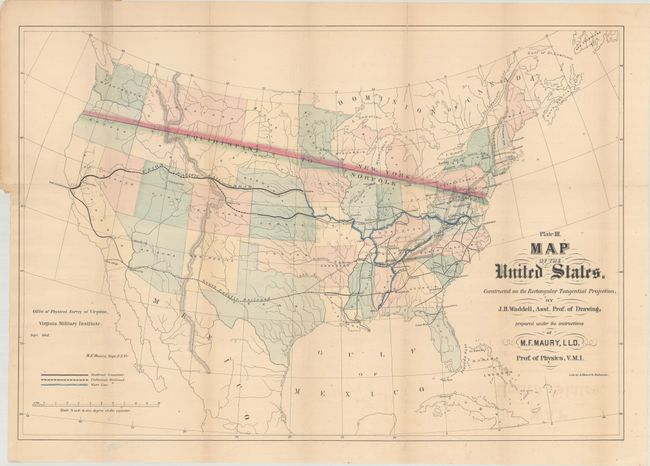
Auction 182, Lot 140
Subject: United States
Maury, M. F.
[Map and Book] Plate III. Map of the United States... [and] Physical Survey of Virginia. Geographical Position of; Its Commercial Advantages, and National Importance. (Preliminary Report), 1868
Size: 26.4 x 18.1 inches (67.1 x 46 cm)
Estimate: $400 - $500
Rare First State
Sold for: $300
Closed on 4/28/2021
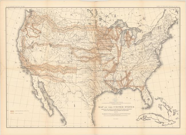
Auction 182, Lot 141
Subject: United States
Powell, John Wesley
Report on the Lands of the Arid Region of the United States, with a More Detailed Account of the Lands of Utah. With Maps, 1879
Size: 9.3 x 11.9 inches (23.6 x 30.2 cm)
Estimate: $300 - $375
Sold for: $220
Closed on 4/28/2021
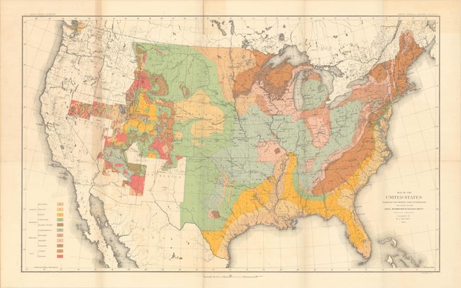
Auction 182, Lot 142
Subject: United States, Geology
U.S. Geological Survey (USGS)
Map of the United States Exhibiting the Present Status of Knowledge Relating to the Areal Distribution of Geologic Groups... [and] Map of the United States Exhibiting the Progress Made in the Geographic Survey [in] Fifth Annual Report..., 1885
Size: 28.2 x 17.4 inches (71.6 x 44.2 cm)
Estimate: $300 - $375
Sold for: $150
Closed on 4/28/2021
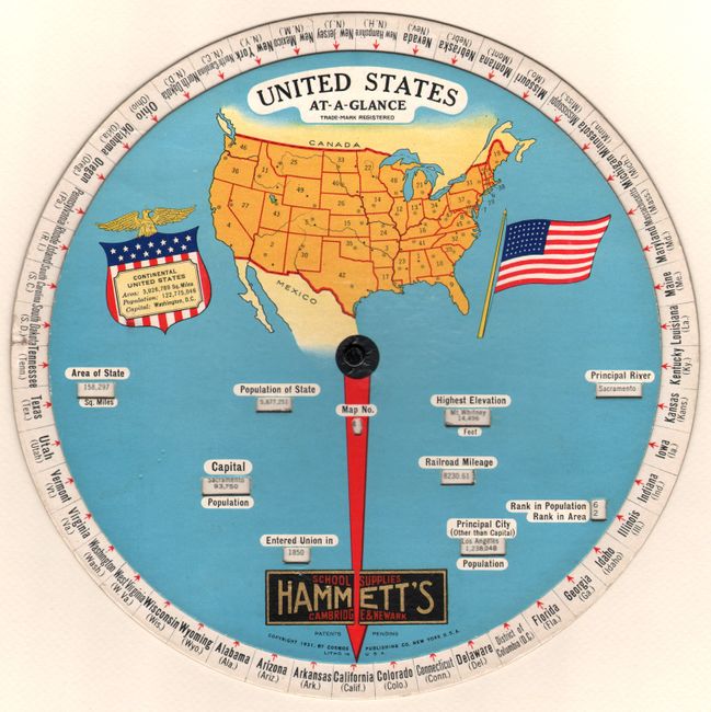
Auction 182, Lot 143
Subject: United States
United States At-a-Glance, 1931
Size: 9.9 x 9.9 inches (25.1 x 25.1 cm)
Estimate: $80 - $100
NO RESERVE
Sold for: $110
Closed on 4/28/2021
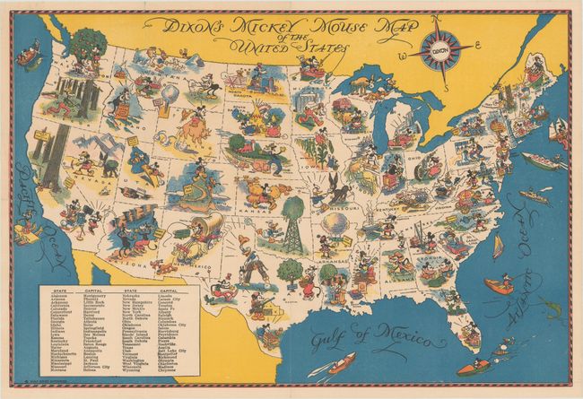
Auction 182, Lot 144
Subject: United States
Dixon's Mickey Mouse Map of the United States [with pencil box] Mickey Mouse Parade, 1935
Size: 13.8 x 9.3 inches (35.1 x 23.6 cm)
Estimate: $200 - $230
Sold for: $600
Closed on 4/28/2021
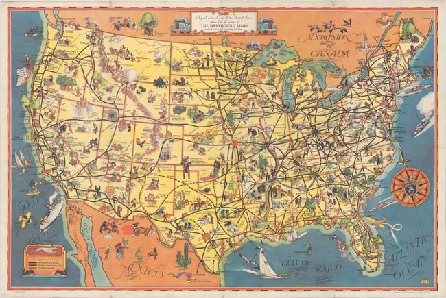
Auction 182, Lot 145
Subject: United States
A Good-Natured Map of the United States Setting Forth the Services of the Greyhound Lines and a Few Principal Connecting Bus Lines, 1935
Size: 28.9 x 19.1 inches (73.4 x 48.5 cm)
Estimate: $250 - $325
Unsold
Closed on 4/28/2021
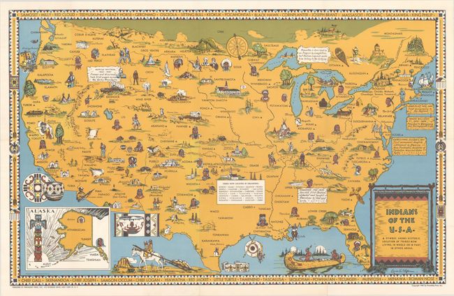
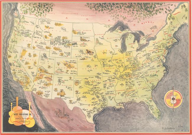
Auction 182, Lot 146
Subject: United States, Indians
Indians of the U.S.A., 1944
Size: 33.1 x 20.9 inches (84.1 x 53.1 cm)
Estimate: $350 - $425
Sold for: $400
Closed on 4/28/2021
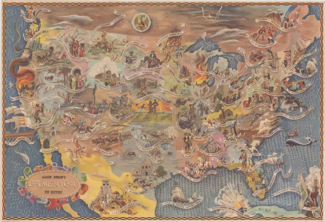
Auction 182, Lot 147
Subject: United States
Aaron Bohrod's America Its History, 1946
Size: 32.6 x 22.1 inches (82.8 x 56.1 cm)
Estimate: $400 - $500
Sold for: $850
Closed on 4/28/2021
Auction 182, Lot 148
Subject: United States
Rand McNally & Co.
[Lot of 2] Wild Bill Hickok Treasure Map [and] Wild Bill Hickok Guide to Lost Treasures, 1952
Size: See Description
Estimate: $160 - $190
Sold for: $120
Closed on 4/28/2021
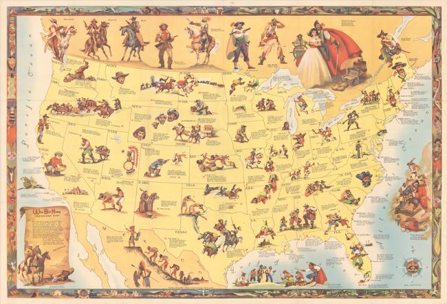
Auction 182, Lot 149
Subject: United States
[Untitled - Map of Birthplaces of Country Music Stars], 1954
Size: 18 x 12.5 inches (45.7 x 31.8 cm)
Estimate: $80 - $100
Sold for: $275
Closed on 4/28/2021
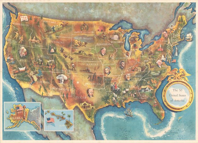
Auction 182, Lot 150
Subject: United States
[Lot of 2] The 50 United States of America [and] Presidential Election Map Compliments of Disabled American Veterans, 1960-64
Size: See Description
Estimate: $200 - $230
Sold for: $150
Closed on 4/28/2021
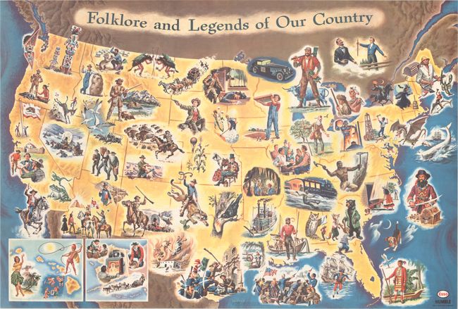
Auction 182, Lot 151
Subject: United States
Folklore and Legends of Our Country, 1962
Size: 33.5 x 22.7 inches (85.1 x 57.7 cm)
Estimate: $180 - $220
Sold for: $120
Closed on 4/28/2021
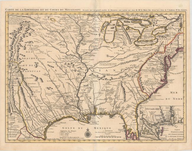
Auction 182, Lot 152
Subject: Colonial Eastern United States, Louisiana Territory
Delisle/Covens & Mortier
Carte de la Louisiane et du Cours du Mississipi Dressee sur un Grand Nombre de Memoires Entr'autres sur ceux de Mr. le Maire, 1730
Size: 23.8 x 17.3 inches (60.5 x 43.9 cm)
Estimate: $1,900 - $2,200
Delisle's Influential Map of the Louisiana Territory
Sold for: $1,600
Closed on 4/28/2021
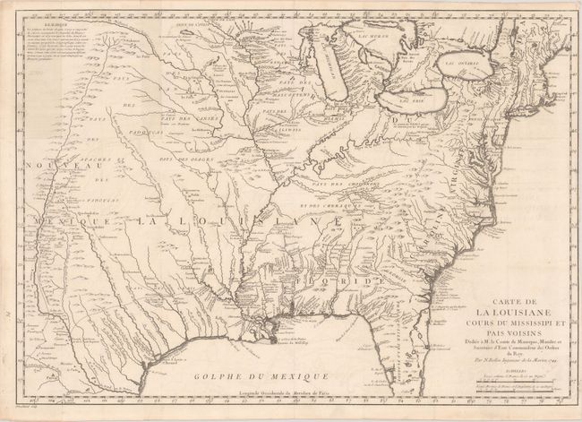
Auction 182, Lot 153
Subject: Colonial Eastern United States
Bellin, Jacques Nicolas
Carte de la Louisiane Cours du Mississipi et Pais Voisins..., 1744
Size: 22.1 x 15.6 inches (56.1 x 39.6 cm)
Estimate: $750 - $900
Sold for: $550
Closed on 4/28/2021
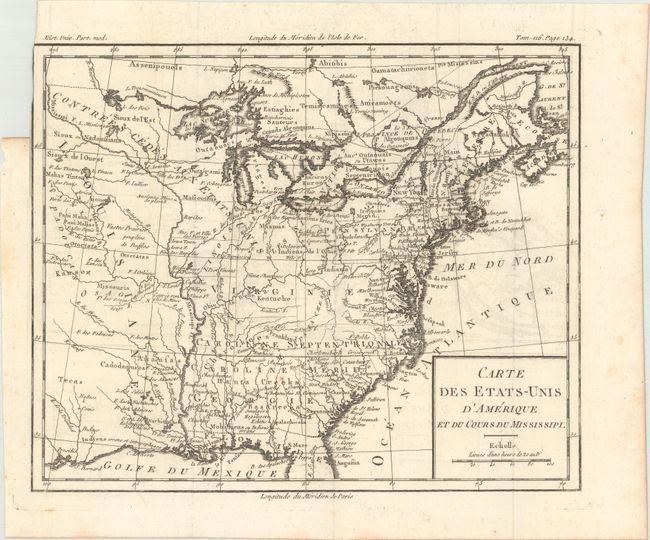
Auction 182, Lot 154
Subject: Eastern United States, Franklin
Brion de la Tour, Louis
Carte des Etats-Unis d'Amerique et du Cours du Mississipi, 1788
Size: 10.6 x 8.7 inches (26.9 x 22.1 cm)
Estimate: $900 - $1,100
One of the Earliest Maps to Feature the State of Franklin
Sold for: $650
Closed on 4/28/2021
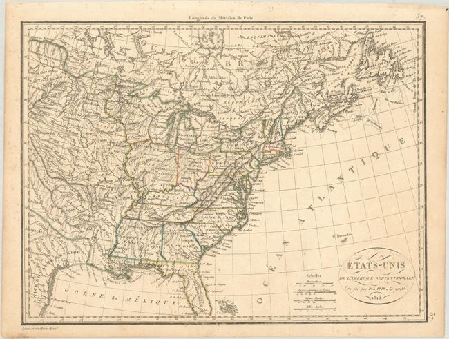
Auction 182, Lot 155
Subject: Eastern United States
Lapie, Alexander Emile & Pierre
Etats-Unis de l'Amerique Septentrionale, 1816
Size: 11.7 x 8.8 inches (29.7 x 22.4 cm)
Estimate: $110 - $140
Sold for: $80
Closed on 4/28/2021
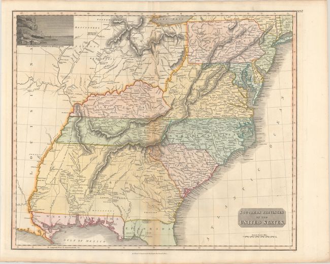
Auction 182, Lot 156
Subject: Eastern United States
Thomson, John
Southern Provinces of the United States, 1817
Size: 23.3 x 19.4 inches (59.2 x 49.3 cm)
Estimate: $550 - $700
Sold for: $400
Closed on 4/28/2021
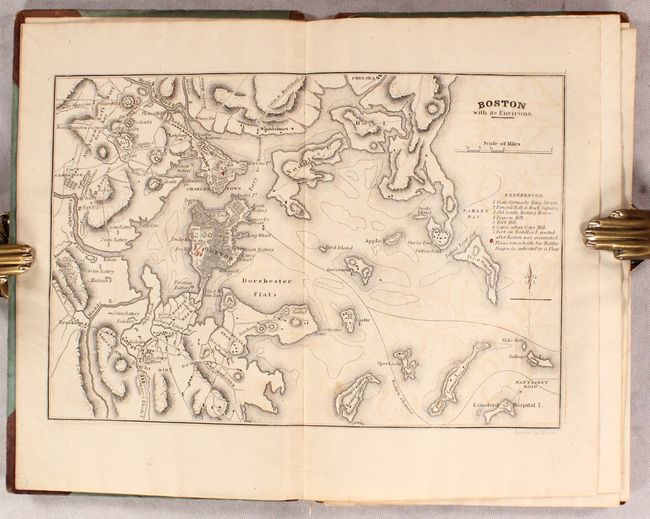
Auction 182, Lot 157
Subject: Eastern United States
Marshall, John
Atlas to Marshall's Life of Washington, 1832
Size: 5.7 x 8.9 inches (14.5 x 22.6 cm)
Estimate: $350 - $425
Sold for: $300
Closed on 4/28/2021
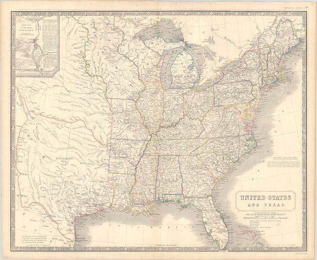
Auction 182, Lot 158
Subject: Eastern United States, Texas
Johnston, Alexander K.
United States and Texas, 1842
Size: 24.1 x 19.6 inches (61.2 x 49.8 cm)
Estimate: $1,200 - $1,500
Sold for: $900
Closed on 4/28/2021
Auction 182, Lot 159
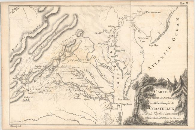
Subject: Northeastern United States, American Revolution
Chastellux, Francois Jean, Marquis de
[Lot of 2 - Northeast, Mid-Atlantic] Carte pour Servir au Journal de Mr. le Mquis. de Chastellux..., 1786
Size: 9.6 x 7.4 inches (24.4 x 18.8 cm)
Estimate: $275 - $350
Sold for: $230
Closed on 4/28/2021
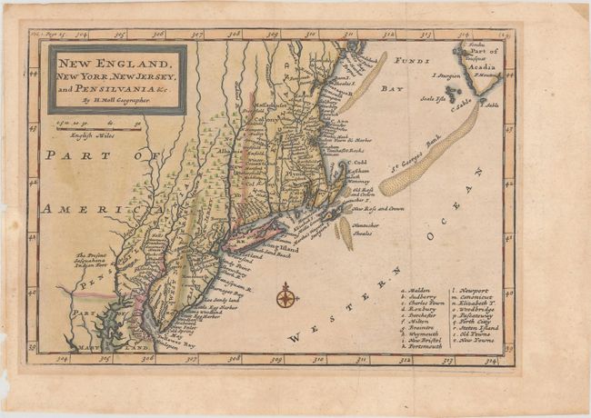
Auction 182, Lot 160
Subject: Colonial New England & Mid-Atlantic United States
Moll, Herman
New England, New York, New Jersey, and Pensilvania &c., 1708
Size: 10.2 x 7 inches (25.9 x 17.8 cm)
Estimate: $400 - $475
Sold for: $200
Closed on 4/28/2021
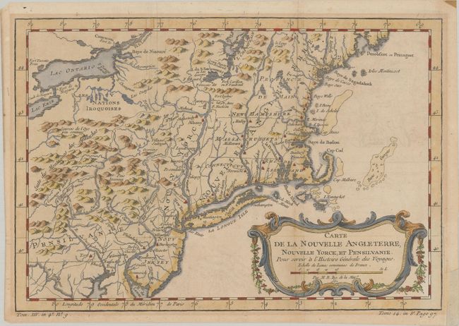
Auction 182, Lot 161
Subject: Colonial New England & Mid-Atlantic United States
Bellin, Jacques Nicolas
Carte de la Nouvelle Angleterre, Nouvelle Yorck, et Pensilvanie. Pour Servir a l'Histoire Generale des Voyages, 1757
Size: 11.8 x 8 inches (30 x 20.3 cm)
Estimate: $200 - $230
Sold for: $170
Closed on 4/28/2021
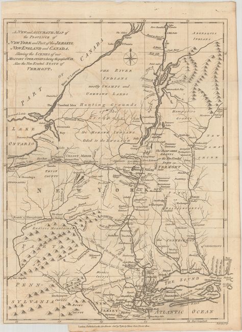
Auction 182, Lot 162
Subject: Colonial New England & Mid-Atlantic United States
Lodge, John
A New and Accurate Map of the Province of New York and Part of the Jerseys, New England and Canada, Shewing the Scenes of Our Military Operations During the Present War. Also the New Erected State of Vermont, 1780
Size: 11 x 14.5 inches (27.9 x 36.8 cm)
Estimate: $800 - $950
Unsold
Closed on 4/28/2021
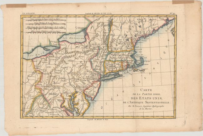
Auction 182, Lot 163
Subject: New England & Mid-Atlantic United States
Bonne/Raynal
Carte de la Partie Nord, des Etats Unis, de l'Amerique Septentrionale, 1783
Size: 12.6 x 8.4 inches (32 x 21.3 cm)
Estimate: $120 - $150
Unsold
Closed on 4/28/2021
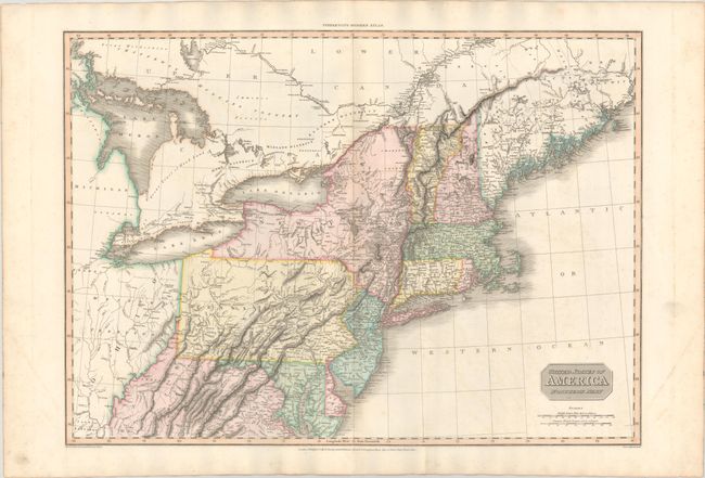
Auction 182, Lot 164
Subject: New England & Mid-Atlantic United States
Pinkerton, John
United States of America Northern Part, 1810
Size: 27.3 x 19.6 inches (69.3 x 49.8 cm)
Estimate: $240 - $300
Sold for: $180
Closed on 4/28/2021
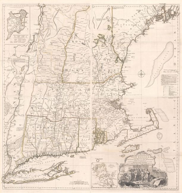
Auction 182, Lot 165
Subject: Colonial New England United States
Jefferys, Thomas
[On 4 Sheets] A Map of the Most Inhabited Part of New England, Containing the Provinces of Massachusets Bay and New Hampshire, with the Colonies of Conecticut and Rhode Island..., 1755
Size: 19.2 x 20.3 inches (48.8 x 51.6 cm)
Estimate: $8,000 - $9,500
Rare State of Jefferys' Influential Map of New England in Contemporary Color
Unsold
Closed on 4/28/2021
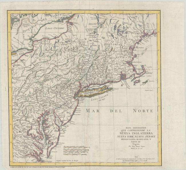
Auction 182, Lot 166
Subject: Colonial New England United States
Lopez, D. Tomas
Mapa Geografico que Comprehende la Nueva Inglaterra, Nueva York, Nueva Jersey, Pensilvania, Maryland y Parte de Virginia, 1778
Size: 15 x 15.3 inches (38.1 x 38.9 cm)
Estimate: $700 - $850
Unsold
Closed on 4/28/2021
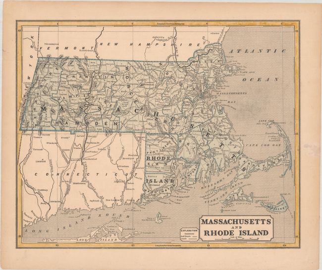
Auction 182, Lot 167
Subject: Massachusetts & Rhode Island
Morse, Sidney Edwards
Massachusetts and Rhode Island, 1842
Size: 14.8 x 11.9 inches (37.6 x 30.2 cm)
Estimate: $50 - $70
NO RESERVE
Sold for: $95
Closed on 4/28/2021
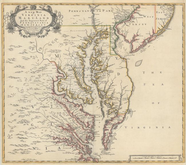
Auction 182, Lot 168
Subject: Colonial Mid-Atlantic United States
Browne/Senex
A New Map of Virginia Mary-land and the Improved Parts of Pennsylvania & New Jersey..., 1719
Size: 21.8 x 19.1 inches (55.4 x 48.5 cm)
Estimate: $3,500 - $4,500
Map of Chesapeake Bay Based on Landmark Herrman Map
Sold for: $4,500
Closed on 4/28/2021
249 lots
Page 1 of 5