Subject: Southwestern United States
Period: 1848 (published)
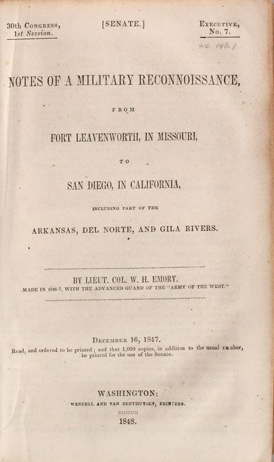
Publication: Sen. Ex. Doc. 7, 30th Congress, 1st Session
Color: Black & White
Size:
64 x 30 inches
162.6 x 76.2 cm
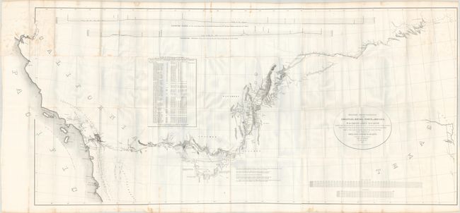
An important Mexican-American War period map that shows the route of Col. Kearny and his Army of the West as they traveled from Ft. Leavenworth to Los Angeles via Santa Fe and San Diego. It provides detailed information of what would become the Southern Trail to the California gold fields. Wheat calls the map “a document of towering significance” and an important milestone in the cartographic development and accurate determination of the geography of the Southwest. A large map printed on three sheets, joined as issued.
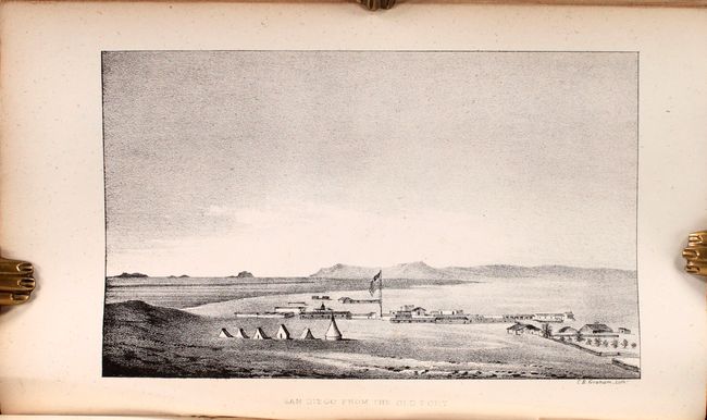
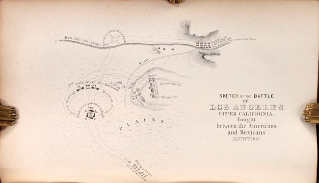
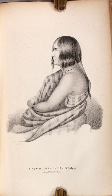
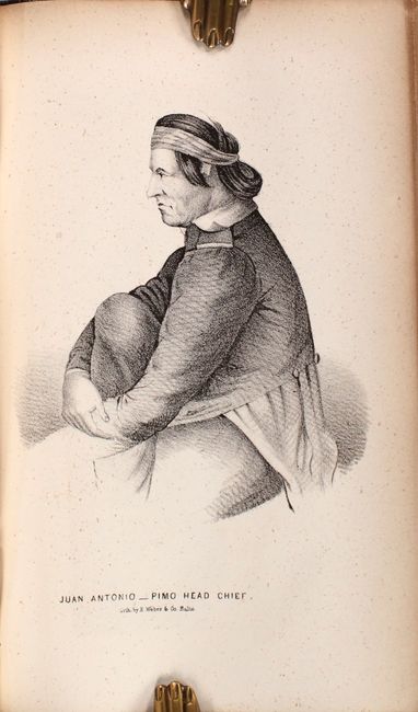
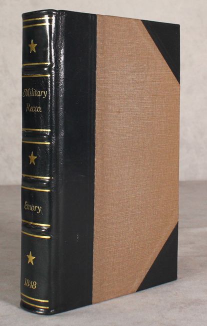
The map is accompanied by the first Senate edition of Emory's important report documenting the 1846-47 journey through an untamed countryside where “barrenness and desolation hold their reign.” Emory's report is a major contribution to the geographical knowledge of the American West and an enjoyable read, with passages such as "I stopped in the little town of Isoletta, to visit my friend, the accolade, who has the reputation, Indian though he be, of being the most honest man and best maker of brandy in the territory." The report summarizes the activity of the U.S. Army of the West after the capture of New Mexico with important early views of the region. It is further illustrated with 26 lithographed views, three battle maps, and 14 botanical plates. The important early view of San Diego is present. The battle plans are: Sketch of the Actions fought at San Pasqual in Upper California…; Sketch of the Passage of the Rio San Gabriel...; and Sketch of the Battle of Los Angeles Upper California. Fought between the Americans and Mexicans Jany. 9th, 1847. Complete with the two page report (Appendix No. 7) by P. St. Geo. Cooke, Major 2d Dragoons. Printed by Wendell and Van Benthuysen. 416 pages, 40 plates, and 3 single-page maps. Octavo, rebound in quarter black leather with tips over brown cloth boards.
References: Wheat (TMW) #544; Wagner & Camp #148:1; Howes #E-145.
Condition: B+
The folding map is on a bright sheet with no tears or separations and only some light scattered foxing primarily in the upper third of the map (please note that the bluish hue in the image is caused by our scanner and not on the physical map). Text and plates are clean, bright and near fine. Modern binding is pristine.