Subject: Atlases
Period: 1856 (published)
Publication:
Color: Hand Color
Size:
16.6 x 19.1 inches
42.2 x 48.5 cm
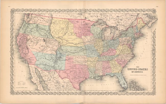
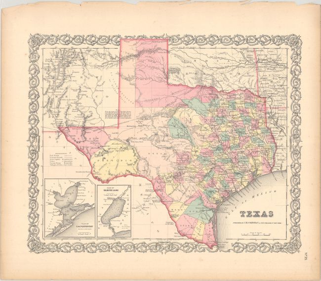
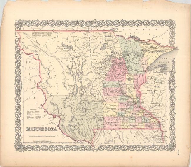
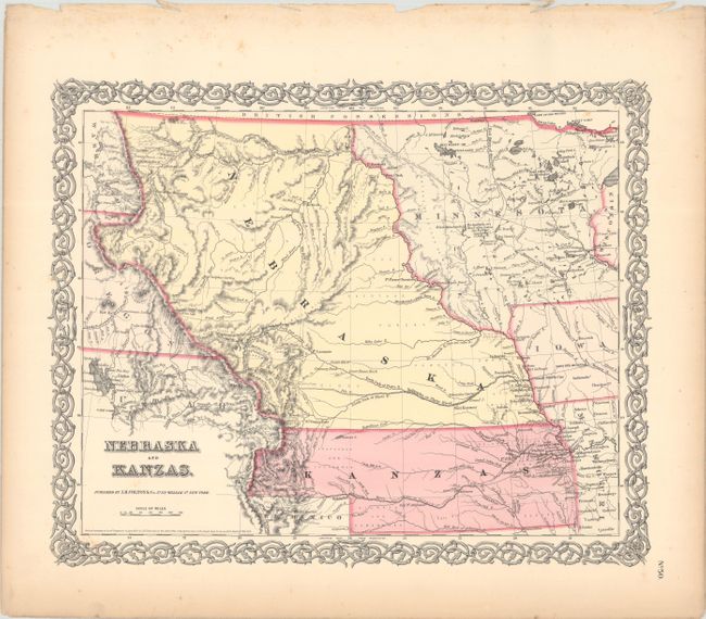
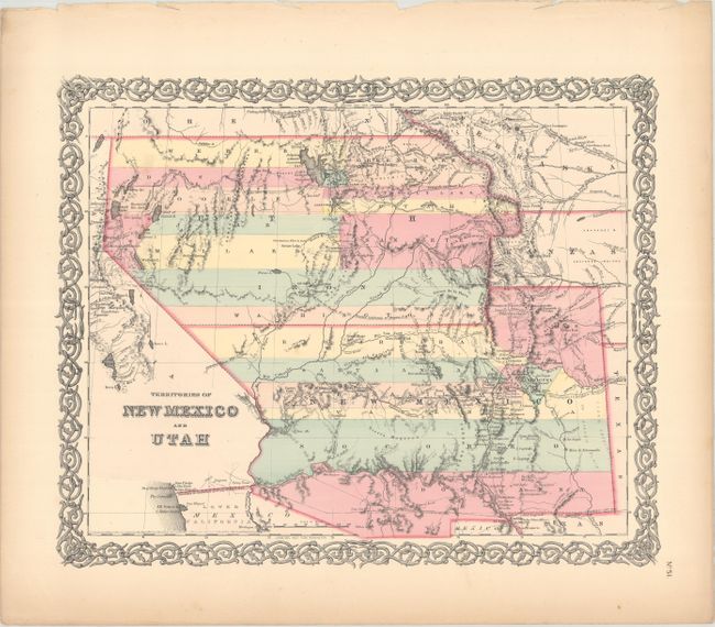
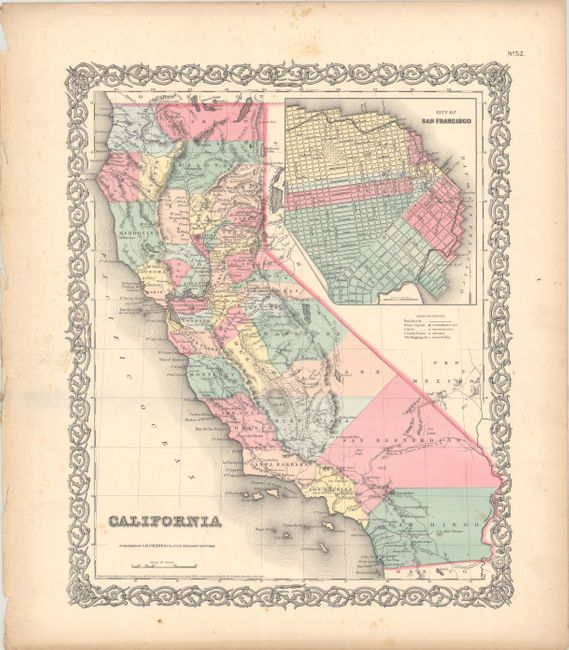
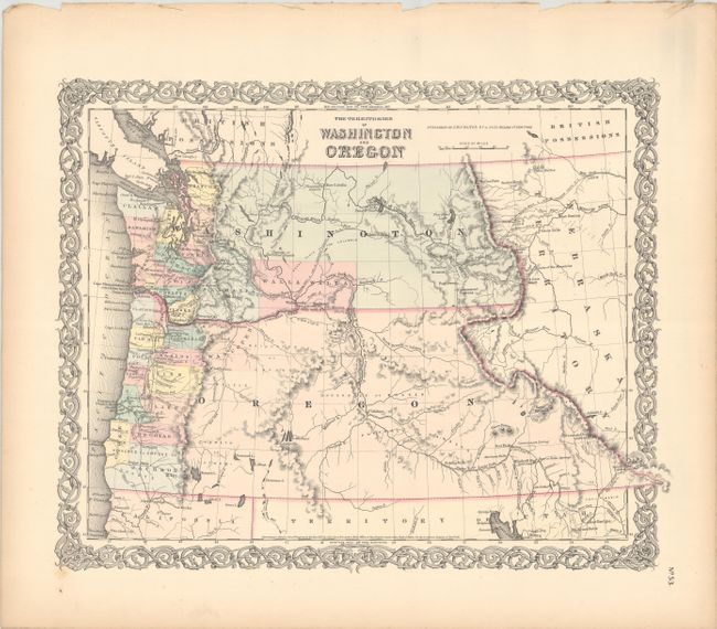
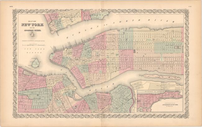
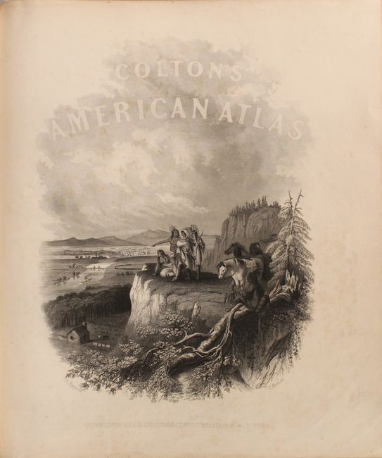
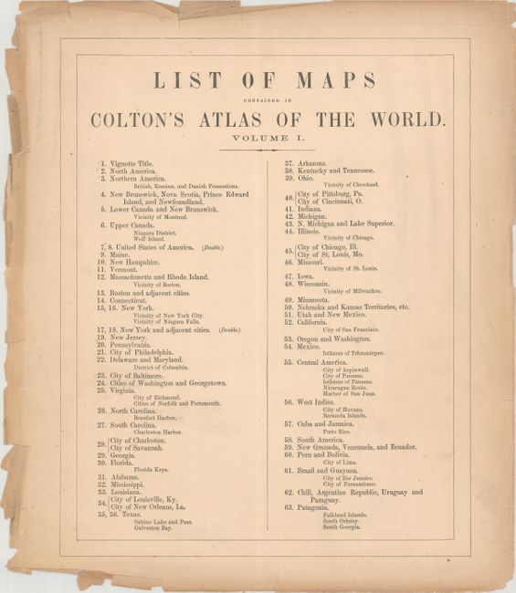
This is the first volume of Colton's two-volume folio atlas, containing all 58 maps/plans, each with Colton's decorative strapwork border. Volume I contains maps concentrating on the Western Hemisphere. 44 sheets relate to the United States, displaying 63 maps/plans, with numerous sought after single-page state maps - many with city insets. The maps of the United States and New York City are double-page maps. There are several great early western maps including: the U.S. map featuring Kanzas; the map of Texas with early county configurations; the early map of Minnesota showing its border on the Missouri River. Also present is the most desirable Nebraska and Kanzas map that depicts Nebraska stretching from Kansas to the Canadian border and bounded on the west by Washington and Oregon at the Continental Divide and Minnesota on the east. Includes the map of the territories of New Mexico and Utah, the California map with the large inset of San Francisco, and the territories of Washington and Oregon with their eastern boundaries on the Continental Divide and county development limited to the coastal areas. City plans included in Volume I are Montreal, Boston, New York (double-page), Philadelphia, Baltimore, Washington, Richmond, Norfolk/Portsmouth, Savannah/ Charleston, Louisville/New Orleans, Pittsburgh/Cincinnati, St. Louis/Chicago, Panama, Havana, Lima, Rio Janeiro, Pernambuco. This edition has the frontispiece showing Native American Indians overlooking a valley filled with frontier settlement and development.
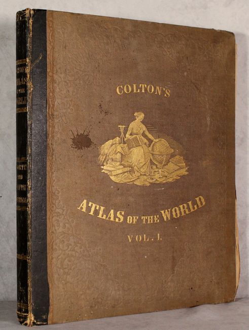
First edition with original brown cloth covers, quarter black leather with gilt banding and title on spine, and embossed gilt illustration on covers. Contains frontispiece, title page, list of maps, text and tables. The atlas is apparently complete with all maps present, however not all text pages have been collated.
References:
Condition:
The atlas is complete, however the binding is perished and every page and map is essentially loose. However, the vast majority of the maps are in excellent condition (A) -- clean and bright with occasional imperfections in the margins, such as toning, foxing, or minor tears or chips along the sheet edges. Only 6 maps (North America, CT, VT, VA, West Indies, Southern South America) are in lesser (B+) condition with light, scattered foxing that enters the image and a 2" tear on the map of Vermont. The text pages are toned with scattered foxing and occasional chips and tears along the fore-edges. The frontispiece is lightly toned with scattered foxing (B+). The title page and list of maps are toned and soiled with a number of chips and tears along the edges (B). The covers and spine are present but not attached to the text block, and have some soiling and abrasions. This is an excellent candidate for rebinding considering the condition of the contents.