Subject: Ancient World & Holy Land
Period: 1543 (published)
Publication:
Color: Black & White
Size:
13.5 x 9.3 inches
34.3 x 23.6 cm
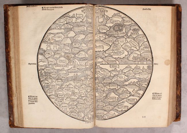
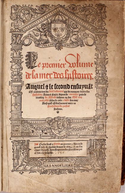
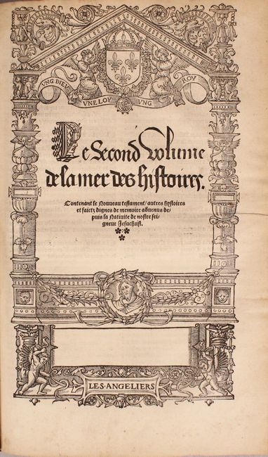
This is a complete edition of the rare and popular Mer des Histoires, a French translation of the world history, Rudimentum Novitiorum. First published in 1475, the Rudimentum Novitiorum was the first publication to include printed maps depicting land forms and countries (one of the world and one of Palestine). The French edition served to popularize the work, and first appeared as Mer des Hystoires in 1488 with new woodblocks, on a slightly smaller scale and with the titles translated into French. A third set of woodblocks were cut in 1491, again slightly reduced in size, and with a few minor changes. In his book, The Earliest Printed Maps, Tony Campbell remarks that the maker of the maps for the 1491 edition was a "thinking individual," because he corrects errors made in 1475 and 1488 blocks. The 1491 blocks were reused in several editions through circa 1555. This 1543 edition (erroneously marked as 1536 on the title page in manuscript ink) was published by Nicolas Cousteau for Charles L'Angelier, and includes woodblocks from the 1491 edition.
This circular world map is shown with east at the top, centered on Palestine. Europe is depicted at bottom left, with numerous countries identified and an illustration of the Pope in the walled city of Rome. The various countries of Asia and Africa are shown as mountains surrounded by water, and include small illustrations of cities, animals, dragons, and the mythological figure of Pan. At the top of the map is a large walled orchard with two priestly figures in place of the traditional Adam and Eve, while at bottom are the pillars of Hercules.
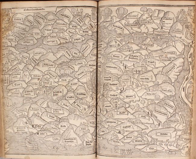
The map of Palestine is centered on Jerusalem and is also oriented with east at the top. This was the first printed map based on first-hand observation, depicting Palestine based on a 13th century pilgrimage. The map extends from Sidon and Damascus in the north to the Red Sea in the south. Eight windheads surround the map.
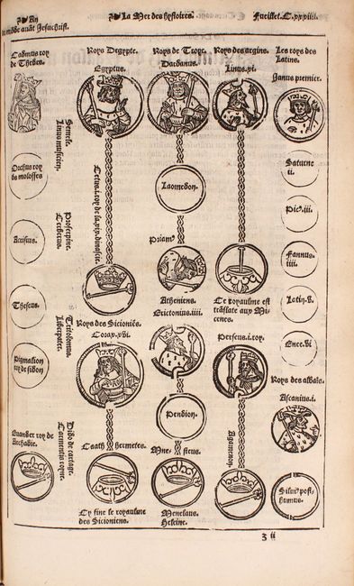
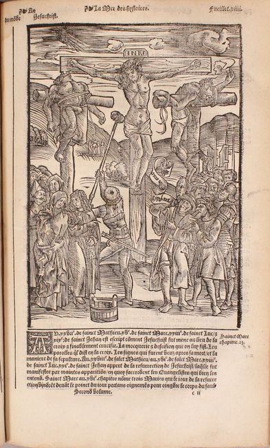
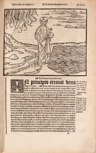
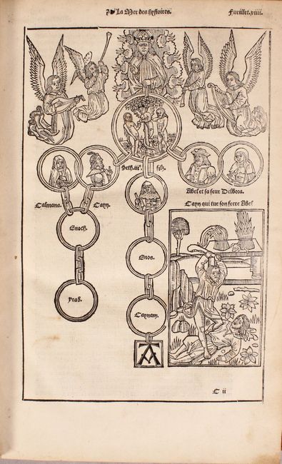
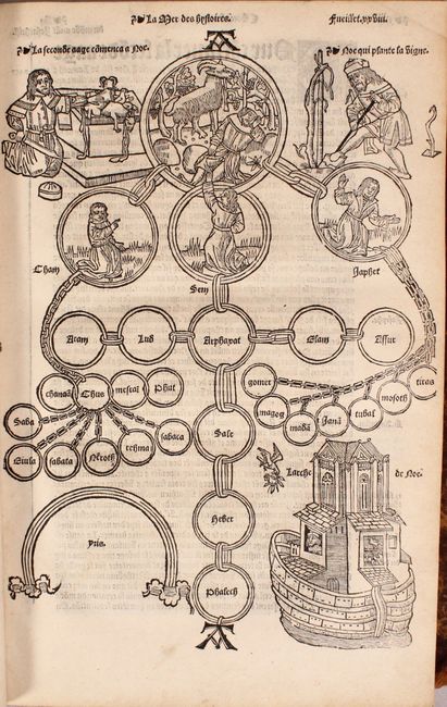
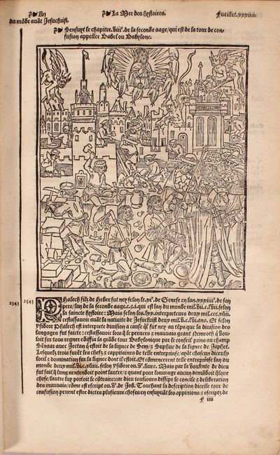
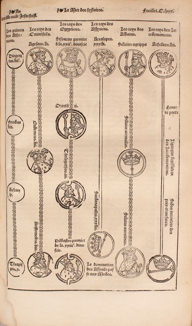
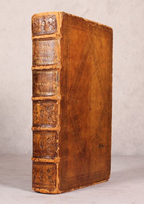
There are over 100 additional woodblock engravings interspersed within the text, including some full single-page and double-page engravings. These include primarily genealogical charts and scenes from the bible, including the crucifixion of Jesus, the creation of the earth, and Adam and Eve tempted by the serpent. Two volumes in one, folio. Hardbound in full leather with tooling on covers and spine, 5 raised bands, and gilt titling on spine.
References: Laor #221; Shirley #17.
Condition: B+
There is overall light toning and soiling. The ancient world map has a few light spots of soiling and a more prominent stain in the right blank margin. The map of Palestine has damp stains in the top corners and was trimmed about 1/4" inside the neatline at right and left by the bookbinder, as is commonly the case with this map. The title page and subsequent 3 leaves are heavily soiled with several repaired tears and chips along the edges of the sheet. Within the remainder of the text and engravings there are occasional damp stains and edge tears, most of which have been archivally repaired. The hinges are starting, and to covers and spine are well worn along the edges with bumped corners and a few cracks along the spine. Overall a very nice example of this rare and highly desired volume, which is difficult to find complete.