Subject: Atlases
Period: 1589 (published)
Publication:
Color: Black & White
Size:
6.4 x 4.8 inches
16.3 x 12.2 cm
This rare and magnificent miniature atlas was produced by Christoffel Plantin for Filips Galle and includes 94 maps of the world, continents, and various regions around the world. This atlas is from the second series of pocket-atlases published by Galle with maps based on Ortelius' Theatrum Orbis Terrarum. The first pocket-sized atlas, Spieghel der Wereld, also by Galle, was published in 1577, with subsequent editions published in several languages through 1585. The maps were accompanied by text prepared by Peter Heyns, who used the text from the Theatrum. The numbers printed above the maps, adjacent to the letterpress title, corresponded with the number of the map within the Theatrum. This innovative, small atlas was designed to reach the lower middle class, and was a commercial success, prompting numerous reprints and imitations.
Apparently dissatisfied with the quality of the plates in the Spieghel der Wereld, Galle began a new edition in 1588, commonly known as the Epitome, replacing some of the old plates with newly engraved ones. The new plates had a cleaner style with simple double-lined borders. The Epitome was quite popular, and was published in editions until 1602. Over the years Galle gradually introduced more new maps, both adding to and replacing the originals. By the final edition in 1602, only 10 of the original plates from the Spieghel remained. After 1598, the plates were passed to Jan B. Vrients, who retouched some of the plates and published the final editions of the Epitome in 1601 and 1602.
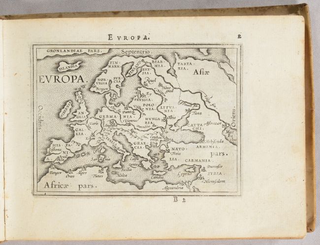
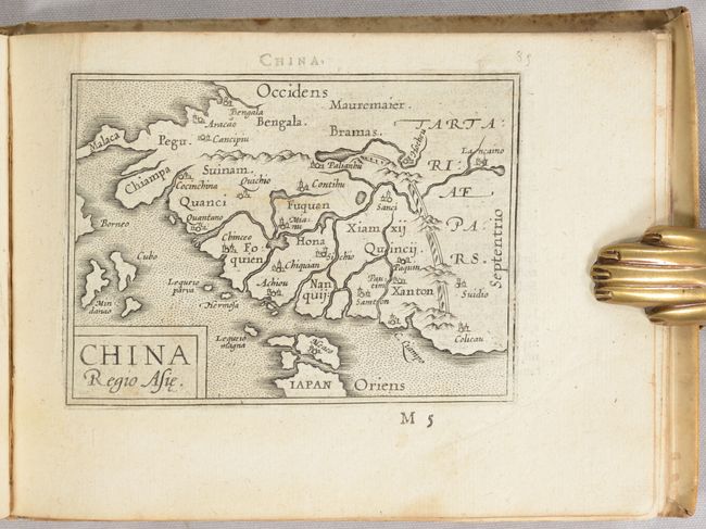
This example is the first Latin edition of the Epitome, which includes 67 of the original maps from the Spieghel der Wereld and 27 newly-engraved maps with the simpler borders. These new maps include those of the world, Europe, and China. Of particular interest are the maps of the world and continents:
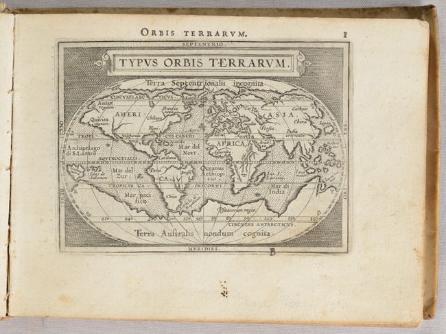
A. Typus Orbis Terrarum. This map was reduced from Ortelius' folio map of 1587. While North America is still a bit too broad, South America has a more correct form. The Northwest Passage, taken from Mercator, is still prominent and there are large landmasses at both poles. References: Shirley #161; Van der Krogt (Vol. III) #0001:332A.
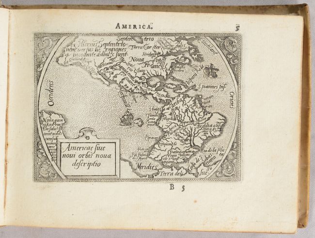
B. Americae sive Novi Orbis Nova Descriptio. This is a reduced version of Ortelius' 1570 folio map of the Americas. The characteristic bulges in the western coastlines of both continents and the huge southern continent are instantly recognizable. Ornamented with two sailing ships and a delicate floral surround. References: Burden #48; Van der Krogt (Vol. III) #9000:331.
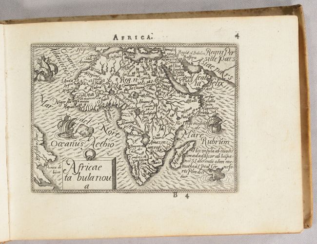
C. Africae Tabula Nova. The map is decorated with three sailing ships, a sea monster, and fully engraved seas. The most notable change made from the folio map to its miniature version is the removal of Lake Zaflan, the smaller of the two Ptolemaic source lakes for the Nile River. References: Betz #18; Van der Krogt (Vol. III) #8600:331.
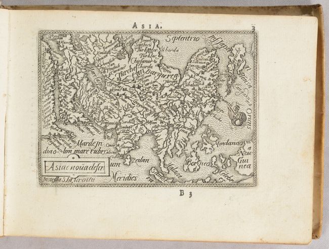
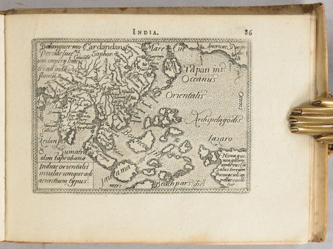
D. Asiae Nova Descr:. This fine miniature map is based on Ortelius' great map of Asia that was the standard map of Asia for more than forty years. Japan is in a 'kite' form taken from Jesuit sources and the islands of the East Indies are not well placed, due to the secrecy of voyages to the region. The Caspian Sea is in a simple oval shape and oriented the wrong direction. References: Van der Krogt (Vol. III) #8000:331.
E. Europa. This simple map of Europe focuses on the major rivers, mountain ranges, and cities in Europe. Greenland stretches across the top of the map. References: Van der Krogt (Vol. III) #1000:332.
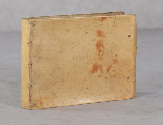
This example is lacking the title page, but is otherwise complete. Bound in original vellum-covered boards with holes along the fore-edge of the front and back covers, indicating that there were likely previously leather or cloth ties.
References: Van der Krogt (Vol. III) #332:11.
Condition: A
Maps are generally nice impressions on bright sheets with minor marginal soiling. The map of the Iberian Peninsula has some old pencil markings, a couple of maps have a bit of soiling that enters the image, and three maps at the end have an extraneous crease in the image. There is light staining on the initial text pages. The covers are soiled with curved fore-edges and the front hinge could use some reinforcement, but the volume is still intact.