Subject: Colonial Eastern North America & West Indies
Period: 1782 (dated)
Publication:
Color: Hand Color
Size:
19.3 x 19.8 inches
49 x 50.3 cm
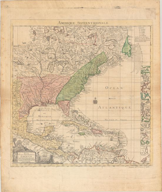
This is a variant of the key map of Henry Popple's seminal map of North America, first published in 1733. This edition contains a geographical difference from the British original - Lake Champlain has two branches on the south end instead of one. The thirteen British colonies are clearly delineated, just one year before the formal peace treaty between the United States and Britain. At right is a column of inset maps including Boston, New York, Charlestown, St. Augustine, Bermuda and several others. The Spanish galleons' route from Vera Cruz to Havana is marked. The pictorial cartouche features Native Americans. The French title above the map is "Amerique Septentrionale Suivant la Carte de Pople…" This is the second state with Longitudes a l'Isle de Fer in the border at lower right (instead of de Londres in the first state).
References: McCorkle #782.14.
Condition: B+
Contemporary color on a watermarked sheet with minor toning. There is light foxing that is more prominent in the side margins, and a long printer's crease near the center of the map image. A short edge tear is confined to the right blank margin.