Subject: Northwestern Germany
Period: 1753 (dated)
Publication:
Color: Hand Color
Size:
16.5 x 18.6 inches
41.9 x 47.2 cm
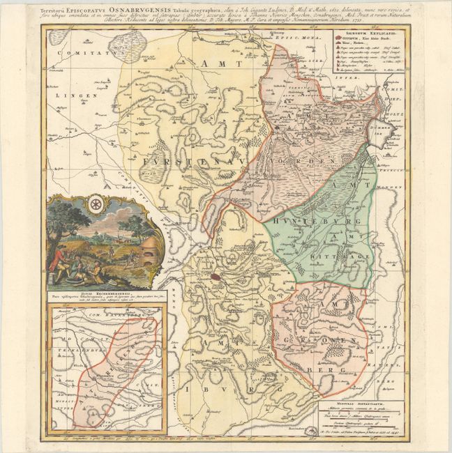
This uncommon map details the region around Osnabruck in northwestern Germany. The map delineates postal routes and features fine topographical detail throughout, with an emphasis on the region's rivers, forests, and marshes. A key at top right identifies towns and villages and notes Catholic, Protestant, and mixed villages. An inset at bottom left, Ditio Reckenbergensis..., centers on Wiedenbruck. Above the inset is an evocative vignette of life in Osnabruck showing workers feasting in the foreground, a kiln, a shepherd, and a man harvesting crops, with the arms of Osnabruck incorporated into the decorative border.
References:
Condition: A
A sharp impression on watermarked paper.