Showing Unsold Lots $100 to $250(remove filter)
Filtered by Category:United States(Show All Categories)
Current Auction
25 lots
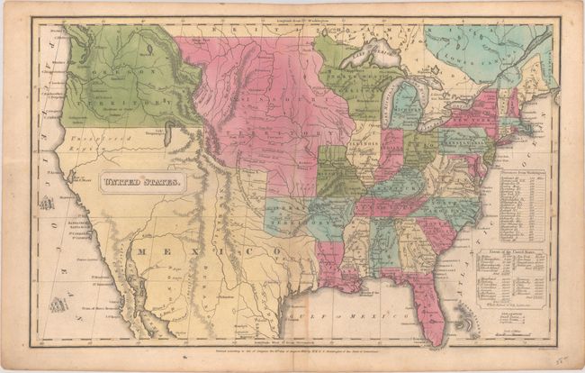
Lot 110
Subject: United States
Huntington, F. J.
United States, 1830
Size: 16 x 10.2 inches (40.6 x 25.9 cm)
Estimate: $160 - $190
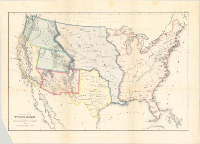
Lot 112
Subject: United States
U.S. Government
Map of the United States Exhibiting the Military Depts. & Posts, 1860
Size: 19.8 x 12.9 inches (50.3 x 32.8 cm)
Estimate: $300 - $375
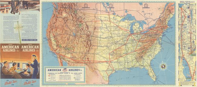
Lot 120
Subject: United States, Aviation
American Airlines Inc. Comprehensive Map Showing the Commercial Air Transport System of the United States, 1939
Size: 27.7 x 17.6 inches (70.4 x 44.7 cm)
Estimate: $180 - $220
A Very Early American Airlines Map

Lot 124
Subject: United States
The National Rifle Association Pictorial Wildlife and Game Map of the United States, 1972
Size: 26.9 x 18.9 inches (68.3 x 48 cm)
Estimate: $240 - $300
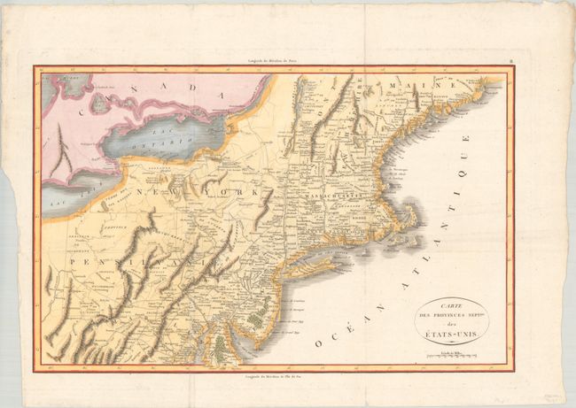
Lot 129
Subject: Eastern United States
Rochefoucald Liancourt, Francois Alexander
Carte des Provinces Septles. des Etats-Unis, 1807
Size: 19.9 x 12.8 inches (50.5 x 32.5 cm)
Estimate: $200 - $230
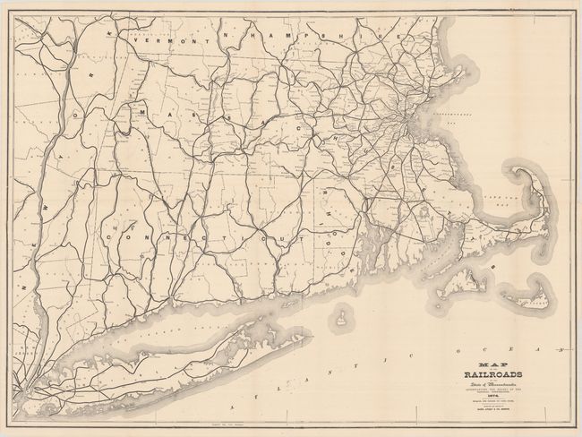
Lot 138
Subject: New England United States
Rand, Avery & Co.
Map of the Railroads of the State of Massachusetts..., 1874
Size: 38 x 28 inches (96.5 x 71.1 cm)
Estimate: $140 - $170

Lot 152
Subject: Upper Midwestern United States
Murray, John
Sources of the Mississippi, 1834
Size: 8.1 x 7.6 inches (20.6 x 19.3 cm)
Estimate: $120 - $150

Lot 156
Subject: Western United States
Gunnison, John William [Capt.]
[Lot of 4] From the Western Boundary of Missouri to the Mouth of Trap Creek [and] From the Mouth of Trap Creek to the Santa Fe Crossing [and] From the Santa Fe Crossing to the Coo-che-to-pa Pass [and] From the Coo-che-to-pa Pass to the Wahsatch Mountains, 1855
Size: 23.2 x 31.3 inches (58.9 x 79.5 cm)
Estimate: $200 - $250

Lot 165
Subject: Southwestern United States
Navajoland U.S.A., 1960
Size: 27.8 x 20.6 inches (70.6 x 52.3 cm)
Estimate: $160 - $190

Lot 167
Subject: Alaska
A Good-Natured Map of Alaska Showing the Services Offered by "The Alaska Line" and Suggesting Some of the Most Interesting Features of the Territory , 1934
Size: 28.4 x 21.1 inches (72.1 x 53.6 cm)
Estimate: $160 - $190

Lot 170
Subject: Southern Arizona
[Map in Book] Part of Salt River Valley Maricopa County Arizona [in] Arizona with Particular Attention to Its Imperial County of Maricopa, 1901
Size: 11.3 x 7.6 inches (28.7 x 19.3 cm)
Estimate: $200 - $250
Early Phoenix Map and Immigration Promotional Piece

Lot 174
Subject: Sacramento, California
Denny's Pocket Map of Sacramento County California Compiled from Latest Official and Private Data, 1913
Size: 24.4 x 26.6 inches (62 x 67.6 cm)
Estimate: $160 - $190

Lot 176
Subject: San Francisco, California
Bill, Henry
San Francisco, 1855
Size: 15.7 x 7.5 inches (39.9 x 19.1 cm)
Estimate: $240 - $300

Lot 180
Subject: Central California
Automobile Club of Southern California
Outing Map of East Central California Camping - Fishing - Hunting, 1925
Size: 22.8 x 36 inches (57.9 x 91.4 cm)
Estimate: $140 - $170

Lot 191
Subject: Florida
Matthews-Northrup Co
[Map in Brochure] Florida East Coast Railway and Hotel, 1902-03
Size: 6.9 x 9.1 inches (17.5 x 23.1 cm)
Estimate: $180 - $220
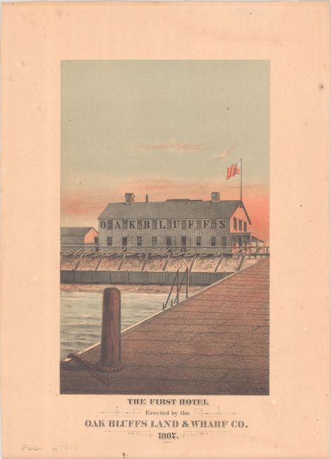
Lot 208
Subject: Martha's Vineyard, Massachusetts
The First Hotel Erected by the Oak Bluffs Land & Wharf Co. 1867, 1878
Size: 6.4 x 10.3 inches (16.3 x 26.2 cm)
Estimate: $275 - $350
Martha’s Vineyard First Hotel

Lot 209
Subject: Boston, Massachusetts
Bellin, Jacques Nicolas
Grundriss von der Stadt Boston und Ihren Gegenden, 1758
Size: 9.9 x 6.4 inches (25.1 x 16.3 cm)
Estimate: $240 - $300

Lot 219
Subject: New York
Colton, G.W. & C.B.
Colton's Railroad & Township Map of the State of New York, with Parts of the Adjoining States & Canada, 1871
Size: 28.4 x 25.2 inches (72.1 x 64 cm)
Estimate: $160 - $190

Lot 220
Subject: New York & New Jersey
[Lot of 3] Waring's Road Maps. Route No. 16 - New York to Oyster Bay [and] Route No. 5. - New York to Lake Hopatcong [and] Route No. 14. New York to Greenwood Lake , 1897
Size: 21 x 2.8 inches (53.3 x 7.1 cm)
Estimate: $180 - $220
Unrecorded Early Spalding Bicycle Road Pocket Maps

Lot 228
Subject: New York City, New York
New York, 1964
Size: 41.9 x 33 inches (106.4 x 83.8 cm)
Estimate: $275 - $350
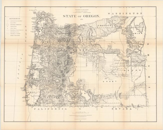
Lot 230
Subject: Oregon
General Land Office
State of Oregon, 1876
Size: 31.5 x 23.9 inches (80 x 60.7 cm)
Estimate: $180 - $220

Lot 231
Subject: Oregon
Geographical Publishing Co.
Premier Series Oregon, 1915
Size: 27.9 x 20 inches (70.9 x 50.8 cm)
Estimate: $140 - $170
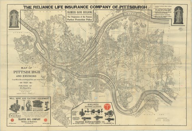
Lot 234
Subject: Pittsburgh, Pennsylvania
Map of Pittsburgh and Environs from Official Records Original Plats and Actual Surveys, 1921
Size: 40.4 x 27.8 inches (102.6 x 70.6 cm)
Estimate: $120 - $150

Lot 238
Subject: Texas
Colton, G.W. & C.B.
Colton's Texas, 1873
Size: 27.6 x 17.5 inches (70.1 x 44.5 cm)
Estimate: $275 - $350
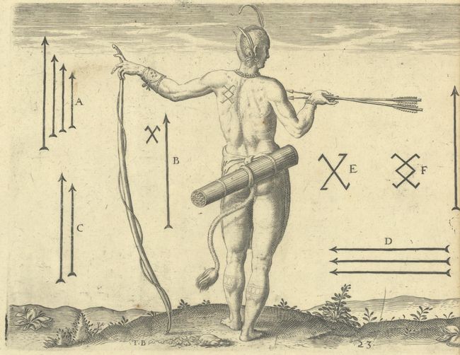
Lot 244
Subject: Virginia, Natives
Bry, Theodore de
[Lot of 2 - The Marks of the Chief Men of Virginia & How the Chief Ladies of Dasamonquepeio Carry their Children] Von Etlichen der Furnembsten Herrn in Virginia Marckzeichen [and] Wie die Weiber Dasamonquepeuc die Kinder Zutragen Pflegen, 1620
Size: 8.3 x 6.3 inches (21.1 x 16 cm)
Estimate: $240 - $300
25 lots