Subject: United States, Aviation
Period: 1939 (dated)
Publication:
Color: Printed Color
Size:
27.7 x 17.6 inches
70.4 x 44.7 cm
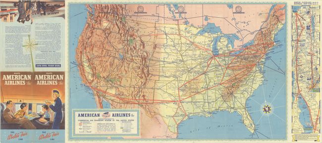
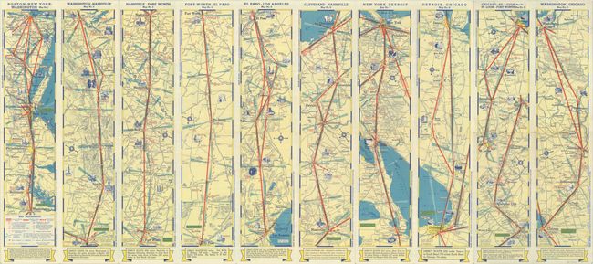
This pre-World War II American Airlines map presents the early routes of the carrier via thick red lines from the Northeast to Chicago, St. Louis, Dallas, and Los Angeles (with several stops in between). Other carrier routes are identified in both blue and red outline, with the combined commercial network serving much of the country. A note below the title states that it "is the largest airline in the United States. Its 6,692 route miles of system directly serve 57 major cities...22 states...39% of the nation's population." There are 10 strip maps on verso (and 1 on recto) showing airline routes between various cities including Boston to Washington, El Paso to Los Angeles, and New York to Detroit. Folds into pictorial wrappers (4.0 x 9.0"). The map is dated January 1939 in the lower left corner.
References:
Condition: A
Clean and colorful with minor wear along a few folds and one short split at a fold junction at the brochure covers (not in the map image). Issued folding.