Subject: Oregon
Period: 1876 (dated)
Publication:
Color: Black & White
Size:
31.5 x 23.9 inches
80 x 60.7 cm
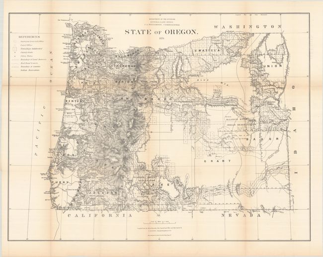
This map is the same size but predates the printed color maps issued in the 1880s. It was compiled from official records in the GLO and other sources by C. Roeser, Principal Draughtsman under the direction of J.A. Williamson, Commissioner. There is excellent detail from the Cascade Mountains west to the coast including all towns and villages, roads, railroads, rivers and topography shown in bold hachure. The legend further identifies Indian reservations, railroad limits and townships subdivided. The granted and indemnity limits of military wagon roads are illustrated. Lithographed and printed by Julius Bien in New York City.
References:
Condition: B
Issued folding with light toning along the fold lines and several fold separations that have been closed on verso with old tape.