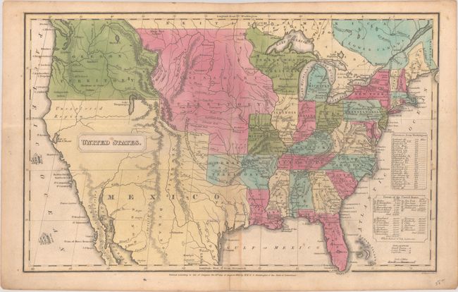
Subject: United States
Period: 1830 (dated)
Publication: Atlas, Designed to Illustrate the Malte-Brun School Geography
Color: Hand Color
Size:
16 x 10.2 inches
40.6 x 25.9 cm
This great map of the United States has early and interesting western territorial configurations. It features a large Arkansas Territory, a Missouri Territory that stretches to the Rocky Mountains, and Oregon Territory that extends north into British Columbia. Mexico is in control of Texas and the Southwest. The map locates numerous Indian tribes and shows good detail of drainage and topography. Engraved by George Boynton.
References: Rumsey #1902.005.
Condition: B+
Contemporary color with light toning along the lower centerfold and a few small spots. There is a short archivally repaired centerfold separation confined to the bottom blank margin.