Subject: Central California
Period: 1925 (circa)
Publication:
Color: Printed Color
Size:
22.8 x 36 inches
57.9 x 91.4 cm
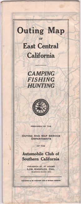
This road map uses red over-printing to identify sites and resources that are useful to campers, fishermen, and hunters. The legend includes camp sites, post offices, forest headquarters, scenic areas, game refuges, trails, locations where resources can be purchased (gas, oil, meals, butter, eggs), and where to hire/rent boats, guides, pack animals, etc. The map extends inland from Los Angeles to Sacramento, and east to the Nevada border. On verso are two detailed "outings" -- one on the west side of the Sierra Nevadas, and the other on the east side -- that give driving directions, sites, and brief historical information.
References:
Condition: A
A clean and bright example, issued folding on a sheet with a "Hammermill Bond Made in U.S.A." watermark and a few minor spots of foxing.