Catalog Archive
Auction 204, Lot 220
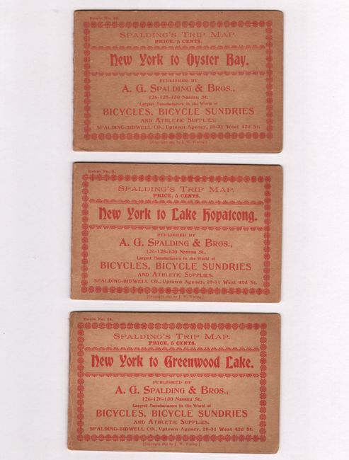
Unrecorded Early Spalding Bicycle Road Pocket Maps
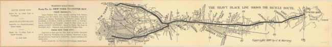
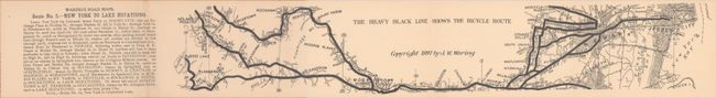
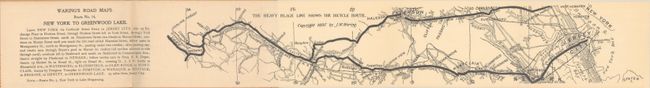
"[Lot of 3] Waring's Road Maps. Route No. 16 - New York to Oyster Bay [and] Route No. 5. - New York to Lake Hopatcong [and] Route No. 14. New York to Greenwood Lake "

Subject: New York & New Jersey
Period: 1897 (dated)
Publication:
Color: Black & White
Size:
21 x 2.8 inches
53.3 x 7.1 cm
Download High Resolution Image
(or just click on image to launch the Zoom viewer)
(or just click on image to launch the Zoom viewer)