Subject: Pittsburgh, Pennsylvania
Period: 1921 (dated)
Publication:
Color: Printed Color
Size:
40.4 x 27.8 inches
102.6 x 70.6 cm
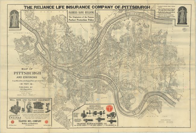
This large and detailed map of the city was published by R.L. Polk & Company. It is roughly centered at the junction of the three rivers and extends west to McKees Rocks and east to Wilkinsburg and presents the street-grid pattern of the city. A legend at bottom further identifies railroads, street car lines, and ward boundaries. Bold lettering above the map advertises "The Reliance Life Insurance Company of Pittsburgh" while illustrated advertisements for the Tranter Manufacturing Company anchor the bottom. There is a detailed street index on verso, though it is obscured by the linen backing. We found only two past sales records for different editions of this map and 8 various institutional examples, also none that were this edition. Folded and backed with linen.
References:
Condition: B
Issued folding and backed on linen with two small holes along the central fold. Paper loss at the center of the map is about 0.25" in diameter and about 0.5" along the lower fold. There are some small separations with minor loss at a few other fold junctions and a few colored pencil notations in the image. Ex-library with a manuscript call number along the upper right border and a sticker on verso with some minor staining visible on recto.