Showing No Reserve Lots(remove filter)
Showing results for:Auction 94
Catalog Archive
59 lots
Page 1 of 2
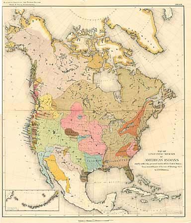
Auction 94, Lot 87
Subject: North America
Powell, John Wesley
Map of the Linguistic Stocks of American Indians, 1890
Size: 17.5 x 20.3 inches (44.5 x 51.6 cm)
Estimate: $200 - $250
Sold for: $170
Closed on 3/7/2001
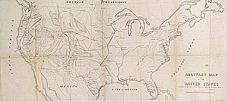
Auction 94, Lot 110
Subject: United States
U.S. War Dept.
Military Map of the United States, 1857
Size: 29.3 x 13.5 inches (74.4 x 34.3 cm)
Estimate: $150 - $200
Sold for: $120
Closed on 3/7/2001
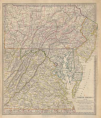
Auction 94, Lot 113
Subject: Eastern United States
SDUK Society for the Diffusion of Useful Knowledge
North America Sheet VII - Pennsylvania, New Jersey, Maryland, Delaware, Columbia and part of Virginia, 1844-52
Size: 12.3 x 14.5 inches (31.2 x 36.8 cm)
Estimate: $60 - $90
Sold for: $0
Closed on 3/7/2001
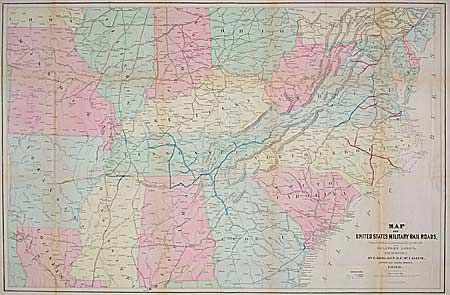
Auction 94, Lot 114
Subject: Southcentral United States
U.S. War Department
Map of United States Military Rail Roads, Showing the Rail Roads Operated during the War from 1862-1866, as Military Lines under the Direction of Bvt. Brig. Gen. B.C. McCallum, Director and General Manager, 1866
Size: 38.2 x 25 inches (97 x 63.5 cm)
Estimate: $300 - $400
Sold for: $275
Closed on 3/7/2001
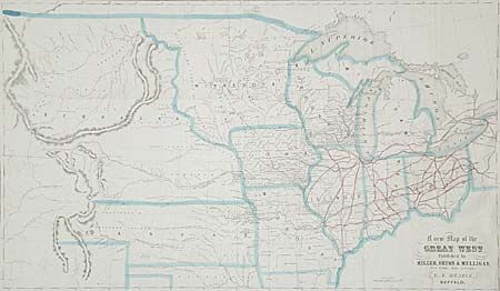
Auction 94, Lot 117
Subject: Central United States
Beadle, D. W.
A New Map of the Great West, 1856
Size: 25.2 x 14.7 inches (64 x 37.3 cm)
Estimate: $150 - $250
Sold for: $300
Closed on 3/7/2001
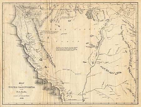
Auction 94, Lot 121
Subject: Western United States
Wilkes, Charles
Map of Upper California by the U.S. Ex. Ex. And Best Authorities, 1841
Size: 11.2 x 8.5 inches (28.4 x 21.6 cm)
Estimate: $220 - $250
Sold for: $120
Closed on 3/7/2001
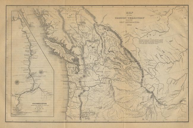
Auction 94, Lot 123
Subject: Northwestern United States
Wilkes, Charles
Map of the Oregon Territory by the U.S. Ex. Ex, 1849
Size: 8.5 x 13 inches (21.6 x 33 cm)
Estimate: $350 - $400
Sold for: $325
Closed on 3/7/2001
Auction 94, Lot 124
Subject: Southwestern United States
Whipple, Amiel Weekes
Map No. 2. From the Rio Grande to the Pacific Ocean…under the direction of the Hon. Jefferson Davis…by Lieut. A.W. Whipple, Topogl. Engrs. And Lieut. J.C. Ives, Topogl. Engrs., 1853-54
Size: 52 x 22 inches (132.1 x 55.9 cm)
Estimate: $450 - $500
Sold for: $160
Closed on 3/7/2001
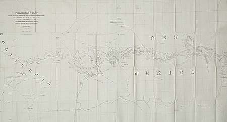
Auction 94, Lot 125
Subject: Southwestern United States
Whipple, Amiel Weekes
Map No. 2. Reconnaissance and Survey of a Railway Route from the Mississippi River near 35th parallel North Lat to Pacific Ocean…by Lieut. A.W. Whipple…J.C. Ives Top Eng…A.H. Campbell Civ. Eng. 1853-4, 1853-54
Size: 75 x 26.2 inches (190.5 x 66.5 cm)
Estimate: $300 - $350
Sold for: $150
Closed on 3/7/2001
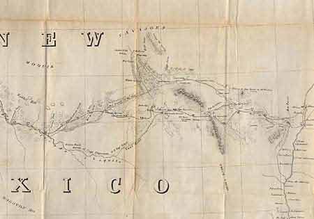
Auction 94, Lot 126
Subject: New Mexico
Whipple, Amiel Weekes
Preliminary Map of the Western Portion of the Reconnaissance and Survey for a Pacific Railroad Route Near the 35th Parallel Made by Capt. A.W. Whipple. T.E. in 1853-4…, 1858
Size: 48.7 x 26.2 inches (123.7 x 66.5 cm)
Estimate: $200 - $250
Sold for: $190
Closed on 3/7/2001
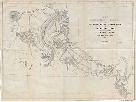
Auction 94, Lot 129
Subject: Western United States
U.S. War Department
Map of a Reconnaissance for a Military Road from the Dalles of the Columbia River to Great Salt Lake under the command of Capt. H.D. Wallen. 4th Inf. By Lieut. Joseph Dixon, T. Engrs, 1859
Size: 21.7 x 16.4 inches (55.1 x 41.7 cm)
Estimate: $120 - $150
Sold for: $160
Closed on 3/7/2001
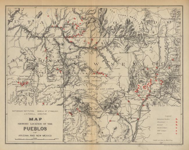
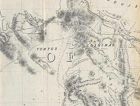
Auction 94, Lot 131
Subject: Arizona and New Mexico
U.S. Bureau of Ethnology
Map of the Province of Tusayan, Arizona Surveyed by A.L. Webster, 1881 [together with] Map Showing the Location of the Pueblos of Arizona and New Mexico, 1881
Size: 11.1 x 8 inches (28.2 x 20.3 cm)
Estimate: $250 - $300
Sold for: $140
Closed on 3/7/2001
Auction 94, Lot 132
Subject: California
U.S. Government
[Lot of 2], 1848
Size: 18.2 x 9.5 inches (46.2 x 24.1 cm)
Estimate: $300 - $350
Sold for: $240
Closed on 3/7/2001
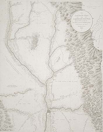
Auction 94, Lot 133
Subject: California
Derby, George Horatio (Lt)
The Sacramento Valley from American River to Butte Creek, Surveyed and drawn by Order of Genl. Riley , commandg. 10th Military Dept. by Lieut. Derby, Topl. Engrs. September & October 1849, 1849
Size: 17.5 x 22.5 inches (44.5 x 57.2 cm)
Estimate: $250 - $300
Sold for: $220
Closed on 3/7/2001
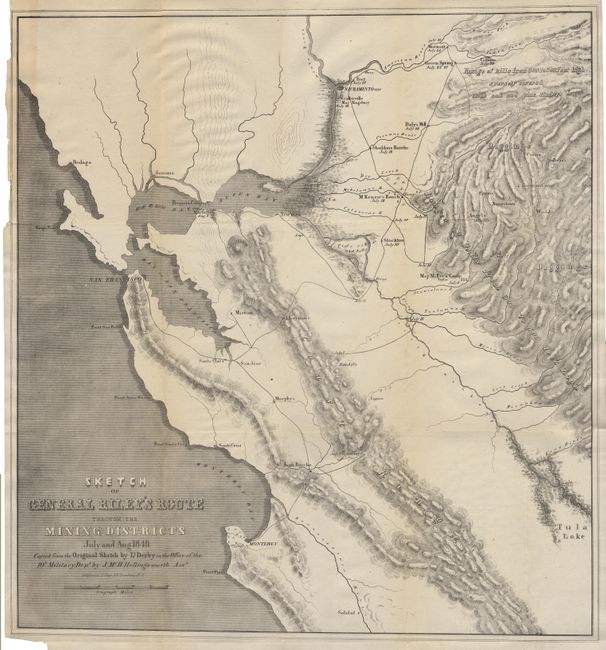
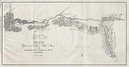
Auction 94, Lot 134
Subject: California & Gold Rush
Derby, George Horatio (Lt)
Sketch of General Riley's Route Through the Mining Districts July and Aug. 1849, 1850
Size: 19.8 x 21 inches (50.3 x 53.3 cm)
Estimate: $400 - $500
Sold for: $325
Closed on 3/7/2001
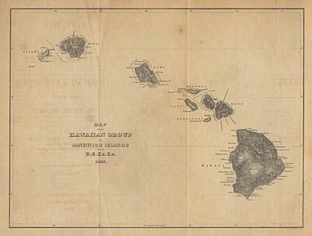
Auction 94, Lot 140
Subject: Hawaii
Wilkes, Charles
Map of the Hawaiian Group or Sandwich Islands by the U.S. Ex. Ex., 1841
Size: 11 x 8.4 inches (27.9 x 21.3 cm)
Estimate: $150 - $200
Sold for: $190
Closed on 3/7/2001
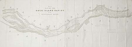
Auction 94, Lot 143
Subject: Illinois
U.S. Government
Map No. 2 Map of the Rock Island Rapids of the Mississippi River, 1837
Size: 62 x 18 inches (157.5 x 45.7 cm)
Estimate: $80 - $100
Sold for: $95
Closed on 3/7/2001
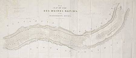
Auction 94, Lot 144
Subject: Illinois
U.S. Government
Map of the Des Moines Rapids of the Mississippi River, 1837
Size: 48 x 21 inches (121.9 x 53.3 cm)
Estimate: $80 - $100
Sold for: $70
Closed on 3/7/2001
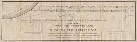
Auction 94, Lot 145
Subject: Indiana
Plat of the Northern Boundary Line of the State of Indiana…, 1827-28
Size: 31 x 9 inches (78.7 x 22.9 cm)
Estimate: $80 - $100
Sold for: $65
Closed on 3/7/2001
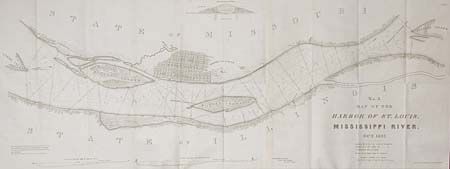
Auction 94, Lot 150
Subject: Missouri
U.S. Government
No. 3 Map of the Harbor of St. Louis, Mississippi River, 1837
Size: 41 x 15.5 inches (104.1 x 39.4 cm)
Estimate: $120 - $150
Sold for: $95
Closed on 3/7/2001
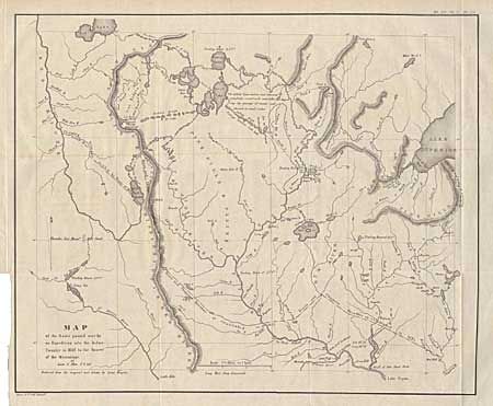
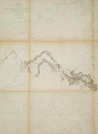
Auction 94, Lot 155
Subject: Minnesota
Allen, James (Lt.)
Map of the Route Passed over by an Expedition into the Indian Country in 1832 to the Source of the Mississippi, 1860
Size: 18.7 x 15.2 inches (47.5 x 38.6 cm)
Estimate: $200 - $250
Sold for: $110
Closed on 3/7/2001
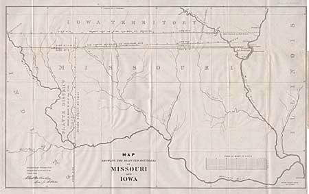
Auction 94, Lot 156
Subject: Missouri and Iowa
U.S. Government
Map Showing the Disputed Boundary of Missouri and Iowa, 1839
Size: 29.2 x 17.8 inches (74.2 x 45.2 cm)
Estimate: $100 - $130
Sold for: $140
Closed on 3/7/2001
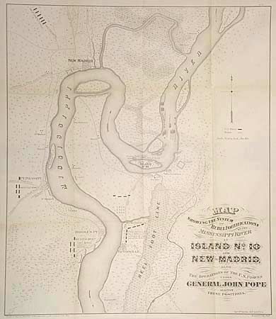
Auction 94, Lot 157
Subject: Mississippi
U.S. War Dept.
Map Showing the System of Rebel Fortifications on the Mississippi River at Island No. 10 and New Madrid , Also the Operations of the U. S. Forces under General John Pope Against These Positions, 1866
Size: 17.2 x 20 inches (43.7 x 50.8 cm)
Estimate: $250 - $300
Sold for: $130
Closed on 3/7/2001
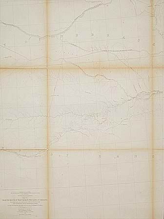
Auction 94, Lot 158
Subject: Nebraska
Gunnison, John William [Capt.]
Map No. 2 From the Mouth of Trap Creek to the Santa Fe Crossing…, 1855
Size: 23 x 31.5 inches (58.4 x 80 cm)
Estimate: $200 - $250
Sold for: $190
Closed on 3/7/2001
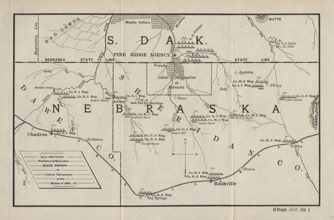
Auction 94, Lot 159
Subject: Nebraska and South Dakota
U.S. Government
Map Showing Positions of Nebraska State Troops in Indian Campaigns of the Winter of 1890-91, 1895
Size: 12 x 7.5 inches (30.5 x 19.1 cm)
Estimate: $120 - $150
Sold for: $170
Closed on 3/7/2001
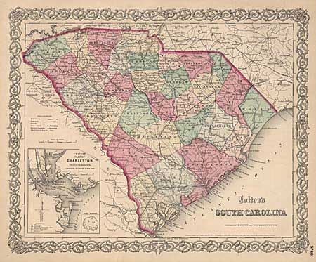
Auction 94, Lot 163
Subject: South Carolina
Colton, Joseph Hutchins
Colton's South Carolina, 1855
Size: 15.5 x 12.6 inches (39.4 x 32 cm)
Estimate: $80 - $100
Sold for: $85
Closed on 3/7/2001
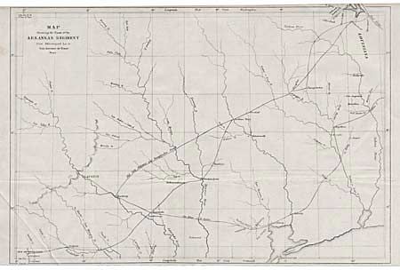
Auction 94, Lot 165
Subject: Texas
U.S. Government
Map Showing the Route of the Arkansas Regiment from Shreveport La. to San Antonio de Bexar, Texas, 1846-50
Size: 17.2 x 11.5 inches (43.7 x 29.2 cm)
Estimate: $300 - $350
Sold for: $150
Closed on 3/7/2001
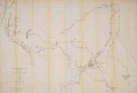
Auction 94, Lot 166
Subject: Texas
U.S. War Department
Reconnaissance of Routes from San Antonio de Bexar to El Paso del Norte &c., 1849
Size: 36.6 x 24.6 inches (93 x 62.5 cm)
Estimate: $400 - $500
Sold for: $220
Closed on 3/7/2001
Auction 94, Lot 169
Subject: Utah
Gunnison, John William [Capt.]
Map No. 4 From the Choo-Che-To-Pa Pass to the Wahsatch Mountains…, 1855
Size: 23 x 31.2 inches (58.4 x 79.2 cm)
Estimate: $100 - $130
Sold for: $95
Closed on 3/7/2001
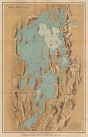
Auction 94, Lot 170
Subject: Utah
U.S. Geological Survey (USGS)
Map of Lake Bonneville, 1878
Size: 17.5 x 28 inches (44.5 x 71.1 cm)
Estimate: $150 - $200
Sold for: $95
Closed on 3/7/2001
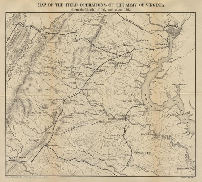
Auction 94, Lot 172
Subject: Virginia
U.S. War Department
Map of Field Operations of the Army of Virginia during the Months of July and August 1862, 1862
Size: 16.2 x 14.2 inches (41.1 x 36.1 cm)
Estimate: $150 - $200
Unsold
Closed on 3/7/2001
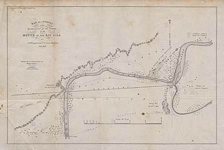
Auction 94, Lot 176
Subject: United States and Mexico
Whipple, Amiel Weekes
Map of a Survey and Reconnaissance of the Vicinity of the Mouth of the Rio Gila, 1849
Size: 16.5 x 10.8 inches (41.9 x 27.4 cm)
Estimate: $80 - $100
Sold for: $75
Closed on 3/7/2001
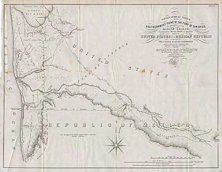
Auction 94, Lot 177
Subject: California & Mexico
Gray, Andrew B.
Topographical Sketch of the Southernmost Part of the Port of San Diego, and measurement of the Marine League for determining Initial Point of Boundary between the United States and Mexican Republic as Surveyed by The United States Commission…, 1849
Size: 22.5 x 17.5 inches (57.2 x 44.5 cm)
Estimate: $250 - $300
Sold for: $140
Closed on 3/7/2001
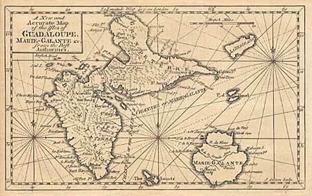
Auction 94, Lot 196
Subject: Guadeloupe
Gibson, John
A New and Accurate Map of the Isles of Guadaloupe, Marie-Galante &c. from the Best Authorities, 1759
Size: 7.5 x 4.5 inches (19.1 x 11.4 cm)
Estimate: $30 - $40
Sold for: $25
Closed on 3/7/2001
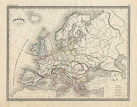
Auction 94, Lot 224
Subject: Europe
Europe Ancienne, 1830
Size: 11.5 x 8.7 inches (29.2 x 22.1 cm)
Estimate: $15 - $20
Sold for: $0
Closed on 3/7/2001
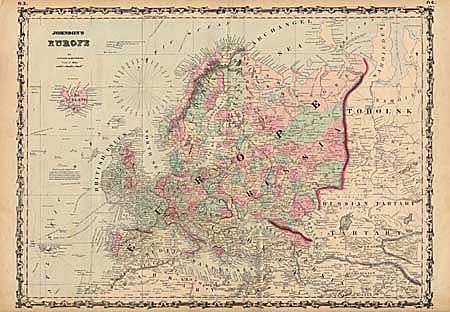
Auction 94, Lot 225
Subject: Europe
Johnson & Browning
Johnson's Europe, 1862
Size: 23.5 x 17 inches (59.7 x 43.2 cm)
Estimate: $30 - $40
Sold for: $0
Closed on 3/7/2001
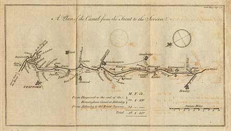
Auction 94, Lot 244
Subject: England
Anon.
A Plan of the Grand Canal from the Trent to the Mersey [and] A Plan of the Canal from the Trent to the Severn, 1771
Size: 15 x 7.5 inches (38.1 x 19.1 cm)
Estimate: $45 - $60
Sold for: $30
Closed on 3/7/2001
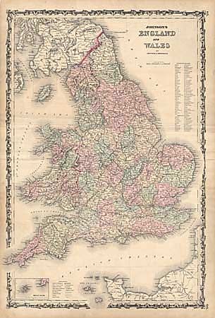
Auction 94, Lot 252
Subject: England and Wales
Johnson & Browning
England and Wales, 1862
Size: 16.5 x 24.5 inches (41.9 x 62.2 cm)
Estimate: $20 - $25
Sold for: $22
Closed on 3/7/2001
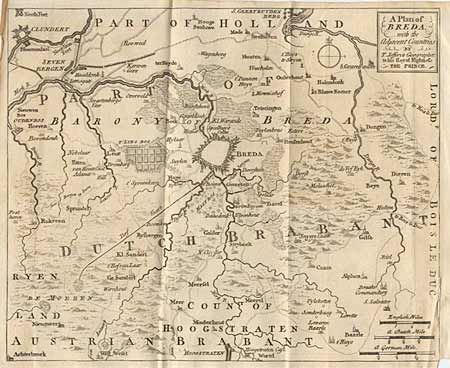
Auction 94, Lot 272
Subject: Netherlands
Jefferys, Thomas
A Plan of Breda with the Adjacent Countries, 1747
Size: 10 x 8.2 inches (25.4 x 20.8 cm)
Estimate: $40 - $50
Sold for: $60
Closed on 3/7/2001
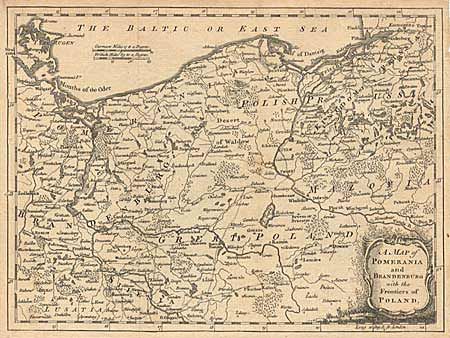
Auction 94, Lot 299
Subject: Poland and Germany
Anon.
A Map of Pomerania and Brandenburg with the Frontiers of Poland, 1759
Size: 10 x 7.5 inches (25.4 x 19.1 cm)
Estimate: $50 - $60
Sold for: $0
Closed on 3/7/2001
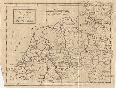
Auction 94, Lot 304
Subject: Germany
Anon.
The Seat of War in the Circle of Westphalia, 1757
Size: 9.8 x 7.8 inches (24.9 x 19.8 cm)
Estimate: $30 - $40
Sold for: $35
Closed on 3/7/2001
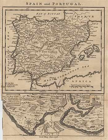
Auction 94, Lot 329
Subject: Spain and Portugal
Anon.
Spain and Portugal, 1756
Size: 7.2 x 9 inches (18.3 x 22.9 cm)
Estimate: $30 - $35
Sold for: $40
Closed on 3/7/2001
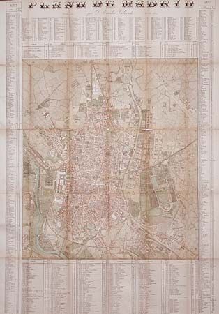
Auction 94, Lot 331
Subject: Spain
Valverde Plano de Madrid, 1884
Size: 35 x 26 inches (88.9 x 66 cm)
Estimate: $25 - $35
Sold for: $20
Closed on 3/7/2001
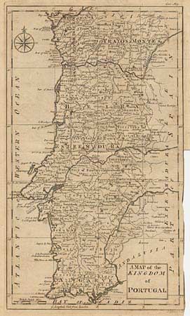
Auction 94, Lot 332
Subject: Portugal
Gibson, John
A Map of the Kingdom of Portugal, 1762
Size: 7.5 x 12.6 inches (19.1 x 32 cm)
Estimate: $45 - $60
Sold for: $0
Closed on 3/7/2001
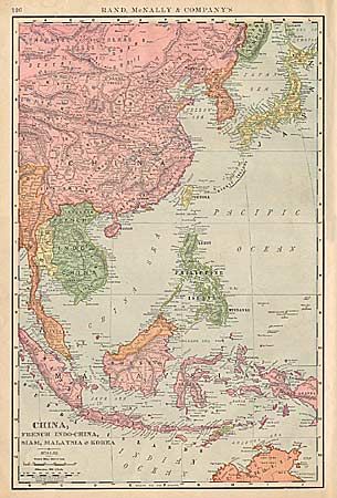
Auction 94, Lot 373
Subject: East Asia
Rand McNally & Co.
China, French Indo-China, Siam, Malaysia and Korea, 1898
Size: 12.5 x 19 inches (31.8 x 48.3 cm)
Estimate: $25 - $30
Sold for: $19
Closed on 3/7/2001
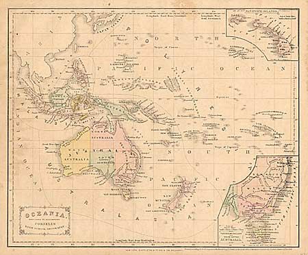
Auction 94, Lot 406
Subject: Oceania
Cornell, Sarah Sophia
Oceania. Designed to accompany Cornell's High School Geography, 1856
Size: 12.2 x 10 inches (31 x 25.4 cm)
Estimate: $25 - $30
Sold for: $10
Closed on 3/7/2001
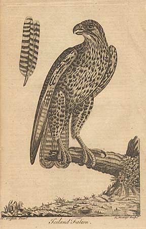
Auction 94, Lot 436
Subject: Birds
Iceland Falcon, 1771
Size: 4 x 7 inches (10.2 x 17.8 cm)
Estimate: $25 - $35
Sold for: $0
Closed on 3/7/2001
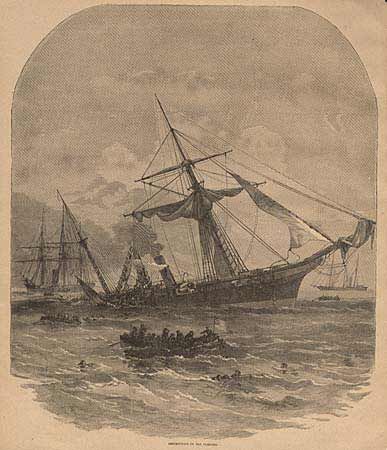
Auction 94, Lot 437
Subject: Military
Various
[Lot of 32 Civil War illustrations], 1866
Size: See Description
Estimate: $30 - $40
Sold for: $30
Closed on 3/7/2001
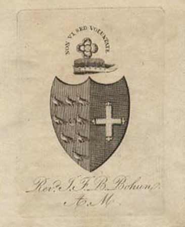
Auction 94, Lot 444
Subject: Heraldry
Anon.
[Lot of 7 coats of arms], 1780
Size: 3 x 4 inches (7.6 x 10.2 cm)
Estimate: $35 - $40
Sold for: $24
Closed on 3/7/2001
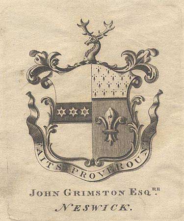
Auction 94, Lot 445
Subject: Heraldry
Anon.
[Lot of 8 coats of arms], 1780
Size: 3 x 4 inches (7.6 x 10.2 cm)
Estimate: $40 - $45
Sold for: $23
Closed on 3/7/2001
59 lots
Page 1 of 2