Catalog Archive
Auction 94, Lot 170

"Map of Lake Bonneville", U.S. Geological Survey (USGS)
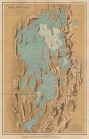
Subject: Utah

Period: 1878 (circa)

Publication:

Color: Printed Color

Size:
17.5 x 28 inches
44.5 x 71.1 cm
Download High Resolution Image
(or just click on image to launch the Zoom viewer)

Lake Bonneville was a prehistoric inland sea that covered a massive area including about half the present day state of Utah and parts of southern Idaho and eastern Nevada. When the sea receded it left behind distinctive benches or terraces on the Wasatch Mountains. The Great Salt Lake, Utah Lake and Lake Sevier are modern remnants of this once great inland sea. This map was prepared by G. K. Gilbert assisted by Gilbert Thompson, Israel C. Russell, H.A. Wheeler and Albert I. Webster.

References:

Condition: A

A few tiny fold intersection splits, lightly toned, still very good.

Estimate: $150 - $200

Sold for: $95

Closed on 3/7/2001

Archived