Filtered by Category:United States(Show All Categories)
Showing results for:Auction 95
Catalog Archive
96 lots
Page 1 of 2
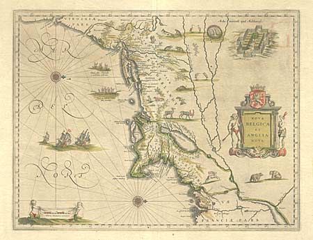
Auction 95, Lot 84
Subject: Colonial New England
Blaeu, Willem
Nova Belgica et Anglia Nova, 1665
Size: 20 x 15.2 inches (50.8 x 38.6 cm)
Estimate: $2,300 - $2,500
Sold for: $2,200
Closed on 6/13/2001
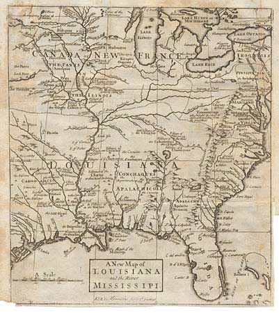
Auction 95, Lot 88
Subject: Colonial United States
Ker, John
A New Map of Louisiana and the River Mississipi, 1726
Size: 8.6 x 9.9 inches (21.8 x 25.1 cm)
Estimate: $250 - $350
Sold for: $550
Closed on 6/13/2001
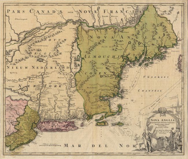
Auction 95, Lot 89
Subject: Colonial New England and Mid Atlantic
Homann, Johann Baptist
Nova Anglia Septentrionali Americae implantata Anglorumque coloniis florentissima, 1730
Size: 22.6 x 19 inches (57.4 x 48.3 cm)
Estimate: $1,300 - $1,500
Sold for: $1,300
Closed on 6/13/2001
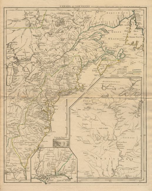
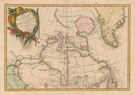
Auction 95, Lot 90
Subject: Colonial North America
Le Rouge, George Louis
Canada et Louisiane…, 1755
Size: 19.2 x 23.7 inches (48.8 x 60.2 cm)
Estimate: $2,400 - $2,750
Unsold
Closed on 6/13/2001
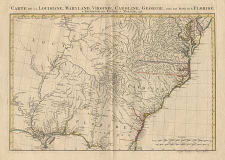
Auction 95, Lot 91
Subject: Colonial Southeast
Covens & Mortier
Carte de la Louisiane, Maryland, Virginie, Caroline, Georgie, avec une Partie de la Floride, 1758
Size: 23.5 x 16.4 inches (59.7 x 41.7 cm)
Estimate: $900 - $1,000
Sold for: $650
Closed on 6/13/2001
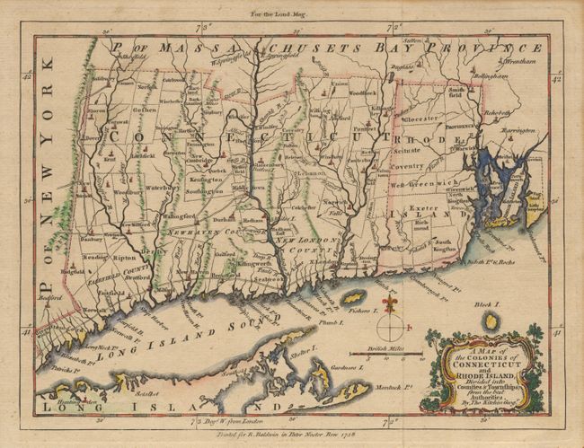
Auction 95, Lot 92
Subject: Colonial United States
Kitchin, Thomas
A Map of the Colonies of Connecticut and Rhode Island, Divided into Counties & Townships, from the best Authorities, 1758
Size: 10 x 8.1 inches (25.4 x 20.6 cm)
Estimate: $220 - $275
Sold for: $275
Closed on 6/13/2001
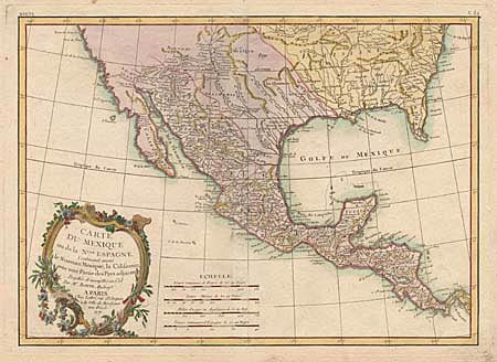
Auction 95, Lot 93
Subject: Southern United States, Mexico & Central America
Bonne, Rigobert
Carte du Mexique ou de la Nouvelle Espagne Contenant aussi le Nouveau Mexique, la Californie, avec une Partie des Pays adjacents, 1771
Size: 16.2 x 11.6 inches (41.1 x 29.5 cm)
Estimate: $400 - $450
Sold for: $300
Closed on 6/13/2001
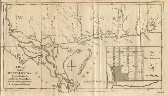
Auction 95, Lot 94
Subject: Colonial South
Lodge, John
A map of Part of West Florida from Pensacola to the Mouth of the Iberville River, with a View to shew the proper Spot for a Settlement on the Mississipi, 1772
Size: 13.3 x 7.4 inches (33.8 x 18.8 cm)
Estimate: $275 - $300
Unsold
Closed on 6/13/2001
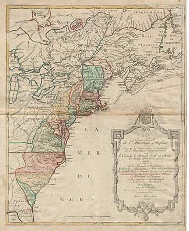
Auction 95, Lot 95
Subject: Colonial United States and Canada
Lotter, Mathias Albrecht
Carte Nouvelle de l'Amerique Angloise contenant tout ce que Anglois possedent sur le Continent de l'Amerique Septentrionale Savoir le Canada, la Nouvelle Ecosse ou Acadie, les treize Provinces unies…, 1776
Size: 19.4 x 23.5 inches (49.3 x 59.7 cm)
Estimate: $550 - $650
Sold for: $550
Closed on 6/13/2001
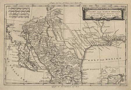
Auction 95, Lot 96
Subject: Southwestern United States and Mexico
Tirion, Isaac
Kaart van Nieuw Mexiko, met het Noordelyk Gedeelte van Oud Mexiko of Nieuw Spanje, 1754
Size: 12.5 x 8.4 inches (31.8 x 21.3 cm)
Estimate: $300 - $350
Sold for: $250
Closed on 6/13/2001
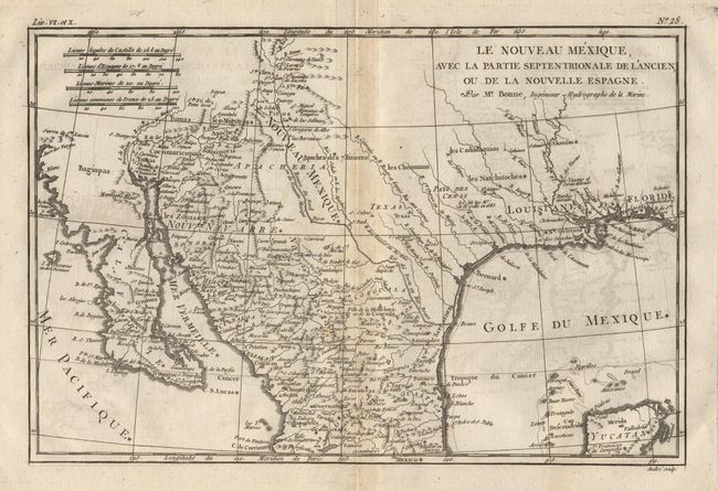
Auction 95, Lot 97
Subject: Southern United States and Mexico
Bonne, Rigobert
Le Nouveau Mexique. Avec la partie septentrionale de l'Ancien, ou de la Noevelle Espagne, 1780
Size: 12.5 x 8.5 inches (31.8 x 21.6 cm)
Estimate: $200 - $250
Sold for: $150
Closed on 6/13/2001
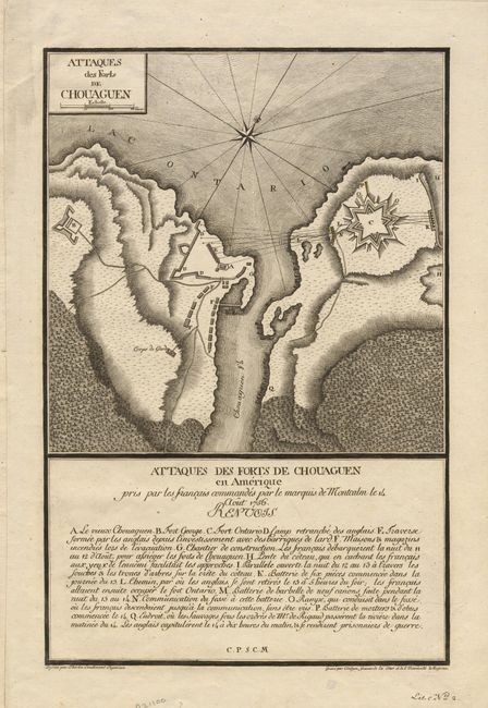
Auction 95, Lot 98
Subject: Colonial New York
Therbu, (Lieut.)
Attaques des Forts de Chouaguen, 1792
Size: 9.2 x 13.9 inches (23.4 x 35.3 cm)
Estimate: $1,000 - $1,200
Sold for: $750
Closed on 6/13/2001
Auction 95, Lot 100
Subject: United States and Canada
Bonne, Rigobert
[On two sheets] Partie de l'Amerique Septentrionale, qui comprend le Canada, la Louisiane, le Labrador, le Groenland, les Etats-Unis et la Floride, 1783
Size: 17.1 x 11.6 inches (43.4 x 29.5 cm)
Estimate: $700 - $750
Sold for: $550
Closed on 6/13/2001
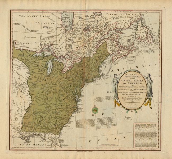
Auction 95, Lot 101
Subject: United States and Canada
Bowles, Carrington
Bowles's New Pocket Map of the United States of America; the British possessions of Canada, Nova Scotia and Newfoundland with the French and Spanish Territories of Louisiana and Florida as Settled by The Preliminary Articles of Peace, Signed at Versailles, 1784
Size: 20 x 18.5 inches (50.8 x 47 cm)
Estimate: $1,700 - $1,900
Sold for: $1,500
Closed on 6/13/2001
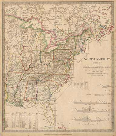
Auction 95, Lot 102
Subject: United States and Canada
SDUK Society for the Diffusion of Useful Knowledge
North America Index Map to Canada and the United States, 1834
Size: 12.4 x 14.5 inches (31.5 x 36.8 cm)
Estimate: $80 - $100
Sold for: $140
Closed on 6/13/2001
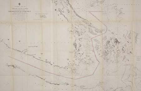
Auction 95, Lot 103
Subject: Northwestern United States and Canada
U.S. Coast Survey
Strait of Juan de Fuca and the channels between the Continent and Vancouver Id. showing the boundary line between British and American Possessions, 1872
Size: 43 x 29 inches (109.2 x 73.7 cm)
Estimate: $200 - $300
Sold for: $600
Closed on 6/13/2001
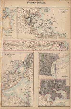
Auction 95, Lot 104
Subject: United States
Bartholomew, George
[Lot of 2 - city plans], 1854
Size: 11.6 x 16.2 inches (29.5 x 41.1 cm)
Estimate: $200 - $250
Sold for: $170
Closed on 6/13/2001
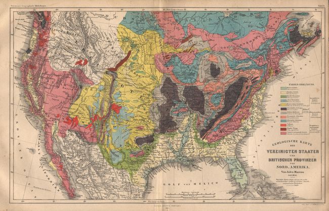
Auction 95, Lot 105
Subject: United States
Perthes, Justus
Geologische Karte der Vereinigten Staaten und Britischen Provinzen von Nord-Amerika, 1855
Size: 15.2 x 9.6 inches (38.6 x 24.4 cm)
Estimate: $75 - $100
Sold for: $650
Closed on 6/13/2001
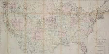
Auction 95, Lot 106
Subject: United States
General Land Office
Map of the United States and Territories Showing the extent of Public Surveys and other details constructed from the Plats and official sources of the General Land Office…, 1870
Size: 55.7 x 28.5 inches (141.5 x 72.4 cm)
Estimate: $350 - $400
Sold for: $375
Closed on 6/13/2001
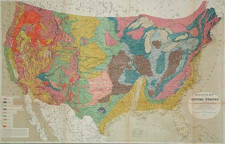
Auction 95, Lot 107
Subject: United States
Hitchcock, Charles Henry
Geological Map of the United States, 1873
Size: 33.2 x 21.2 inches (84.3 x 53.8 cm)
Estimate: $200 - $300
Sold for: $300
Closed on 6/13/2001
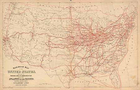
Auction 95, Lot 108
Subject: United States
Mitchell, S. A.
Railroad Map of the United States, Showing the Through Lines of Communication From the Atlantic to the Pacific. Together with the various Steamship Lines along the Seaboard, 1880
Size: 22.5 x 14.1 inches (57.2 x 35.8 cm)
Estimate: $150 - $200
Sold for: $200
Closed on 6/13/2001
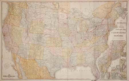
Auction 95, Lot 109
Subject: United States
Rand McNally & Co.
New Official Railroad Map of the United States and Canada, 1885
Size: 42.5 x 26.5 inches (108 x 67.3 cm)
Estimate: $400 - $500
Sold for: $230
Closed on 6/13/2001
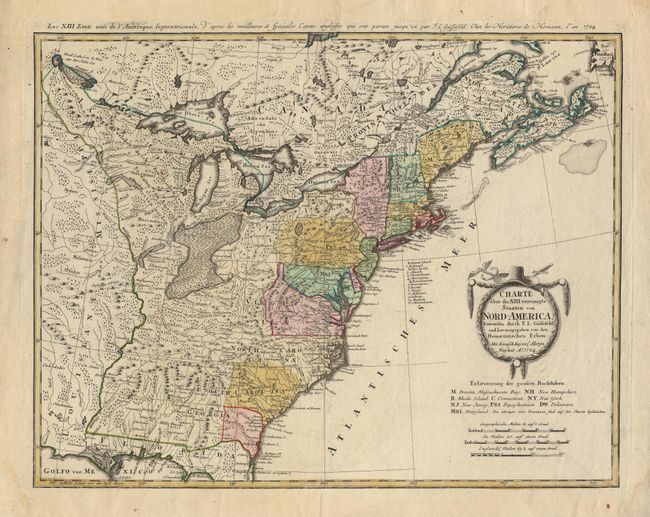
Auction 95, Lot 110
Subject: Eastern United States
Gussefeld/Homann Heirs
Charte uber die XIII vereinigte Staaten von Nord-America…, 1784
Size: 22.6 x 17.6 inches (57.4 x 44.7 cm)
Estimate: $700 - $800
Sold for: $650
Closed on 6/13/2001
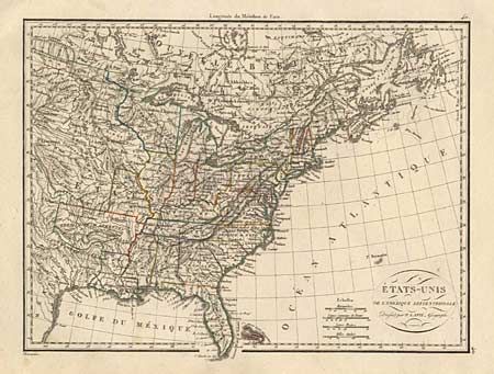
Auction 95, Lot 111
Subject: Eastern United States
Lapie, Alexander Emile & Pierre
Etats-Unis de l'Amerique Septentrionale, 1830
Size: 11.8 x 8.8 inches (30 x 22.4 cm)
Estimate: $210 - $240
Sold for: $150
Closed on 6/13/2001
Auction 95, Lot 112
Subject: Eastern United States
Blunt, Edmund
[Lot of 4 maps], 1833
Size: 8.5 x 8 inches (21.6 x 20.3 cm)
Estimate: $200 - $250
Sold for: $100
Closed on 6/13/2001
Auction 95, Lot 113
Subject: Eastern United States
Black, Adam & Charles
United States, 1844
Size: 14.5 x 19.1 inches (36.8 x 48.5 cm)
Estimate: $100 - $150
Sold for: $85
Closed on 6/13/2001
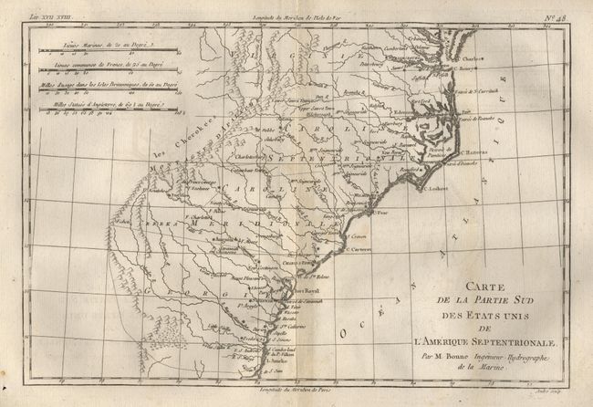
Auction 95, Lot 114
Subject: Colonial United States
Bonne, Rigobert
Carte de la Partie Sud des Etats Unis de l'Amerique Septentrionale, 1780
Size: 8.5 x 12.5 inches (21.6 x 31.8 cm)
Estimate: $200 - $250
Sold for: $150
Closed on 6/13/2001
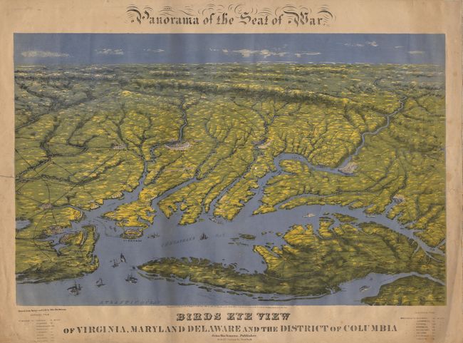
Auction 95, Lot 115
Subject: Southeastern United States
Bachmann, John
Panorama of the Seat of War - Birds Eye View of Virginia, Maryland, Delaware and the District of Columbia, 1861
Size: 28 x 21.7 inches (71.1 x 55.1 cm)
Estimate: $1,300 - $1,500
Unsold
Closed on 6/13/2001
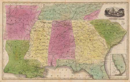
Auction 95, Lot 116
Subject: Southern United States
Anon.
Southern States, 1838
Size: 16.2 x 10.2 inches (41.1 x 25.9 cm)
Estimate: $120 - $140
Sold for: $100
Closed on 6/13/2001
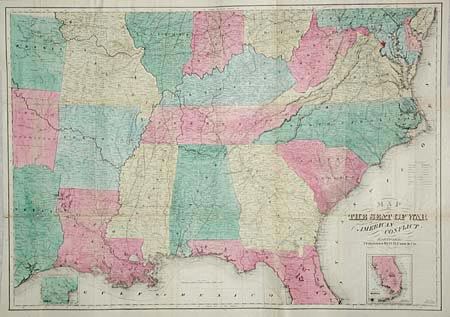
Auction 95, Lot 117
Subject: Southern United States
Case & Company
Map of the Seat of War to Accompany the American Conflict, 1865
Size: 36.8 x 25.8 inches (93.5 x 65.5 cm)
Estimate: $450 - $500
Sold for: $230
Closed on 6/13/2001
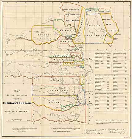
Auction 95, Lot 118
Subject: Central United States
U.S. War Dept.
Map Showing the Lands assigned to Emigrant Indians West of Arkansas & Missouri, 1860
Size: 17.7 x 18.7 inches (45 x 47.5 cm)
Estimate: $325 - $375
Sold for: $350
Closed on 6/13/2001
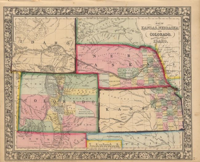
Auction 95, Lot 119
Subject: Central United States
Mitchell, Samuel Augustus
Map of Kansas, Nebraska and Colorado, Showing also the Eastern Portion of Idaho, 1863
Size: 14 x 11.5 inches (35.6 x 29.2 cm)
Estimate: $100 - $150
Sold for: $150
Closed on 6/13/2001

Auction 95, Lot 120
Subject: Western United States
Colton, Joseph Hutchins
Colton's Traveler and Tourist's Guide-Book through the Western States and Territories, containing brief descriptions of each, with the routes and distances of the great lines of travel. Accompanied by a map., 1856
Size: 23.2 x 21.5 inches (58.9 x 54.6 cm)
Estimate: $500 - $600
Unsold
Closed on 6/13/2001
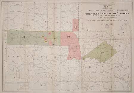
Auction 95, Lot 121
Subject: Central United States
Royce, C. C.
Map of the Former Territorial Limits of the Cherokee Nation of Indians… [together with] Map Showing the Territory Originally Assigned to the Cherokee Nation of Indians West of the Mississippi…, 1884
Size: 30 x 20.7 inches (76.2 x 52.6 cm)
Estimate: $300 - $350
Sold for: $350
Closed on 6/13/2001
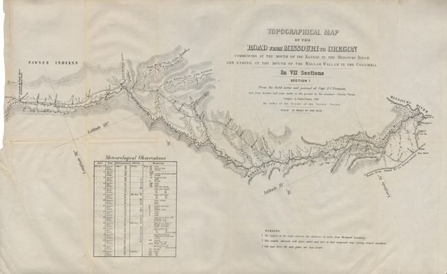
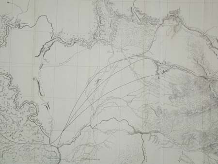
Auction 95, Lot 122
Subject: United States
Fremont/Preuss
Topographical Map of the Road from Missouri to Oregon in Seven Sections, 1846
Size: 26 x 16 inches (66 x 40.6 cm)
Estimate: $2,000 - $3,000
Sold for: $2,100
Closed on 6/13/2001
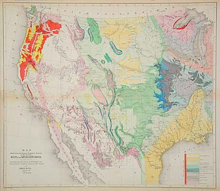
Auction 95, Lot 123
Subject: Western United States
Hall, James
Map Illustrating the General Geological Features of the Country West of the Mississippi River - Compiled from the Surveys of W.H. Emory and from the Pacific Railroad Surveys & other sources., 1857
Size: 23 x 20 inches (58.4 x 50.8 cm)
Estimate: $300 - $400
Sold for: $650
Closed on 6/13/2001
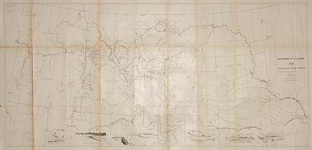
Auction 95, Lot 124
Subject: Western United States
U.S. War Dept.
Map of the Nez Perce Indian Campaign. Bbr. Gen. O.O. Howard, Commanding, 1877
Size: 45.5 x 21.4 inches (115.6 x 54.4 cm)
Estimate: $300 - $400
Sold for: $400
Closed on 6/13/2001
Auction 95, Lot 125
Subject: Northwestern United States
U.S. Railroad Surveys
Milk R. to the Crossing of the Columbia R…, 1855
Size: 61 x 24 inches (154.9 x 61 cm)
Estimate: $200 - $250
Sold for: $120
Closed on 6/13/2001
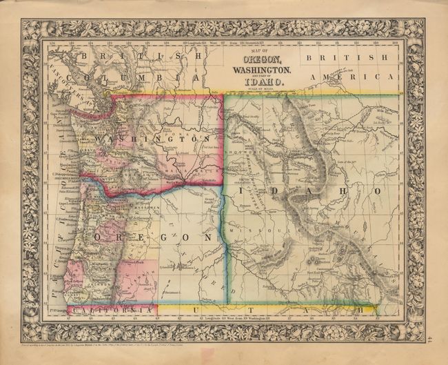
Auction 95, Lot 126
Subject: Northwestern United States
Mitchell, Samuel Augustus
Map of Oregon, Washington, and Part of Idaho, 1863
Size: 13.4 x 10.7 inches (34 x 27.2 cm)
Estimate: $80 - $100
Sold for: $90
Closed on 6/13/2001
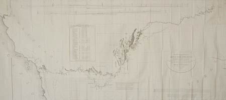
Auction 95, Lot 127
Subject: Western United States
Emory, William Hemsley
Military Reconnaissance of the Arkansas, Rio del Norte and Rio Gila…, 1847
Size: 67 x 30 inches (170.2 x 76.2 cm)
Estimate: $400 - $500
Sold for: $220
Closed on 6/13/2001
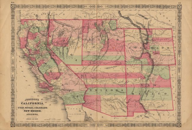
Auction 95, Lot 128
Subject: Southwestern United States
Johnson and Ward
Johnson's California, with Territories of Utah, Nevada, Colorado, New Mexico, and Arizona, 1864
Size: 23.3 x 16.7 inches (59.2 x 42.4 cm)
Estimate: $200 - $250
Sold for: $160
Closed on 6/13/2001
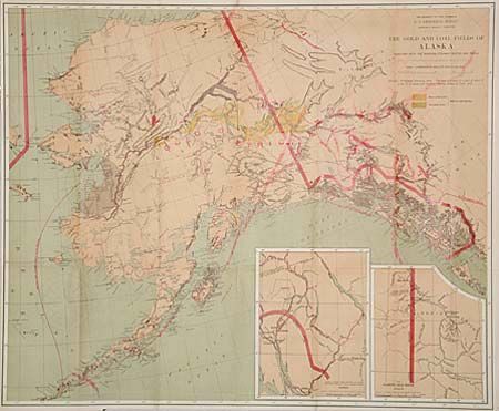
Auction 95, Lot 129
Subject: Alaska
U.S. Geological Survey (USGS)
The Gold and Coal Fields of Alaska Together with the Principal Steamer Routes and Trails, 1898
Size: 28.5 x 23.5 inches (72.4 x 59.7 cm)
Estimate: $200 - $300
Sold for: $210
Closed on 6/13/2001
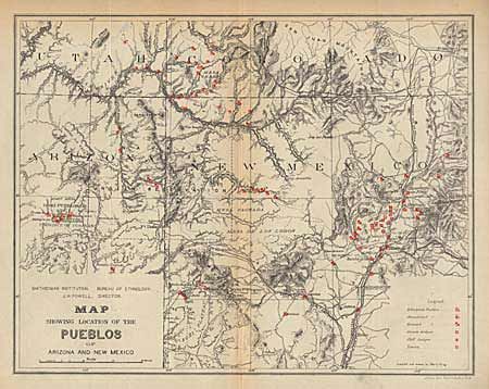
Auction 95, Lot 130
Subject: Arizona and New Mexico
U.S. Bureau of Ethnology
Map of the Province of Tusayan, Arizona Surveyed by A.L. Webster, 1881 [together with] Map Showing the Location of the Pueblos of Arizona and New Mexico, 1881
Size: See Description
Estimate: $120 - $150
Sold for: $230
Closed on 6/13/2001
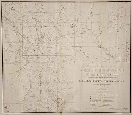
Auction 95, Lot 131
Subject: Arizona and New Mexico
U.S. War Dept.
Outline map of the Field of Operations against hostile Chiricahua Indians, 1886
Size: 28.8 x 25.2 inches (73.2 x 64 cm)
Estimate: $350 - $400
Sold for: $325
Closed on 6/13/2001

Auction 95, Lot 132
Subject: Arizona
Baumann, Jules
Prescott and Tributary Mining Districts, Yavapai County, Arizona, 1895
Size: 35 x 26.7 inches (88.9 x 67.8 cm)
Estimate: $250 - $350
Sold for: $130
Closed on 6/13/2001
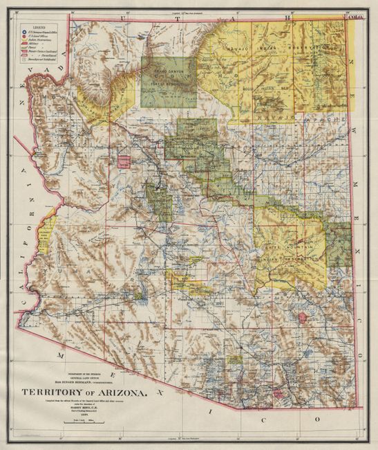
Auction 95, Lot 133
Subject: Arizona
General Land Office
Map of the Territory of Arizona, 1899
Size: 16.7 x 20 inches (42.4 x 50.8 cm)
Estimate: $100 - $125
Sold for: $110
Closed on 6/13/2001
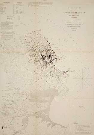
Auction 95, Lot 134
Subject: San Francisco, California
U.S. Coast Survey
City of San Francisco and its Vicinity California, 1853
Size: 17.8 x 25.3 inches (45.2 x 64.3 cm)
Estimate: $300 - $400
Sold for: $375
Closed on 6/13/2001
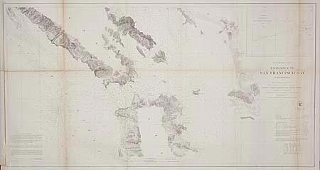
Auction 95, Lot 135
Subject: California
U.S. Coast Survey
Preliminary Chart of Entrance to San Francisco Bay California, 1856
Size: 37 x 20 inches (94 x 50.8 cm)
Estimate: $150 - $200
Sold for: $130
Closed on 6/13/2001
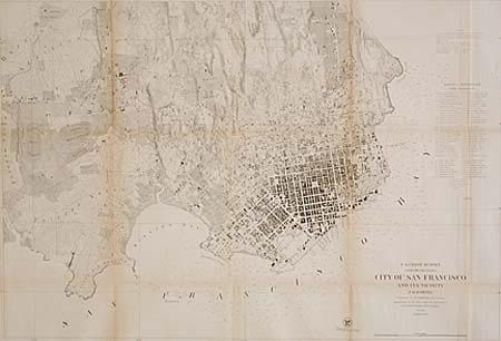
Auction 95, Lot 136
Subject: San Francisco, California
U.S. Coast Survey
City of San Francisco and its Vicinity California, 1859
Size: 34.6 x 23.7 inches (87.9 x 60.2 cm)
Estimate: $300 - $400
Sold for: $240
Closed on 6/13/2001
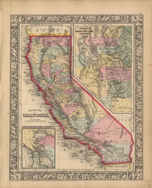
Auction 95, Lot 137
Subject: California
Mitchell, Samuel Augustus
County Map of California, 1863
Size: 10.7 x 13.3 inches (27.2 x 33.8 cm)
Estimate: $100 - $120
Sold for: $110
Closed on 6/13/2001
96 lots
Page 1 of 2