Catalog Archive
Auction 95, Lot 101

"Bowles's New Pocket Map of the United States of America; the British possessions of Canada, Nova Scotia and Newfoundland with the French and Spanish Territories of Louisiana and Florida as Settled by The Preliminary Articles of Peace, Signed at Versailles", Bowles, Carrington

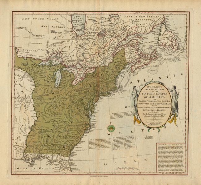
Subject: United States and Canada

Period: 1784 (dated)

Publication:

Color: Hand Color

Size:
20 x 18.5 inches
50.8 x 47 cm
Download High Resolution Image
(or just click on image to launch the Zoom viewer)

A striking map of the United States issued shortly after Independence. The map includes an inset containing Article III of the treaty of Versailles, which deals with the fishing rights of American fishermen on the Banks off Nova Scotia and New Foundland. The western boundaries of the states are shown on the Appalachians with the region between there and the Mississippi River labeled 'Reserved Country'. Florida is depicted as the Spanish provinces of 'East' and 'West' Florida. The original thirteen states are shown and named in a table below the compass rose. Title contained in a decorative cartouche flanked by women representing America and Europe.

References:

Condition: B

Original color with some browning along centerfold and linen tape repair on split in bottom margin fold, else very good.

Estimate: $1,700 - $1,900

Sold for: $1,500

Closed on 6/13/2001

Archived