Catalog Archive
Auction 95, Lot 130

"Map of the Province of Tusayan, Arizona Surveyed by A.L. Webster, 1881 [together with] Map Showing the Location of the Pueblos of Arizona and New Mexico", U.S. Bureau of Ethnology

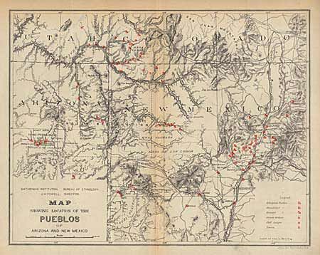
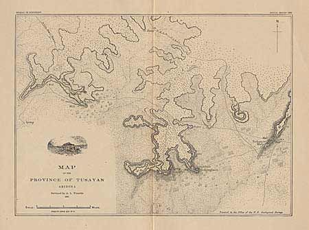
Subject: Arizona and New Mexico

Period: 1881 (dated)

Publication: 2nd Annual Report - 1883

Color: Black & White

Size:
See Description
Download High Resolution Image
(or just click on image to launch the Zoom viewer)

The first (11.1 x 8") is a finely detailed map of the Hopi mesas with the villages of Oraibi, Shipauiluvi (sic), Tewa and Walpi. Small engraving of Walpi within the title cartouche. Locates trails, springs and ruins. The second map (12 x 9.4") was compiled and drawn by Harry King and shows the location of pueblos, lodges and ruins extending from Taos west to Hopi land in Arizona, and south below Acoma. Names forts, agencies and railroads. Red over-printing and legend identify the inhabited, abandoned and ruined pueblos, cliff lodges and towers.

References:

Condition: A

Latter is toned along centerfold with a soft crease. A nice pair of Pueblo related maps.

Estimate: $120 - $150

Sold for: $230

Closed on 6/13/2001

Archived