Subject: Colonial United States
Period: 1726 (published)
Publication:
Color: Black & White
Size:
8.6 x 9.9 inches
21.8 x 25.1 cm
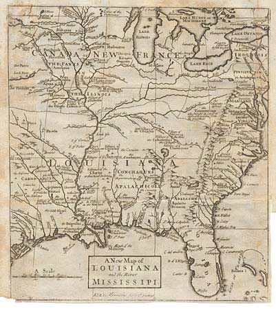
Strong copper engraved map from "The Memoirs and Secret Negotiations of John Ker Containing Material on Louisiana and French Empire in America." Excellent detail of river systems, Indian tribes, villages and towns. Names Fort Prudhome (demolished), Fort Louis, also F. Louis formerly called Crevecour. Locates dozens of Indian villages and nations, names the Cenis. Filled with incredible detail and notations, e.g. "the Tionontatecaga who inhabit in Caves," and an arrow shows "the road the French take to go to Villages of Taogarias..." , etc.
References: Lande 485.
Condition: B
A few light spots on map else very good. Folds and narrow margins as issued.