Catalog Archive
Auction 95, Lot 93
"Carte du Mexique ou de la Nouvelle Espagne Contenant aussi le Nouveau Mexique, la Californie, avec une Partie des Pays adjacents", Bonne, Rigobert
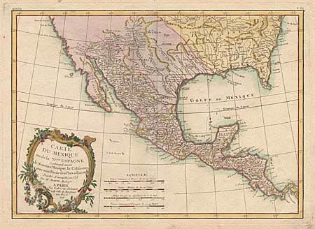
Subject: Southern United States, Mexico & Central America
Period: 1771 (dated)
Publication: Lattre's Atlas Moderne
Color: Hand Color
Size:
16.2 x 11.6 inches
41.1 x 29.5 cm
Download High Resolution Image
(or just click on image to launch the Zoom viewer)
(or just click on image to launch the Zoom viewer)