Catalog Archive
Auction 95, Lot 92
"A Map of the Colonies of Connecticut and Rhode Island, Divided into Counties & Townships, from the best Authorities", Kitchin, Thomas
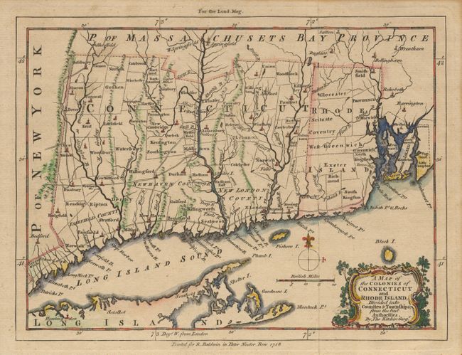
Subject: Colonial United States
Period: 1758 (dated)
Publication: London Magazine
Color: Hand Color
Size:
10 x 8.1 inches
25.4 x 20.6 cm
Download High Resolution Image
(or just click on image to launch the Zoom viewer)
(or just click on image to launch the Zoom viewer)