Subject: Colonial North America
Period: 1755 (dated)
Publication:
Color: Hand Color
Size:
19.2 x 23.7 inches
48.8 x 60.2 cm
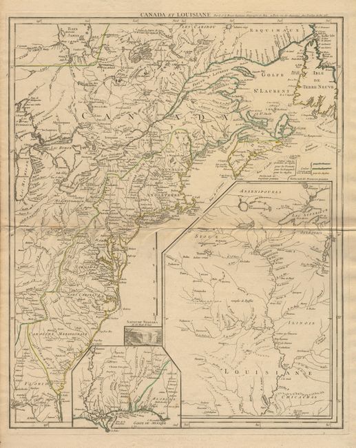
An important and scarce map issued at the outbreak of hostilities in the French and Indian Wars. The map depicts the entire eastern seaboard and the Great Lakes up to Lake Michigan with a great amount of detail. The American interests of France, England and Spain are shown in great detail and color coded. A large inset shows the upper Mississippi River valley with the important frontier forts. A smaller inset shows the lower Mississippi and Gulf coast. A small vignette of Niagara Falls adds further interest to this fascinating map.
References:
Condition: A
Fine clean impression with very faint toning along fold and a tiny split in fold margin.