Filtered by Category:United States(Show All Categories)
Showing results for:Auction 167
Catalog Archive
130 lots
Page 1 of 3
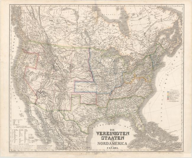
Auction 167, Lot 70
Subject: Canada & United States
Weimar Geographisches Institut
Die Vereinigten Staaten von Nordamerica nebst Canada, 1869
Size: 24.7 x 20.9 inches (62.7 x 53.1 cm)
Estimate: $150 - $180
Sold for: $80
Closed on 3/28/2018
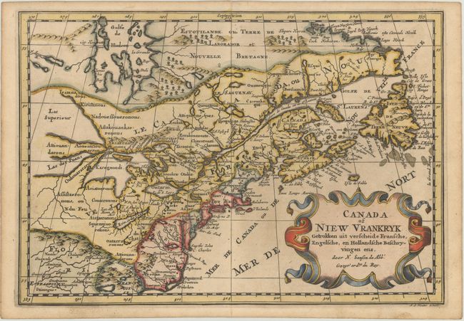
Auction 167, Lot 71
Subject: Colonial Northeastern United States & Canada, Great Lakes
Sanson, Nicolas
Canada of Niew Vrankryk Getrokken uit Verscheide Fransche, Engelsche, en Hollandsche Beschryvingen Enz., 1705
Size: 11.9 x 8.2 inches (30.2 x 20.8 cm)
Estimate: $700 - $850
Small Version of a Keystone Map for Great Lakes Collections
Unsold
Closed on 3/28/2018
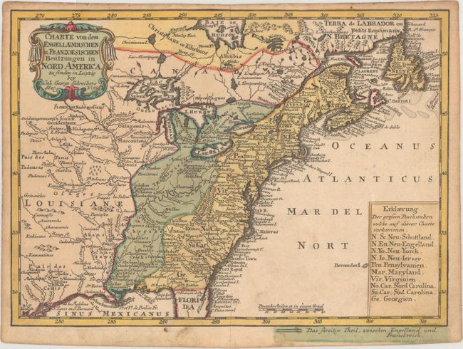
Auction 167, Lot 72
Subject: Colonial Eastern United States & Canada
Schreiber, Johann Georg
Charte von dem Engellaendischen u. Franzoesischen Besitzungen in Nord America..., 1753
Size: 9.4 x 6.9 inches (23.9 x 17.5 cm)
Estimate: $350 - $450
Sold for: $200
Closed on 3/28/2018
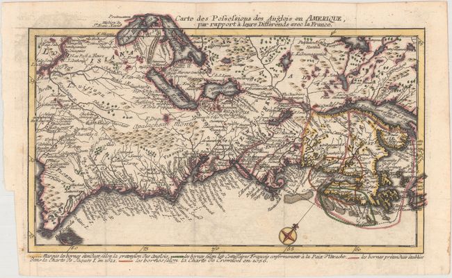
Auction 167, Lot 73
Subject: Colonial Eastern United States & Canada
Back, Jean C.
Carte des Possessions des Anglois en Amerique, par Rapport a Leurs Differends avec la France, 1759
Size: 11.9 x 7.1 inches (30.2 x 18 cm)
Estimate: $700 - $850
One of the Most Unusual French & Indian War Period Maps
Sold for: $750
Closed on 3/28/2018
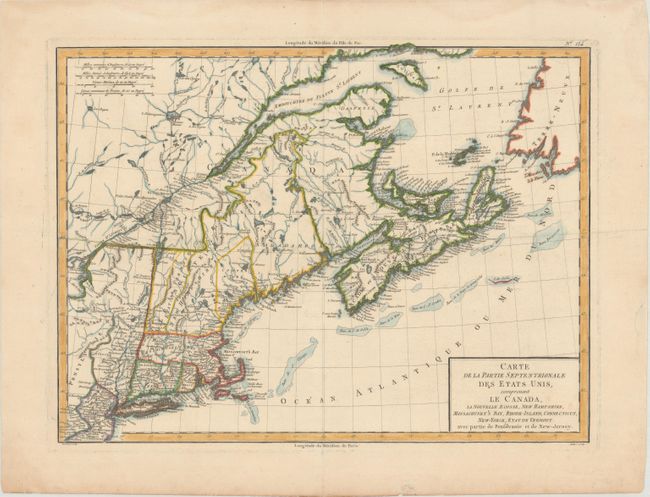
Auction 167, Lot 74
Subject: Eastern United States & Canada
Tardieu, Pierre Francois
Carte de la Partie Septentrionale des Etats Unis, Comprenant le Canada, la Nouvelle Ecosse, New Hampshire, Massachuset's Bay, Rhode-Island, Connecticut, New-Yorck, Etat de Vermont avec Partie de Pensilvanie et de New-Jersey, 1797
Size: 16.8 x 12.6 inches (42.7 x 32 cm)
Estimate: $250 - $325
Sold for: $140
Closed on 3/28/2018
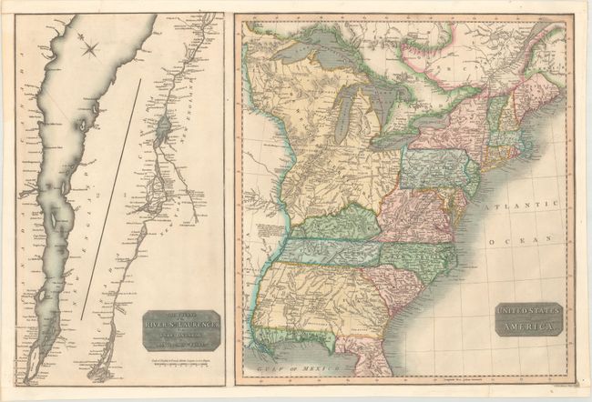
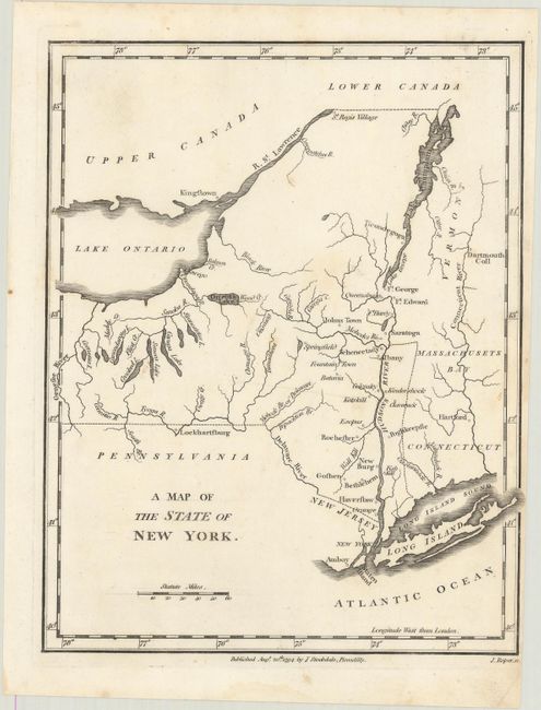
Auction 167, Lot 75
Subject: Eastern United States & Canada
Thomson, John
United States of America [on sheet with] The Course of the River St. Laurence, from Lake Ontario, to Manicouagan Point, 1814
Size: 24.3 x 16.1 inches (61.7 x 40.9 cm)
Estimate: $220 - $250
Sold for: $150
Closed on 3/28/2018
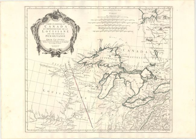
Auction 167, Lot 76
Subject: Colonial Central United States & Canada, Great Lakes
D'Anville/Santini
Partie Occidentale du Canada et Septentrionale de la Louisiane avec une Partie de la Pensilvanie, 1775
Size: 22.3 x 18.9 inches (56.6 x 48 cm)
Estimate: $1,000 - $1,300
Sold for: $800
Closed on 3/28/2018
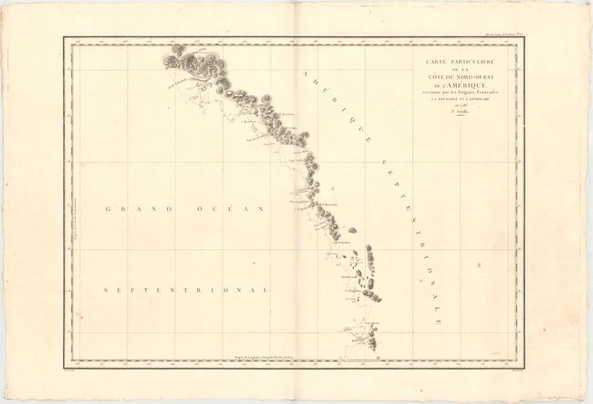
Auction 167, Lot 77
Subject: Western United States & Canada, Alaska
La Perouse, Comte Jean F. Galoup, de
[Lot of 3] Carte Particuliere de la Cote du Nord-Ouest de l'Amerique Reconnue par les Fregates Francaises la Boussole et l'Astrolabe en 1786. 1e. Feuille [and] 2e Feuille [and] 3e Feuille, 1797
Size: 26.8 x 19.4 inches (68.1 x 49.3 cm)
Estimate: $400 - $475
Unsold
Closed on 3/28/2018
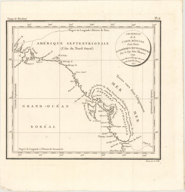
Auction 167, Lot 78
Subject: Pacific Northwest, Southeast Alaska
Meares, John (Capt.)
Fragment de la Carte Reduite d'une Partie de l'Amerique Septentrionale par le Cap. John Meares..., 1798
Size: 9.4 x 8.4 inches (23.9 x 21.3 cm)
Estimate: $400 - $500
Sold for: $300
Closed on 3/28/2018
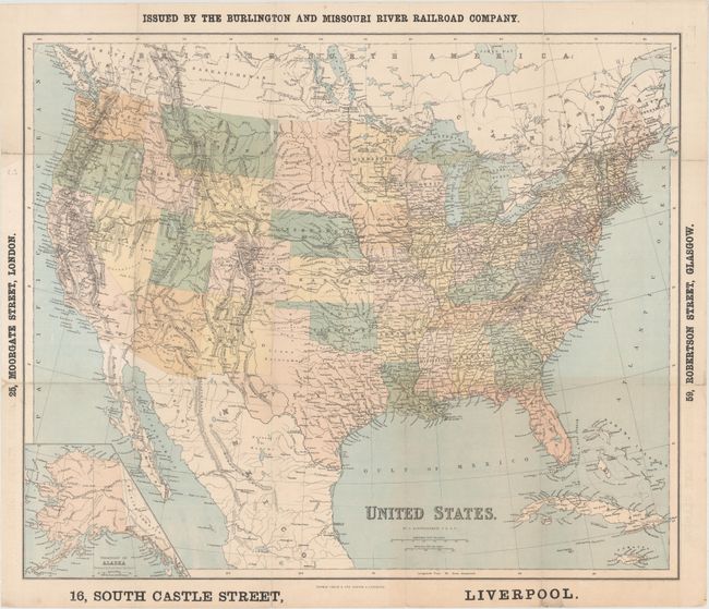
Auction 167, Lot 79
Subject: United States
Bartholomew, John
United States, 1867
Size: 23.8 x 19.9 inches (60.5 x 50.5 cm)
Estimate: $220 - $250
Unsold
Closed on 3/28/2018
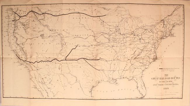
Auction 167, Lot 80
Subject: United States
Gorlinski, Joseph
The Great Railroad Routes to the Pacific, and Their Connections [in] The Policy of Extending Government Aid to Additional Railroads to the Pacific..., 1869
Size: 27.6 x 14.1 inches (70.1 x 35.8 cm)
Estimate: $275 - $350
Sold for: $150
Closed on 3/28/2018
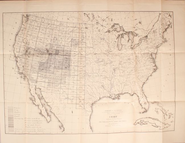
Auction 167, Lot 81
Subject: United States
U.S. Government
[Lot of 3] Chart Exhibiting the Areas Surveyed by King, Wheeler, Hayden, Jenney, and Powell... [and] Map Showing Progress of the Work of U.S. Geological and Geographical Survey... [and] 1878 Progress Map of the U.S. Geographical Surveys... [with reports], 1878
Size: 5.8 x 9 inches (14.7 x 22.9 cm)
Estimate: $200 - $250
Sold for: $75
Closed on 3/28/2018
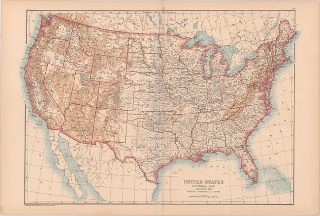
Auction 167, Lot 82
Subject: United States
Black, Adam & Charles
United States General Map Showing the Principal Topographical Features, 1896
Size: 23.3 x 16.1 inches (59.2 x 40.9 cm)
Estimate: $80 - $95
Unsold
Closed on 3/28/2018
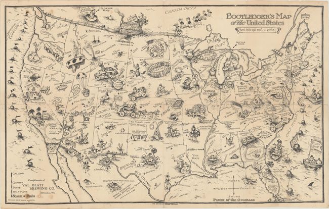
Auction 167, Lot 83
Subject: United States
Bootlegger's Map of the United States , 1926
Size: 33.9 x 21.3 inches (86.1 x 54.1 cm)
Estimate: $500 - $650
McCandlish's Humorous Prohibition Map
Sold for: $350
Closed on 3/28/2018
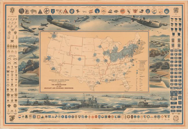
Auction 167, Lot 84
Subject: United States, World War II
Hammond, C. S.
Defense Map of United States Prepared by C.S. Hammond & Co., N.Y. Showing the Mobilization of Our Military and Economic Resources, 1942
Size: 30.9 x 21.1 inches (78.5 x 53.6 cm)
Estimate: $220 - $250
Sold for: $300
Closed on 3/28/2018
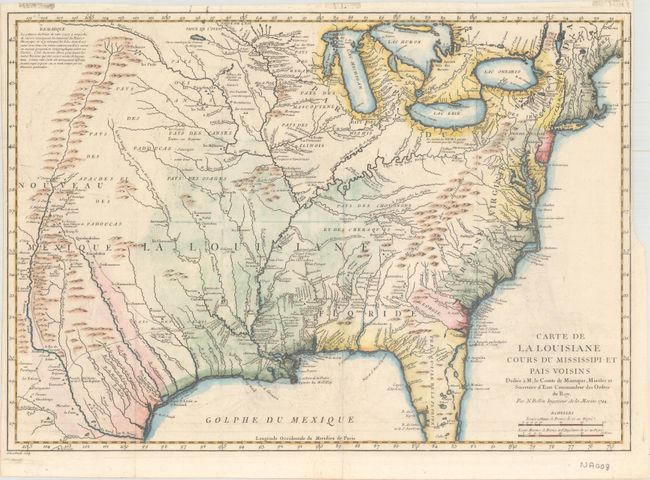
Auction 167, Lot 85
Subject: Colonial Eastern United States
Bellin, Jacques Nicolas
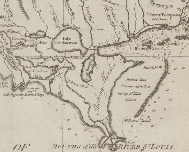
Carte de la Louisiane Cours du Mississipi et Pais Voisins, 1744
Size: 22.1 x 15.6 inches (56.1 x 39.6 cm)
Estimate: $950 - $1,200
Sold for: $550
Closed on 3/28/2018
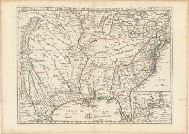
Auction 167, Lot 86
Subject: Colonial Eastern United States, Louisiana Territory
Delisle/Dezauche
Carte de la Louisiane et du Cours du Mississipi avec les Colonies Anglaises, 1782
Size: 25.4 x 19.1 inches (64.5 x 48.5 cm)
Estimate: $1,600 - $1,900
Delisle's Influential Map of the Louisiana Territory
Unsold
Closed on 3/28/2018
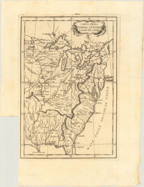
Auction 167, Lot 87
Subject: Eastern United States
Anon.
Carta della Florida, Luigiana e Laghi del Canada, 1787
Size: 6.8 x 9.9 inches (17.3 x 25.1 cm)
Estimate: $200 - $230
Unsold
Closed on 3/28/2018
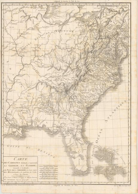
Auction 167, Lot 88
Subject: Eastern United States
Poirson, Jean Baptiste
Carte des Carolines Meridionale et Septentrionale, la Georgie, la Floride, Orientale et Occidentale, le Pays des Cherokees, la Vaste Contree des Muscogulges, ou la Confederation des Creks et Pays des Chataws, 1799
Size: 17.4 x 24.3 inches (44.2 x 61.7 cm)
Estimate: $750 - $900
Sold for: $900
Closed on 3/28/2018
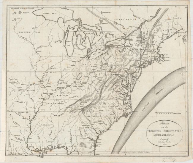
Auction 167, Lot 89
Subject: Eastern United States
Melish, John
Karte von dem Vereinten Freistaaten Nordamericas, 1821
Size: 16.6 x 13.9 inches (42.2 x 35.3 cm)
Estimate: $450 - $550
Sold for: $325
Closed on 3/28/2018
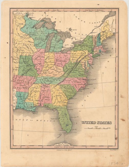
Auction 167, Lot 90
Subject: Eastern United States
Finley, Anthony
United States, 1824
Size: 8.7 x 11.3 inches (22.1 x 28.7 cm)
Estimate: $120 - $150
Sold for: $70
Closed on 3/28/2018
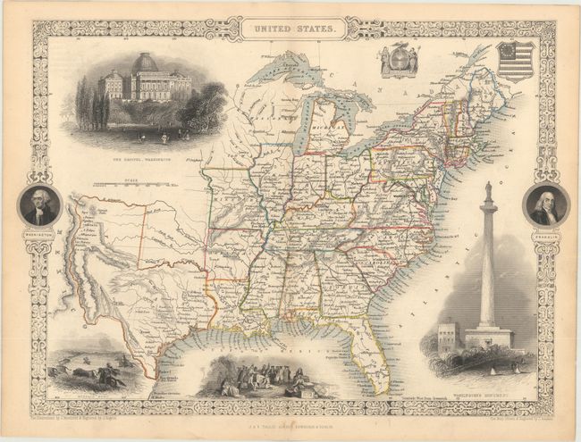
Auction 167, Lot 91
Subject: Eastern United States, Texas
Tallis, John
United States, 1850
Size: 13.4 x 9.7 inches (34 x 24.6 cm)
Estimate: $275 - $350
Sold for: $230
Closed on 3/28/2018
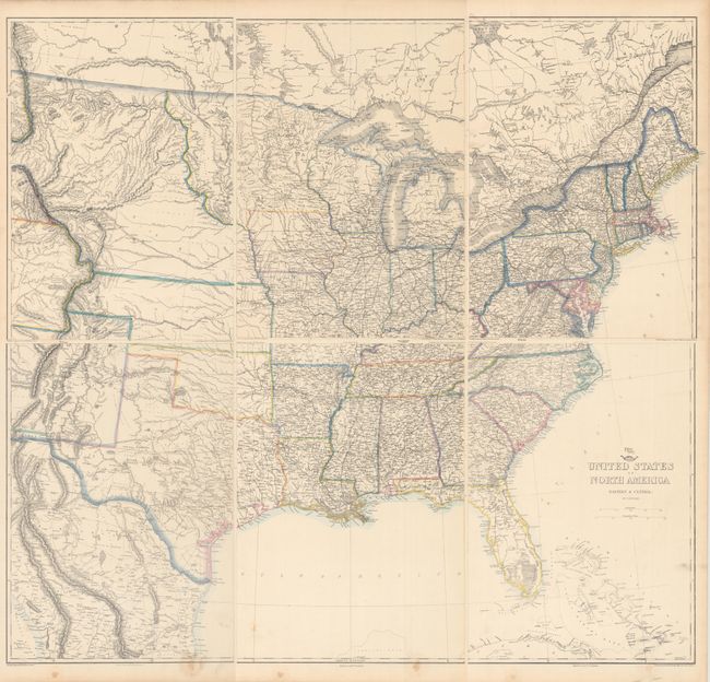
Auction 167, Lot 92
Subject: Eastern United States
Ettling, Theodor
[On 6 Sheets] United States of North America (Eastern & Central), 1860
Size: 12 x 16.9 inches (30.5 x 42.9 cm)
Estimate: $240 - $300
Sold for: $180
Closed on 3/28/2018
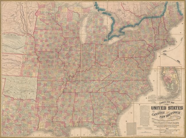
Auction 167, Lot 93
Subject: Eastern United States
Lloyd, James T.
Lloyd's New Map of the United States the Canadas and New Brunswick from the Latest Surveys Showing Every Railroad & Station Finished to June 1862 and the Atlantic and Gulf Coasts..., 1863
Size: 49.9 x 37.3 inches (126.7 x 94.7 cm)
Estimate: $1,100 - $1,400
Unsold
Closed on 3/28/2018
Auction 167, Lot 94
Subject: Northeastern United States
Morse, Jedidiah (Rev.)
[Lot of 7] A Map of the State of New York [and] A Map of Massachusets... [and] A Map of New Jersey... [and] A Map of Pensylvania... [and] A Map of Connecticut [and] A Map of Vermont [and] A Map of New Hampshire, 1794
Size: See Description
Estimate: $450 - $550
Unsold
Closed on 3/28/2018
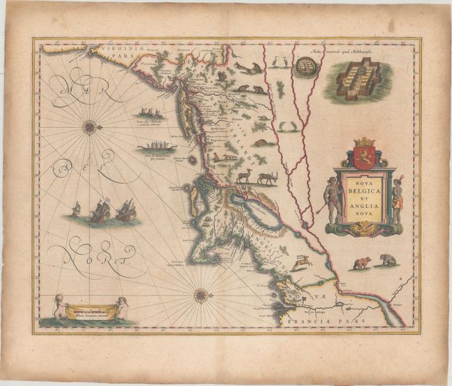
Auction 167, Lot 95
Subject: Colonial New England & Mid-Atlantic United States
Blaeu, Willem
Nova Belgica et Anglia Nova, 1638
Size: 19.9 x 15.3 inches (50.5 x 38.9 cm)
Estimate: $2,300 - $2,750
Important Map of Colonial New England and the Mid-Atlantic
Unsold
Closed on 3/28/2018
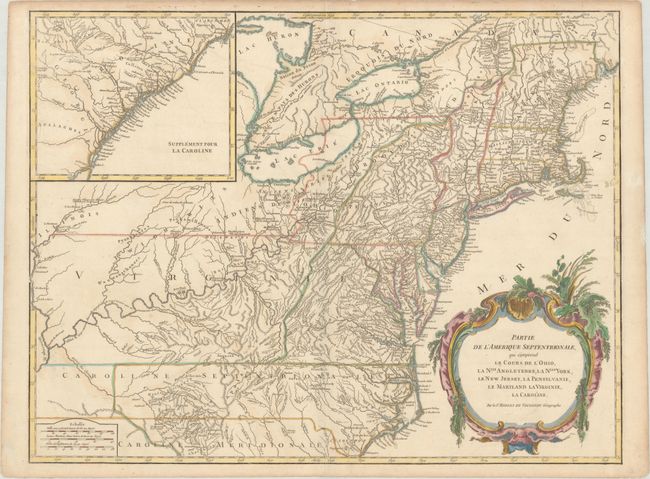
Auction 167, Lot 96
Subject: Colonial New England & Mid-Atlantic United States
Robert de Vaugondy
Partie de l'Amerique Septentrionale, qui Comprend le Cours de l'Ohio, la Nlle. Angleterre, la Nlle York, le New Jersey, la Pensylvanie, le Maryland la Virginie, la Caroline, 1768
Size: 24.5 x 18.8 inches (62.2 x 47.8 cm)
Estimate: $600 - $750
Unsold
Closed on 3/28/2018
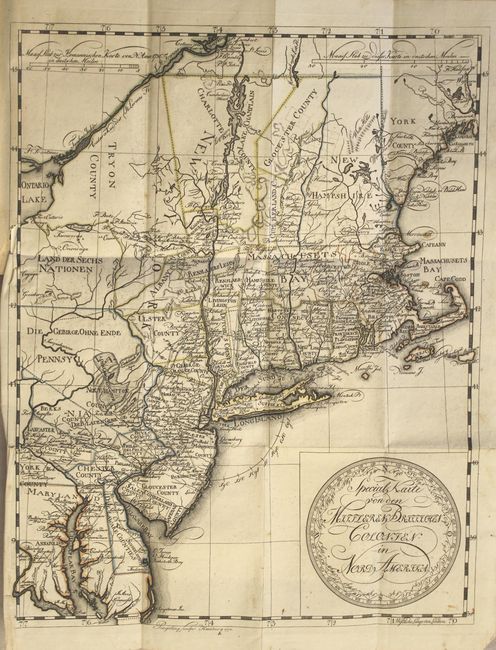
Auction 167, Lot 97
Subject: Colonial New England & Mid-Atlantic United States
Leiste/Pingeling
Special Karte von den Mittleren Britisshen Colonien in Nord Amerika... [bound in] Beschreibung des Brittischen Amerika zur Ersparung der Englischen Karten..., 1778
Size: 11.7 x 14.8 inches (29.7 x 37.6 cm)
Estimate: $1,800 - $2,100
Scarce Revolutionary War Map
Unsold
Closed on 3/28/2018
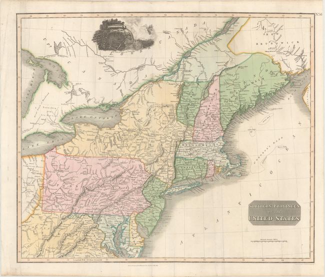
Auction 167, Lot 98
Subject: New England & Mid-Atlantic United States
Thomson, John
Northern Provinces of the United States, 1817
Size: 22.9 x 19.3 inches (58.2 x 49 cm)
Estimate: $350 - $425
Sold for: $190
Closed on 3/28/2018
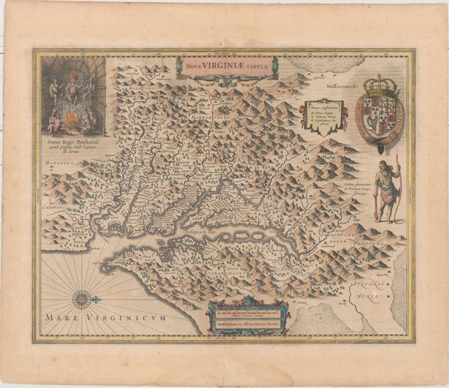
Auction 167, Lot 99
Subject: Colonial Mid-Atlantic United States
Hondius, Henricus
Nova Virginiae Tabula, 1636
Size: 19.5 x 15.1 inches (49.5 x 38.4 cm)
Estimate: $1,800 - $2,200
One of the Most Important 17th Century Maps of the Chesapeake Bay
Sold for: $1,000
Closed on 3/28/2018
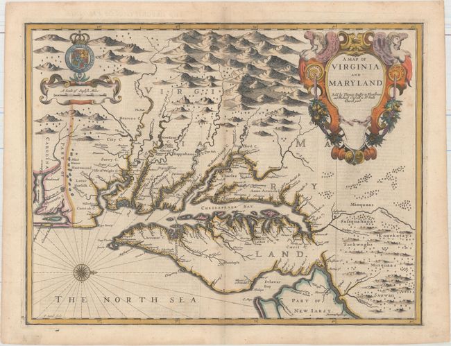
Auction 167, Lot 100
Subject: Colonial Mid-Atlantic United States
Speed/Lamb
A Map of Virginia and Maryland, 1676
Size: 19.4 x 14.9 inches (49.3 x 37.8 cm)
Estimate: $4,000 - $5,000
The First Printed Map to Draw Upon the Legendary Herrman Map of the Chesapeake Bay
Sold for: $3,000
Closed on 3/28/2018
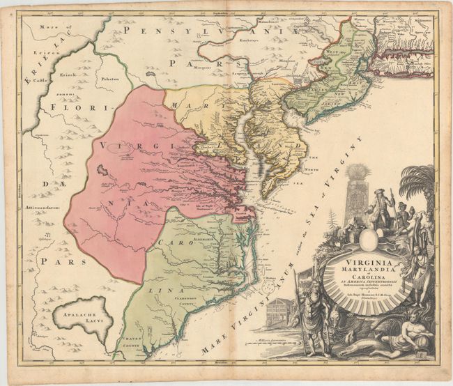
Auction 167, Lot 101
Subject: Colonial Mid-Atlantic United States
Homann, Johann Baptist
Virginia Marylandia et Carolina in America Septentrionali Britannorum Industria Excultae, 1714
Size: 23.1 x 19.3 inches (58.7 x 49 cm)
Estimate: $1,200 - $1,500
Map Created to Promote German Immigration to the New World
Sold for: $800
Closed on 3/28/2018
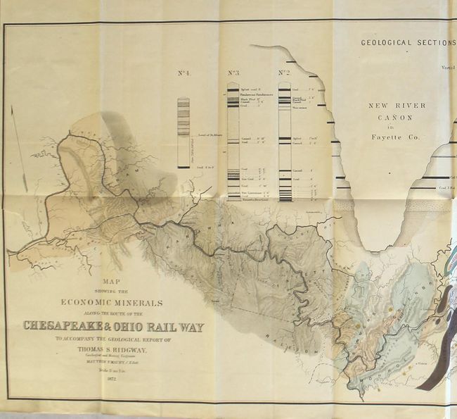
Auction 167, Lot 102
Subject: Virginia, West Virginia
Maury, M. F.
Map Showing the Economic Minerals Along the Route of the Chesapeake & Ohio Rail Way to Accompany the Geological Report of Thomas S. Ridgway... [with report], 1872
Size: 39.4 x 14.3 inches (100.1 x 36.3 cm)
Estimate: $500 - $650
Sold for: $375
Closed on 3/28/2018
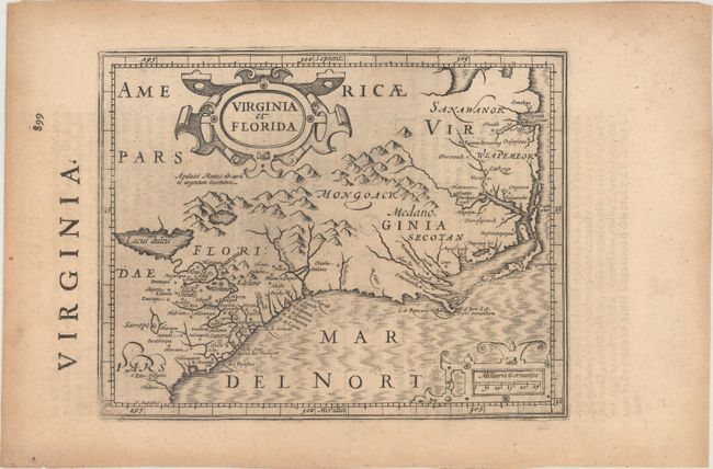
Auction 167, Lot 103
Subject: Colonial Southeastern United States
Mercator/Hondius
Virginia et Florida, 1635
Size: 7.3 x 5.7 inches (18.5 x 14.5 cm)
Estimate: $350 - $425
Unsold
Closed on 3/28/2018
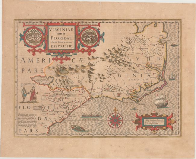
Auction 167, Lot 104
Subject: Colonial Southeastern United States
Hondius, Jodocus
Virginiae Item et Floridae Americae Provinciarum, Nova Descriptio, 1639
Size: 19.1 x 13.4 inches (48.5 x 34 cm)
Estimate: $1,600 - $1,900
A Seminal Map of the Southeast and Early American Cartography - Full Contemporary Color
Sold for: $1,200
Closed on 3/28/2018
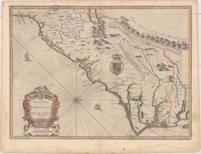
Auction 167, Lot 105
Subject: Colonial Southeastern United States
Speed/Lamb
A New Description of Carolina, 1676
Size: 20 x 14.8 inches (50.8 x 37.6 cm)
Estimate: $3,500 - $4,250
Speed's Map of the Carolinas Based Upon the Lords Proprietor's Map
Unsold
Closed on 3/28/2018
Auction 167, Lot 106
Subject: Colonial Southeastern United States
Anville, Jean Baptiste Bourguignon d'
[Canada Louisiane et Terres Angloises - Southeastern Sheet], 1755
Size: 25.3 x 15.7 inches (64.3 x 39.9 cm)
Estimate: $375 - $450
Unsold
Closed on 3/28/2018
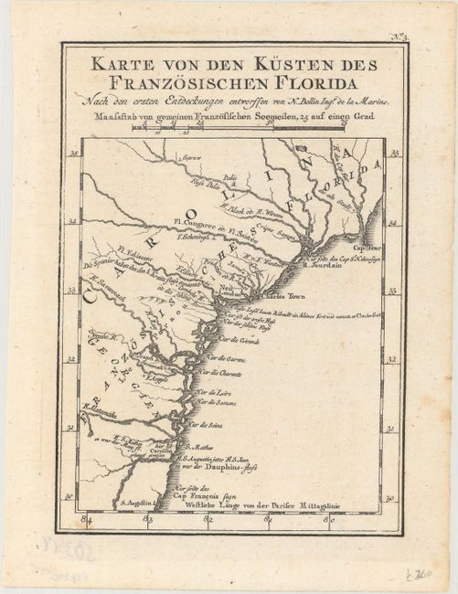
Auction 167, Lot 107
Subject: Colonial Southeast United States
Bellin, Jacques Nicolas
Karte von den Kusten des Franzosischen Florida nach den Ersten Entdeckungen Entworffen, 1760
Size: 5.8 x 8.1 inches (14.7 x 20.6 cm)
Estimate: $150 - $180
Unsold
Closed on 3/28/2018
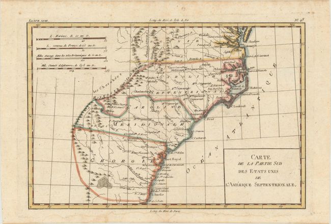
Auction 167, Lot 108
Subject: Colonial Southeastern United States
Bonne, Rigobert
Carte de la Partie Sud des Etats Unis de l'Amerique Septentrionale, 1780
Size: 12.4 x 8.3 inches (31.5 x 21.1 cm)
Estimate: $140 - $170
Unsold
Closed on 3/28/2018
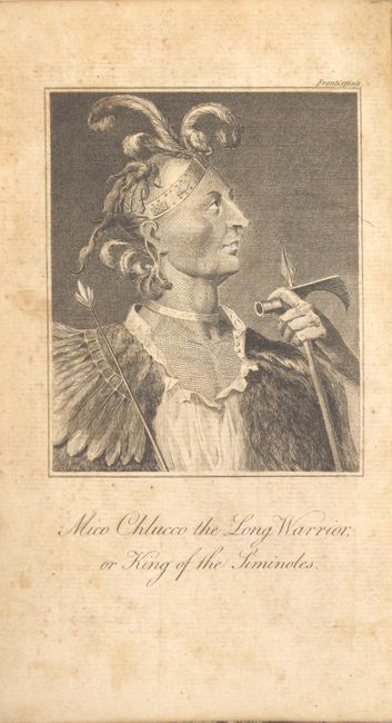
Auction 167, Lot 109
Subject: Southeastern United States
Bartram, William
Travels Through North and South Carolina, Georgia, East and West Florida, the Cherokee Country, the Extensive Territories of the Muscogulges or Creek Confederacy, and the Country of the Chactaws..., 1793
Size: 5.5 x 8.3 inches (14 x 21.1 cm)
Estimate: $2,750 - $3,500
Irish Edition of Bartram's Work on the Southeast
Unsold
Closed on 3/28/2018
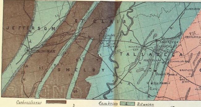
Auction 167, Lot 110
Subject: Georgia & Alabama
[Map Bound in Report] Economic Geological Survey, in Georgia and Alabama, Throughout the Belt Traversed by the Macon & Birmingham Railway..., 1889
Size: 5.5 x 8.2 inches (14 x 20.8 cm)
Estimate: $150 - $180
Sold for: $110
Closed on 3/28/2018

Auction 167, Lot 111
Subject: Alabama & Mississippi
Map of the Lands Known as the M. & O.R.R. Lands, in Alabama and Mississippi..., 1890
Size: 11.1 x 36.8 inches (28.2 x 93.5 cm)
Estimate: $140 - $170
Unsold
Closed on 3/28/2018
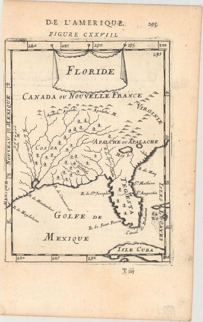
Auction 167, Lot 112
Subject: Colonial Southern United States
Mallet, Alain Manesson
Floride, 1683
Size: 4.5 x 6 inches (11.4 x 15.2 cm)
Estimate: $190 - $230
Sold for: $125
Closed on 3/28/2018
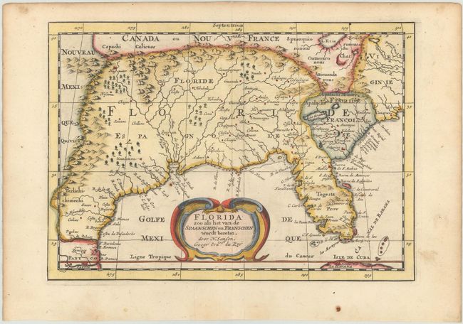
Auction 167, Lot 113
Subject: Colonial Southern United States
Sanson, Nicolas
Florida zoo als het van de Spaanschen en Franschen Wordt Bezeten, 1705
Size: 9.9 x 7 inches (25.1 x 17.8 cm)
Estimate: $550 - $650
Unsold
Closed on 3/28/2018
Auction 167, Lot 114
Subject: Colonial Southern United States
D'Anville/Santini
Partie Meridionale de la Louisiane, avec la Floride, la Caroline et la Virginie, 1784
Size: 22.8 x 18.9 inches (57.9 x 48 cm)
Estimate: $600 - $750
Unsold
Closed on 3/28/2018
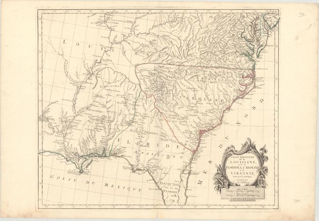
Auction 167, Lot 115
Subject: Southern United States
Harrison, John
Map of Louisiana, from D'Anville's Atlas, 1788
Size: 19.5 x 12.1 inches (49.5 x 30.7 cm)
Estimate: $800 - $950
Unsold
Closed on 3/28/2018
Auction 167, Lot 116
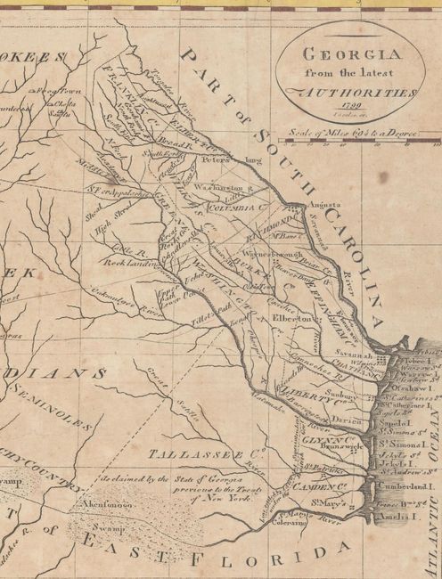
Subject: Southern United States
Payne, John
Georgia from the Latest Authorities, 1799
Size: 15.1 x 7.9 inches (38.4 x 20.1 cm)
Estimate: $475 - $600
Unsold
Closed on 3/28/2018
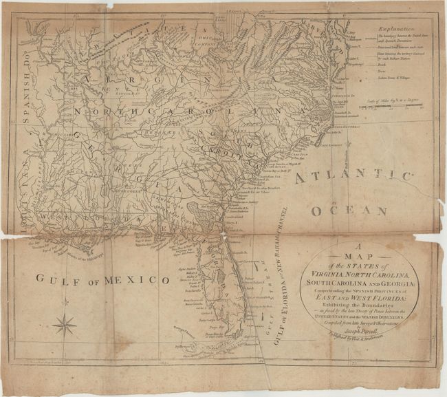
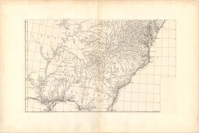
Auction 167, Lot 117
Subject: Southern United States, Franklin
Purcell, Joseph
A Map of the States of Virginia, North Carolina, South Carolina and Georgia; Comprehending the Spanish Provinces of East and West Florida: Exhibiting the Boundaries as Fixed by the Late Treaty of Peace..., 1800
Size: 14 x 11.6 inches (35.6 x 29.5 cm)
Estimate: $400 - $600
Scarce Vint & Anderson Edition
Sold for: $700
Closed on 3/28/2018
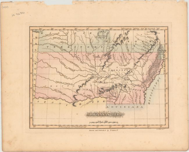
Auction 167, Lot 118
Subject: South Central United States, Arkansas
Lucas, Fielding
Arkansas Ter., 1823
Size: 11.2 x 8.2 inches (28.4 x 20.8 cm)
Estimate: $750 - $900
Unsold
Closed on 3/28/2018
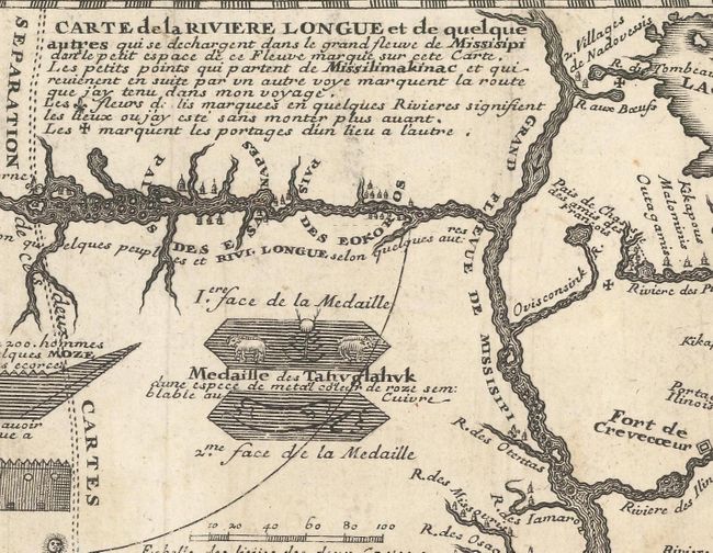
Auction 167, Lot 119
Subject: Colonial Upper Midwestern United States, River Longue
Lahontan, Louis Armand, Baron de
Carte que les Gnacsitares ont Dessine... / Carte de la Riviere Longue..., 1703
Size: 11.8 x 4.8 inches (30 x 12.2 cm)
Estimate: $550 - $700
Sold for: $500
Closed on 3/28/2018
130 lots
Page 1 of 3