Filtered by Category:Canada(Show All Categories)
Showing results for:Auction 167
Catalog Archive
18 lots
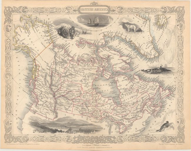
Auction 167, Lot 62
Subject: Canada
Tallis, John
[Lot of 3] British America [and] West Canada [and] East Canada, and New Brunswick, 1850
Size: 12.9 x 10.2 inches (32.8 x 25.9 cm)
Estimate: $240 - $300
Sold for: $150
Closed on 3/28/2018
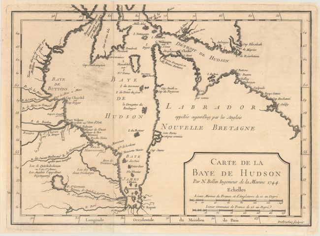
Auction 167, Lot 63
Subject: Eastern Canada, Hudson Bay
Bellin, Jacques Nicolas
Carte de la Baye de Hudson, 1744
Size: 11.5 x 8.4 inches (29.2 x 21.3 cm)
Estimate: $140 - $170
Unsold
Closed on 3/28/2018
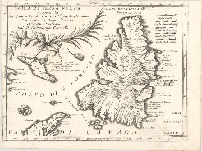
Auction 167, Lot 64
Subject: Newfoundland, Canada
Coronelli, Vincenzo Maria
Isola di Terra Nuova Scoperta da Gio: Cabota Veneto con suo Figliuolo Sebastiano…, 1691
Size: 12.1 x 9.1 inches (30.7 x 23.1 cm)
Estimate: $400 - $475
Unsold
Closed on 3/28/2018
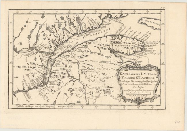
Auction 167, Lot 65
Subject: St. Lawrence River, Canada
Bellin, Jacques Nicolas
Karte von dem Laufe des Flusses St. Laurenz von Seiner Mundung an bis uber Quebec zu der Allgemeinen Historie der Reisen, 1757
Size: 11.9 x 7.6 inches (30.2 x 19.3 cm)
Estimate: $120 - $150
Sold for: $90
Closed on 3/28/2018
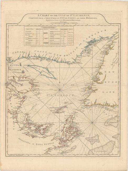
Auction 167, Lot 66
Subject: Gulf of St. Lawrence
Jefferys/Sayer & Bennett
A Chart of the Gulf of St. Laurence, Composed from a Great Number of Actual Surveys and Other Materials, Regulated and Connected by Astronomical Observations, 1775
Size: 19.6 x 24.2 inches (49.8 x 61.5 cm)
Estimate: $450 - $550
Sold for: $250
Closed on 3/28/2018
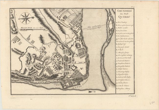
Auction 167, Lot 67
Subject: Quebec, Canada
Bellin, Jacques Nicolas
Grundriss der Stadt Quebec, 1758
Size: 11 x 7.7 inches (27.9 x 19.6 cm)
Estimate: $120 - $150
Sold for: $70
Closed on 3/28/2018
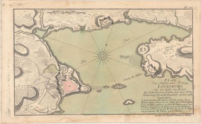
Auction 167, Lot 68
Subject: Cape Breton Island, Canada
Raspe, Gabriel Nikolaus
Plan des Hafens und Festung Louisburg auf der Insul Cap Breton..., 1762
Size: 14.1 x 8.4 inches (35.8 x 21.3 cm)
Estimate: $200 - $250
Sold for: $150
Closed on 3/28/2018
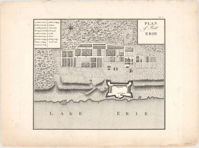
Auction 167, Lot 69
Subject: Fort Erie, Canada
Collot, George Henry Victor
Plan of Fort Erie, 1826
Size: 9.3 x 7.8 inches (23.6 x 19.8 cm)
Estimate: $450 - $550
Sold for: $400
Closed on 3/28/2018
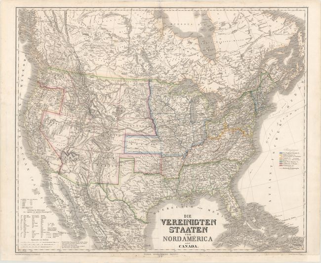
Auction 167, Lot 70
Subject: Canada & United States
Weimar Geographisches Institut
Die Vereinigten Staaten von Nordamerica nebst Canada, 1869
Size: 24.7 x 20.9 inches (62.7 x 53.1 cm)
Estimate: $150 - $180
Sold for: $80
Closed on 3/28/2018
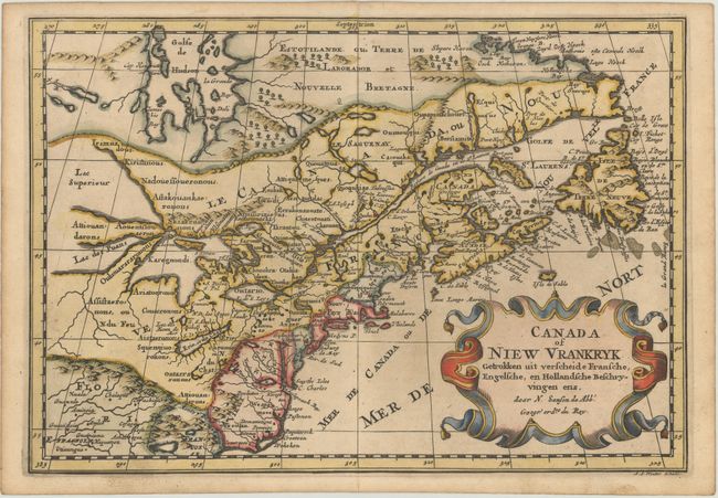
Auction 167, Lot 71
Subject: Colonial Northeastern United States & Canada, Great Lakes
Sanson, Nicolas
Canada of Niew Vrankryk Getrokken uit Verscheide Fransche, Engelsche, en Hollandsche Beschryvingen Enz., 1705
Size: 11.9 x 8.2 inches (30.2 x 20.8 cm)
Estimate: $700 - $850
Small Version of a Keystone Map for Great Lakes Collections
Unsold
Closed on 3/28/2018
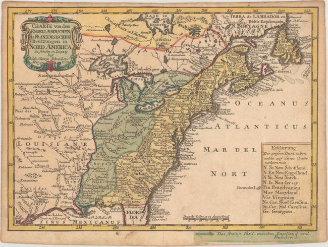
Auction 167, Lot 72
Subject: Colonial Eastern United States & Canada
Schreiber, Johann Georg
Charte von dem Engellaendischen u. Franzoesischen Besitzungen in Nord America..., 1753
Size: 9.4 x 6.9 inches (23.9 x 17.5 cm)
Estimate: $350 - $450
Sold for: $200
Closed on 3/28/2018
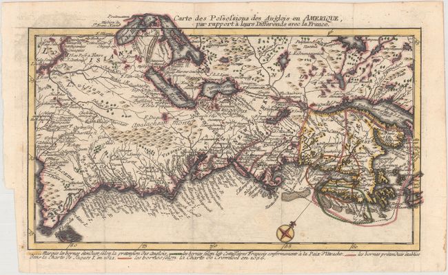
Auction 167, Lot 73
Subject: Colonial Eastern United States & Canada
Back, Jean C.
Carte des Possessions des Anglois en Amerique, par Rapport a Leurs Differends avec la France, 1759
Size: 11.9 x 7.1 inches (30.2 x 18 cm)
Estimate: $700 - $850
One of the Most Unusual French & Indian War Period Maps
Sold for: $750
Closed on 3/28/2018
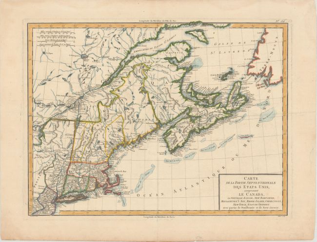
Auction 167, Lot 74
Subject: Eastern United States & Canada
Tardieu, Pierre Francois
Carte de la Partie Septentrionale des Etats Unis, Comprenant le Canada, la Nouvelle Ecosse, New Hampshire, Massachuset's Bay, Rhode-Island, Connecticut, New-Yorck, Etat de Vermont avec Partie de Pensilvanie et de New-Jersey, 1797
Size: 16.8 x 12.6 inches (42.7 x 32 cm)
Estimate: $250 - $325
Sold for: $140
Closed on 3/28/2018
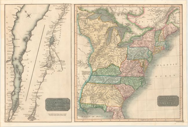
Auction 167, Lot 75
Subject: Eastern United States & Canada
Thomson, John
United States of America [on sheet with] The Course of the River St. Laurence, from Lake Ontario, to Manicouagan Point, 1814
Size: 24.3 x 16.1 inches (61.7 x 40.9 cm)
Estimate: $220 - $250
Sold for: $150
Closed on 3/28/2018
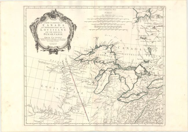
Auction 167, Lot 76
Subject: Colonial Central United States & Canada, Great Lakes
D'Anville/Santini
Partie Occidentale du Canada et Septentrionale de la Louisiane avec une Partie de la Pensilvanie, 1775
Size: 22.3 x 18.9 inches (56.6 x 48 cm)
Estimate: $1,000 - $1,300
Sold for: $800
Closed on 3/28/2018
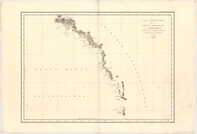
Auction 167, Lot 77
Subject: Western United States & Canada, Alaska
La Perouse, Comte Jean F. Galoup, de
[Lot of 3] Carte Particuliere de la Cote du Nord-Ouest de l'Amerique Reconnue par les Fregates Francaises la Boussole et l'Astrolabe en 1786. 1e. Feuille [and] 2e Feuille [and] 3e Feuille, 1797
Size: 26.8 x 19.4 inches (68.1 x 49.3 cm)
Estimate: $400 - $475
Unsold
Closed on 3/28/2018
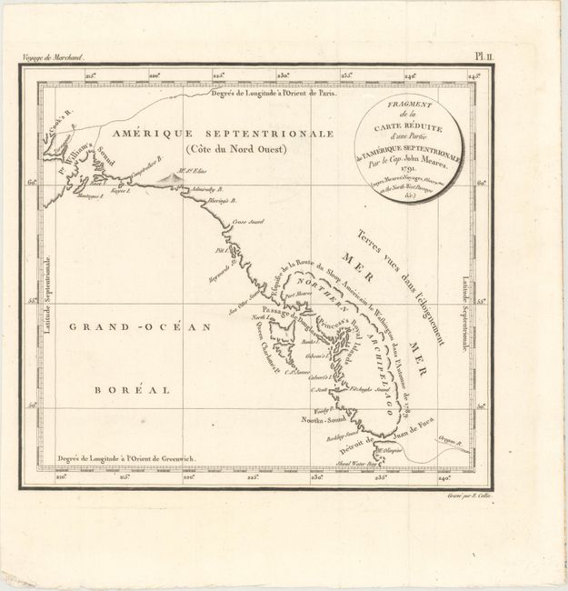
Auction 167, Lot 78
Subject: Pacific Northwest, Southeast Alaska
Meares, John (Capt.)
Fragment de la Carte Reduite d'une Partie de l'Amerique Septentrionale par le Cap. John Meares..., 1798
Size: 9.4 x 8.4 inches (23.9 x 21.3 cm)
Estimate: $400 - $500
Sold for: $300
Closed on 3/28/2018
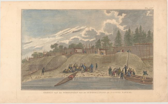
Auction 167, Lot 430
Subject: Prints - Native American, Nootka Sound, Canada
Cook, James (Capt.)
Gezigt van de Wooningen van de Inboorlingen in Nootka Kanaal, 1786
Size: 14.1 x 8.6 inches (35.8 x 21.8 cm)
Estimate: $140 - $170
Sold for: $100
Closed on 3/28/2018
18 lots