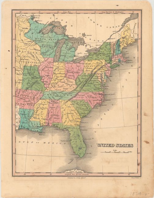
Subject: Eastern United States
Period: 1824 (circa)
Publication: A New General Atlas...
Color: Hand Color
Size:
8.7 x 11.3 inches
22.1 x 28.7 cm
Finely's maps employ a delicate and elegant engraving style and provided extensive topographical and watershed information. He was the dominant map maker in the United States in the early 1820s into the 1830s. His atlases were very successful, outselling rival atlases by Carey & Lea, and Tanner. His maps were printed on high quality paper and were routinely corrected and updated.
A nice map of the states that extends to just beyond the Mississippi River. Shows a large Arkansas Territory and a huge Missouri Territory that extends from Canada to Arkansas. A large North West Territory east of Missouri Territory occupies today's Wisconsin and parts of Minnesota, including the Upper Peninsula. Locates towns, cities, forts, and Indian tribes. Engraved by Young & Delleker. Finley published his atlases annually between 1824-1834, with one final edition appearing in 1836 (Ristow states his last atlas was 1834).
References: Phillips (Atlases) #752-6; Ristow pp 268-70.
Condition: B+
Original color with minor soiling and faint offsetting of the title. An edge tear at right that just touches the border has been closed on verso with archival tape.