Subject: United States
Period: 1869 (published)
Publication: Rep. Com. No. 219, 40th Congress, 3rd Session
Color: Black & White
Size:
27.6 x 14.1 inches
70.1 x 35.8 cm
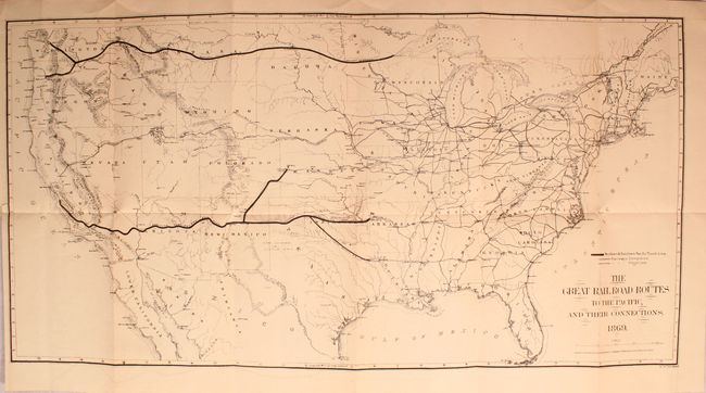
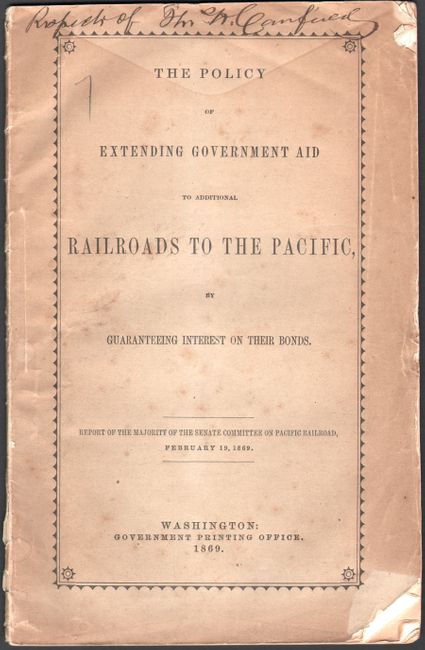
A terrific railroad map that is most notable in its depiction of the Golden Spike area in Utah: the entire track is shown completed except for 50 miles between Weber Canyon and Fort Bridger! As far as we know this is the only railroad map with this unique depiction. It was published just days before the completion of this historic railway. Scores of railroads are located throughout the country, including complete and projected lines; the Northern & Southern Pacific Trunk lines are shown in bold lines. Published by the American Photo-Lithographic Company using a printing technique called "Osborne's Process." The map is still bound into the original 31-page report with gray paper wrappers entitled "The Policy of Extending Government Aid to Additional Railroads to the Pacific by Guaranteeing Interest on Their Bonds."
The map is signed on the front wrapper "Respects of Th. H. Canfield." Canfield spent his career establishing telegraph lines and railroads, first in New England and later in the West. When Canfield proposed a northern route to the Pacific to President Pierce, Secretary of War Jefferson Davis blocked it by arguing that three different routes should be explored. After the Civil War, Canfield was instrumental in establishing the Northern Pacific Rail Road where he served as director.
References:
Condition: B+
The map has pleasant light toning and faint offsetting. Report text is near fine. Paper wrappers are toned with a few chips and manuscript signature at top.