Subject: Colonial Mid-Atlantic United States
Period: 1636 (circa)
Publication: Gerardi Mercatoris Atlantis Novi...
Color: Hand Color
Size:
19.5 x 15.1 inches
49.5 x 38.4 cm
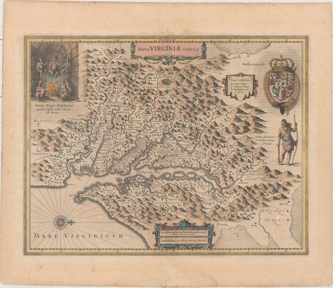
This graphic map is Henricus Hondius' version of Capt. John Smith's important map of 1612, drawn from his brother's map of 1618. After the death of Jodocus Hondius in 1629, his widow sold a number of plates to Blaeu. Angry at the sale to a competitor, Henricus and Joannes Jansson engaged engravers to cut new plates, which were largely based on Jodocus' work. This is the 5th derivative of Smith's map. It is beautifully engraved with topographical features and the locations of scores of Indian villages. In the upper left corner is an engraving of the great Indian chief Powhatan seated on his throne and surrounded by his subjects. A Susquehanna chief, facing in toward Chesapeake Bay (opposite of Jodocus' plate), is depicted on the right under a coat of arms. Latin text on verso, published between 1636-1644.
References: Burden #228; Tooley (Amer) pp. 165-66; Van der Krogt (Vol. I) #9410:1.
Condition: B+
There are several light damp stains, a few spots of foxing, and a short centerfold separation confined to the bottom blank margin.