Filtered by Category:United States(Show All Categories)
Showing results for:Auction 133
Catalog Archive
195 lots
Page 1 of 4
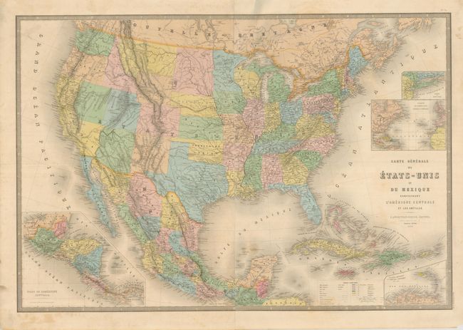
Auction 133, Lot 95
Subject: United States & Mexico
Andriveau-Goujon, E.
Carte Generale des Etats-Unis et du Mexique Comprenant l'Amerique Centrale et les Antilles, 1868
Size: 36 x 24.5 inches (91.4 x 62.2 cm)
Estimate: $325 - $400
Unsold
Closed on 9/1/2010
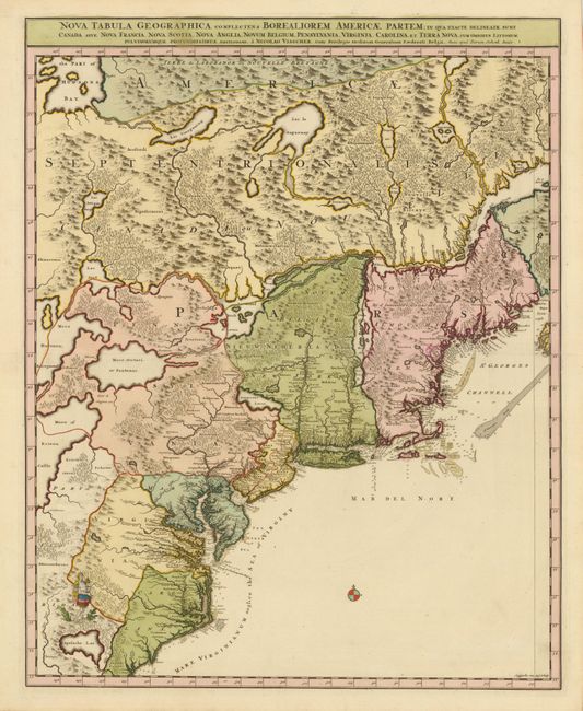
Auction 133, Lot 105
Subject: Colonial United States and Canada
Visscher/Schenk
[Lot of 2] Nova Tabula Geographica Complectens Borealiorem Americae Partem… [and] Carte Nouvelle contenant la Partie d'Amerique la Plus Septentrionale…, 1718
Size: 18.5 x 23 inches (47 x 58.4 cm)
Estimate: $3,000 - $4,000
Sold for: $2,200
Closed on 9/1/2010
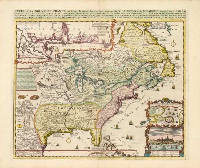
Auction 133, Lot 106
Subject: Colonial United States and Canada
Chatelain, Henry Abraham
Carte de la Nouvelle France, ou se voit le cours des Grandes Rivieres de S. Laurens & de Mississipi Aujour d'hui S. Louis, Aux Environs des-quelles se trouvent les Etats, Pais, Nations, Peuples &c., 1719
Size: 19.2 x 16.5 inches (48.8 x 41.9 cm)
Estimate: $2,500 - $3,000
Sold for: $3,250
Closed on 9/1/2010
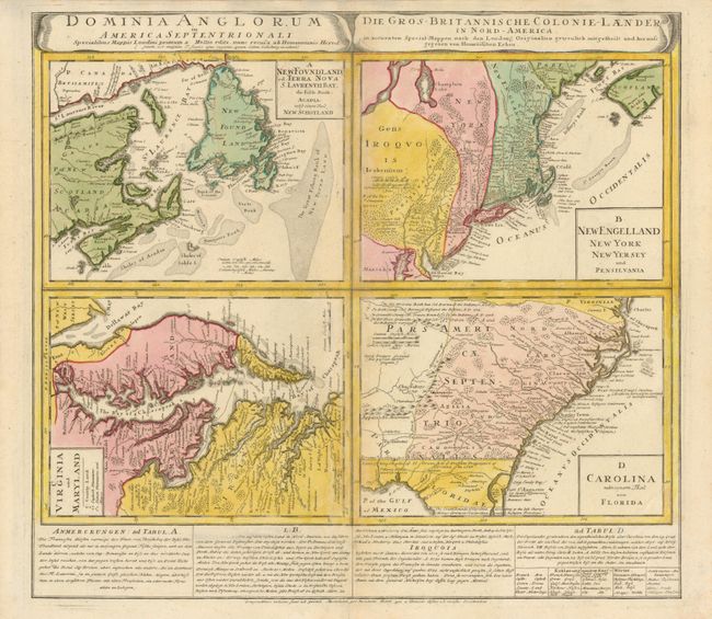
Auction 133, Lot 107
Subject: Colonial United States and Canada
Homann Heirs
Dominia Anglorum in America Septentrionali, 1740
Size: 21.8 x 19.8 inches (55.4 x 50.3 cm)
Estimate: $700 - $800
Unsold
Closed on 9/1/2010
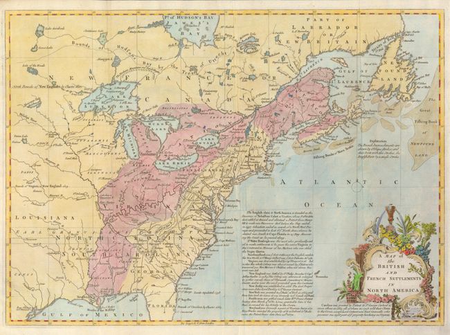
Auction 133, Lot 108
Subject: Colonial United States and Canada
Lodge, John
A Map of the British and French Settlements in North America, 1755
Size: 15 x 11 inches (38.1 x 27.9 cm)
Estimate: $475 - $550
Sold for: $550
Closed on 9/1/2010
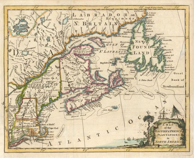
Auction 133, Lot 109
Subject: Colonial New England and Canada
Anon.
A Map of the British & French Plantations in North America, 1755
Size: 10.4 x 8.3 inches (26.4 x 21.1 cm)
Estimate: $300 - $375
Sold for: $200
Closed on 9/1/2010
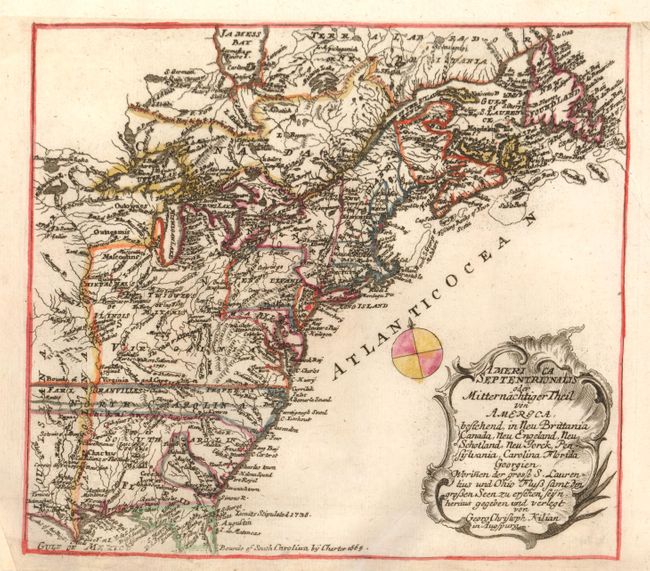
Auction 133, Lot 110
Subject: Colonial United States and Canada
Kilian, George Christophe
America Septentrionalis oder Mitternachtiger Theil von America, Bestehend, in Neu Brittania Canada, Neu Engeland, Neu Schotland, Neu Jorck, Pensylvania, Carolina Florida Georgien. Worinnen der Grosse S. Laurentius und Ohio Fluss Samt…, 1764
Size: 9 x 8 inches (22.9 x 20.3 cm)
Estimate: $325 - $425
Sold for: $230
Closed on 9/1/2010
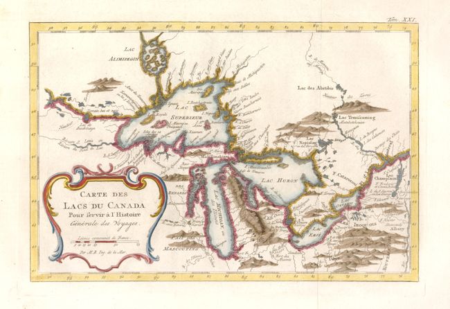
Auction 133, Lot 111
Subject: Colonial United States and Canada - Great Lakes
Bellin, Jacques Nicolas
Carte des Lacs du Canada…, 1777
Size: 11.2 x 7.4 inches (28.4 x 18.8 cm)
Estimate: $475 - $550
Sold for: $400
Closed on 9/1/2010
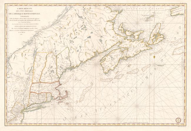
Auction 133, Lot 112
Subject: Colonial New England and Canada
Sartine
Carte Reduite des Cotes Orientales de l'Amerique Septentrionale Contenant Celles des Provinces de New-York et de la Nouvelle Angleterre, Celles de l'Acadie ou Nouvelles Ecosse, de L'Ile Royale, de L'Ile St.Jean, avec L'Interieure du Pays…, 1780
Size: 34.3 x 23 inches (87.1 x 58.4 cm)
Estimate: $1,900 - $2,200
Unsold
Closed on 9/1/2010
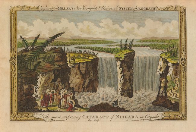
Auction 133, Lot 113
Subject: Canada & United States, Niagara
Millar, George H.
The most surprising Cataract of Niagara in Canada, 1783
Size: 11.3 x 7.3 inches (28.7 x 18.5 cm)
Estimate: $80 - $110
Sold for: $90
Closed on 9/1/2010
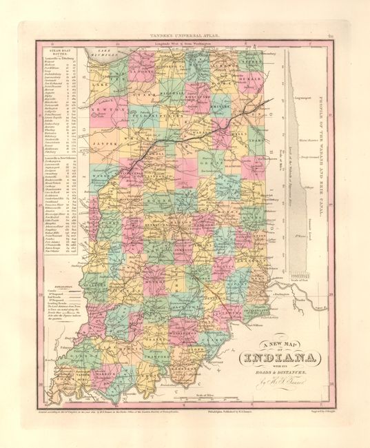
Auction 133, Lot 114
Subject: United States and Canada
Tanner, Henry Schenck
[Lot of 8], 1836-41
Size: See Description
Estimate: $375 - $500
Sold for: $275
Closed on 9/1/2010
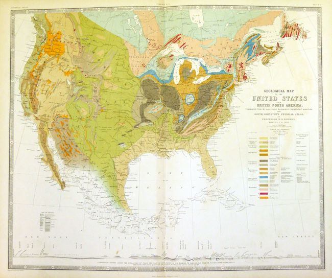
Auction 133, Lot 115
Subject: United States and Canada
Rogers, Henry Darwin
Geological Map of the United States and British North America…, 1855
Size: 24 x 20 inches (61 x 50.8 cm)
Estimate: $300 - $350
Sold for: $600
Closed on 9/1/2010
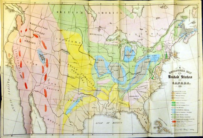
Auction 133, Lot 116
Subject: United States and Canada
Hitchcock, Edward
[Maps and Report] A Geological Map of the United States and Canada 1853 [and] Outline of the Geology of the Globe 1853, 1856
Size: See Description
Estimate: $600 - $800
Sold for: $1,100
Closed on 9/1/2010

Auction 133, Lot 117
Subject: Eastern United States and Canada
Lloyd, James T.
Lloyd's New Map of the United States, the Canadas and New Brunswick from the Latest Surveys Showing Every Railroad & Station Finished to June 1862 and the Atlantic and Gulf Coasts, 1862
Size: 49 x 37.5 inches (124.5 x 95.3 cm)
Estimate: $800 - $950
Sold for: $850
Closed on 9/1/2010
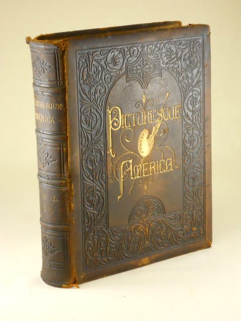
Auction 133, Lot 118
Subject: Canada & United States
Bryant, William C.
Picturesque America; or, the Land we Live in… Volume I, 1872-74
Size: 11 x 13 inches (27.9 x 33 cm)
Estimate: $160 - $250
Sold for: $210
Closed on 9/1/2010
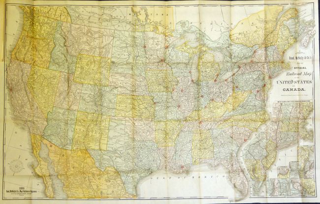
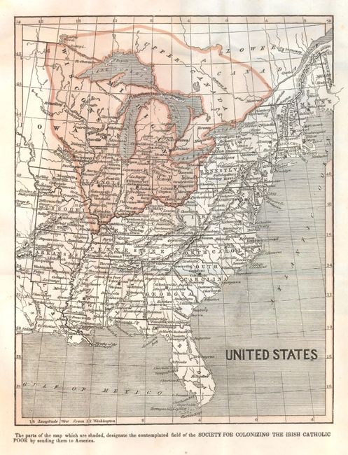
Auction 133, Lot 119
Subject: Canada & United States
Rand McNally & Co.
Rand McNally & Co.'s New Official Railroad Map of the United States and Canada, 1885
Size: 42 x 27 inches (106.7 x 68.6 cm)
Estimate: $180 - $220
Sold for: $140
Closed on 9/1/2010
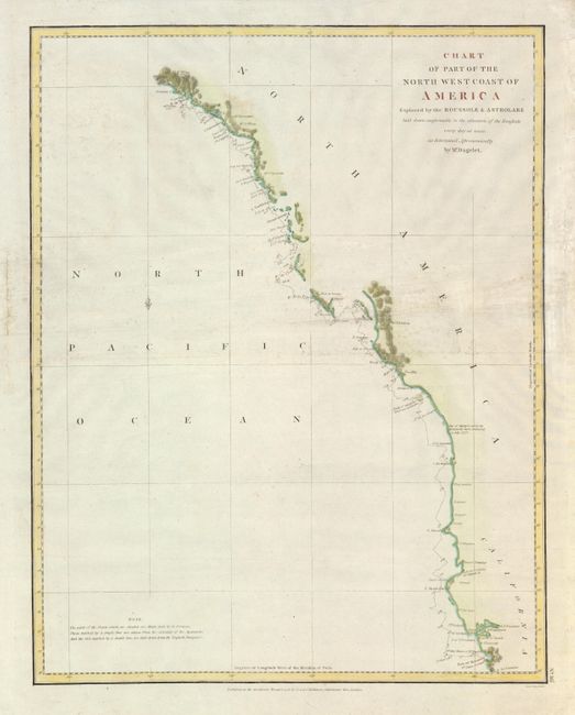
Auction 133, Lot 120
Subject: Western Canada & United States
La Perouse, Comte Jean F. Galoup, de
Chart of Part of the North West Coast of America, 1798
Size: 15 x 19.2 inches (38.1 x 48.8 cm)
Estimate: $200 - $250
Sold for: $150
Closed on 9/1/2010
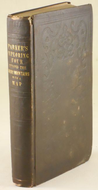
Auction 133, Lot 121
Subject: Western Canada and United States
Parker, Samuel (Rev.)
Journal of an Exploring Tour Beyond the Rocky Mountains … with a Map of Oregon Territory, 1846
Size: 5 x 8 inches (12.7 x 20.3 cm)
Estimate: $550 - $650
Sold for: $650
Closed on 9/1/2010
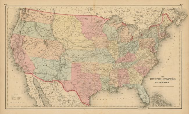
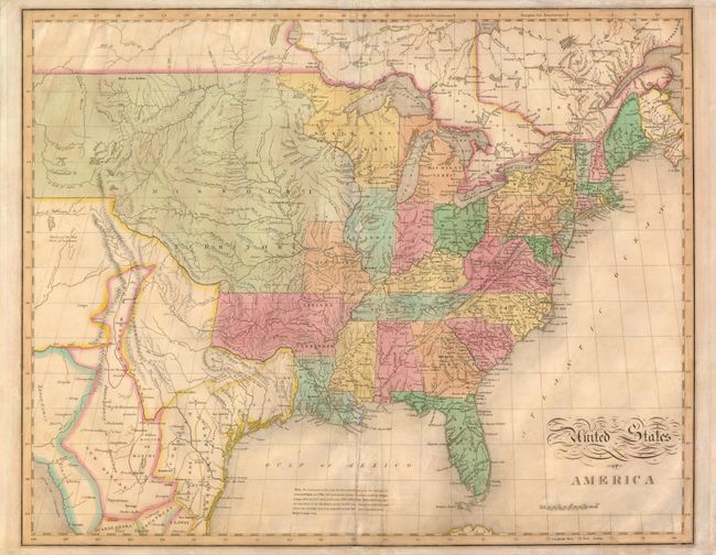
Auction 133, Lot 122
Subject: United States
Colton, Joseph Hutchins
The United States of America, 1855
Size: 26 x 15 inches (66 x 38.1 cm)
Estimate: $200 - $300
Sold for: $130
Closed on 9/1/2010
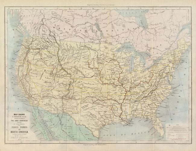
Auction 133, Lot 123
Subject: United States
Bineteau, P.
Map Drawn to Illustrate the Travels & from the Documents of the Abbe Domenech Showing the Actual Situation of the Indian Tribes of North America and the road described by the author, 1860
Size: 18 x 13.3 inches (45.7 x 33.8 cm)
Estimate: $325 - $400
Sold for: $180
Closed on 9/1/2010
Auction 133, Lot 124
Subject: United States
Various
[Lot of Approximately 120 - United States], 1870-1900
Size: See Description
Estimate: $150 - $250
Sold for: $0
Closed on 9/1/2010
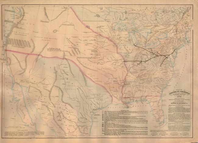
Auction 133, Lot 125
Subject: United States
Asher & Adams
Map of the American Colonies and Adjacent Country As known in 1776, 1875
Size: 23 x 16 inches (58.4 x 40.6 cm)
Estimate: $250 - $300
Unsold
Closed on 9/1/2010
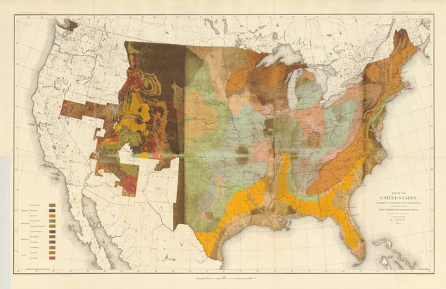
Auction 133, Lot 126
Subject: United States
U.S. Geological Survey (USGS)
Map of the United States Exhibiting the Present Status of Knowledge Relating to the Areal Distribution of Geologic Groups, 1884
Size: 28 x 17.3 inches (71.1 x 43.9 cm)
Estimate: $200 - $250
Sold for: $325
Closed on 9/1/2010
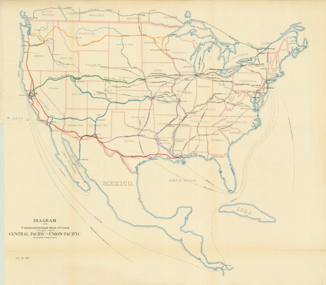
Auction 133, Lot 127
Subject: United States
U.S. Government
Diagram of the Transcontinental Lines of Road Showing the Original Central Pacific and Union Pacific and their Competitors, 1887
Size: 20 x 18.5 inches (50.8 x 47 cm)
Estimate: $80 - $100
Sold for: $60
Closed on 9/1/2010
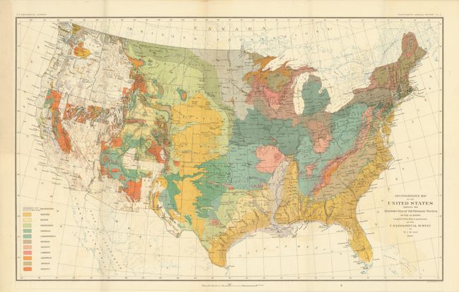
Auction 133, Lot 128
Subject: United States
U.S. Geological Survey (USGS)
Reconnaissance Map of the United States Showing the Distribution of the Geologic System So Far As Known, 1893
Size: 28 x 17.4 inches (71.1 x 44.2 cm)
Estimate: $180 - $220
Sold for: $325
Closed on 9/1/2010

Auction 133, Lot 129
Subject: United States
Central School Supply House
Relief Map of United States, 1899
Size: 40 x 27 inches (101.6 x 68.6 cm)
Estimate: $180 - $240
Sold for: $210
Closed on 9/1/2010
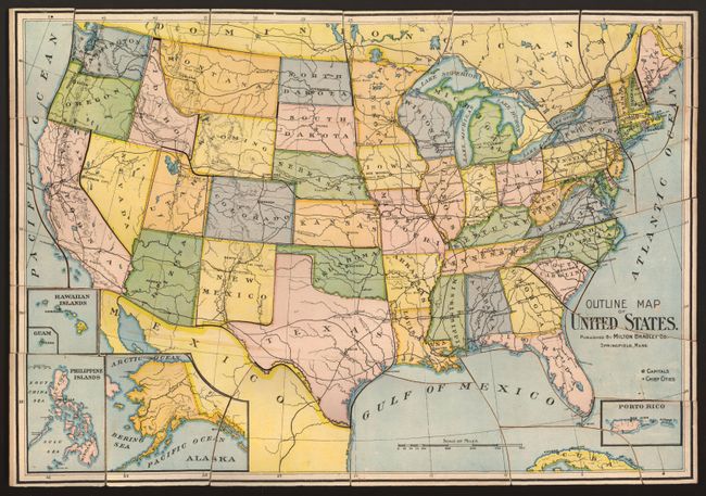
Auction 133, Lot 130
Subject: United States, Puzzle Map
Milton Bradley Co.
Outline Map of United States, 1905
Size: See Description
Estimate: $100 - $140
Sold for: $80
Closed on 9/1/2010
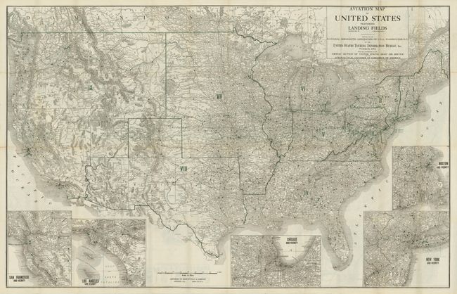
Auction 133, Lot 131
Subject: United States
Rand McNally & Co.
Aviation Map of United States Featuring Landing Fields / Official Auto Trails Map of the United States [together with] The Complete Camp Site Guide…With Official Directory of Aeroplane Landing Fields, 1923
Size: 40.5 x 26 inches (102.9 x 66 cm)
Estimate: $150 - $200
Sold for: $325
Closed on 9/1/2010
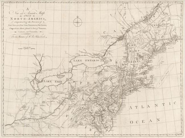
Auction 133, Lot 132
Subject: Colonial United States
Kalm, Peter
A New and Accurate Map of Part of North America, Comprehending the Provinces of New England, New York, Pensilvania, New Yersey, Connecticut, Rhode Island, & part of Virginia, Canada, and Hallifax, 1771
Size: 30 x 22.3 inches (76.2 x 56.6 cm)
Estimate: $1,400 - $1,800
Unsold
Closed on 9/1/2010
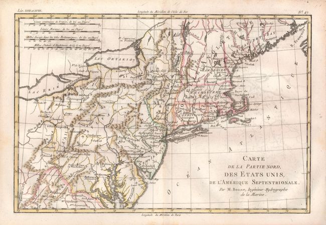
Auction 133, Lot 133
Subject: Eastern United States
Bonne, Rigobert
[Lot of 3] Carte de la Partie Nord, des Etats Unis [and] Carte de la Partie Sud des Etats Unis [and] Carte de la Louisiane, et de la Floride, 1783-85
Size: 12.5 x 8.5 inches (31.8 x 21.6 cm)
Estimate: $300 - $400
Sold for: $220
Closed on 9/1/2010
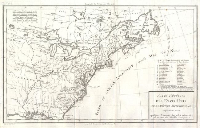
Auction 133, Lot 134
Subject: Eastern United States
Tardieu, Pierre Francois
Carte Generale des Etats-Unis de l'Amerique Septentrionale, Renfermant Aussi quelques Provinces Angloises adjacentes…, 1787
Size: 16.6 x 10 inches (42.2 x 25.4 cm)
Estimate: $275 - $350
Sold for: $200
Closed on 9/1/2010
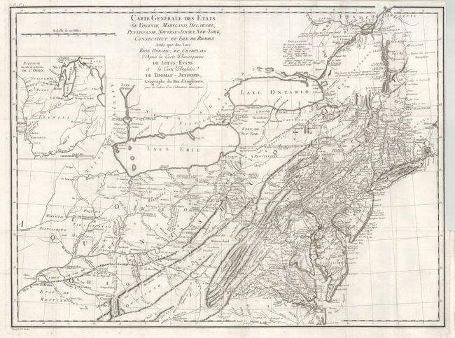
Auction 133, Lot 135
Subject: Eastern United States
Crevecoeur, Michel Guillaume De
Carte Generale des Etats de Virginie, Maryland, Delaware, Pensilvanie, Nouveau-Jersey, New-York, Connecticut et Isle de Rhodes Ainsi que des Lacs Erie, Ontario, et Champlain…, 1787
Size: 25.5 x 18.8 inches (64.8 x 47.8 cm)
Estimate: $1,000 - $1,400
Sold for: $550
Closed on 9/1/2010
Auction 133, Lot 136
Subject: Eastern United States
Lattre, Jean
Etats-Unis de l'Amerique Seple avec le Canada et la Floride, 1790
Size: 7.3 x 9.8 inches (18.5 x 24.9 cm)
Estimate: $200 - $240
Sold for: $150
Closed on 9/1/2010
Auction 133, Lot 137
Subject: Eastern United States
Wilkinson, R
A Map of the United States of America, with Part of the Adjoining Provinces from the latest Authorities, 1794
Size: 10.8 x 8.4 inches (27.4 x 21.3 cm)
Estimate: $200 - $250
Sold for: $150
Closed on 9/1/2010
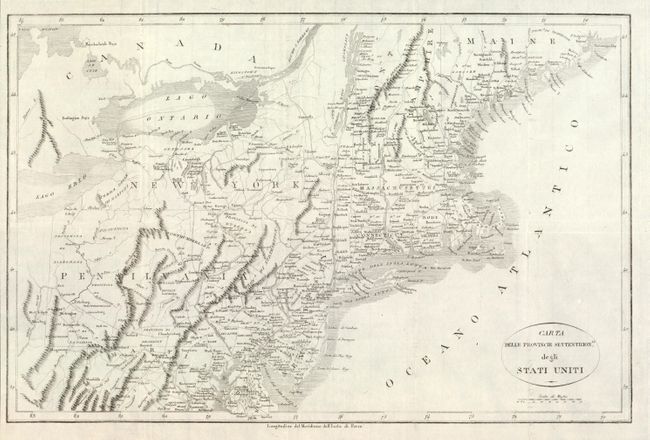
Auction 133, Lot 138
Subject: Eastern United States
Rochefoucald Liancourt, Francois Alexander
Carta delle Provincie Settentrionli degli Stati Uniti, 1800
Size: 19.2 x 12.5 inches (48.8 x 31.8 cm)
Estimate: $275 - $325
Unsold
Closed on 9/1/2010
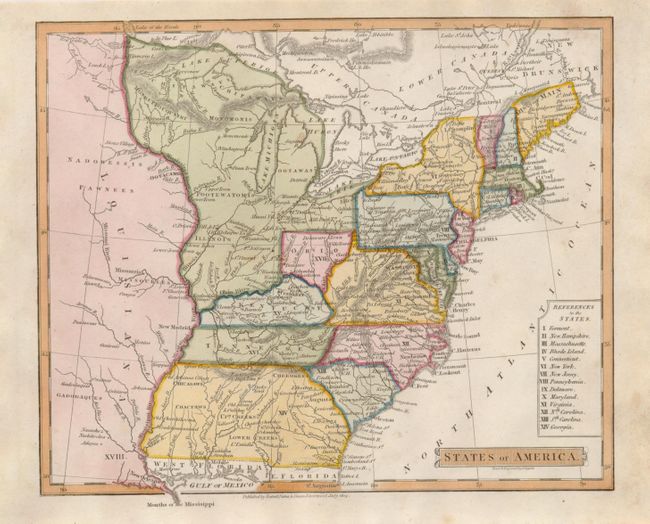
Auction 133, Lot 139
Subject: Eastern United States
Nuttall, Fisher & Dixon
States of America, 1814
Size: 8.5 x 7 inches (21.6 x 17.8 cm)
Estimate: $350 - $450
Sold for: $210
Closed on 9/1/2010
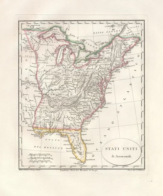
Auction 133, Lot 140
Subject: Eastern United States
Stati Uniti di Arrowsmith, 1815
Size: 8 x 9.3 inches (20.3 x 23.6 cm)
Estimate: $140 - $170
Sold for: $90
Closed on 9/1/2010
Auction 133, Lot 141
Subject: Eastern United States
Russell, John C.
United States, 1822
Size: 9.8 x 8 inches (24.9 x 20.3 cm)
Estimate: $150 - $200
Sold for: $190
Closed on 9/1/2010
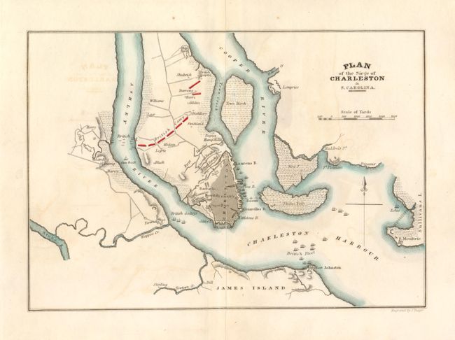
Auction 133, Lot 142
Subject: Eastern United States
Marshall, John
[Lot of 6 - Revolutionary War Plans], 1825
Size: See Description
Estimate: $375 - $450
Sold for: $275
Closed on 9/1/2010
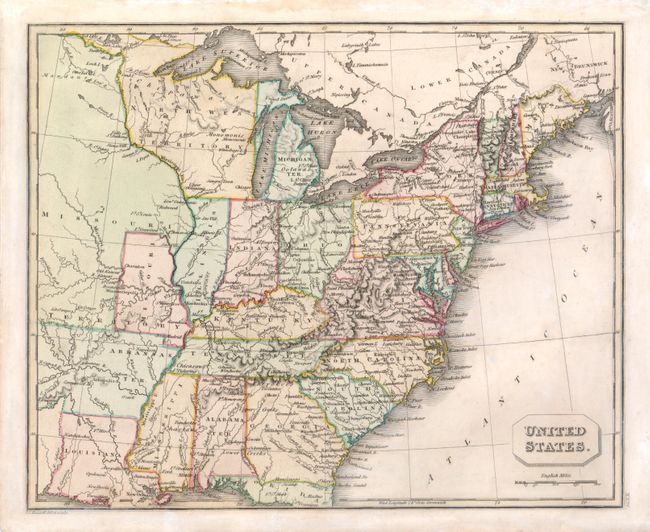
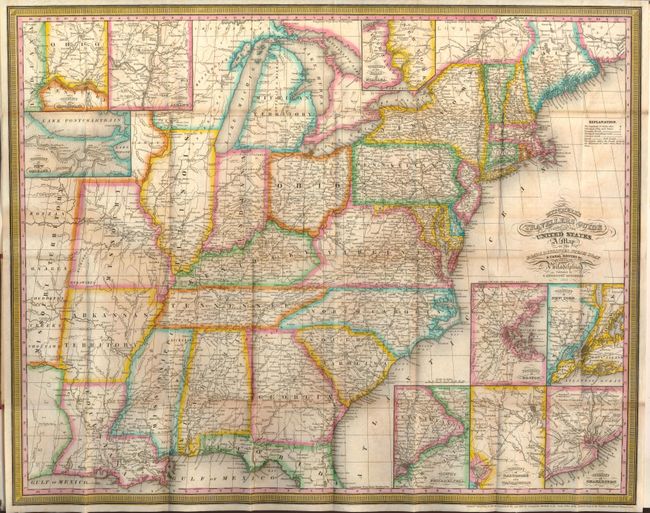
Auction 133, Lot 143
Subject: Eastern United States
Melish, John
United States of America, 1827
Size: 21.4 x 17 inches (54.4 x 43.2 cm)
Estimate: $550 - $650
Sold for: $400
Closed on 9/1/2010
Auction 133, Lot 144
Subject: Eastern United States
Mitchell, Samuel Augustus
Mitchell's Travellers Guide Through the United States. A Map of the Roads, Distances, Steam Boat & Canal Routes & c. by J.H. Young, 1833
Size: 21.7 x 17.3 inches (55.1 x 43.9 cm)
Estimate: $750 - $850
Sold for: $850
Closed on 9/1/2010
Auction 133, Lot 145
Subject: Eastern United States
Phelps, Humphrey
Map of the United States, 1836
Size: 19.8 x 19 inches (50.3 x 48.3 cm)
Estimate: $600 - $700
Unsold
Closed on 9/1/2010
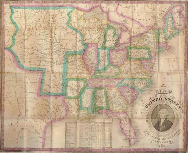
Auction 133, Lot 146
Subject: Eastern United States
United States, 1842
Size: 8.3 x 10.5 inches (21.1 x 26.7 cm)
Estimate: $100 - $140
Sold for: $95
Closed on 9/1/2010
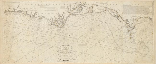
Auction 133, Lot 147
Subject: Eastern United States
Norie, John William
To the Independent Mariners of America, This Chart of their Coast from Savannah to Boston Is most Respectfully Dedicated…, 1852
Size: 61.3 x 25.3 inches (155.7 x 64.3 cm)
Estimate: $3,250 - $3,750
Unsold
Closed on 9/1/2010

Auction 133, Lot 148
Subject: U.S. States - Illinois, Delaware, West Virginia
White, Ruth Taylor
[Lot of 3] Illinois [and] Delaware [and] West Virginia, 1932
Size: 8.5 x 11.5 inches (21.6 x 29.2 cm)
Estimate: $120 - $180
Sold for: $110
Closed on 9/1/2010
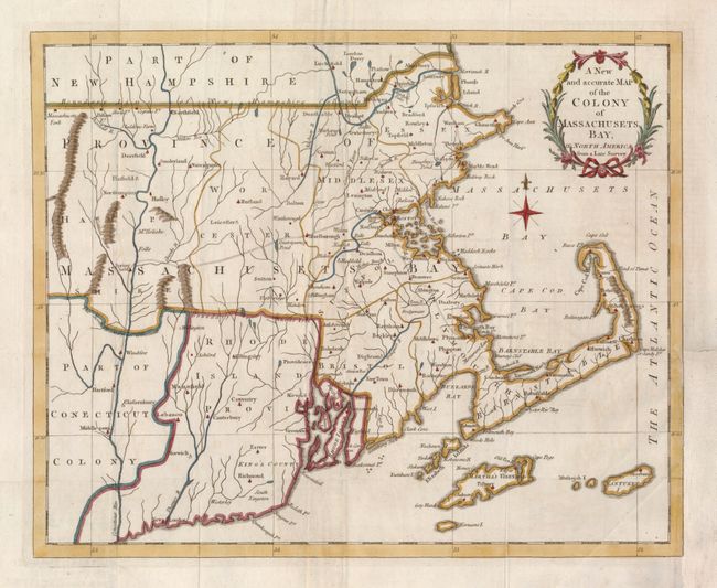
Auction 133, Lot 149
Subject: Colonial New England
Anon.
A New and accurate Map of the Colony of Massachusets Bay, in North America from a Late Survey, 1780
Size: 12.8 x 10.4 inches (32.5 x 26.4 cm)
Estimate: $300 - $375
Sold for: $325
Closed on 9/1/2010
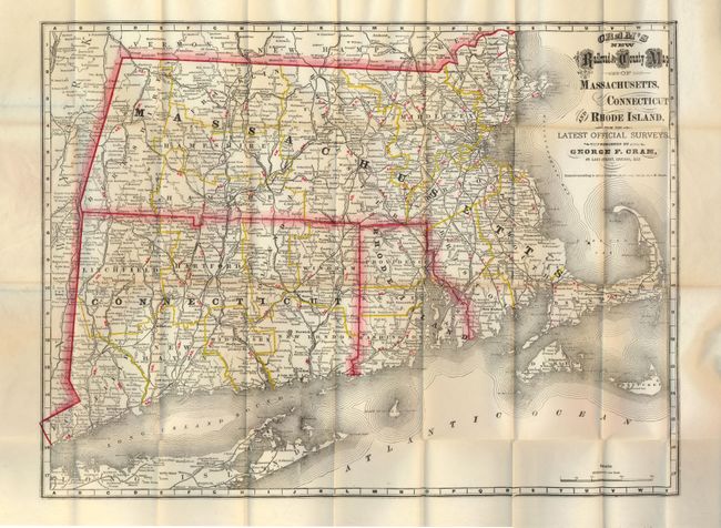
Auction 133, Lot 150
Subject: New England
Cram, George F. & Company
Cram's New Railroad and County Map of Massachusetts, Connecticut and Rhode Island, from the Latest Official Surveys, 1879
Size: 20.5 x 15.3 inches (52.1 x 38.9 cm)
Estimate: $180 - $220
Unsold
Closed on 9/1/2010
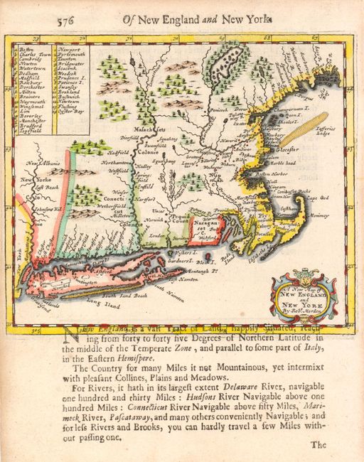
Auction 133, Lot 151
Subject: Colonial New England and Mid-Atlantic
Morden, Robert
A New Map of New England and New York, 1693
Size: 5.8 x 4.8 inches (14.7 x 12.2 cm)
Estimate: $800 - $950
Sold for: $600
Closed on 9/1/2010
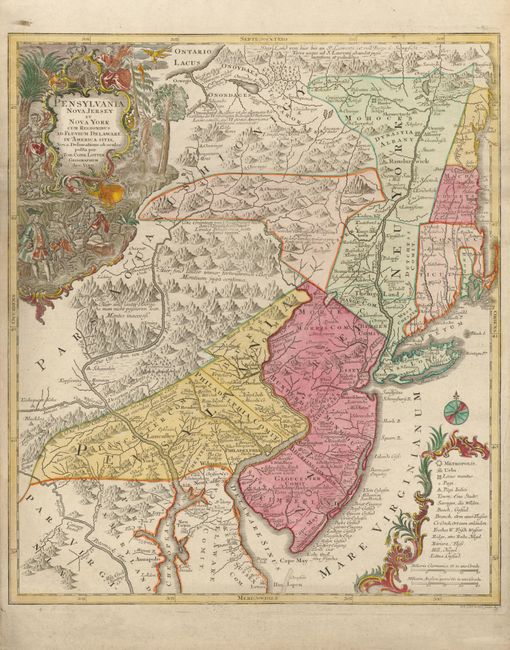
Auction 133, Lot 152
Subject: Colonial New England and Mid-Atlantic
Seutter/Lotter
Pensylvania Nova Jersey et Nova York cum Regionibus ad Fluvium Delaware in America sitis…, 1760
Size: 19.5 x 22.5 inches (49.5 x 57.2 cm)
Estimate: $1,600 - $1,900
Sold for: $1,100
Closed on 9/1/2010
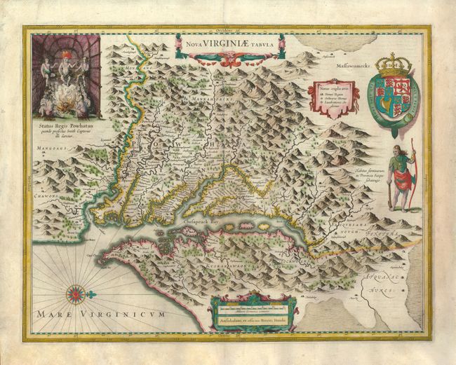
Auction 133, Lot 153
Subject: Colonial Mid-Atlantic
Hondius, Henricus
Nova Virginiae Tabula, 1633
Size: 19.3 x 14.8 inches (49 x 37.6 cm)
Estimate: $2,400 - $3,000
Sold for: $1,800
Closed on 9/1/2010
195 lots
Page 1 of 4