Subject: Eastern United States
Period: 1833 (dated)
Publication:
Color: Hand Color
Size:
21.7 x 17.3 inches
55.1 x 43.9 cm
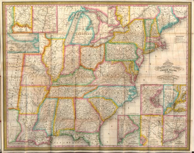
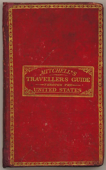
This fine pocket map shows the United States west to the Mississippi River and a little beyond to include a small portion of Missouri Territory. The map is very detailed and features nine insets; namely the Vicinity of Philadelphia, Washington, Charleston, Boston, New York, Cincinnati, Albany, New Orleans plus the Vicinity of the Falls of Niagara. The labyrinth of canals and early roads are clearly shown. The legend shows a dotted line for railroads but we can find none on this early issue. This series of maps, first published in 1832, was designed for the market represented by the burgeoning number of travelers and new immigrants. The maps were printed on thin bank note paper and folded so they could be carried easily for quick reference while traveling. Map folds into original red tooled and gilt covers with the original separate Index sheet which unfolds to the same size as the map. The map was "Engraved on steel by J.H. Young & D. Haines" and bears the copyright date of 1832. This is a rare edition given the inclusion of the large folding index sheet rather than the 78pp booklet. The cover is titled Mitchell's Travellers Guide Through the United States.
References:
Condition: B+
The map has bright original hand coloring. A little offsetting and one fold with light foxing, otherwise fine example of this map. The covers and index sheet are very good.