Subject: United States
Period: 1875 (dated)
Publication:
Color: Hand Color
Size:
23 x 16 inches
58.4 x 40.6 cm
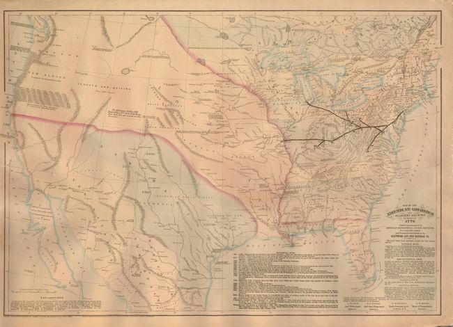
This historical map shows the country to the Pacific as it appeared in 1776. Created in 1875, it is based on information compiled by the American Geographical Society on their 50th year celebration, presented by the Baltimore and Ohio railroad. It is unclear if any 1770s map was used as a basis for this compilation. The map locates the River of the West, suggests a possible Northwest Passage, names New Albion, Teguayo and Quivira, and presents typical geography. The B&O Railway lines are overprinted with the locations thought to be the present sites of 15 major cities noted. Text panels describe the National Road; the Semi-Centennial Year of the B&O Railroad; and the National Capital. A table compiles a historical chronology of the history of North America up to 1867. This is a separately issued and linen backed map that was prepared for presentation to the Patrons of the Society. Scarce issue.
References:
Condition: B+
The original linen backing is sound with no flaws, but there is a short marginal paper tear/split that extends through the border and slightly into the Atlantic Ocean at right.