Subject: Colonial New England and Mid-Atlantic
Period: 1693 (published)
Publication: Geography Rectified
Color: Hand Color
Size:
5.8 x 4.8 inches
14.7 x 12.2 cm
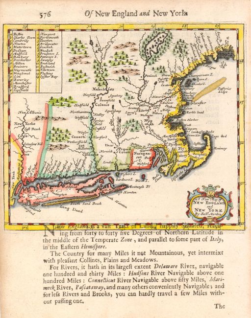
This uncommon little map of New England and Long Island is centered on the Connecticut River and the Boston area. The map has been updated from Morden's 1680 map with corrected river systems and new place names. Still, the map illustrates the general lack of knowledge of the region in the late seventeenth century. A table at left names and locates 32 towns and villages in Massachusetts where the settlements were too dense to engrave the place names on the small map. Printed on a full sheet (6 x 7.8") with English text that continues on the verso. The text encroaches in the bottom margin, as is usual with this map.
References: Burden #649; McCorkle #688.3.
Condition: A