Catalog Archive
Auction 133, Lot 127

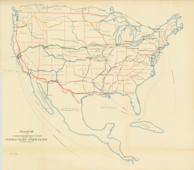
"Diagram of the Transcontinental Lines of Road Showing the Original Central Pacific and Union Pacific and their Competitors", U.S. Government

Subject: United States

Period: 1887 (published)

Publication: Senate Ex. Doc. 51, 50th , 1st Session

Color: Printed Color

Size:
20 x 18.5 inches
50.8 x 47 cm
Download High Resolution Image
(or just click on image to launch the Zoom viewer)

This color lithographed map focuses on the railroad network throughout the United States. The major railroads are shown via a boldly colored line and finely engraved text. The presumed competitors are shown via small black lines, also labeled with the name. The Canadian Pacific R.R. is detailed in southern Canada, and one line is shown to Guaymas, Mexico from Benson, Arizona Territory. Sea routes are also depicted and named including the Morgan Line and Clipper Ships route around Cape Horn.

References:

Condition: B+

The map image and color are very good. The lower horizontal fold is fragile with a few splits, two closed on verso with archival tape.

Estimate: $80 - $100

Sold for: $60

Closed on 9/1/2010

Archived