Filtered by Category:Canada(Show All Categories)
Showing results for:Auction 133
Catalog Archive
22 lots
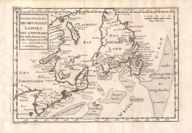
Auction 133, Lot 102
Subject: Canada Maritime Provinces and Newfoundland
Moll, Herman
Eine Neue Charte des Neu Gefundnen Landes, Neu Schottlands…, 1729
Size: 10.1 x 7 inches (25.7 x 17.8 cm)
Estimate: $325 - $375
Sold for: $200
Closed on 9/1/2010
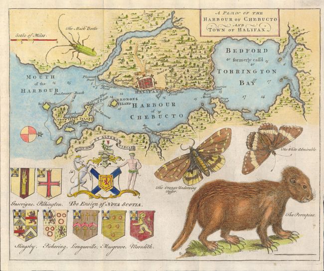
Auction 133, Lot 103
Subject: Halifax, Canada
Anon.
A Plan of the Harbour of Chebucto and Town of Halifax, 1750
Size: 10.6 x 8.6 inches (26.9 x 21.8 cm)
Estimate: $600 - $800
Sold for: $800
Closed on 9/1/2010
Auction 133, Lot 104
Subject: Canada
Various
[Lot of 80 - Canada], 1850-1900
Size: See Description
Estimate: $100 - $200
Sold for: $550
Closed on 9/1/2010
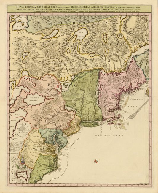
Auction 133, Lot 105
Subject: Colonial United States and Canada
Visscher/Schenk
[Lot of 2] Nova Tabula Geographica Complectens Borealiorem Americae Partem… [and] Carte Nouvelle contenant la Partie d'Amerique la Plus Septentrionale…, 1718
Size: 18.5 x 23 inches (47 x 58.4 cm)
Estimate: $3,000 - $4,000
Sold for: $2,200
Closed on 9/1/2010
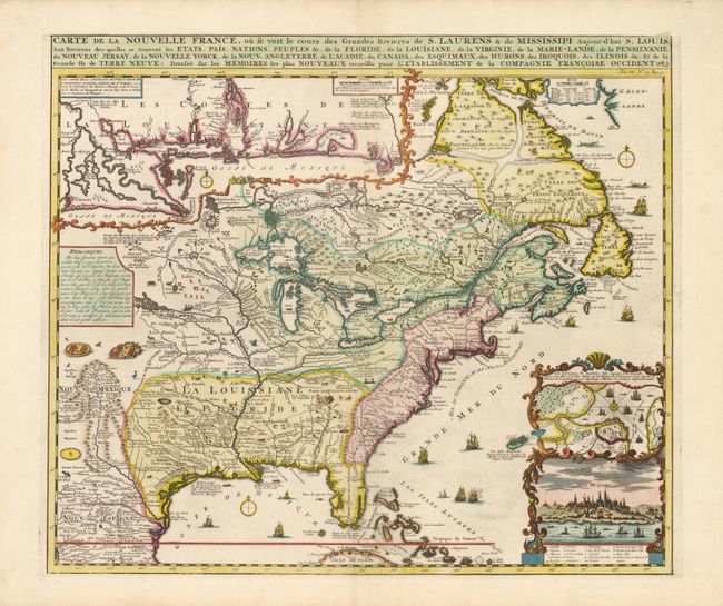
Auction 133, Lot 106
Subject: Colonial United States and Canada
Chatelain, Henry Abraham
Carte de la Nouvelle France, ou se voit le cours des Grandes Rivieres de S. Laurens & de Mississipi Aujour d'hui S. Louis, Aux Environs des-quelles se trouvent les Etats, Pais, Nations, Peuples &c., 1719
Size: 19.2 x 16.5 inches (48.8 x 41.9 cm)
Estimate: $2,500 - $3,000
Sold for: $3,250
Closed on 9/1/2010
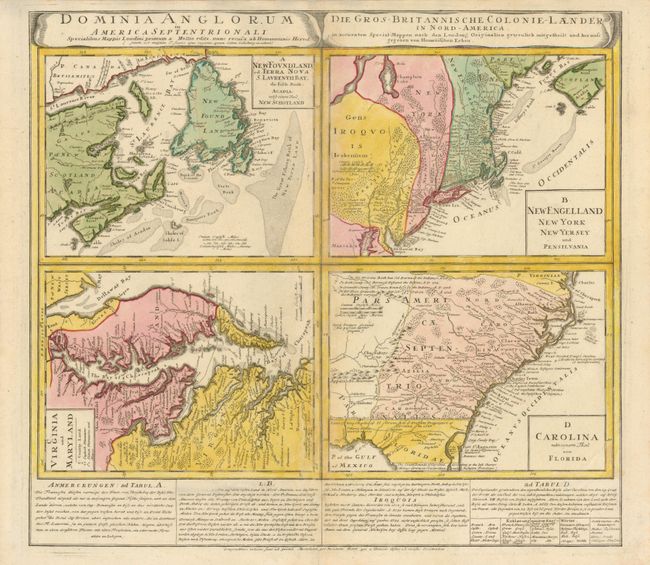
Auction 133, Lot 107
Subject: Colonial United States and Canada
Homann Heirs
Dominia Anglorum in America Septentrionali, 1740
Size: 21.8 x 19.8 inches (55.4 x 50.3 cm)
Estimate: $700 - $800
Unsold
Closed on 9/1/2010
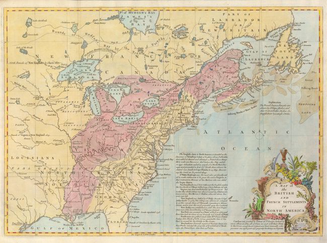
Auction 133, Lot 108
Subject: Colonial United States and Canada
Lodge, John
A Map of the British and French Settlements in North America, 1755
Size: 15 x 11 inches (38.1 x 27.9 cm)
Estimate: $475 - $550
Sold for: $550
Closed on 9/1/2010
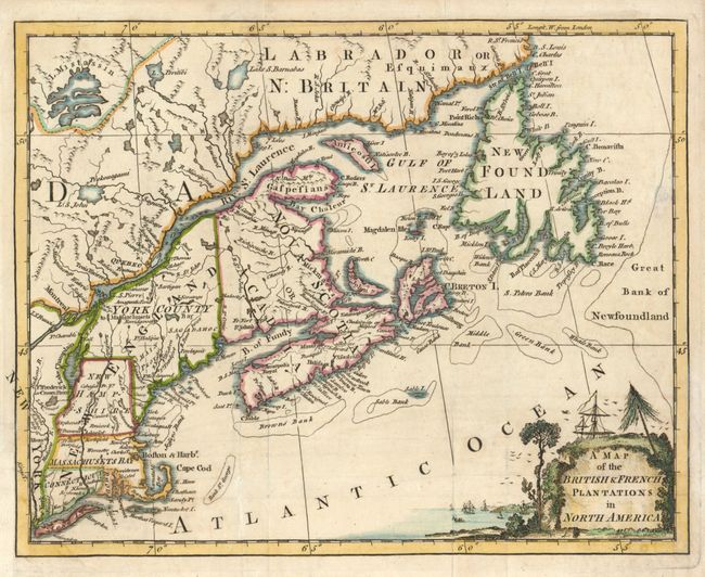
Auction 133, Lot 109
Subject: Colonial New England and Canada
Anon.
A Map of the British & French Plantations in North America, 1755
Size: 10.4 x 8.3 inches (26.4 x 21.1 cm)
Estimate: $300 - $375
Sold for: $200
Closed on 9/1/2010
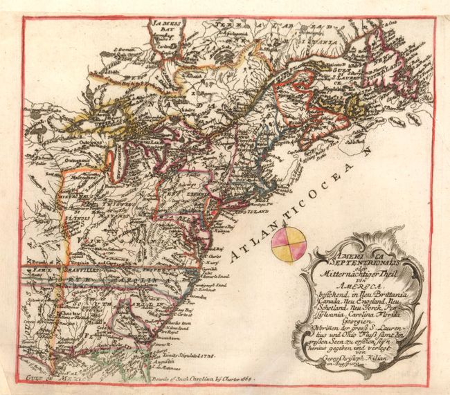
Auction 133, Lot 110
Subject: Colonial United States and Canada
Kilian, George Christophe
America Septentrionalis oder Mitternachtiger Theil von America, Bestehend, in Neu Brittania Canada, Neu Engeland, Neu Schotland, Neu Jorck, Pensylvania, Carolina Florida Georgien. Worinnen der Grosse S. Laurentius und Ohio Fluss Samt…, 1764
Size: 9 x 8 inches (22.9 x 20.3 cm)
Estimate: $325 - $425
Sold for: $230
Closed on 9/1/2010
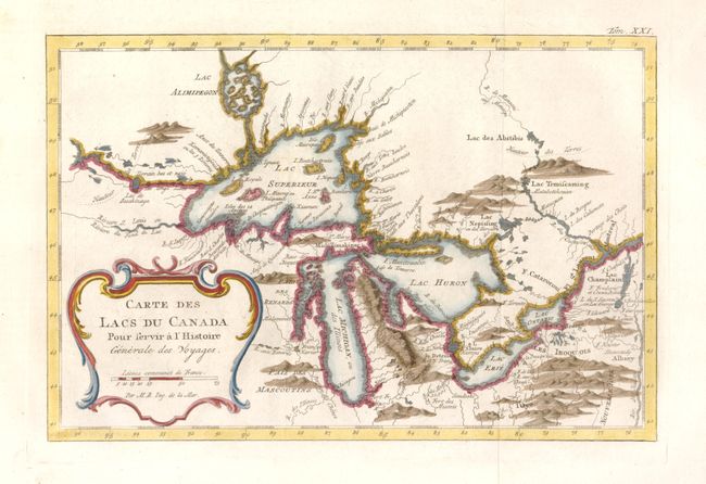
Auction 133, Lot 111
Subject: Colonial United States and Canada - Great Lakes
Bellin, Jacques Nicolas
Carte des Lacs du Canada…, 1777
Size: 11.2 x 7.4 inches (28.4 x 18.8 cm)
Estimate: $475 - $550
Sold for: $400
Closed on 9/1/2010
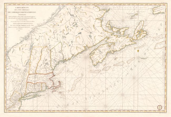
Auction 133, Lot 112
Subject: Colonial New England and Canada
Sartine
Carte Reduite des Cotes Orientales de l'Amerique Septentrionale Contenant Celles des Provinces de New-York et de la Nouvelle Angleterre, Celles de l'Acadie ou Nouvelles Ecosse, de L'Ile Royale, de L'Ile St.Jean, avec L'Interieure du Pays…, 1780
Size: 34.3 x 23 inches (87.1 x 58.4 cm)
Estimate: $1,900 - $2,200
Unsold
Closed on 9/1/2010
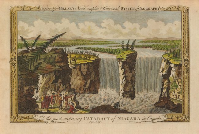
Auction 133, Lot 113
Subject: Canada & United States, Niagara
Millar, George H.
The most surprising Cataract of Niagara in Canada, 1783
Size: 11.3 x 7.3 inches (28.7 x 18.5 cm)
Estimate: $80 - $110
Sold for: $90
Closed on 9/1/2010
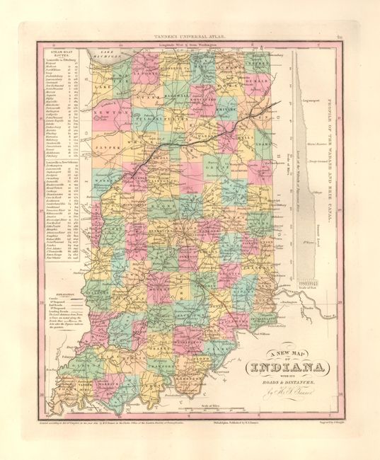
Auction 133, Lot 114
Subject: United States and Canada
Tanner, Henry Schenck
[Lot of 8], 1836-41
Size: See Description
Estimate: $375 - $500
Sold for: $275
Closed on 9/1/2010
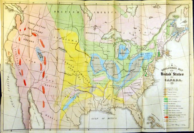
Auction 133, Lot 115
Subject: United States and Canada
Rogers, Henry Darwin
Geological Map of the United States and British North America…, 1855
Size: 24 x 20 inches (61 x 50.8 cm)
Estimate: $300 - $350
Sold for: $600
Closed on 9/1/2010
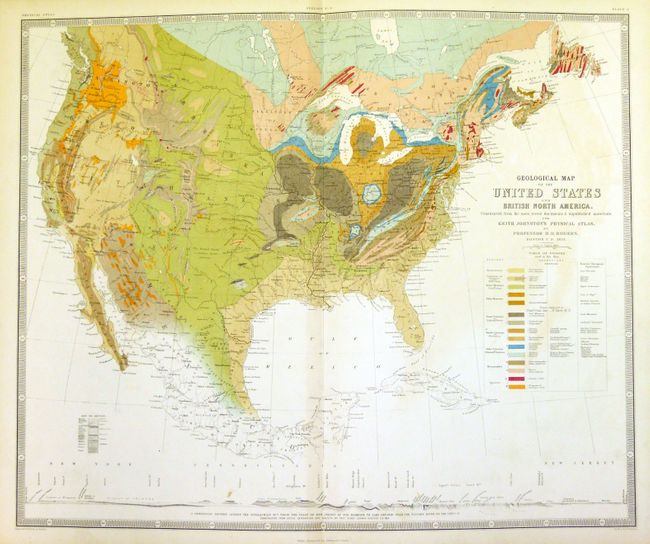
Auction 133, Lot 116
Subject: United States and Canada
Hitchcock, Edward
[Maps and Report] A Geological Map of the United States and Canada 1853 [and] Outline of the Geology of the Globe 1853, 1856
Size: See Description
Estimate: $600 - $800
Sold for: $1,100
Closed on 9/1/2010

Auction 133, Lot 117
Subject: Eastern United States and Canada
Lloyd, James T.
Lloyd's New Map of the United States, the Canadas and New Brunswick from the Latest Surveys Showing Every Railroad & Station Finished to June 1862 and the Atlantic and Gulf Coasts, 1862
Size: 49 x 37.5 inches (124.5 x 95.3 cm)
Estimate: $800 - $950
Sold for: $850
Closed on 9/1/2010
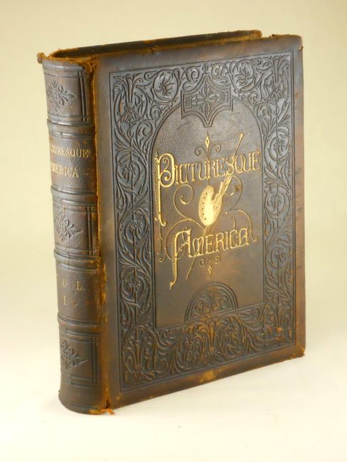
Auction 133, Lot 118
Subject: Canada & United States
Bryant, William C.
Picturesque America; or, the Land we Live in… Volume I, 1872-74
Size: 11 x 13 inches (27.9 x 33 cm)
Estimate: $160 - $250
Sold for: $210
Closed on 9/1/2010
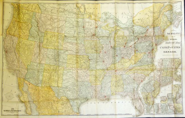
Auction 133, Lot 119
Subject: Canada & United States
Rand McNally & Co.
Rand McNally & Co.'s New Official Railroad Map of the United States and Canada, 1885
Size: 42 x 27 inches (106.7 x 68.6 cm)
Estimate: $180 - $220
Sold for: $140
Closed on 9/1/2010
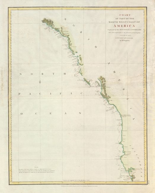
Auction 133, Lot 120
Subject: Western Canada & United States
La Perouse, Comte Jean F. Galoup, de
Chart of Part of the North West Coast of America, 1798
Size: 15 x 19.2 inches (38.1 x 48.8 cm)
Estimate: $200 - $250
Sold for: $150
Closed on 9/1/2010
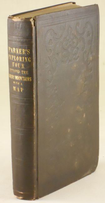
Auction 133, Lot 121
Subject: Western Canada and United States
Parker, Samuel (Rev.)
Journal of an Exploring Tour Beyond the Rocky Mountains … with a Map of Oregon Territory, 1846
Size: 5 x 8 inches (12.7 x 20.3 cm)
Estimate: $550 - $650
Sold for: $650
Closed on 9/1/2010
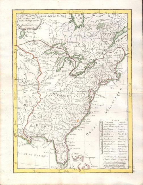
Auction 133, Lot 136
Subject: Eastern United States
Lattre, Jean
Etats-Unis de l'Amerique Seple avec le Canada et la Floride, 1790
Size: 7.3 x 9.8 inches (18.5 x 24.9 cm)
Estimate: $200 - $240
Sold for: $150
Closed on 9/1/2010
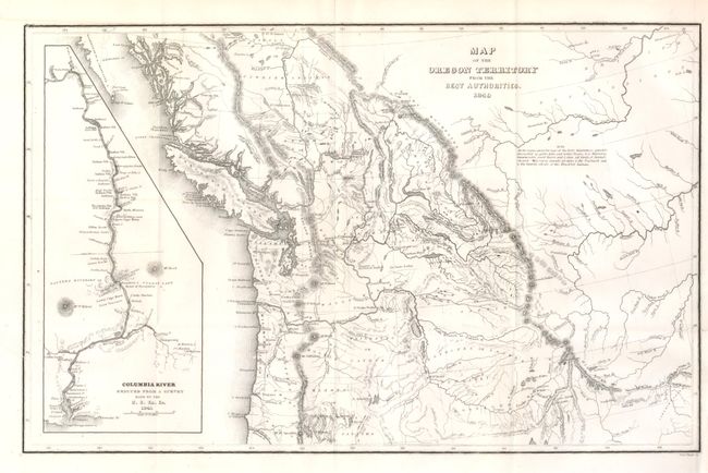
Auction 133, Lot 190
Subject: Northwestern United States
Wilkes, Charles
Map of the Oregon Territory from the Best Authorities, 1849
Size: 13.2 x 8.3 inches (33.5 x 21.1 cm)
Estimate: $200 - $300
Sold for: $100
Closed on 9/1/2010
22 lots