Filtered by Category:United States(Show All Categories)
Showing results for:Auction 115
Catalog Archive
194 lots
Page 1 of 4
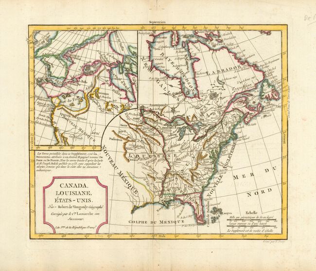
Auction 115, Lot 102
Subject: Canada & United States
Robert de Vaugondy/Delamarche
Canada, Louisiane, Etats-Unis, 1795
Size: 11.3 x 9.4 inches (28.7 x 23.9 cm)
Estimate: $230 - $300
Sold for: $210
Closed on 6/21/2006
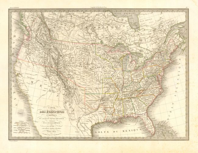
Auction 115, Lot 104
Subject: United States & Canada
Lapie, Alexander Emile & Pierre
Carte des Etats-Unis d'Amerique, du Canada, du Nouveau Brunswick et d'une partie de la Nouvelle Bretagne, 1832
Size: 21 x 15 inches (53.3 x 38.1 cm)
Estimate: $300 - $400
Unsold
Closed on 6/21/2006
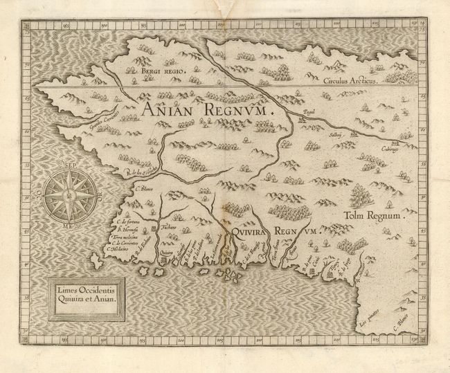
Auction 115, Lot 111
Subject: Western Canada & Alaska
Wytfliet, Cornelis
Limes Occidentis Quivira et Anian, 1607
Size: 11.5 x 9.2 inches (29.2 x 23.4 cm)
Estimate: $1,900 - $2,100
Unsold
Closed on 6/21/2006
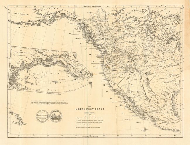
Auction 115, Lot 114
Subject: Western North America
Greenhow, Robert
The North-West Coast of North America and adjacent Territories…, 1840
Size: 21.3 x 16 inches (54.1 x 40.6 cm)
Estimate: $350 - $450
Sold for: $250
Closed on 6/21/2006
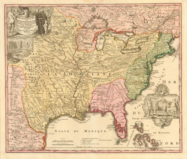
Auction 115, Lot 121
Subject: Colonial United States and Canada
Homann, Johann Baptist
Amplissimae Regionis Mississipi Seu Provinciae Ludovicianae…, 1730
Size: 23 x 19.3 inches (58.4 x 49 cm)
Estimate: $2,100 - $2,400
Sold for: $1,800
Closed on 6/21/2006
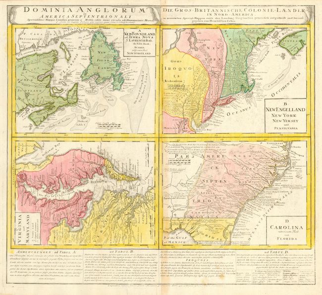
Auction 115, Lot 122
Subject: Colonial United States and Canada
Homann Heirs
Dominia Anglorum in America Septentrionali, 1740
Size: 21.8 x 19.8 inches (55.4 x 50.3 cm)
Estimate: $900 - $1,100
Sold for: $450
Closed on 6/21/2006
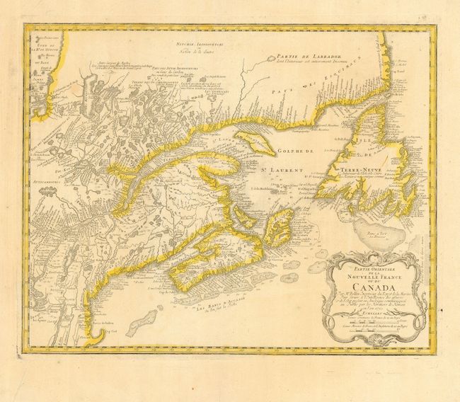
Auction 115, Lot 123
Subject: Colonial United States and Canada
Homann Heirs
Partie Orientale de la Nouvelle France ou du Canada, 1755
Size: 21.2 x 16.8 inches (53.8 x 42.7 cm)
Estimate: $550 - $650
Unsold
Closed on 6/21/2006
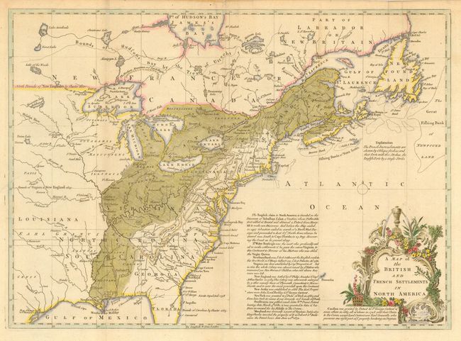
Auction 115, Lot 124
Subject: Colonial United States and Canada
Lodge, John
A Map of the British and French Settlements in North America, 1755
Size: 15.3 x 11 inches (38.9 x 27.9 cm)
Estimate: $550 - $650
Sold for: $750
Closed on 6/21/2006
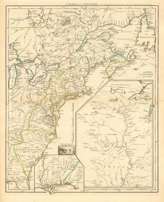
Auction 115, Lot 125
Subject: Colonial United States and Canada
Le Rouge, George Louis
Canada et Louisiane…, 1755
Size: 19.6 x 24 inches (49.8 x 61 cm)
Estimate: $1,700 - $2,000
Sold for: $1,700
Closed on 6/21/2006
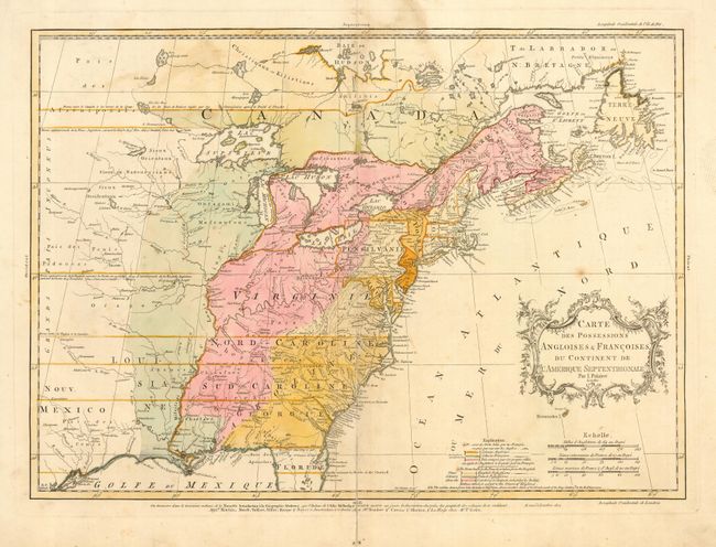
Auction 115, Lot 126
Subject: Colonial United States and Canada
Palairet, Jean
Carte des Possessions Angloises & Francoises du Continent de l'Amerique Septentrionale, 1756
Size: 22.5 x 16.7 inches (57.2 x 42.4 cm)
Estimate: $2,200 - $2,400
Unsold
Closed on 6/21/2006
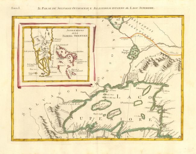
Auction 115, Lot 127
Subject: Colonial Great Lakes and Florida and Bahamas
Zatta, Antonio
Il Paese de Selvaggi Outauacesi e Kilistinesi Intorno al Lago Superiore, 1778
Size: 16.5 x 12 inches (41.9 x 30.5 cm)
Estimate: $350 - $400
Sold for: $250
Closed on 6/21/2006
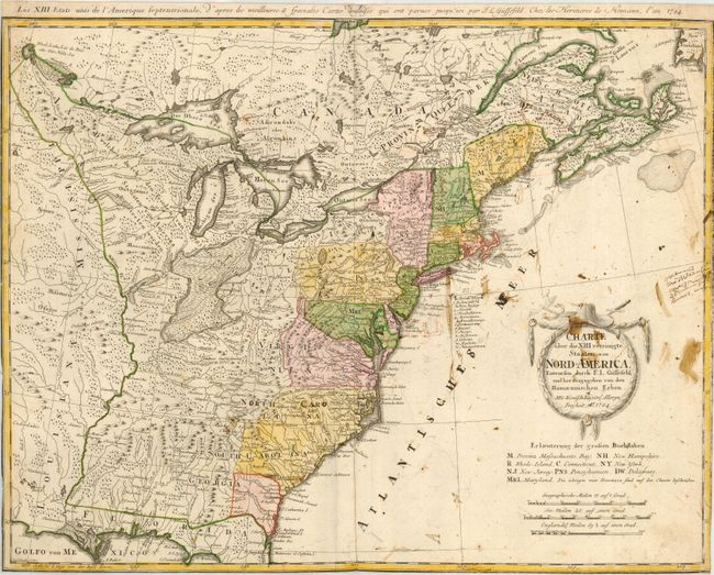
Auction 115, Lot 128
Subject: Eastern United States
Gussefeld/Homann Heirs
Charte uber die XIII vereinigte Staaten von Nord-America…, 1784
Size: 23 x 17.5 inches (58.4 x 44.5 cm)
Estimate: $500 - $600
Sold for: $375
Closed on 6/21/2006
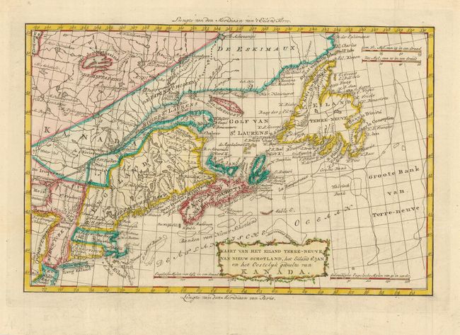
Auction 115, Lot 129
Subject: Eastern Canada & United States
Bachiene, Willem Albert
Kaart van het Eiland Terre-Neuve, van Nieuw Schotland, het Eiland St. Jan en het Oostelyk gedeelte van Kanada, 1785
Size: 12.5 x 8.5 inches (31.8 x 21.6 cm)
Estimate: $275 - $325
Sold for: $275
Closed on 6/21/2006
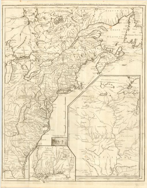
Auction 115, Lot 130
Subject: United States & Canada
Le Rouge, George Louis
Carte d'une Partie de l'Amerique Septentrionale, pour servir a l'Histoire de la derniere Guerre, 1787
Size: 19.5 x 24.2 inches (49.5 x 61.5 cm)
Estimate: $1,500 - $1,700
Unsold
Closed on 6/21/2006
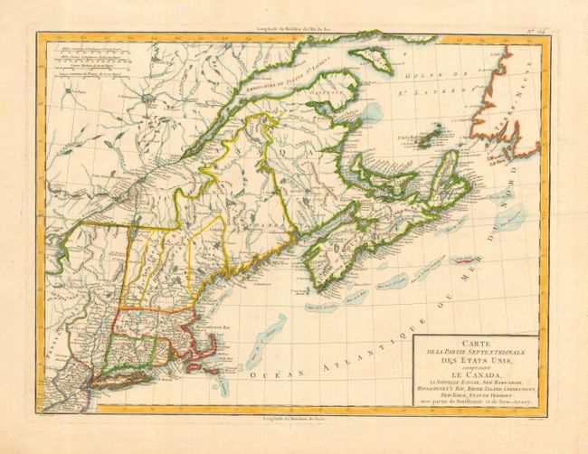
Auction 115, Lot 131
Subject: Eastern Canada & United States
Tardieu
Carte de la Partie Septentrionale des Etats Unis, comprenant le Canada, La Nouvelle Ecosse, New Hampshire, Massachuset's Bay, Rhode-Island, Connecticut, New-Yorck, Etat de Vermont avec partie de Pensilvanie et de New-Jersey, 1797
Size: 17 x 13 inches (43.2 x 33 cm)
Estimate: $350 - $400
Unsold
Closed on 6/21/2006
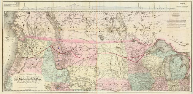
Auction 115, Lot 132
Subject: Western Canada & United States
Colton, G.W. & C.B.
Map of the Country from Lake Superior to the Pacific Ocean. From the latest Explorations and Surveys to accompany the Report of Edwin F. Johnson Chf. Engr. Northern Pacific R.R., 1867
Size: 44.5 x 22 inches (113 x 55.9 cm)
Estimate: $450 - $550
Sold for: $550
Closed on 6/21/2006
Auction 115, Lot 133
Subject: United States
[Lot of 8 - United States], 1821-49
Size: See Description
Estimate: $250 - $350
Sold for: $425
Closed on 6/21/2006
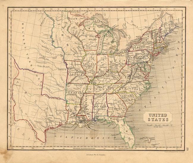
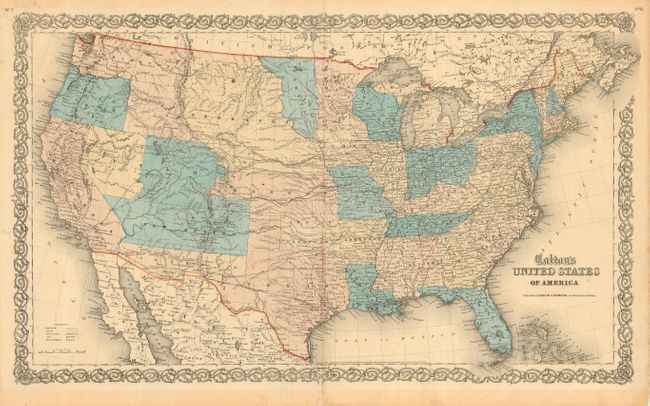
Auction 115, Lot 134
Subject: United States
Swanston, George H.
United States North America, 1852
Size: 20.5 x 16 inches (52.1 x 40.6 cm)
Estimate: $150 - $200
Sold for: $140
Closed on 6/21/2006
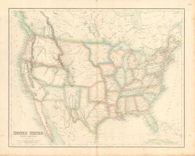
Auction 115, Lot 135
Subject: United States
Colton, Joseph Hutchins
The United States of America, 1855
Size: 25 x 14.6 inches (63.5 x 37.1 cm)
Estimate: $350 - $450
Sold for: $250
Closed on 6/21/2006
Auction 115, Lot 136
Subject: United States
Burr, David H.
Map of the United States Exhibiting the Several Collection Districts, 1856
Size: 49 x 31.5 inches (124.5 x 80 cm)
Estimate: $200 - $250
Sold for: $150
Closed on 6/21/2006
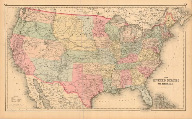
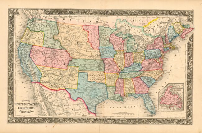
Auction 115, Lot 138
Subject: United States
Johnson & Browning
Colton's United States of America, 1859
Size: 26.5 x 15.5 inches (67.3 x 39.4 cm)
Estimate: $500 - $600
Sold for: $600
Closed on 6/21/2006
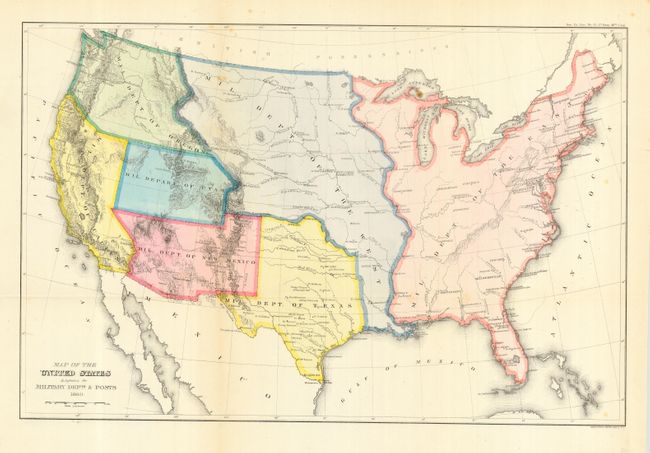
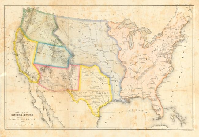
Auction 115, Lot 139
Subject: United States
U.S. Government
Map of the United States Exhibiting the Military Depts. & Posts, 1860
Size: 19.7 x 13 inches (50 x 33 cm)
Estimate: $120 - $140
Sold for: $200
Closed on 6/21/2006
Auction 115, Lot 140
Subject: United States
Mitchell, Samuel Augustus
Map of the United States, and Territories. Together with Canada &c., 1860
Size: 21.5 x 13.2 inches (54.6 x 33.5 cm)
Estimate: $300 - $400
Sold for: $375
Closed on 6/21/2006
Auction 115, Lot 141
Subject: United States
[Lot of 2 - United States], 1860-64
Size: See Description
Estimate: $100 - $150
Sold for: $150
Closed on 6/21/2006
Auction 115, Lot 142
Subject: United States
Black, Adam & Charles
General Map of the United States, 1861-62
Size: 21.5 x 16.3 inches (54.6 x 41.4 cm)
Estimate: $275 - $350
Sold for: $200
Closed on 6/21/2006
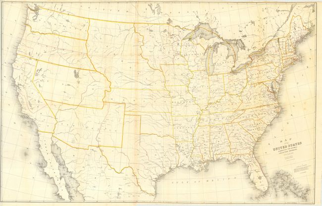
Auction 115, Lot 143
Subject: United States
General Land Office
Map of the United States and Territories Showing the extent of Public Surveys and other details constructed from the Plats and official sources of the General Land Office…, 1866
Size: 54.5 x 28 inches (138.4 x 71.1 cm)
Estimate: $350 - $450
Sold for: $250
Closed on 6/21/2006
Auction 115, Lot 144
Subject: United States
General Land Office
Map of the United States and Territories Showing the extent of Public Surveys and other details constructed from the Plats and official sources of the General Land Office…, 1867
Size: 54 x 28 inches (137.2 x 71.1 cm)
Estimate: $250 - $300
Sold for: $180
Closed on 6/21/2006
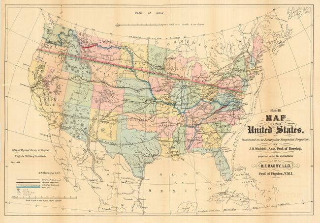
Auction 115, Lot 145
Subject: United States
Maury, M. F.
Plate III. Map of the United States. Constructed on the Rectangular Tangential Projection, by J. H. Waddell, Asst. Prof.of Drawing…, 1868
Size: 26.3 x 18 inches (66.8 x 45.7 cm)
Estimate: $275 - $325
Unsold
Closed on 6/21/2006
Auction 115, Lot 146
Subject: United States
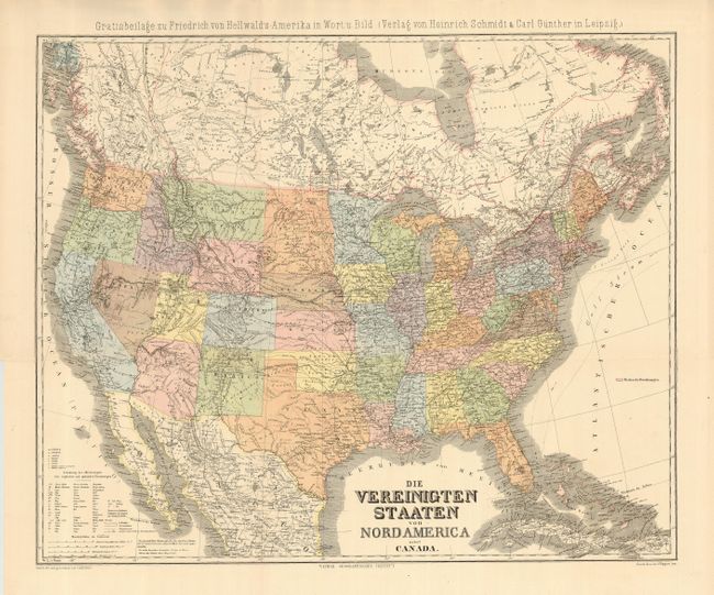
Kiepert, Heinrich C.
Die Vereinigten Staaten von Nord America nebst Canada, 1875
Size: 25 x 20.7 inches (63.5 x 52.6 cm)
Estimate: $100 - $140
Sold for: $50
Closed on 6/21/2006
Auction 115, Lot 147
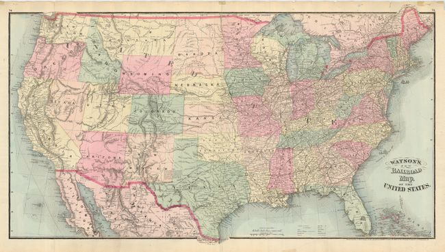
Subject: United States
Watson, Gaylord
Watson's New Railroad Map, of the United States, 1875
Size: 30 x 17 inches (76.2 x 43.2 cm)
Estimate: $100 - $140
Sold for: $210
Closed on 6/21/2006
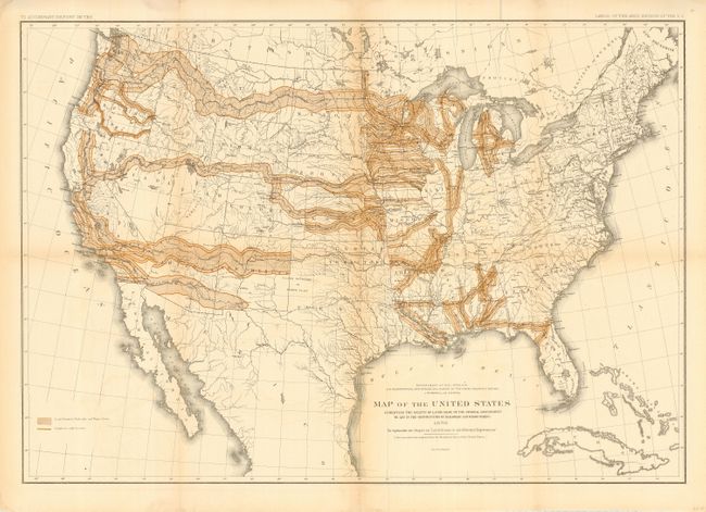
Auction 115, Lot 148
Subject: United States
U.S. Department of Interior
Map of the United States Exhibiting the Grants of Lands Made by the General Government to aid in the Construction of Railroads and Wagon Roads, 1878
Size: 28.3 x 19.8 inches (71.9 x 50.3 cm)
Estimate: $200 - $250
Sold for: $180
Closed on 6/21/2006
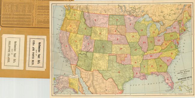
Auction 115, Lot 149
Subject: United States, Cuba & Philippines
Fort Dearborn Pub. Co.
Northwestern Yeast Co.'s Improved Maps of the United States and Newly Acquired Islands, 1899
Size: 6.8 x 10.8 inches (17.3 x 27.4 cm)
Estimate: $140 - $180
Sold for: $130
Closed on 6/21/2006
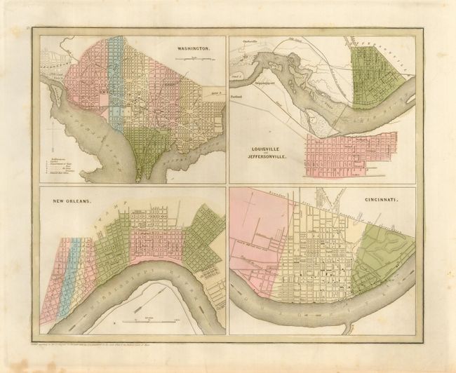
Auction 115, Lot 150
Subject: United States City Plans
Bradford, Thomas Gamaliel
Washington [on sheet with] Louisville and Jeffersonville [and] New Orleans [and] Cincinnati, 1838
Size: 13.5 x 11 inches (34.3 x 27.9 cm)
Estimate: $100 - $140
Sold for: $75
Closed on 6/21/2006
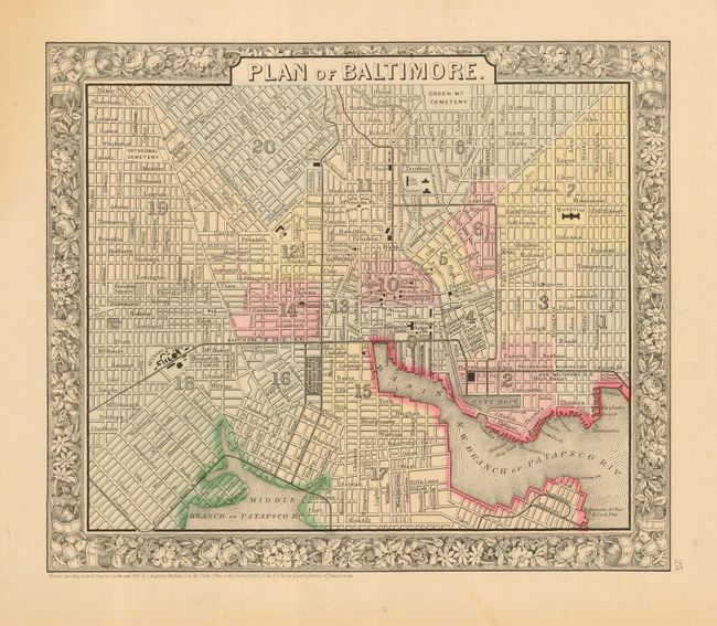
Auction 115, Lot 151
Subject: United States City Plans
[Lot of 4 - City Plans], 1856-67
Size: See Description
Estimate: $180 - $220
Sold for: $130
Closed on 6/21/2006
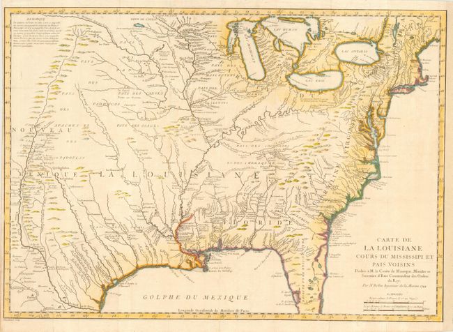
Auction 115, Lot 152
Subject: United States - Eastern
Bellin, Jacques Nicolas
Carte de la Louisiane Cours du Mississipi et Pais Voisins…, 1744
Size: 22.5 x 16 inches (57.2 x 40.6 cm)
Estimate: $1,000 - $1,300
Sold for: $550
Closed on 6/21/2006
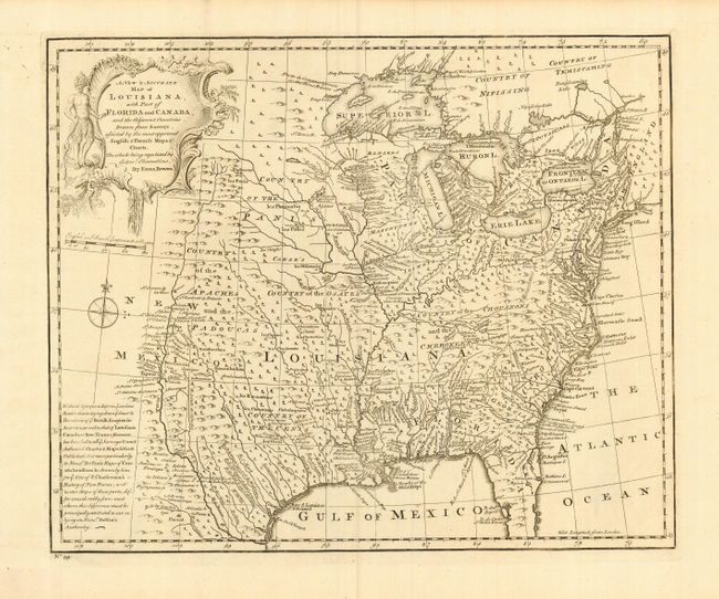
Auction 115, Lot 153
Subject: United States - Eastern
Bowen, Emanuel
A New & Accurate Map of Louisiana, with Part of Florida and Canada, and the Adjacent Countries Drawn from Surveys…, 1747
Size: 16.5 x 13.5 inches (41.9 x 34.3 cm)
Estimate: $1,000 - $1,200
Sold for: $550
Closed on 6/21/2006
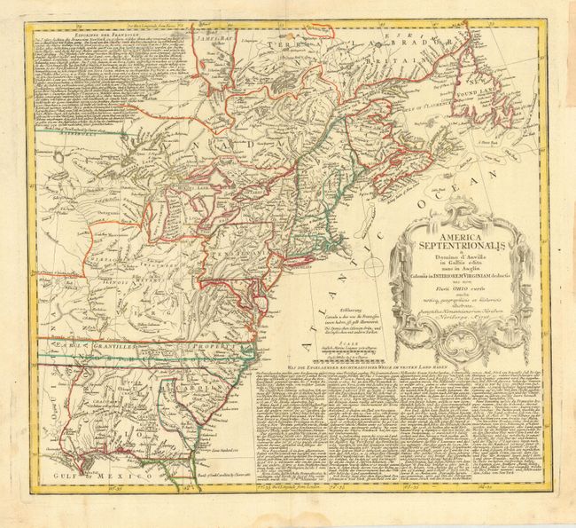
Auction 115, Lot 154
Subject: Colonial United States and Canada
Homann Heirs
America Septentrionalis a Domino d'Anville in Galliis edita nunc in Anglia Coloniis in Interiorem Virginiam deductis nec non Fluvii Ohio cursu…, 1756
Size: 19.8 x 17.8 inches (50.3 x 45.2 cm)
Estimate: $800 - $900
Unsold
Closed on 6/21/2006
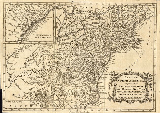
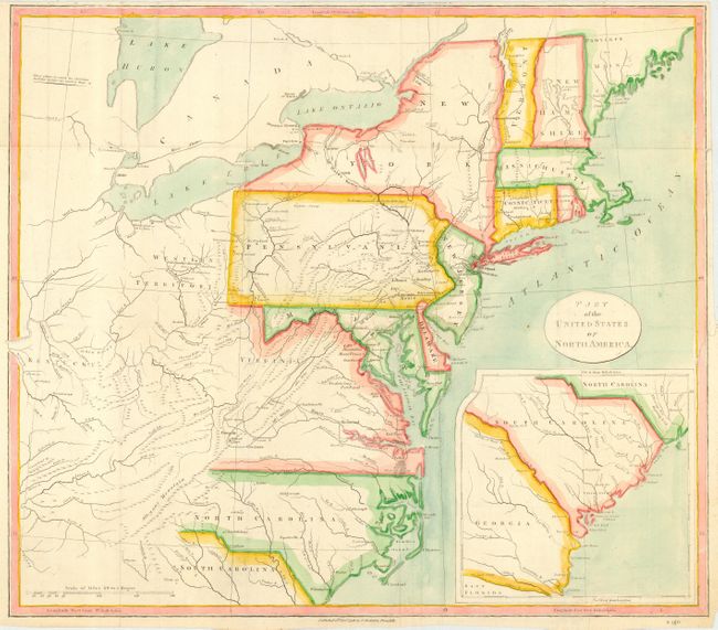
Auction 115, Lot 155
Subject: United States - Eastern
Kitchin, Thomas
Part of North America, comprehending The Course of the Ohio, New England, New York, New Jersey, Pensilvania, Maryland, Virginia, Carolina and Georgia, 1760
Size: 11.6 x 8 inches (29.5 x 20.3 cm)
Estimate: $450 - $500
Sold for: $425
Closed on 6/21/2006
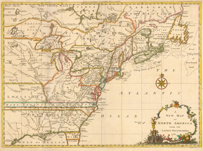
Auction 115, Lot 156
Subject: Colonial United States and Canada
Spilsbury, J.
A New Map of North America from the Latest Discoveries, 1761
Size: 15 x 11 inches (38.1 x 27.9 cm)
Estimate: $375 - $450
Sold for: $550
Closed on 6/21/2006
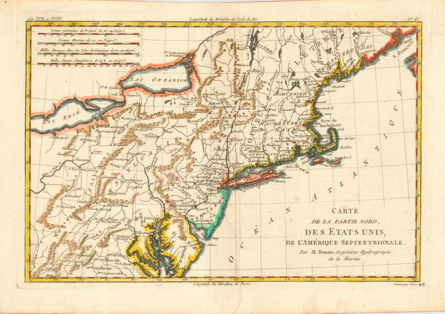
Auction 115, Lot 157
Subject: United States - Eastern
Bonne, Rigobert
Carte de la Partie Nord, des Etats Unis, de l'Amerique Septentrionale, 1782
Size: 12.5 x 8.2 inches (31.8 x 20.8 cm)
Estimate: $180 - $220
Sold for: $130
Closed on 6/21/2006
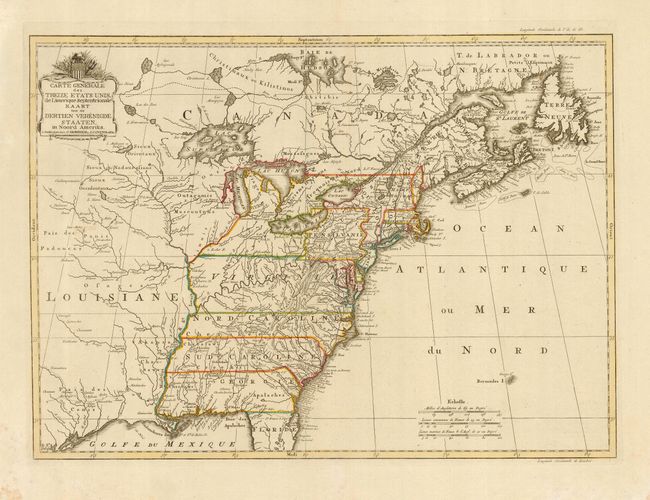
Auction 115, Lot 158
Subject: United States - Eastern
Covens & Mortier
Carte Generale des Treize Etats Unis de l'Amerique Septentrionale, 1785
Size: 22.5 x 16.3 inches (57.2 x 41.4 cm)
Estimate: $1,800 - $2,200
Sold for: $1,700
Closed on 6/21/2006
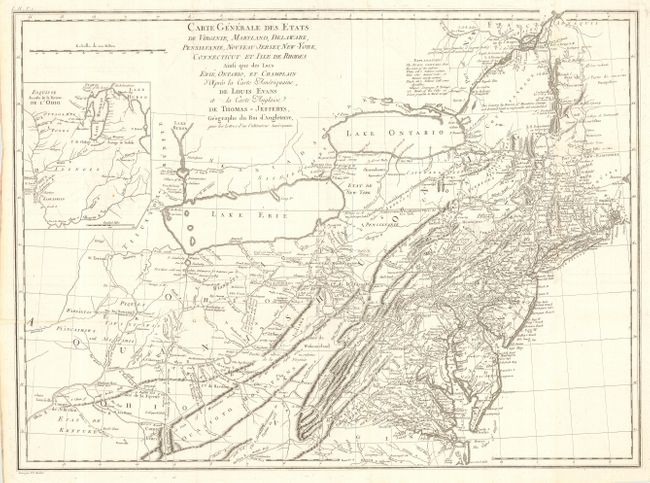
Auction 115, Lot 159
Subject: Eastern United States
Crevecoeur, Michel Guillaume De
Carte Generale des Etats de Virginie, Maryland, Delaware, Pensilvanie, Nouveau-Jersey, New-York, Connecticut et Isle de Rhodes Ainsi que des Lacs Erie, Ontario, et Champlain…, 1787
Size: 25.6 x 18.8 inches (65 x 47.8 cm)
Estimate: $1,500 - $1,800
Unsold
Closed on 6/21/2006
Auction 115, Lot 160
Subject: United States - Eastern
Stockdale, John
Part of the United States of North America, 1798
Size: 18.5 x 16 inches (47 x 40.6 cm)
Estimate: $250 - $300
Sold for: $325
Closed on 6/21/2006
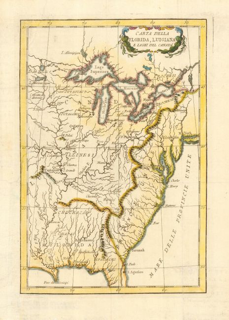
Auction 115, Lot 161
Subject: United States - Eastern
Rossi, Luigi
Carte Della Florida, Luigiana, e Leghi del Canada, 1802
Size: 7 x 10 inches (17.8 x 25.4 cm)
Estimate: $230 - $275
Sold for: $325
Closed on 6/21/2006
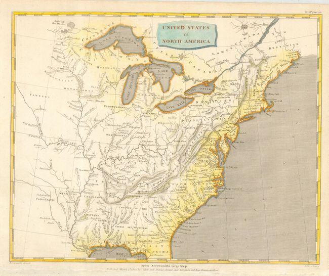
Auction 115, Lot 162
Subject: United States - Eastern
Arrowsmith, Aaron, Sr.
United States of North America, 1802
Size: 10 x 8 inches (25.4 x 20.3 cm)
Estimate: $170 - $200
Sold for: $130
Closed on 6/21/2006
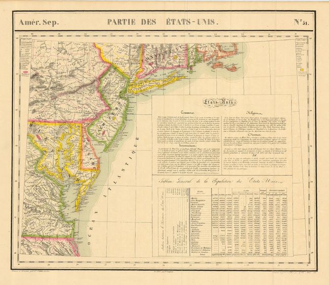
Auction 115, Lot 163
Subject: United States - Eastern
Vandermaelen, Philippe Marie Guillaume
Amer. Sep. Partie des Etats Unis. No. 51, 1825
Size: 22.3 x 19 inches (56.6 x 48.3 cm)
Estimate: $300 - $350
Sold for: $220
Closed on 6/21/2006
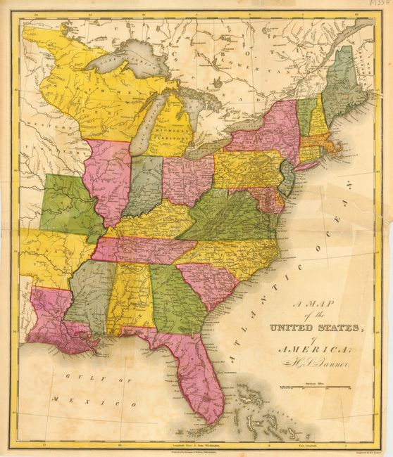
Auction 115, Lot 164
Subject: United States - Eastern
Tanner, Henry Schenck
A Map of the United States, of America, 1827
Size: 12.8 x 14.5 inches (32.5 x 36.8 cm)
Estimate: $100 - $140
Sold for: $75
Closed on 6/21/2006
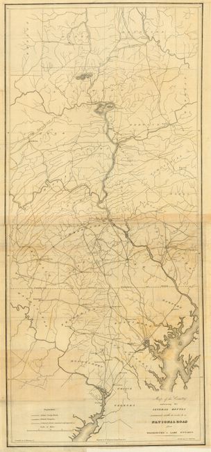
Auction 115, Lot 165
Subject: United States - Eastern
U.S. War Department
Map of the Country embracing the Several Routes examined with a view to a National Road from Washington to Lake Ontario, 1829
Size: See Description
Estimate: $300 - $400
Sold for: $170
Closed on 6/21/2006
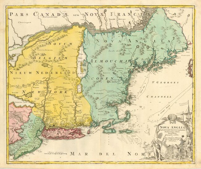
Auction 115, Lot 166
Subject: Colonial New England
Homann, Johann Baptist
Nova Anglia Septentrionali Americae implantata Anglorumque coloniis florentissima, 1730
Size: 22.8 x 19 inches (57.9 x 48.3 cm)
Estimate: $2,000 - $2,200
Sold for: $1,900
Closed on 6/21/2006
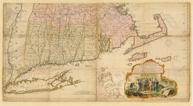
Auction 115, Lot 167
Subject: Colonial New England
Jefferys, Thomas
A Map of the Most Inhabited part of New England containing the Provinces of Massachusetts Bay and New Hampshire with the Colonies of Connecticut and Rhode Island Divided into Counties and Townships…, 1774
Size: 39 x 20.5 inches (99.1 x 52.1 cm)
Estimate: $5,000 - $7,000
Sold for: $4,000
Closed on 6/21/2006
194 lots
Page 1 of 4